
Chapter 8 Political Geography Key Question How is
- Slides: 84
Chapter 8: Political Geography
Key Question How is space politically organized into states and nations?
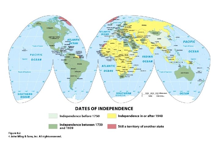
How Is Space Politically Organized into States and Nations? • Political geography is the study of the political organization of the world. • A state is a politically organized territory with a permanent population, a defined territory, and a government. IV, A. 1. a • Geographer Stuart Elden: modern concept of territory arose in early modern Europe as a system of political units came into being with fixed, distinct boundaries and at least a quasiindependent government; process by which this happens is territoriality. IV. B 1. b
How Is Space Politically Organized into States and Nations? • Today, territoriality is tied to the concept of sovereignty. • Sovereignty means having a recognized right to control a territory both politically and militarily. • Under international law, states are sovereign, and they have the right to defend their territorial integrity against incursion from other states. IV. B 1. b
How Is Space Politically Organized into States and Nations? The Modern State Idea • Idea of the state appeared in various forms across world regions 400 or 500 years ago • The European state idea most influenced the development of the modern state system • Emerging political state was accompanied by mercantilism, which led to the accumulation of wealth through plunder, colonization, and the protection of home industries and foreign markets IV. A. 2. a&b
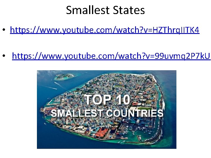
Smallest States • https: //www. youtube. com/watch? v=HZThrq. IITK 4 • https: //www. youtube. com/watch? v=99 uvmq 2 P 7 k. U
How Is Space Politically Organized into States and Nations? The Modern State Idea • The Peace of Westphalia, negotiated in 1648, marks the beginning of the modern state system. • In the Westphalian system it became the territory that defined the society. • Territory is treated as a fixed element of political identification, and states define exclusive, nonoverlapping territories. IV. A. 2. a&b
How Is Space Politically Organized into States and Nations? Nations • Nation is a culturally defined term, and few people agree on exactly what it means. • The term was originally meant to refer to a group of people who think of themselves as one based on a sense of shared culture and history, and who seek some degree of political-territorial autonomy. • All nations are ultimately mixtures of different peoples. • A nation is identified by its own membership; therefore, we cannot simply define a nation as the people within a territory • Examples: • Japanese, Han Chinese, Swedish, Basque, Kurds, Palestinians, Chechens, Israelis, Cherokee, etc. IV. A. 1. b
How Is Space Politically Organized into States and Nations? Nation-State • A nation-state is a politically organized area in which nation and state occupy the same space. • The goal of creating nation-states dates to the French Revolution: democracy • Key problem associated with the idea of the nation-state is that it assumes the presence of reasonably well-defined, stable nations living contiguously in discrete territories. IV. A. 1. b
How Is Space Politically Organized into States and Nations? Nation-State • When people have a strong sense of nationalism, they have a loyalty to and a belief in the nation itself. • A state, in contrast, seeks to promote a sense of nationhood that coincides with its own borders. • To help people within the borders relate to the dominant national ideal, states provide security, infrastructure, and goods and services for their citizens. IV. A. 1. b
How Is Space Politically Organized into States and Nations? Multistate Nations, Multinational States, and Stateless Nations • Nearly every state in the world is a multinational state, a state with more than one nation inside its borders. • When a nation stretches across borders and across states, the nation is called a multistate nation. • When multiple nations or states claim attachments to the same piece of territory, the potential for conflict is significant. IV. A. 1. b
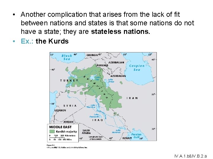
• Another complication that arises from the lack of fit between nations and states is that some nations do not have a state; they are stateless nations. • Ex. : the Kurds IV. A. 1. b&IV. B. 2. a
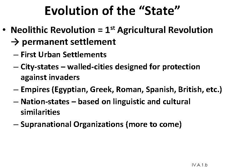
Evolution of the “State” • Neolithic Revolution = 1 st Agricultural Revolution → permanent settlement – First Urban Settlements – City-states – walled-cities designed for protection against invaders – Empires (Egyptian, Greek, Roman, Spanish, British, etc. ) – Nation-states – based on linguistic and cultural similarities – Supranational Organizations (more to come) IV. A. 1. b
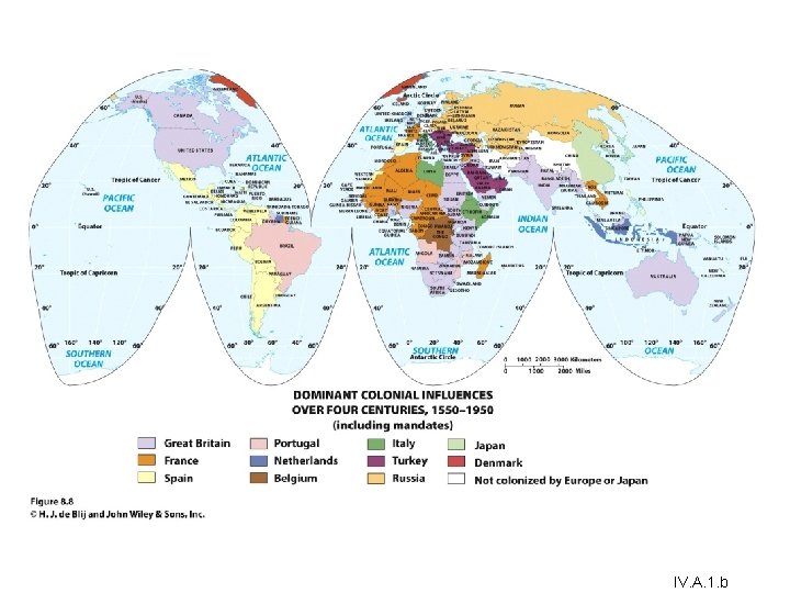
How Is Space Politically Organized into States and Nations? European Colonialism and the Diffusion of the Nation-State Model • Europe exported its concepts of state, sovereignty, and the desire for nation-states to much of the rest of the world through two waves of colonialism. • During the heyday of colonialism, imperial powers exercised ruthless control over their domains and organized them for maximum economic exploitation. • Despite the end of colonialism, the political organization of space and the global world economy persist. IV. A. 2. a&b
IV. A. 1. b
How Is Space Politically Organized into States and Nations? Construction of the Capitalist World Economy • One of the most powerful impacts of colonialism was the construction of a global order characterized by great differences in economic and political power. • The concentration of wealth that colonialism brought to Europe, and to parts of the world dominated by European settlers. • Colonialism is at the heart of highly uneven global distribution of power that continues even today. IV. A. 1. b
How Is Space Politically Organized into States and Nations? Construction of the Capitalist World Economy • Social scientists seek to see how each “dot” fits into the whole. • Proponents of world-systems theory view the world as much more than the sum total of the world’s states. IV. A. 1. b
How Is Space Politically Organized into States and Nations? Construction of the Capitalist World Economy The three basic tenets of world-systems theory, as Immanuel Wallerstein defines them: 1. The world economy has one market and a global division of labor. • Capitalism: in the world economy, individuals, corporations, and states produce goods and services that are exchanged for profit. • Commodification is the process of placing a price on a good, service, or idea and then buying, selling, and trading that item. IV. A. 1. b
How Is Space Politically Organized into States and Nations? Construction of the Capitalist World Economy 2. Although the world has multiple states, almost everything takes place within the context of the world economy: • Colonialism played a major role in establishing this system by exporting the European state idea and facilitating the construction of an interdependent global economy. IV. A. 1. b
How Is Space Politically Organized into States and Nations? Construction of the Capitalist World Economy 3. The world economy has a three-tier structure: • Core is where one is most likely to find higher levels of education, higher salaries, and more technology • Periphery: processes associated with a more marginal position in the world economy • Semiperiphery: places where core and periphery processes are both occurring IV. A. 1. b
How Is Space Politically Organized into States and Nations? Construction of the Capitalist World Economy Major concerns of the world-systems theory: • Overemphasizes economic factors in political development • Very state-centric • Does not fully account for how places move from one category to another IV. A. 1. b
How Is Space Politically Organized into States and Nations? World-Systems and Political Power • Each state is theoretically sovereign, but not all states have the same ability to influence others or achieve their political goals. • World-systems theory helps explain how Europe politically reorganized the world during colonialism. The Enduring Impact of the Nation-State • Idea Regardless of many problems and lack of simple solutions to nation and state conflicts, the European territorial state idea became the world model and still shapes the political organization of space worldwide. IV. A. 1. b
Imagine you are the leader of a newly independent state in Africa or Asia. Determine what your government can do to build a nation that corresponds with the borders of your state. Consider the roles of education, government, military, and culture in your exercise in nation-building.
Key Question How do states spatially organize their governments?
How Do States Spatially Organize Their Governments? • Political geographer Richard Hartshorne described the forces within the state that unify the people as centripetal and the forces that divide them as centrifugal. • According to Hartshorne, whether a state continues to exist depends on the balance between centripetal and centrifugal forces. IV. C. 2. a&b
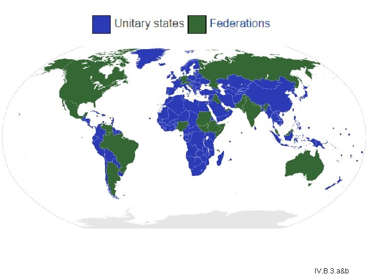
How Do States Spatially Organize Their Governments? Form of Government • Unitary governments: centralized states whose administrative framework is designed to ensure the central government’s authority over all of the state. • Regional gov’t can exist BUT power can be removed by central gov’t • Same laws throughout the country • Ex. France, U. K. , China, DRC • 60 Minutes – Escape From Camp 14 - Born in a prison camp, Shin Dong-hyuk describes how three generations of a family are incarcerated if one family member is considered disloyal. https: //www. youtube. com/watch? v=ZNxt. MIL 2 Kek / (13: 54) IV. B. 3. a&b
How Do States Spatially Organize Their Governments? • In a strong federal system, the regions have much control over government policies and funds, and in a weak federal system, the central government retains a significant measure of power. • Federalism accommodates regional interests by vesting primary power in provinces, States, or other regional units over all matters except those explicitly given to the central government. • Different laws throughout the country (can cause confusion). • More suited for large states/multinational • Ex. U. S. A. , Brazil, India, Nigeria IV. B. 3. a&b
IV. B. 3. a&b
How Do States Spatially Organize Their Governments? Devolution • • Devolution is the movement of power from the central government to regional governments within the state. One state can split into more than one state. Caused by a rise in nationalism amongst a group. Ex. Scotland (own Parliament w/in UK), Yugoslavia (Slovenia, Croatia, Bosnia-Herzegovina, Macedonia, Montenegro, Serbia), Czechoslovakia (Czech Republic, Slovakia), IV. C. 1. c&d
How Do States Spatially Organize Their Governments? Electoral Geography • Partitioning of state territory into electoral districts. • Electoral geographers examine how the spatial configuration of electoral districts and the voting patterns that emerge in particular elections reflect and influence social and political affairs. • Ex. : 1994 South Africa • Geographers study patterns of voting behavior to assess the influence of their geographic situation • Reapportionment: process by which districts are moved according to population shifts so that each district has about the same number of people. IV. B. 2. e
Choose an example of a devolutionary movement and consider which geographic factors favor, or work against, greater autonomy (self-governance) for the region. Would granting the region autonomy strengthen or weaken the state in which the region is currently situated?
Key Question How are boundaries established, and why do boundary disputes occur?
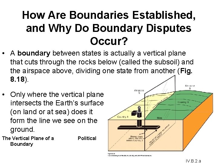
How Are Boundaries Established, and Why Do Boundary Disputes Occur? • A boundary between states is actually a vertical plane that cuts through the rocks below (called the subsoil) and the airspace above, dividing one state from another (Fig. 8. 18). • Only where the vertical plane intersects the Earth’s surface (on land or at sea) does it form the line we see on the ground. The Vertical Plane of a Boundary Political IV. B. 2. a
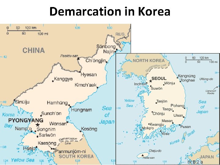
How Are Boundaries Established, and Why Do Boundary Disputes Occur? Establishing Boundaries • States typically define the boundary in a treaty-like legal document in which actual points in the landscape or points of latitude and longitude are described. (written) • Cartographers delimit the boundary by drawing on a map. (delimitation) • If either or both of the states so desire, they can demarcate the boundary by using steel posts, concrete pillars, fences, walls, or some other visible means to mark the boundary on the ground. IV. B. 2. a
Demarcation in Korea IV. B. 2. a
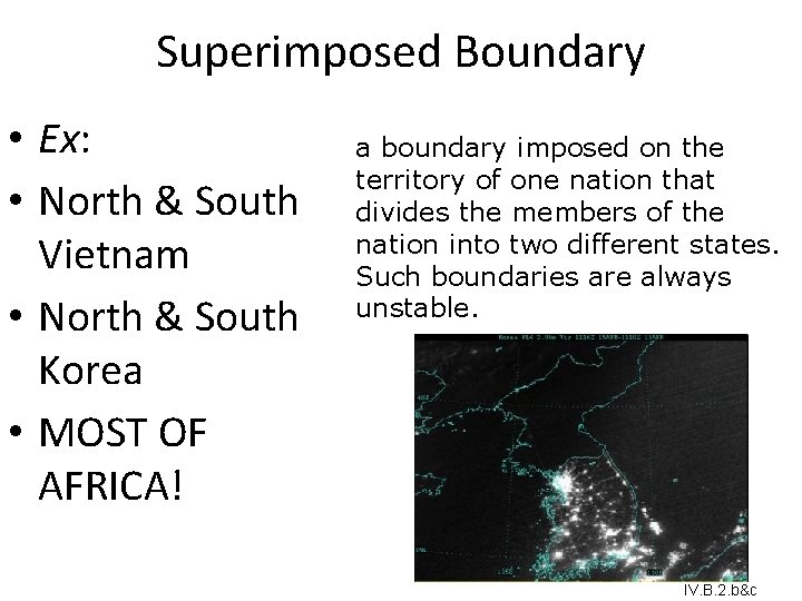
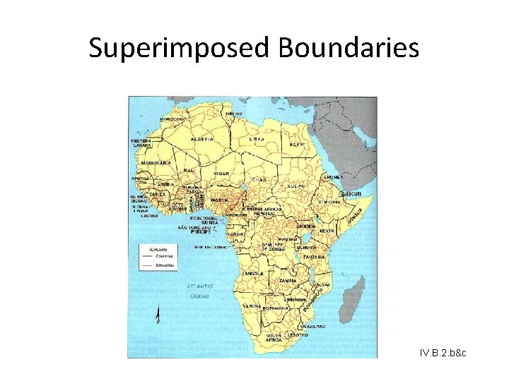
Superimposed Boundary • Ex: • North & South Vietnam • North & South Korea • MOST OF AFRICA! a boundary imposed on the territory of one nation that divides the members of the nation into two different states. Such boundaries are always unstable. IV. B. 2. b&c
Superimposed Boundaries IV. B. 2. b&c
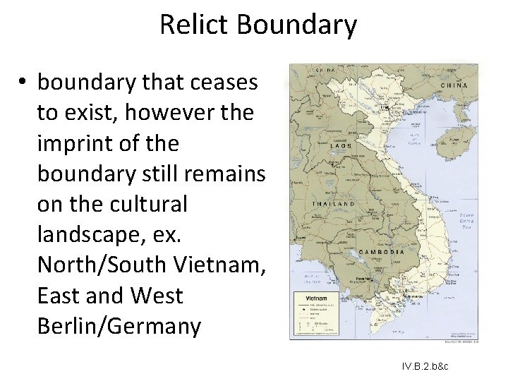
Relict Boundary • boundary that ceases to exist, however the imprint of the boundary still remains on the cultural landscape, ex. North/South Vietnam, East and West Berlin/Germany IV. B. 2. b&c
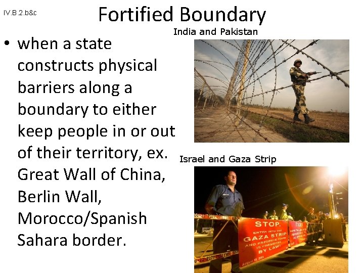
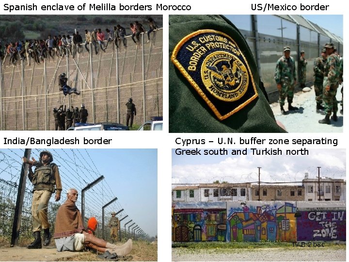
IV. B. 2. b&c Fortified Boundary India and Pakistan • when a state constructs physical barriers along a boundary to either keep people in or out of their territory, ex. Israel and Gaza Strip Great Wall of China, Berlin Wall, Morocco/Spanish Sahara border.
Spanish enclave of Melilla borders Morocco India/Bangladesh border US/Mexico border Cyprus – U. N. buffer zone separating Greek south and Turkish north IV. B. 2. b&c
State for Morphology • 5 Boundary Shapes countries: – Compact – Elongated – Prorupted – Fragmented – Perforated IV. B. 3. c
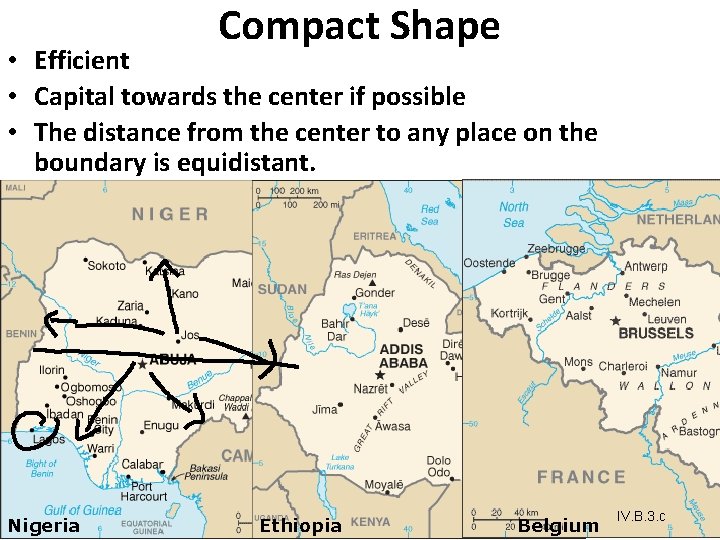
Compact Shape • Efficient • Capital towards the center if possible • The distance from the center to any place on the boundary is equidistant. Nigeria Ethiopia Belgium IV. B. 3. c
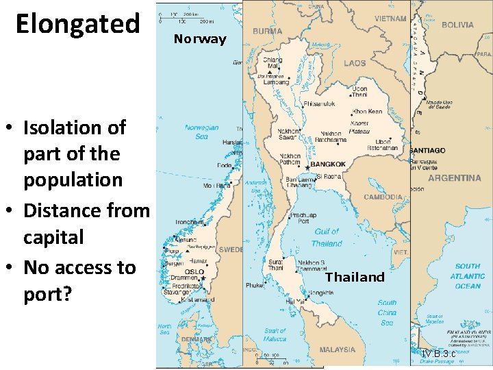
Elongated Norway Chile • Isolation of part of the population • Distance from capital • No access to port? Thailand IV. B. 3. c
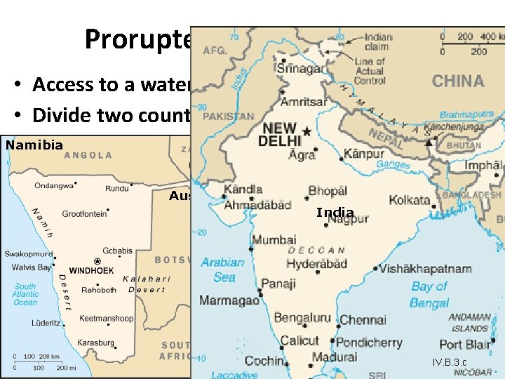
Prorupted • Access to a waterway • Divide two countries Namibia Demo. Rep. of Congo Afghanistan Austria India IV. B. 3. c
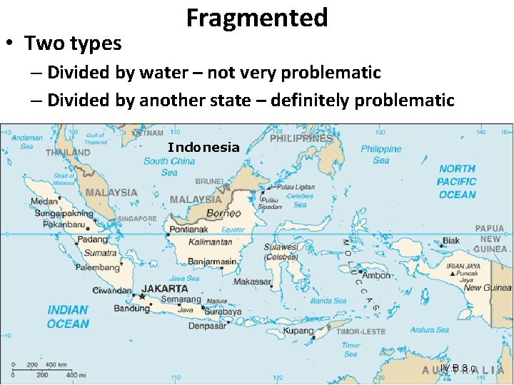
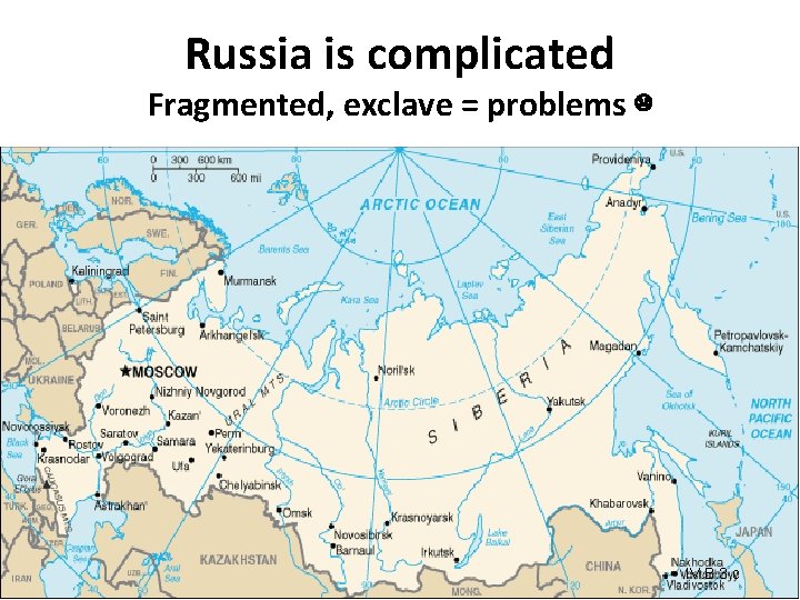
• Two types Fragmented – Divided by water – not very problematic – Divided by another state – definitely problematic Indonesia IV. B. 3. c
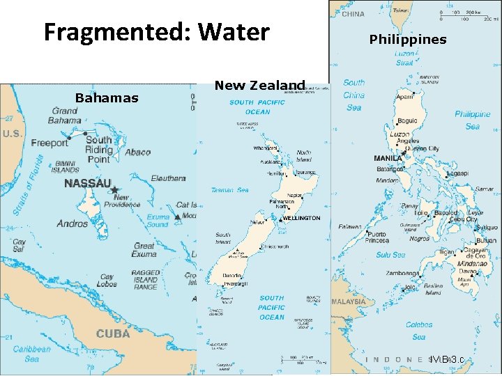
Fragmented: Water Bahamas Philippines New Zealand IV. B. 3. c
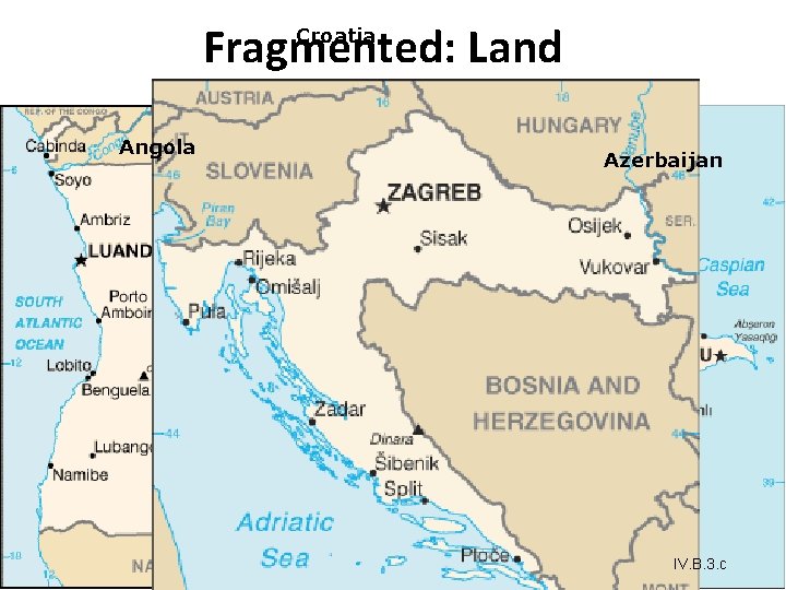
Fragmented: Land Croatia Angola Azerbaijan IV. B. 3. c
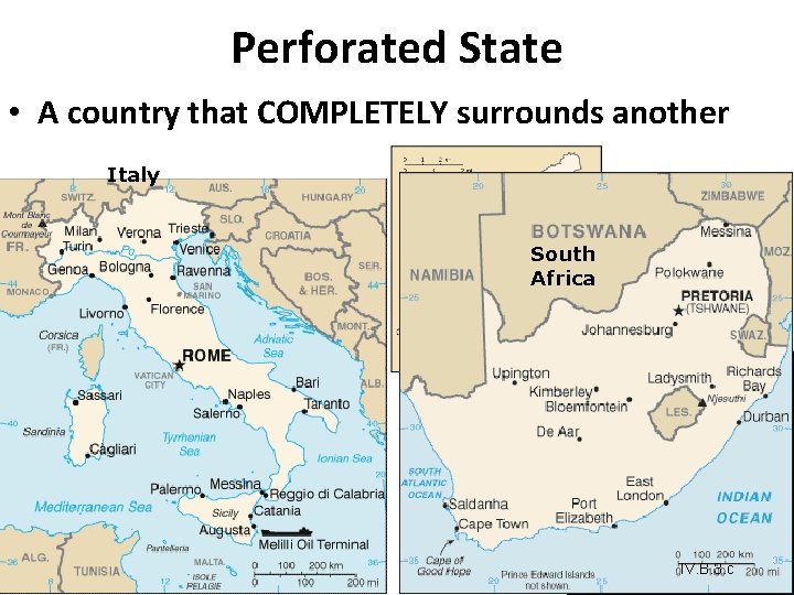
Perforated State • A country that COMPLETELY surrounds another Italy South Africa IV. B. 3. c
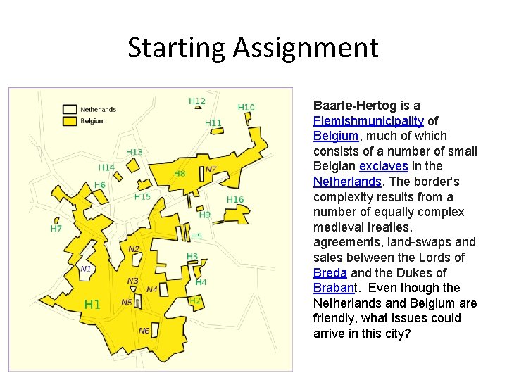
Starting Assignment Baarle-Hertog is a Flemishmunicipality of Belgium, much of which consists of a number of small Belgian exclaves in the Netherlands. The border's complexity results from a number of equally complex medieval treaties, agreements, land-swaps and sales between the Lords of Breda and the Dukes of Brabant. Even though the Netherlands and Belgium are friendly, what issues could arrive in this city?
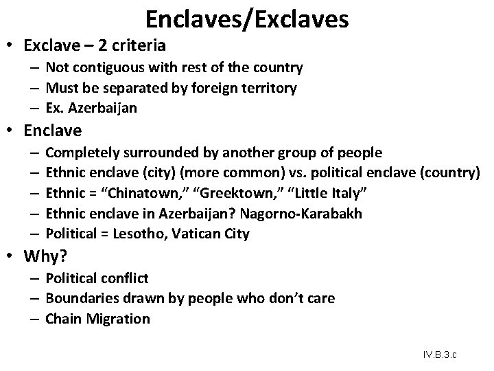
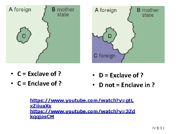
Enclaves/Exclaves • Exclave – 2 criteria – Not contiguous with rest of the country – Must be separated by foreign territory – Ex. Azerbaijan • Enclave – – – Completely surrounded by another group of people Ethnic enclave (city) (more common) vs. political enclave (country) Ethnic = “Chinatown, ” “Greektown, ” “Little Italy” Ethnic enclave in Azerbaijan? Nagorno-Karabakh Political = Lesotho, Vatican City • Why? – Political conflict – Boundaries drawn by people who don’t care – Chain Migration IV. B. 3. c
• C = Exclave of ? • C = Enclave of ? • D = Exclave of ? • D not = Enclave in ? https: //www. youtube. com/watch? v=gt. L x. Ziiua. Xs https: //www. youtube. com/watch? v=3 Zd kqqjos. CM IV. B. 3. c
Russia is complicated Fragmented, exclave = problems ☹ IV. B. 3. c
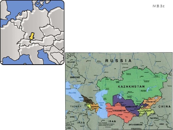
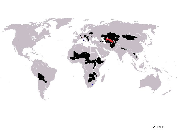
Landlocked Boundaries IV. B • 45 Landlocked countries • 2 Doubly landlocked (surrounded by landlocked countries) – Liechtenstein – Uzbekistan • Trade very challenging – Dependent on foreign ports • UNCLOS – no taxation on these countries to transport goods IV. B. 3. c
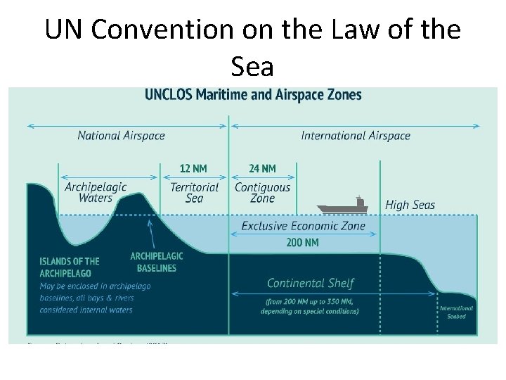
UN Convention on the Law of the Sea
IV. B. 3. c
IV. B. 3. c
How Are Boundaries Established, and Why Do Boundary Disputes Occur? Boundary Disputes • Geometric boundaries are drawn using grid systems such as latitude and longitude or township and range (ex. 1300 mile (straight line) United States/Canadian border). • Physical-political boundaries follow an agreed upon figure in the natural landscape. • Ex. : The center point of a river or crest of a mountain range. (KY/IN separated by Ohio R. ) • Also called antecedent boundaries. IV. B. 2. b&c
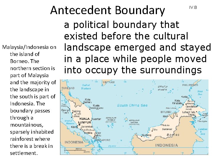
Antecedent Boundary Malaysia/Indonesia on the island of Borneo. The northern section is part of Malaysia and the majority of the landscape in the south is part of Indonesia. The boundary passes through a mountainous, sparsely inhabited rainforest where there is a break in settlement. IV. B a political boundary that existed before the cultural landscape emerged and stayed in a place while people moved into occupy the surroundings
How Are Boundaries Established, and Why Do Boundary Disputes Occur? Types of Boundary Disputes • Definitional boundary disputes focus on the legal language of the boundary agreement. • Locational boundary disputes center on the delimitation and possibly the demarcation of the boundary. The definition is not in dispute, but its interpretation is. • Operational boundary disputes involve neighbors who differ over the way their border should function. • Allocational boundary disputes are becoming more common as the search for resources intensifies. • Boundary dispute over area in TN/GA. Which types is it? • https: //www. youtube. com/watch? v=AW 3 Odks. QG 0 k IV. B. 2. b&c
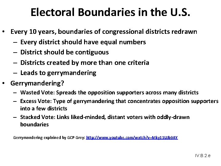
“Gerrymandering” Redistricting for partisan purposes – to give one political party or candidate an advantage. IV. B. 2. e
IV. B. 2. e
IV. B. 2. e
IV. B. 2. e
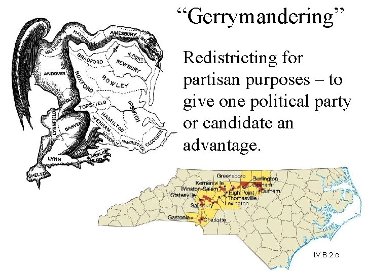
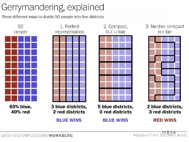
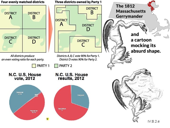
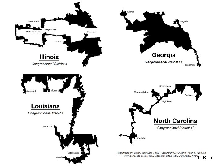
Electoral Boundaries in the U. S. • Every 10 years, boundaries of congressional districts redrawn – Every district should have equal numbers – District should be contiguous – Districts created by more than one criteria – Leads to gerrymandering • Gerrymandering? – Wasted Vote: Spreads the opposition supporters across many districts – Excess Vote: Type of gerrymandering that concentrates opposition supporters into a few districts – Stacked Vote: Links liked-minded, distant voters with oddly-drawn boundaries Gerrymandering explained by GCP Grey: http: //www. youtube. com/watch? v=Mky 11 UJb 9 AY IV. B. 2. e
Key Question How does the study of geopolitics help us understand the world?
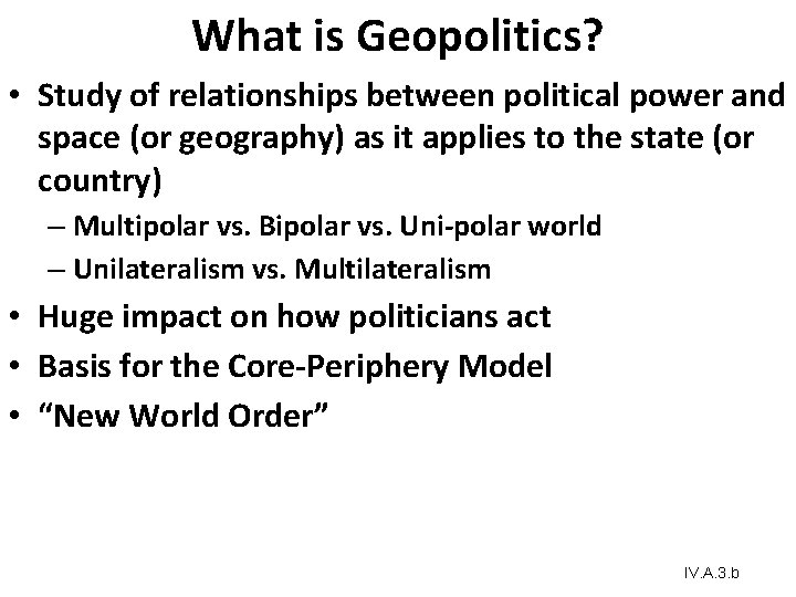
What is Geopolitics? • Study of relationships between political power and space (or geography) as it applies to the state (or country) – Multipolar vs. Bipolar vs. Uni-polar world – Unilateralism vs. Multilateralism • Huge impact on how politicians act • Basis for the Core-Periphery Model • “New World Order” IV. A. 3. b
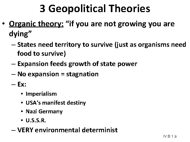
3 Geopolitical Theories • Organic theory: “if you are not growing you are dying” – States need territory to survive (just as organisms need food to survive) – Expansion feeds growth of state power – No expansion = stagnation – Ex: • • Imperialism USA’s manifest destiny Nazi Germany U. S. S. R. – VERY environmental determinist IV. B. 1. a
Geopolitical Theory cont. 2. Rimland (Imperial Japan, British empire, maybe USA) – Ports are im. PORTant – Control the oceans • Control trade • Conquer territory – Assumed a Multipolar world IV. B. 1. a
Geopolitical Theory cont. 3. Heartland (USSR, Mongols) • How does one become powerful? – – – Pivot area = Eastern Europe/Central Asia If you control the pivot area you control Eurasia If you control Eurasia you control the world! Resources and Roads (Especially RR) Focused on one super powerful ARMY IV. B. 1. a
How Does the Study of Geopolitics Help Us Understand the World? Classical Geopolitics • Late 19 th century/early 20 th century geopoliticians were usually either part of the German school or the British/American school. The German School • Tried to explain why certain states were powerful and how they became powerful. • Friedrick Ratzel: influenced by Darwin; the state resembles a biological organism whose life cycle extends from birth through maturity and, ultimately, decline and death. IV. B. 1. a
How Does the Study of Geopolitics Help Us Understand the World? The British/American School • Sir Halford J. Mackinder, “The Geographical Pivot of History” in the Royal Geographical Society’s Geographical Journal. • Land-based power, not sea power, would ultimately rule the world. Influence of Geopoliticians on Politics • NATO • Geopolitics: term with negative connotations IV. B. 1. a
How Does the Study of Geopolitics Help Us Understand the World? Critical Geopolitics • Critical Geopolitics: intellectuals of statecraft construct ideas about geographical circumstances and places, these ideas influence and reinforce their political behaviors and policy choices, and then affect what happens and how most people interpret what happens. IV. A. 3. a&b
How Does the Study of Geopolitics Help Us Understand the World? Geopolitical World Order • Cold War: bipolar, with Soviet versus West alliances • New World Order: Global cooperation to bring discipline to rogue states • Unilateralism: one country (e. g. , United States) in position of dominance, with other countries following its lead IV. A. 3. a&b
Key Question What are supranational organizations, and what are their implications for the state?
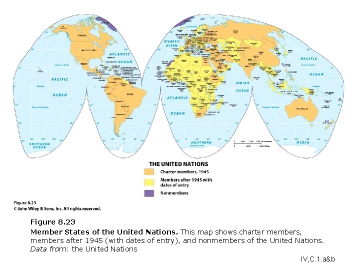
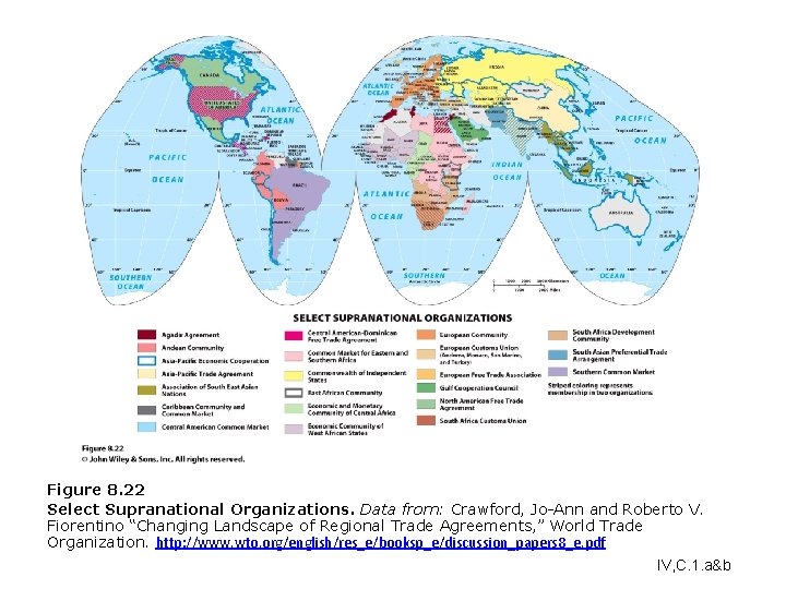
What Are Supranational Organizations, and What Are Their Implications for the State? • Supranational organization: three or more states that forge an association and form an administrative structure for mutual benefit and in pursuit of shared goals League of Nations to United Nations • Started with the League of Nations in 1919 • United Nations (UN), FAO, WTO, UNESCO Regional Supranational Organizations • Benelux, Marshall Plan, NAFTA IV, C. 1. a&b
What Are Supranational Organizations, and What Are Their Implications for the State? European Union • After the Marshall Plan, the Organization for European Economic Cooperation (OEEC) formed. • EU formed in 1992. • Not all EU member states are currently a part of the euro-zone, but the euro has emerged as a significant global currency. IV, C. 1. a&b
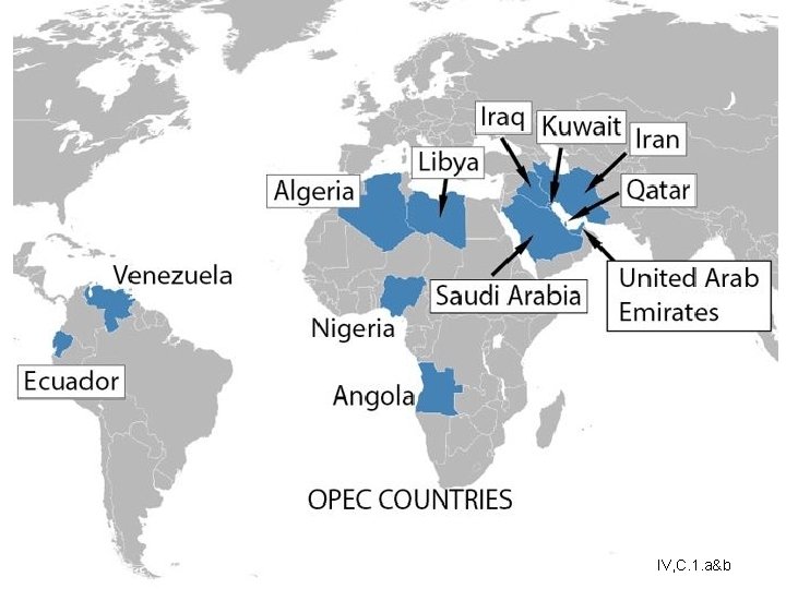
Rise of Supranationalism • Why join one? – More money (funding) – Economic Cooperation • Reduce trade restrictions → everyone can benefit • Join forces (OPEC) to become more powerful economically – Maintain peace → makes unilateral decisions less likely IV, C. 1. a&b
IV, C. 1. a&b
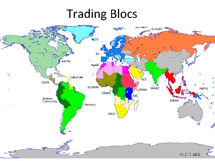
Trading Blocs IV, C. 1. a&b
Figure 8. 23 Member States of the United Nations. This map shows charter members, members after 1945 (with dates of entry), and nonmembers of the United Nations. Data from: the United Nations IV, C. 1. a&b
Figure 8. 22 Select Supranational Organizations. Data from: Crawford, Jo-Ann and Roberto V. Fiorentino “Changing Landscape of Regional Trade Agreements, ” World Trade Organization. http: //www. wto. org/english/res_e/booksp_e/discussion_papers 8_e. pdf IV, C. 1. a&b
What Are Supranational Organizations, and What Are Their Implications for the State? How Does Supranationalism Affect the State? • Economics associations: NAFTA, CIS, etc. • European Union: “taken on a life of its own” • Deterritorialization: globalization, networked communities, etc. undermine the state’s traditional territorial authority • Reterritorialization: the state is moving to solidify control over its territory that has exhibited IV, C. 1. e deterritorialization
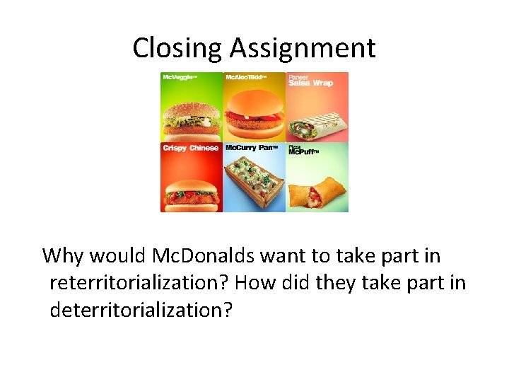
Closing Assignment Why would Mc. Donalds want to take part in reterritorialization? How did they take part in deterritorialization?