Chapter 7 Regions of the United States Section


 states that")


 growing season is more than 200 days long.")


 and Hawai’i (50 th), the nation’s two remote states,")


- Slides: 67
Chapter 7: Regions of the United States Section 1: The Northeast
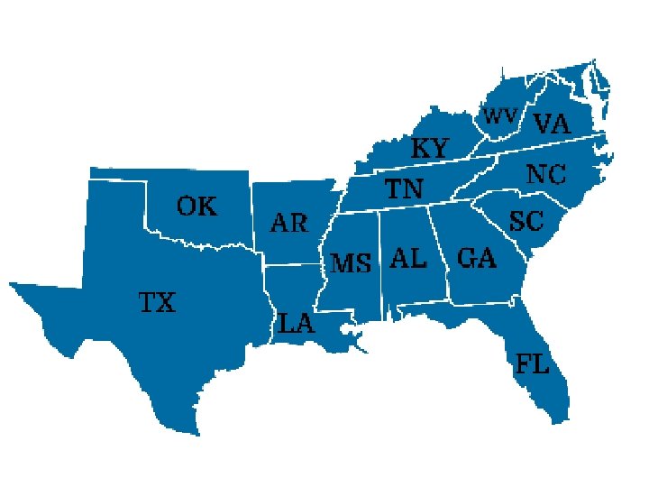
Northeast Introduction • People define regions in order to identify places that have similar characteristics or close connections. – We can define regions by the ways people live, work, and play in them, or political orientation. • The government divides the country into four major regions: – Northeast – South – Midwest – West
• The government divides the nation into regions for statistical purposes. • The government’s definition of these regions is based on a combination of physical, economic, cultural and historical factors.
Physical Characteristics of the Northeast • New England region includes six (6) states that are located in the northeastern part of the United States. • Known for its beautiful landscape.
• Beauty result of Geography and climate of the region. – Combination of precipitation, soil type and varieties of trees that thrive in the region give New England its breathtaking fall colors. • Northeast has far more to offer than forests.
• New York is considered by many to be the cultural center of the nation, whereas Boston and Philadelphia offer visitors a view into the nation’s history.
Natural Resources of the Northeast • Apart from the coal rich area of Pennsylvania, the region lacks mineral resources. • However, its water has turned the Northeast into a center of trade, commerce, and industry. – The regions rocky and jagged shoreline provides many excellent harbors. – Throughout the 1700 and 1800 s these natural harbors were used by merchant ships sailing to and from other regions of the world.
A Leader in Industry • The Northeast’s many rivers, including the Connecticut and the Hudson, have been vital to its history. • Abundant precipitation (35 -50 in. annually) combined with the hilly terrain, keeps the rivers of the region flowing swiftly. • Industrialists harnessed the power of these rivers by building water wheels (converted water power into machine power).
• Massachusetts, Rhode Island New Hampshire factories were built at waterfalls along the region’s many rivers. • Factories produced shoes, cotton cloth, and other goods. • Region’s river valleys served as trade routes, railroad routes, and later as modern highway routes for the Northeast. • By early 1900 s, the Northeast was the most productive manufacturing region in the world.
The Megalopolis • Cities along the Atlantic coast first grew in importance as harbors of international trade and as centers of shipbuilding. • Young people from the Northeastern countryside flocked to the factory towns to take industrial jobs. • Europeans were also attracted by the job opportunities in cities of the Northeast.
• In 1840, about 80, 000 Europeans immigrated to the United States, by 1850 the number jumped to 308 k. – Many came to escape political oppression and economic hardships. – Many people in the Northeast are descendants of these earlier immigrants who came by sea.
• Over time, coastal cities began to spread and run together. • By the 1960 s, the area from Boston to Washington, D. C. , had earned a new name: Megalopolis. – Greek roots, meaning “very large city. ” – About 40 million people live in this area. 1/7 th of the entire U. S. population (2005).
• While the east coast megalopolis remains one of the dominant centers of American business and industry, it faces serious problems. – Fear that area might run out of water or waste disposal facilities. – Northeast cities declining in population. • EX. Between 1970 and 2000, 430 k people moved out of Philadelphia. – As a result, remaining residents and businesses were hit with higher taxes. – City has to rely on other sources of revenue to pay for street repairs and police protection.
• Northeast remains a vital area. • Despite the destruction of the World Trade Center in 2001, New York is still the business capital of the world, and its population has grown to more than 8 million people.
Chapter 7, Section 2 The South
Intro to the South • Many Americans think of the South as the old Confederacy. • In 1860 -1861, eleven states ranging from Texas to Virginia withdrew from the United States because of conflicts over economic and moral issues, including tariffs and, especially, slavery. • These states formed the Confederate States of America.
• Between 1861 -1865, the United States military forces from the Northeast and Midwest fought a bloody war with the Confederacy… The Civil War. • At the war’s end, slavery was abolished and the South was drawn back into the Union.
• South is a region rich in resources and culture that has become an increasingly popular place in which to live and work. • South stands out from the rest of the country because of its humid, subtropical climate and the lush, mixed forests that are common to most of its areas.
Linking Climate to Vegetation • South’s location closer to Equator makes it warmer than the northern regions. • Weather systems rising north from the Gulf of Mexico and Caribbean Sea provide an ample amount of rain to the region (55 -60 inches).
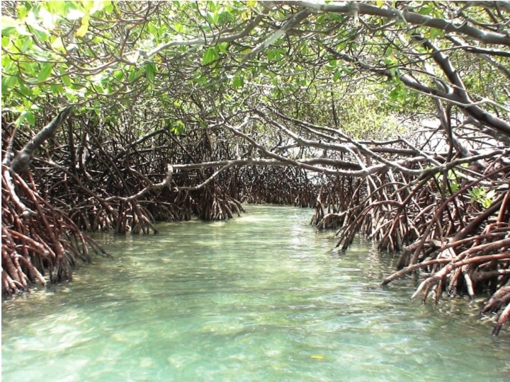
• Warm, wet climate produces thick, mixed forests of pine and other trees, or marshy stands of mangrove trees. – Tropical trees that grow in swampy ground along coastal areas.
• Other unique regions to the South include Bayous. – Marshy inlets of lakes and rivers of Louisiana.
• In Florida, the Everglades, a large area of swampland covered in places with tall grass, provide a refuge for a wide variety of birds and animals.
Linking Climate, History and Agriculture • The South’s wide variety of plant and animal life is due to subtropical climate of most of the region and rich soils of the wide coastal plains. • Native American groups, such as the Natchez, Creek and Cherokee grew maize, melons, squash, beans tobacco and other crops. • By the mid 1500 s, Europeans also began to settle in the South. (First permanent European settlements in the US were located in the South).
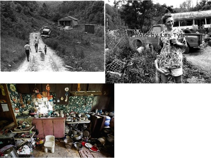
• The South’s rich soil and long growing season attracted Europeans to the region. • Some built huge plantations and used slaves from Africa and the West Indies to work on tobacco, rice and cotton plantations. • There are people in the South who live in bleak poverty despite its fertile soil and mild climate.
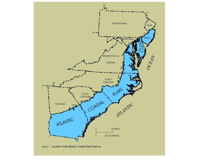
Linking Resources to Industry • Traditional image of the South has been of a rural region, largely dependent on agriculture. • South has other industries… – Entrepreneurs built textile mills, on fall lines, powered by the fast-moving streams of the Piedmont section of the Carolinas. • Imaginary line between the Appalachian Mountains and the Atlantic coastal plain. • It’s the place where rivers and streams form waterfalls and rapids as they descend from plateau to coastal plain.
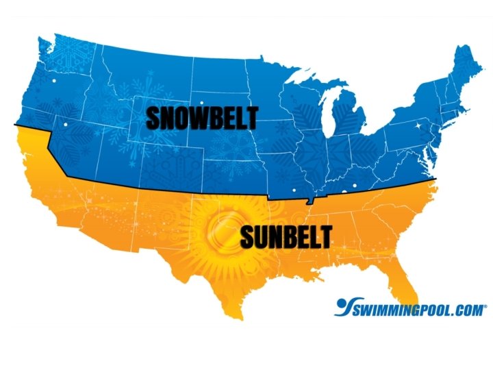
The Sunbelt • Looking for jobs, thousands of people moved South. • Thanks to its climate, the South has also grown as a tourism and retirement center. • Band of southern states from the Carolinas to southern California became known as the Sunbelt.
Southern Population • The South has grown rapidly. • During the 70 s, the South’s population grew by about 7 million people. • By 1990, three of the US’ largest cities were located in the South (Houston, Dallas and San Antonio). • By 1995, Texas was the second most populous state, next to California.
A Varied Population • Today, the South has a diverse population. • Half of the nation’s African American population lives in the South. • Hispanics who relocate from Mexico and other Latin American countries also reside down South. • San Antonio, Texas is one of the first major cities in the US to have a Hispanic majority in its population.
• Another large Hispanic group lives in southern Florida, the Cubans. • One area of Miami is populated by a Cuban majority. Called Little Havana. – Spanish restaurants, Spanish-language television and radio station reflect Cuban Heritage in this area.
• Many white Southerners have ancestors who came from England, Scotland or Ireland. • In Louisiana, many boast of French Ancestry. – French settled the area in Colonial times and made a lasting impression on the region’s culture. – New Orleans is famous for its French cuisine.
Major Cities • New Orleans is a major trading center near the mouth of the Mississippi River. • Miami is the United States gateway to the Caribbean and South America. • Houston is a large industrial and trading center. (NASA is located in here).
• Forth Worth, heart of Texas cattle industry. • Dallas, business and electronics center. • City of Washington is located in the District of Columbia (carved from the states of Maryland Virginia). • Chosen as nation’s capital in 1790, it is located on the shore of the Potomac River. It was the first planned city in the nation
The Midwest • Chapter 7, Section 3
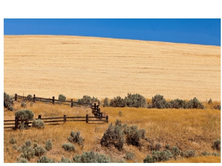
An Agricultural Economy • Most of the Midwest is flat with fertile soil. • Animals that live in the soil die and decay, this is known as humus. – Humus combines with weathered bedrock to build more soil.
• Midwestern climate favors agriculture. • Winters can be very cold but summers are long and hot. • Most places receive at least 20 inches of precipitation annually.
Regional Variations • Southern Midwest, (Kansas) growing season is more than 200 days long. – The average number of days between the last frost of spring and the first frost of fall. • Northern Midwest, (near Canadian border) the growing season is less than 120 days long.
The Nation’s Breadbasket • Thanks to favorable conditions, Midwestern farms are among the most productive in the world. – Because of this, the United States is well fed. – This remarkable productivity also allows the US to export sizable amounts of its produce to other countries. • High wheat output has earned the Midwest the nickname “the nation’s breadbasket. ”
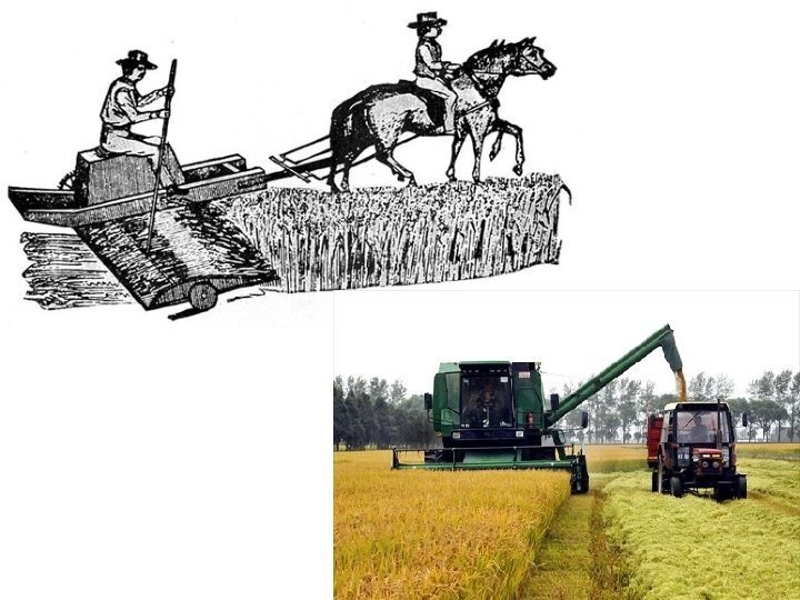
The Changing Face of American Farms • In years past, American farms were mostly modest family enterprises. • People worked long days of hard physical labor. • Few farms like this remain in existence in the US. • Farming has become big business, involving fewer people and more machinery.
Farming Technology • In 1834, Cyrus Mc. Cormick patented the mechanical reaper, which revolutionized farming. – Reaper allowed farmers to harvest vast amounts of wheat in much less time than it took by hand. – As more tasks became mechanized, farmers could produce more crops than before with fewer workers. • Number of farms has decreased year after year because higher-paid jobs have attracted them to cities.
Linking Farms to Cities • Agriculture dominates the economy, even in many Midwestern towns and cities. • Business activities center on dairies or on grain elevators. – Tall buildings equipped with machinery for loading, cleaning, mixing and storing grain. • The Mercantile Exchange is the world’s busiest market for eggs, hogs, cattle and other farm products. • The Board of Trade is the largest grain exchange. – A place where buyers and sellers deal for grain.
Linking Industries to Resources • Midwest is rich in natural resources. • Due to this, its cities are home to heavy manufacturing. • Minnesota leads the region in iron ore production. • Indiana and Illinois have sizable coal deposits. • Easy access to the mentioned minerals spurred the development of steel. • All of these together led to Detroit becoming the automobile capital.
The West • Chapter 7, Section 4
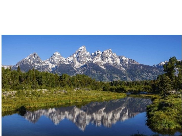
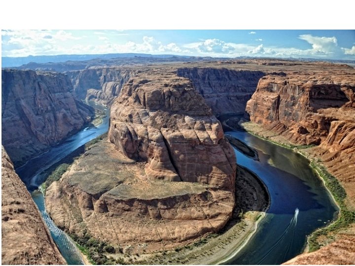
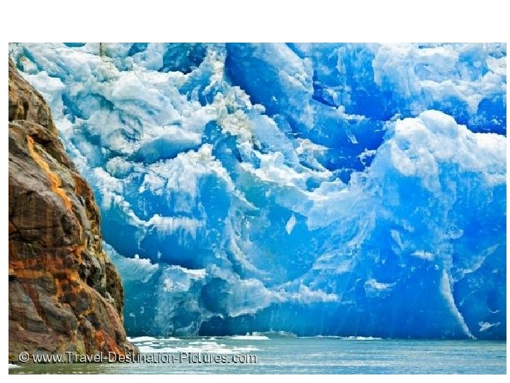
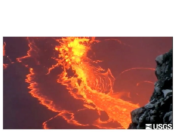
Introduction • Breathtaking natural landscape is the most memorable feature of much of the West. – Rocky Mountains – Rivers – Canyons – Broad Plains – Massive Glaciers (Alaska) – Smoking Volcanoes (Hawai’i)
Characteristic that most affects region? • Water!!!!!!!
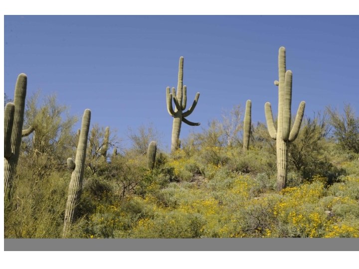
Available Water • An abundance or scarcity of water is the major factor shaping the West’s natural vegetation, economic activity and population density. • Most of the West has a semiarid or arid climate. • San Diego, California - 9 inches of rain per year. • Reno, Nevada - 7 inches of rain per year. • Vegetation in this area consists of short grass, hardy shrubs, sagebrush and cactus.
• In contrast, other areas of West receive adequate rainfall and contain rich deciduous and coniferous forests. • Seattle, Washington – 39 inches of rain per year.
Space Needle in Seattle, Washington
• Alaska (49 th) and Hawai’i (50 th), the nation’s two remote states, offer another contrast. • Much of Hawai’i has a wet tropical climate and dense tropical rain forest vegetation. • A world apart is northern Alaska’s tundra. – A dry, treeless plain that sprouts grasses and mosses only in summer, when the top layer of soil thaws.
Natural Resources and the Economy • West has gold, silver and uranium. • When gold and silver deposits were uncovered in the 1800 s, folks who sought fortune rushed the area. • Few individuals struck gold, the successful ones were huge mining companies that had equipment and resources to dig deep into the earth.
• Rumors of great strikes and dreams of wealth kept drawing people into the region. • Along with the prospectors, came people who set up businesses to provide service to the miners. • The population of the West grew rapidly. • Western lands also contained valuable deposits of natural gas and oil (Alaska, 1960).
• Natural resources of West also support two other important economic activities, forestry and commercial fishing. – Half of nation’s lumber is harvested from the Pacific Northwest forests. – Billions of tons of fish caught in the waters off Alaska, Hawaii and other Pacific Coast states bring in billions of dollars.
The Growth of Western Cities • West grew thanks to mining, and people moving West during the Gold Rush. • Railroad fares were lowered between Midwest and Los Angeles. • By the 1920 s, the city was attracting new residents with the development of the military and civil aircraft industry and the motion picture industry. – To support its growing population, Los Angeles (LA) has to obtain huge amounts of water via aqueducts. • Large pipes that carry water over long distances. • Brings water 685 miles south from Sacramento.
Conquering Western Distances • 2 States face challenges due to distances. – Alaska and Hawai’i • Alaska – Largest state (3 x larger than Northeast) – Population = < 630, 000 – Juneau (capital) can only be reached by plane or boat. – Anchorage (250 k pop. ) only 2 roads leading in and out. • Hawai’i – 8 Main islands, 100 small islands in central Pacific. – Over 2, 000 mi. from US Mainland. – Annexed in 1898, became 50 th state in 1959.