Chapter 6 Air Pressure and Winds Atmospheric Pressure


- Slides: 60

Chapter 6 Air Pressure and Winds

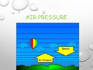
Atmospheric Pressure • Air Pressure – is simply the mass of air above a given level • Recall as we go up in the atmosphere, there are fewer molecules above us. • Pressure always decreases with height! • Pressure = temperature x density x a constant • Standard Atmosphere=1013. 25 h. Pa (mb) or 29. 92 in Hg.

A simple Atmospheric Model • A model of the atmosphere where air density remains constant with height. The air pressure at the surface is related to the number of molecules above. When air of the same temperature is stuffed into the column, the surface air pressure rises. When air is removed from the column, the surface pressure falls.

All things equal • Two columns of air, at equal temperature and height. • p ~T x ρ p is pressure T is temperature r (rho) is density

Pressures equal but Temps different! • It takes a shorter column of cold air to exert the same pressure as a taller column of warm air. . . • • (The difference in height between the two columns is greatly exaggerated. ) Pressures are the same Temperatures are not the same p~T ρ↓ p~T↓ ρ

Air flows from a High into a Low • . . . because of this fact, aloft, cold air is associated with low pressure and warm air with high pressure. The pressure differences aloft create a force that causes the air to move from a region of higher pressure toward a region of lower pressure. The removal of air from column 2 causes its surface pressure to drop, whereas the addition of air into column 1 causes its surface pressure to rise.

Measuring Air Pressure • Air pressure – mass of the atmosphere above any level or the force exerted by the air molecules over a given area. • Barometer – Instrument used to detect and measure pressure changes • Millibar (mb) – unit of pressure most commonly found on surface weather maps. One thousandth of a bar. • Hectopascal (h. Pa) – new preferred unit of pressure on surface maps • 1 mb = 1 h. Pa • Inch of mercury (Hg) – english unit of measure for pressure. (Used on TV quite a bit)

Atmospheric pressure in inches of mercury and in millibars.

Diurnal Pressure Changes • Daily sea-level pressure variations in middle and low latitudes. Middle-latitude pressure changes are primarily the result of large high- and low-pressure areas that move toward or away from a region. Diurnal surface pressure changes in the tropics reflect the influence of the atmospheric tides.

Barometers • “Barometric Pressure” – term often applied to atmospheric pressure because it is measured using a barometer.

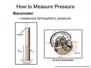
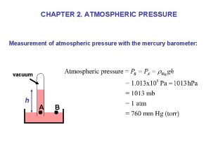
Mercury Barometer • Mercury Barometer – Torricelli – 1643 – long glass tube filled with mercury • The height of the mercury column is a measure of atmospheric pressure.

Aneroid Barometer • Aneroid barometer – most common type of home barometer. No fluid but rather an aneroid cell (small flexible metal box) sealed to outside so when pressure changes the box expands/contracts. Altimeter and barograph are two types of aneroid barometers.

A recording barograph

Pressure Readings • Station Pressure – barometer reading at a particular location and elevation • Altitude corrections – must be made so that a barometer reading taken at one elevation can be compared with a reading taken at another site. (Near the surface, pressure decreases on the average by about 1 mb for every 10 m increase in elevation. • Sea level pressure – adjusted barometer reading. Size of correction depends on how high station is above sea level. • Isobar – lines connecting points of equal pressure

• The top diagram (a) shows four cities (A, B, C, and D) at varying elevations above sea level, all with different station pressures. The middle diagram (b) represents sea-level pressures of the four cities plotted on a sea-level chart. The bottom diagram (c) shows isobars drawn on the chart (gray lines) at intervals of 4 mb.

Sea-level isobars drawn so that each observation is taken into account. Not all observations are plotted.

Sea-level isobars after smoothing

Surface and Upper Air Charts • Sea level pressure chart (surface map) – chart with sea level pressure values plotted on it • Surface weather map (chart) – a map that shows the distribution of sea level pressure with isobars and weather phenomena. “Surface Chart”

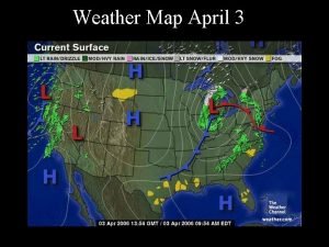
Surface map showing areas of high and low pressure. The solid lines are isobars drawn at 4 -mb intervals. The arrows represent wind direction.

Surface Charts • Winds – arrows on a surface map indicate the direction from which the wind is blowing (a frommy!) • Blue H’s – represent High pressure – or anticyclones • Red L’s – represent Low pressure – or mid latitude cyclones- extratropical cyclones • Isobars – lines of equal pressure [millibars (mb)]

Because of the changes in air density, a surface of constant pressure (shaded gray area) rises in warm, less-dense air and lowers in cold, more-dense air. Where the horizontal temperature changes most quickly, the constant pressure surface changes elevation most rapidly.

The 500 -mb map for the same day as the surface map. Solid gray lines on the map are contour lines in meters above sea level. Dashed red lines are isotherms in °C. Arrows show wind direction.

Upper Air Charts • Upper air charts are charts of equal pressure, therefore the heights of these equal pressures vary. • Isoheights – contour lines – lines that connect points of equal elevation above sea level • Blue H’s – are high heights • Red L’s – are low heights • Ridges – elongated highs- warm ridges • Troughs – (trofs) – elongated lows – cold trofs

Why the wind blows • Newton’s First Law – an object at rest will remain at rest and an object in motion will remain in motion (travel at a constant velocity along a straight line) as long as no force is exerted on the object (i. e. thrown baseball) • Newton’s Second Law – the force exerted on an object equals its mass times the acceleration produced; F=ma

Why the wind blows (cont) • F=ma • When mass of an object is constant, the force on the object is directly related to the acceleration that is produced. (Acceleration is the speeding up, the slowing down, or the changing of direction of an object) – Change in velocity over time. • More than one force acts on an object, and Newton’s second law refers to the net (total) force that results. • Objects accelerate in the direction of the total force acting on it

Forces that influence the wind • The higher water level creates higher fluid pressure at the bottom of tank A and a net force directed toward the lower fluid pressure at the bottom of tank B. This net force causes water to move from higher pressure toward lower pressure. Since it is easier to visualize a tank of water than a tank of air…

Forces that affect the horizontal movement of air • • Pressure Gradient Force (PGF) Coriolis Force (CF) Centripetal Force Friction

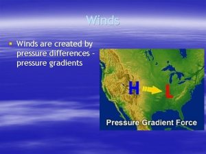
Pressure Gradient and PGF • The pressure gradient between point 1 and point 2 is 4 mb per 100 km. The net force directed from higher toward lower pressure is the pressure gradient force. Winds always blow from Higher toward Lower Pressure!!

Pressure Gradient and PGF • Pressure gradient = difference in pressure/distance • Pressure Gradient Force – the force due to differences in pressure within the atmosphere that causes air to move and, hence, the wind to blow. Directionally proportional to pressure gradient • PGF is directed from higher toward lower pressure at right angles to the isobars. • PGF causes the wind to blow!!!!

PGF • The closer the spacing of the isobars, the greater the pressure gradient. The greater the pressure gradient, the stronger the pressure gradient force (PGF). The stronger the PGF, the greater the wind speed. The red arrows represent the relative magnitude of the force, which is always directed from higher toward lower pressure.

Pressure Gradient Force • Surface weather map for 6 A. M. (CST), Tuesday, November 10, 1998. Dark gray lines are isobars with units in millibars. The interval between isobars is 4 mb. The distance along the green line X-X' is 500 km. Wind directions are given by lines that parallel the wind. Wind speeds are indicated by barbs and flags. The solid blue line is a cold front, the solid red line a warm front, and the solid purple line an occluded front. The heavy dashed line is a trough.

Coriolis Force • If PGF was the only force acting upon air, we would always find winds blowing directly from higher pressure to lower pressure. • However, the moment air starts to move from higher pressure to lower pressure it is deflected (to the right in the N. Hemisphere and to the left in the S. Hemisphere) by the Coriolis force. • An apparent force that is due to the rotation of the earth. • As speed of wind increases, deflection due to the Coriolis force increases. • Deflection is zero at the equator and a maximum at the poles.

Coriolis Force Summary • Objects moving any direction (N, S, E, W) are deflected to the right of their intended path in the NH and to the left in the SH • The amount of deflection depends on: – The rotation of the earth – The latitude – The object’s speed

Coriolis Force • On nonrotating platform A, the thrown ball moves in a straight line. On platform B, which rotates counterclockwise, the ball continues to move in a straight line. However, platform B is rotating while the ball is in flight; thus, to anyone on platform B, the ball appears to deflect to the right of its intended path

Coriolis Force • Except at the equator, a free-moving object heading either east or west (or any other direction) will appear from the earth to deviate from its path as the earth rotates beneath it. The deviation (Coriolis force) is greatest at the poles and decreases to zero at the equator.

Coriolis Force • Except at the equator, a free-moving object heading either east or west (or any other direction) will appear from the earth to deviate from its path as the earth rotates beneath it. The deviation (Coriolis force) is greatest at the poles and decreases to zero at the equator.

Straight line flow aloft • Above the level of friction, air initially at rest will accelerate until it flows parallel to the isobars at a steady speed with the pressure gradient force (PGF) balanced by the Coriolis force (CF). Wind blowing under these conditions is called geostrophic. Why is this wind blowing from the west? Pt. 1 PGF wind moves toward low pressure Coriolis deflects the air to right. As parcel increases speed, deflection increases. Pt. 5 the wind speed increases to a point Where the CF balances the PGF (net force zero) and the wind blows parallel to isobars.

The isobars and contours on an upper-level chart are like the banks along a flowing stream. When they are widely spaced, the flow is weak; when they are narrowly spaced, the flow is stronger. The increase in winds on the chart results in a stronger Coriolis force (CF), which balances a larger pressure gradient force (PGF).

Wind flow around low pressure • Winds and related forces around an area of low pressure above the friction level in the Northern Hemisphere. Notice that the pressure gradient force (PGF) is in red, while the Coriolis force (CF) is in blue Cyclonic flow around a low!!!

Wind flow around high pressure • Winds and related forces around an area of high pressure above the friction level in the Northern Hemisphere. • Clockwise flow around a high Anticyclonic flow around a High!!

Wind flow around Highs and Lows • Gradient wind – wind that blows at a constant speed parallel to curved isobars above the level of frictional influence • Centripetal Force (Centri: center; petal: to push toward) – the radial force required to keep an object moving in a circular path. Directed toward the center of that curved path.

Winds on Upper level charts • Winds tend to parallel the contour lines • Widely spaced contour lines = light winds • Closely spaced contour lines = strong winds • Meridional flow – a type of atmospheric circulation pattern in which the north-south component of the wind is dominant • Zonal flow – a pattern in which the eastwest component of the wind is dominant

An upper-level 500 -mb map showing wind direction, as indicated by lines that parallel the wind. Wind speeds are indicated by barbs and flags. (See the green insert. ) Solid gray lines are contours in meters above sea level. Dashed red lines are isotherms in °C. Point out zonal and meridional flow!

Surface Winds • The effect of surface friction is to slow down the wind so that, near the ground, the wind crosses the isobars and blows toward lower pressure. Note: Surface winds do not blow exactly parallel to the isobars!

Friction • This phenomenon at the surface produces an inflow of air around a low and an outflow around a high. Aloft, the winds blow parallel to the lines.

Southern Hemisphere • Winds around areas of low and high pressure in the Southern Hemisphere. Notice that at the surface winds blow clockwise and inward around the low (L); counterclockwise and outward around the high (H).

Southern Hemisphere • Surface weather map showing isobars and winds on a day in December in South America.

Buys-Ballot Law • In the Northern Hemisphere, if you stand with the wind aloft at your back, lower pressure aloft will be to your left and higher pressure to your right.

Buys-Ballot at the Surface • At the surface, the same relationship holds if, with your back to the surface wind, you turn clockwise about 30°.

Winds and Vertical Air Motions • Generally speaking vertical motions are only about several centimeters per second or about 1 mile per day • Air rises over a surface low and sinks over a surface high. • Why doesn’t air over a low rush off into space? • Hydrostatic equilibrium – the state of the atmosphere when there is a balance between the vertical pressure gradient force and the downward pull of gravity.

Winds and air motions associated with surface highs and lows in the Northern Hemisphere.

Measuring and Determining Wind • Wind is characterized by direction, speed, and gustiness. • Wind direction is the direction from which the wind is blowing • Prevailing Wind – name given to the wind direction most often observed during a given time of day. Prevailing wind in winter in US is NW, and SW in summer. (Houses should have windows facing SW to provide summertime ventilation and few windows facing NW (where cold winds come from)

An onshore wind blows from water to land, whereas an offshore wind blows from land to water.

Wind direction • Wind direction can be expressed in degrees about a circle or as compass points.

Flag Trees • In the high country, trees standing unprotected from the wind are often sculpted into "flag" trees.

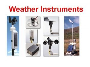
Wind Instruments • Wind vane – old, reliable weather instrument for determining wind direction (long arrow with tail) • Anemometer – measures wind speed • Aerovane (skyvane) – instrument used to indicate both wind speed and direction. • Wind profiler – a doppler radar capable of measuring the turbulent eddies that move with the wind. Provides a vertical picture of wind speed and wind direction.

The aerovane (skyvane).

Wind Rose • This wind rose represents the percent of time the wind blew from different directions at a given site during the month of January for the past ten years. The prevailing wind is NW and the wind direction of least frequency is NE.

Automated Surface Observing System (ASOS) • A wind vane and a cup anemometer. These instruments are part of the ASOS system.

 How does the air move in a sea breeze?
 Easterlies and westerlies
 What is the difference between global and local winds?
 Global winds and local winds
 Nullschool global wind
 Air pressure at different altitudes
 Atmospheric pressure head
 What measures pressure
 Low atmospheric pressure
 Retention definition in prosthodontics
 Mapline of atmospheric pressure
 Uses of wind vane
 Hubungan air tanah dan tanaman
 Air mass vocabulary
 Winds
Winds High pressure winds
 High pressure winds
 Valley and mountain breezes are examples of ____.
 Chapter 19 air pressure and wind
 Air pressure & windwhat is a convection cell?
 Section 1 what causes air pollution
 Chapter 12 air section 1 what causes air pollution
 Atmospheric opacity
 Atmospheric perspective watercolor
 Atmospheric suits
 Atmospheric gravity waves
 Psu meteorology jobs
 Lab 5 atmospheric moisture
 Atmospheric gravity waves
 Single cell model of atmospheric circulation
 Atmospheric stability
 Air expands
 Atmospheric stability
 Single cell model of atmospheric circulation
 Stellar heaven
 The four main layers of the atmosphere
 Atmospheric opacity
 Atmospheric circulation
 Atmospheric distortion correction
 What is weather variables
 Structure of atmosphere
 Atmospheric convection
 Tatiana erukhimova
 Atmospheric convection
 Atmospheric convection
 Atmospheric convection
 Weather studies introduction to atmospheric science
 Regional atmospheric soaring prediction
 Atmospheric diving suit
 Atmospheric chemistry lecture notes
 Facility for airborne atmospheric measurements
 Atmospheric refraction
 Atmospheric reaction
 Atmospheric
 Traveling southward from the arctic regions of canada
 Weather studies introduction to atmospheric science
 Zonation and succession
 Atmospheric vortex engine
 Atmospheric vortex engine
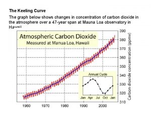
 The graph below shows atmospheric carbon dioxide
 Snell's law


