CHAPTER 3 DRAINAGE TOPICS DRAINAGE BASIN DRAINAGE SYSTEM

CHAPTER 3 DRAINAGE

TOPICS • DRAINAGE BASIN • DRAINAGE SYSTEM IN INDIA • HIMALAYAN RIVERS • PENINSULAR RIVERS

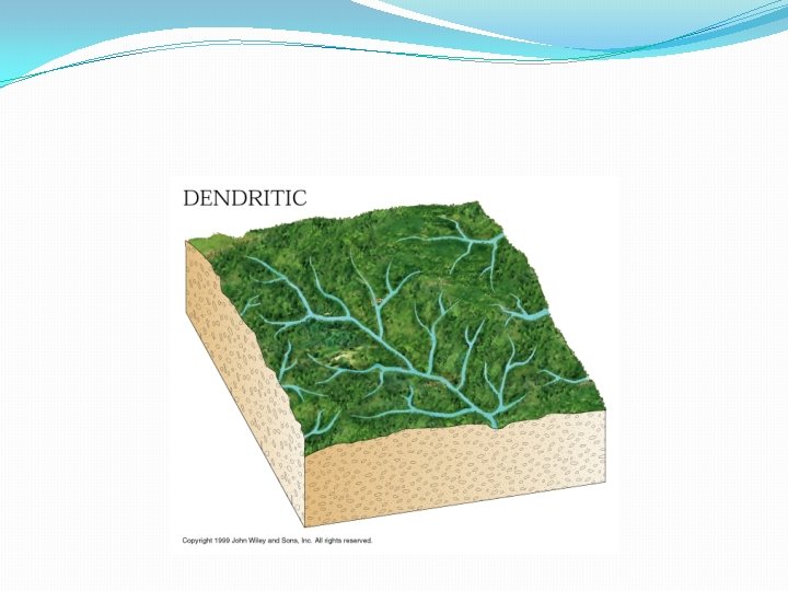
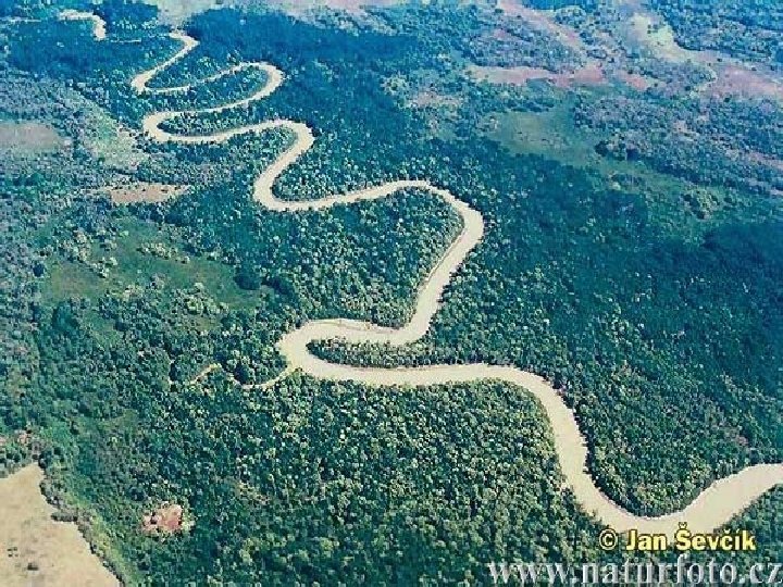
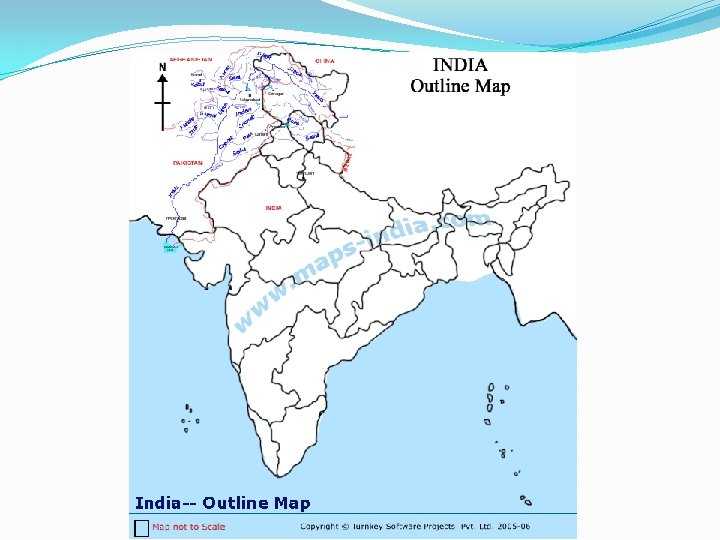
The term drainage describes the river system of an area. The area drained by a single river system is called a drainage basin.

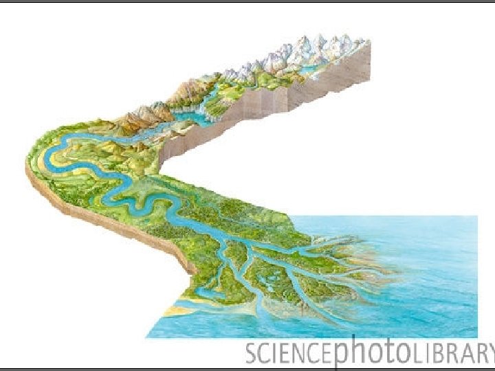
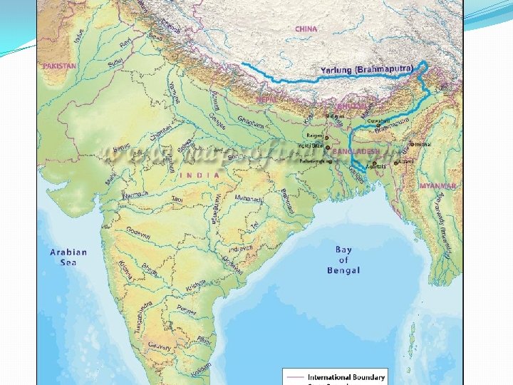
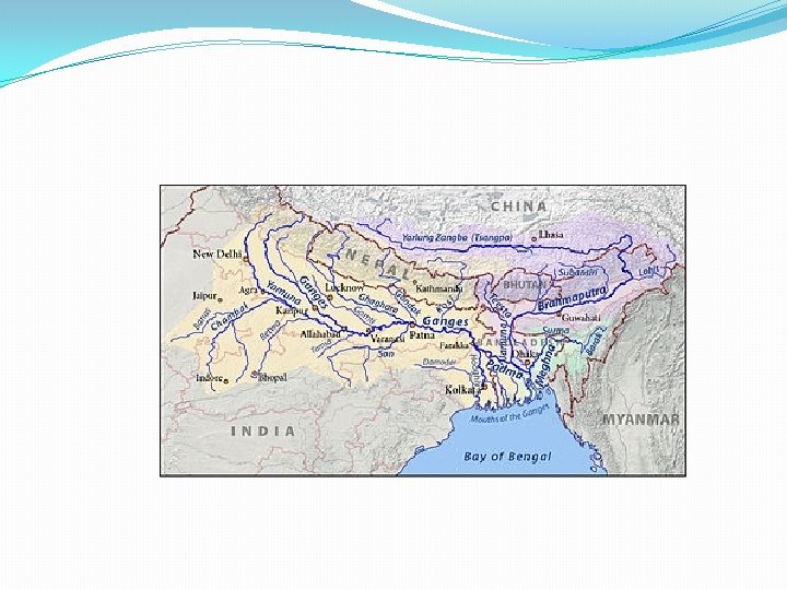
DRAINAGE SYSTEMS IN INDIA The drainage systems of India are mainly controlled by the broad relief features of the subcontinent. Accordingly, the Indian rivers are divided in to two major groups: �The Himalayan rivers. �The Peninsular rivers.

Comparison between the Himalayan & Peninsular Rivers Himalayan Rivers I. III. IV. V. VI. These rivers originate from the glaciers. Catchment area is very large. Engaged in high erosion activity. Useful in irrigation Perennial. Eg. : - Indus, Ganga. Peninsular Rivers These rivers originate from the plateaus. II. Catchment area is very small. III. Engaged in low erosion activity. I. IV. Not very useful in irrigation V. Non-perennial.

HIMALAYAN RIVERS

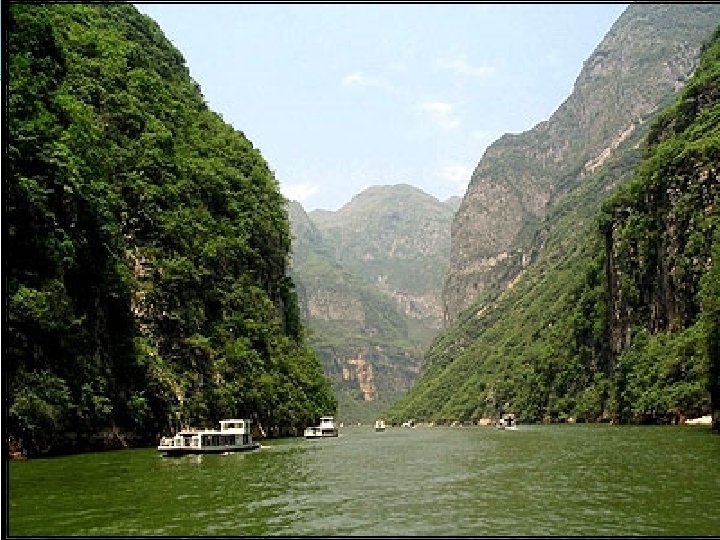
Himalayan Rivers The Ganges, the Brahmaputr a and the Indus together are known as the Himalayan

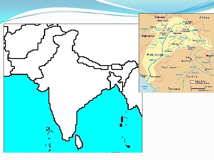
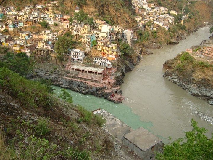
�INDUS RIVER �Source: Rises in Tibet �Near lake Manasarovar. �Tributaries: Chenab, Sutlej, jhelum, Ravi �Beas. �Length: 2900 km. �Indus Water Treaty 1960.

Confluence of Indus and Zanskar rivers. The Indus is at the bottom of the picture, flowing left-to-right; the Zanskar, carrying more water, comes in from the middle left of the picture. The Indus River near Skardu, in. Gilgit– Baltistan.

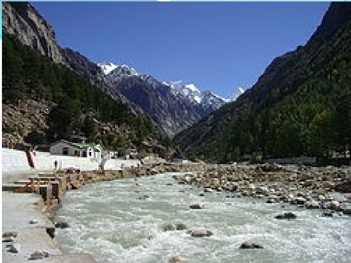
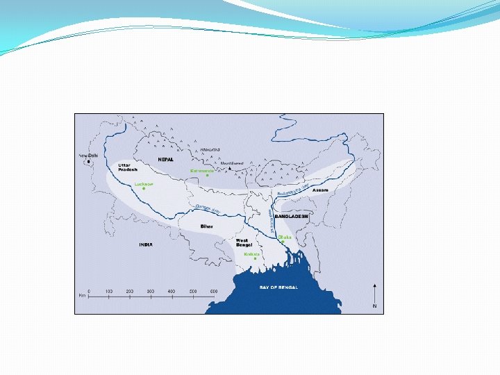
System The Gan in ges ani Var The Ganges , is the largest river of the Indian subcontinent, flowing east through the Gangetic Plain of northern India int o Bangladesh. The 2, 500 km river rises in the Gangotri Glacier.
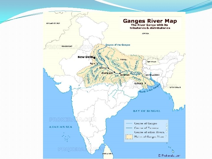

BASIC INFORMATION OF THE GANGES RIVER OF INDIA Total Length of River Ganges 2, 510 Kms (1, 560 miles) Average depth of Ganga River 52 Feet (maximum depth, 100 feet) Place of Origin of Ganga River Foot of Gangotri Glacier, at Gaumukh, at an elevation of 3, 892 m Area drained by Ganges River (Ganges Plains) 1, 000 Square Kilometres Major Tributaries of Ganges Yamuna, Son, Kosi, Gandak, Gomati, Ghaghara, Bhagirathi etc. . . Cities on the bank of Ganges Kanpur, Soron, Allahabad, Varanasi, Patna, Ghazipur, Bhagalpur, Mirzapur, Buxar, Saidpur etc. . .

GANGETIC DOLPHIN

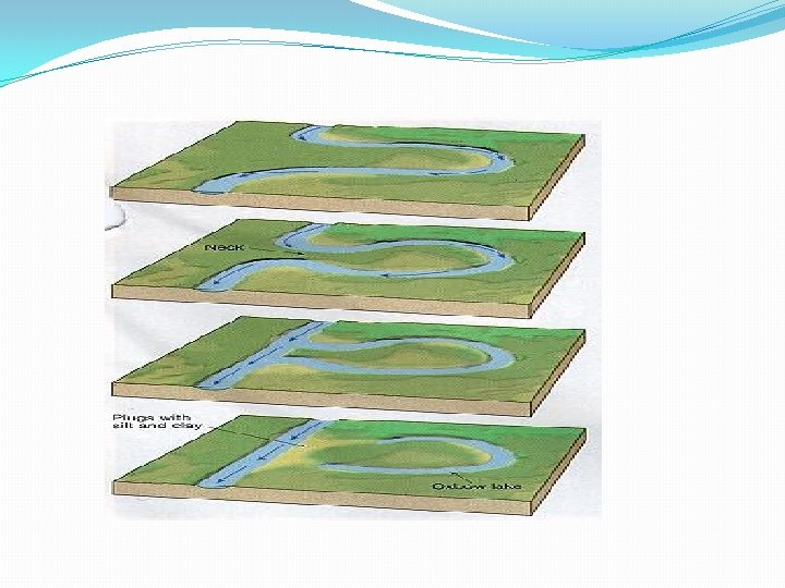
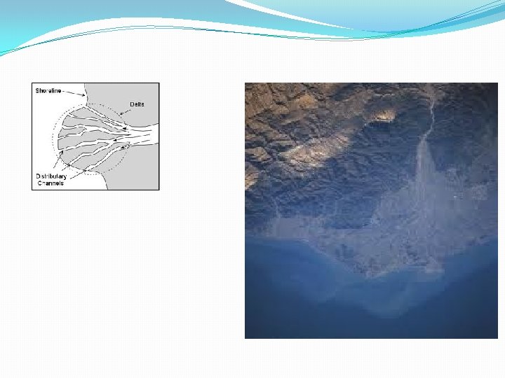
Main Features Of The Ganga System ØThe length of the Ganga is over 2500 kms. ØIt has the largest basin. ØFrom the Himalayas the Ganga enters the plains at Haridwar. ØIt is joined by a number of tributaries i. e. Yamuna, Son, Kosi & Gandak. ØThe Ganga enters Bangladesh as Padma. ØThe river is called Meghna when Brahmaputra joins it. ØIt creates the largest delta, Sunderban with the help of Brahmaputra.

BRAHMAPUTRA RIVER
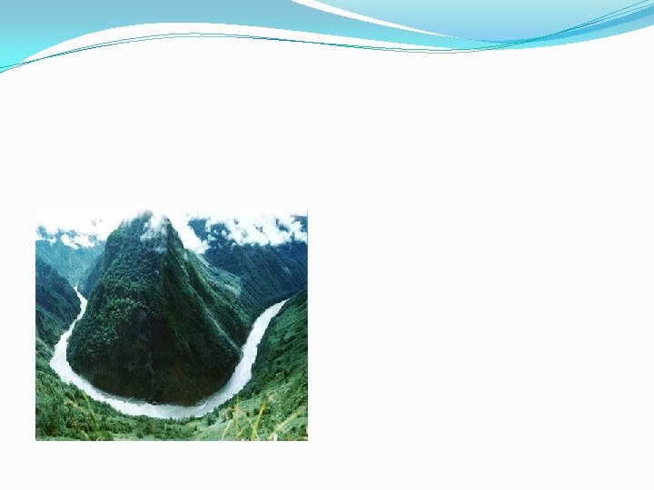

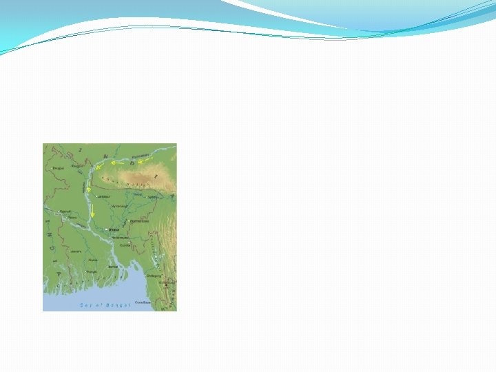
BRAHMAPUTRA RIVER �Source: Rises in tibet east of Manasarovar lake �Flow eastward parallel to the Himalayas. On reaching the Namcha. Barwa it takes a ‘U’ turn and enters India in. Arunachal pradesh through a gorge. �Tributaries: Dibang, Lohit. �Form riverine island.

BRAIDED STREAM

PENINSULAR RIVER
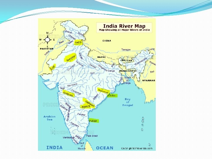

NARMADA RIVER

ORIGIN OF RIVER NARMADA IN SANSKRIT MEANING “THE GIVER OF PLEASURE “
, also called the Rewa, is a")
�The Narmada (Devanagari: ������ , Gujarati: ������ ), also called the Rewa, is a river in central India and the fifth longest river in the. Indian subcontinent. �It is the third longest river that flows entirely within India, after the Godavari and the Krishna. It is also known as "Life Line of Madhya Pradesh" for its huge contribution to the state of Madhya Pradesh in many ways. � It forms the traditional boundary between North India and South India and flows westwards over a

MARBLE ROCKS

DHUADAR FALLS

THE TAPI BASIN

Tapti River �River in India �The Tapti River ancient original name Tapi River, is a river in central India. �Length: 724 km �Basin area: 65, 145 km² �Source: Satpura Range �Mouth: Gulf of Khambhat �Country: India �Cities: Surat, Burhanpur, Bhusawal, Jalgaon, Dhule, Nas hik, more �

DAKSHINA GANGA

Tributaries of Godavari River. Pravara. Penganga. Indravathi. Purna. Wardha. Sabari. Manjira. Vine Ganga Manair. Pranahitha
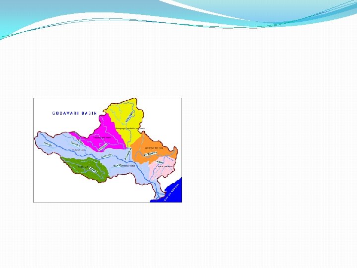

� Biggest river in South India. � It originates at Triambakeshwar in Nasik District of Maharashtra. � Its total length – 1465 Km. � It travels 694 Km. , in Maharashtra State. � It travels 767 Km. , in Andhra Pradesh State. � In Telangana Region, it travels 653 Km. , and� In Andhra Region, 114 Km. �

Statue of Mother Godavari at Rajahmundry Railway station

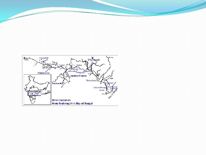
GODAVARI RIVER

MAHANADI BASIN The Mahanadi is a major river in East Central India Area of around 141, 600 square kilometres and has a total course of 858 kilometres. The river flows through the states of Chhattisgarh and Odisha. Length: 858 km Discharge: 2, 119 m³/s Source: Sihawa Country: India Bridges: Second Mahanadi Rail Bridge Cities: Cuttack, Sambalpur, Sonepur, Odisha, Boudh, Birmaharajpur, Subalaya

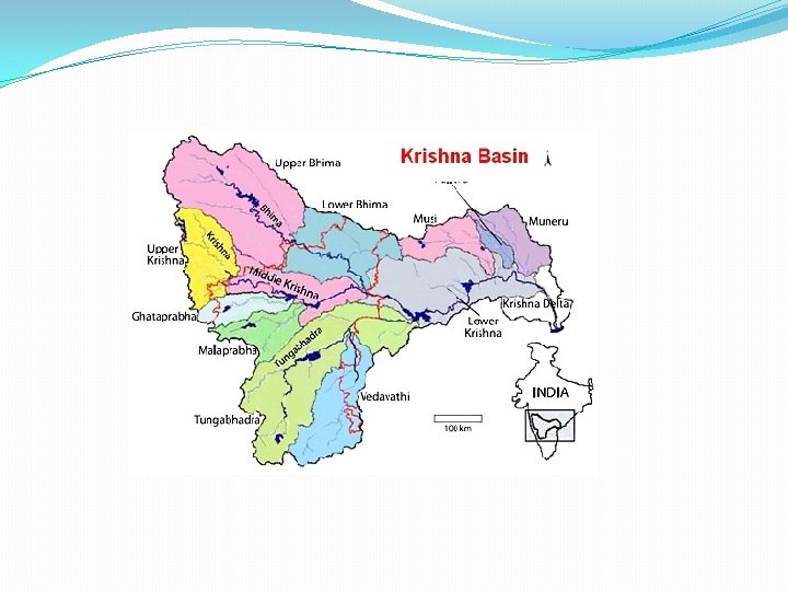
KRISHNA BASIN

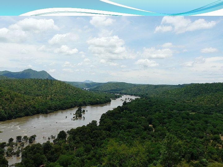
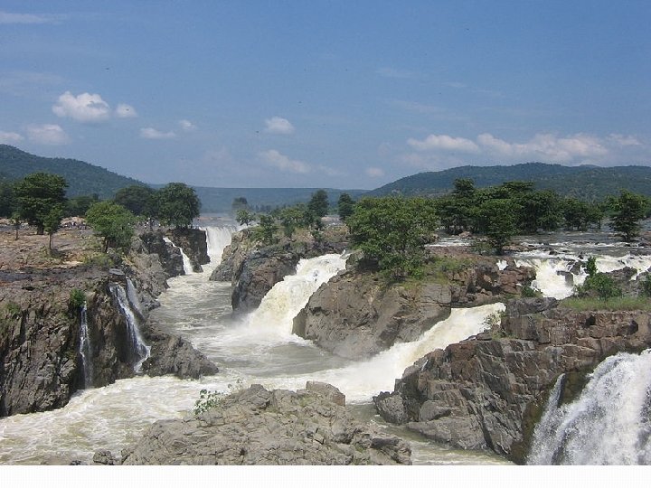
KAVERI BASIN

�The Kaveri, also spelled Cauvery in English, is a large � Indian river. The origin of the river is traditionally placed �at Talakaveri, Kodagu in the Western Ghats in Karnataka. �Length: 765 km �Basin area: 72, 000 km² �Source elevation: 1, 276 m �Source: Western Ghats �Country: India �Cities: Tiruchirappalli, Thanjavur, Talakaveri, Srirangapat na, more �
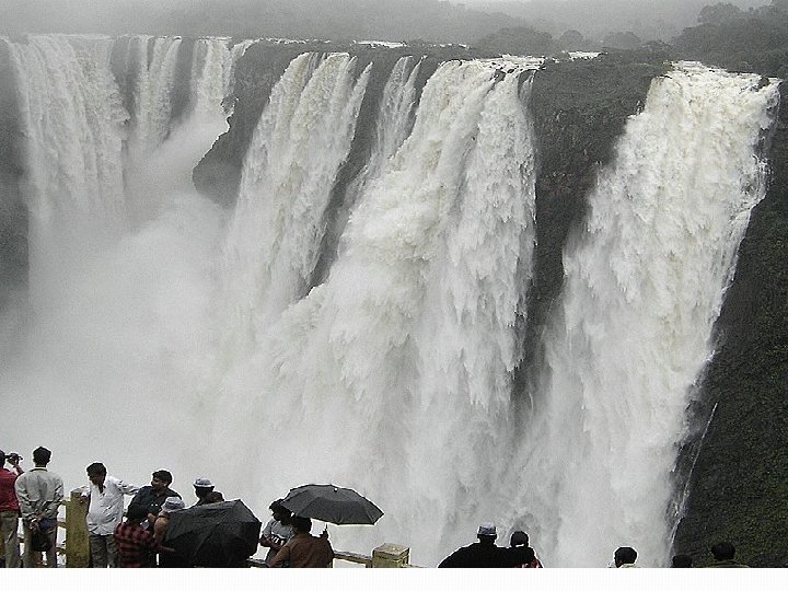

SHIVASAMUDRAM WATE
 The rivers contain fresh water which is most necessary")
Benefits of a River a) The rivers contain fresh water which is most necessary for man as well as animals for survival. b) They provide water for irrigation and cultivation available in abundance. c) They make the soil rich in Alluvial. d) These serve as arteries of commerce. e) They are good for navigation. f) Estuaries, near the shores , where the sweet water mixes freely with the salt water of the oceans, have proved to be the most biologically productive areas of the world. All type of fishes survive over here. g) Rivers are harnessed for generation of hydro-

� THANK YOU
- Slides: 63