CHAPTER 24 PHYSICAL GEOGRAPHY OF SOUTH ASIA THE


- Slides: 21
CHAPTER 24 PHYSICAL GEOGRAPHY OF SOUTH ASIA: THE LAND WHERE CONTINENTS COLLIDED South Asia’s major landforms, including the massive Himalayan mountains, were created when the subcontinent broke off from Africa and drifted into Asia.
The Indian Subcontinent - Countries: • India, Pakistan, Bangladesh, Bhutan, Nepal, Sri Lanka, the Maldives - Subcontinent: large landmass that’s smaller than a continent
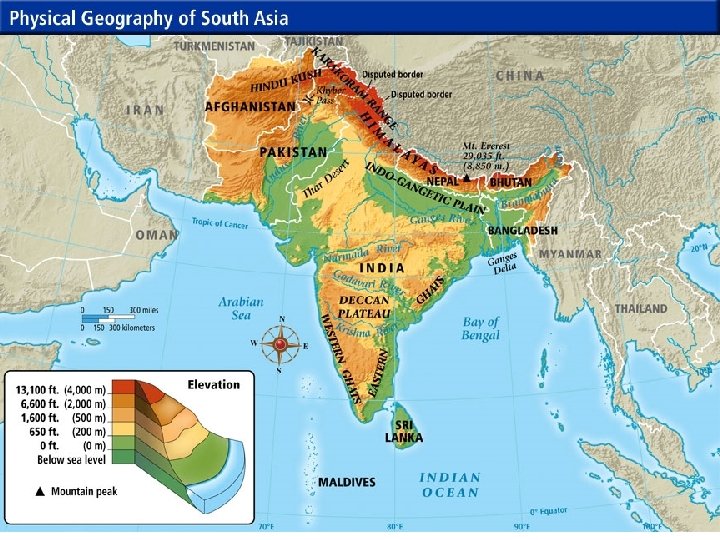
MOUNTAINS AND PLATEAUS South Asia was once part of East Africa § Split off 50 million years ago and collided with Central Asia Collision of tectonic plates pushed land into huge mountain ranges Himalaya Mountains — 1, 500 milelong system of parallel ranges § Include world’s tallest mountain—Mt. Everest § Form barrier between Indian subcontinent and China § Kingdoms of Nepal, Bhutan are also in these mountains
MOUNTAINS AND PLATEAUS South Asia was once part of East Africa § Split off 50 million years ago and collided with Central Asia Collision of tectonic plates pushed land into huge mountain ranges Himalaya Mountains — 1, 500 milelong system of parallel ranges § Include world’s tallest mountain—Mt. Everest § Form barrier between Indian subcontinent and China § Kingdoms of Nepal, Bhutan are also in these mountains
MOUNTAINS AND PLATEAUS • At west end, Hindu Kush mountains separate Pakistan, Afghanistan • Historically blocked invasions from Central Asian tribes • Khyber Pass is one of the major land routes through the mountains • Karakoram Mountains are in northeastern part of Himalayas • Include world’s second highest peak, K 2
RIVERS, DELTAS, & PLAINS The Indus & Ganges are two of the greatest river systems in South Asia These rivers play a key role in supporting life in South Asia When the rivers overflow their banks, they deposit rich soil on alluvial plains (rich farmlands) The Indo-Gangetic Plain is also the most heavily populated part of South Asia
RIVERS, DELTAS, & PLAINS The Indus & Ganges are two of the greatest river systems in South Asia These rivers play a key role in supporting life in South Asia When the rivers overflow their banks, they deposit rich soil on alluvial plains (rich farmlands) The Indo-Gangetic Plain is also the most heavily populated part of South Asia
GANGES RIVER A Sacred River Hinduism is the religion of most Indians To Hindus, the Ganges River is the sacred home of the goddess Ganga § Hindus believe waters have healing powers; temples line its banks § Pilgrims come to bathe, scatter ashes of dead § At sacred site of Varanasi they gather daily for prayer, purification § Float baskets of flowers, burning candles on water
GANGES RIVER A Polluted River Centuries of use have made Ganges most polluted river in world § Sewage, industrial waste, human bodies poison the water Users get stomach and intestinal diseases, hepatitis, typhoid, cholera I n 1986, government plans sewage treatment plants, regulations § Today few plants are operational, factories still dump waste § Clean up will take time, money, a change in how people see river
OFFSHORE ISLANDS Sri Lanka & the Maldives are located in the Indian Ocean § Sri Lanka is a large tropical island with great natural beauty Maldives comprise an archipelago (1200 k islands, 200 of which are inhabitated) § They are considered atoll islands § Low-lying tops of submerged volcanoes § Look like ring-like coral island or string of small islands surrounding a lagoon
OFFSHORE ISLANDS Sri Lanka & the Maldives are located in the Indian Ocean § Sri Lanka is a large tropical island with great natural beauty Maldives comprise an archipelago (1200 k islands, 200 of which are inhabitated) § They are considered atoll islands § Low-lying tops of submerged volcanoes § Look like ring-like coral island or string of small islands surrounding a lagoon
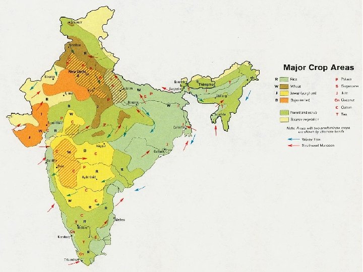
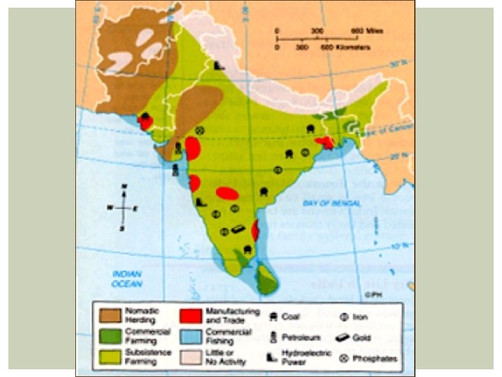
NATURAL RESOURCES The subcontinent coasts a wide variety of natural resources that support human life South Asia relies heavily on soil & water resources to provide food through farming & fishing Water also provides a means of transportation & power Forest products are another important resource in South Asia is abundant in coal & iron ore & other metals
CONTINUED NATURAL RESOURCES Minerals § India § Fourth in world in coal production, has petroleum, uranium § Mica for electrical equipment and growing computer industry § Known for diamonds § Iron ore from India’s Deccan Plateau used in steel industry, exported § Sri Lanka § Known for sapphires, rubies § Pakistan, Bangladesh § Have natural gas resources
CONTINUED NATURAL RESOURCES Forests Deforestation is a severe problem § Causes soil erosion, flooding, landslides, loss of wildlife habitats § Overcutting has devastated forests in India, Bangladesh, Sri Lanka
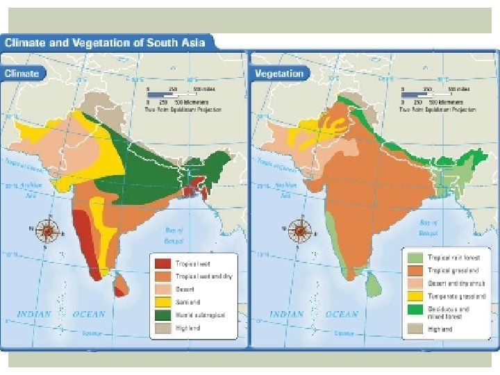
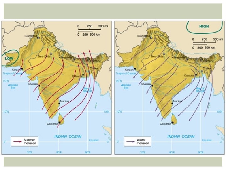
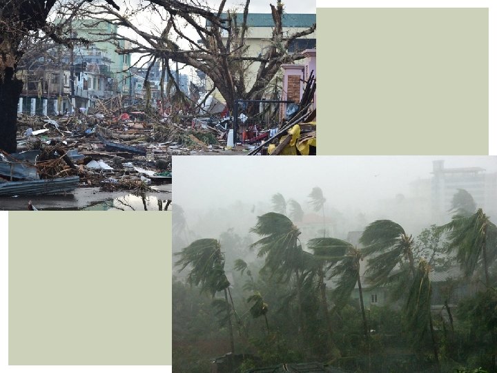
CLIMATE—WET AND DRY, HOT AND COLD Monsoons and Cyclones Monsoons—seasonal winds that affect entire region § Dry winds blow from northeast October–February § Moist ocean winds blow from southwest June–September § Moist winds bring heavy rainfall, especially in southwest, Ganges Delta § Unpredictable; cause hardship in lowlands of India, Bangladesh Cyclone—violent storm with fierce winds, heavy rain § In Bangladesh low coastal region swamped by high waves