Chapter 2 Section 1 Exploring the Earths Surface


- Slides: 23
Chapter 2 - Section 1 Exploring the Earth’s Surface
DO NOW • What is a map key and how can it be used to identify features on a map? What are some example features it identifies?
Map key- a part of a map that explains any symbols or colors on a map. Gives you information needed for the map to make sense
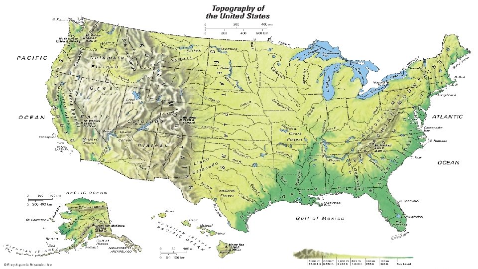
Topography • Topography- shape of the land, may be hilly, flat, sloping, or mountainous • Topography of an area- the area’s elevation, relief, and landforms
Topography • Your desk has piles of books, papers, and other objects of different size and shape • Your desk has both elevation and relief!
Elevation • Elevation- height above sea level of a point on Earth’s surface
Relief • Reliefdifference in elevation between the highest and lowest parts of an area
• Mauna Loa a volcano making up part of the Hawaiian Islands, extends from the ocean floor 5, 000 m below sea level to an elevation of about 4, 170 m. What is the volcano’s elevation? • 4, 170 m
• What is the relief of an area where the highest point is 1, 560 m above sea level and the lowest point is 300 m below sea level? • Relief = 1, 260 • 1, 560 – 300 = 1, 260
Turn and Talk • What is the difference between elevation and relief? • Elevation is the height of an area above sea level. Relief is the difference in elevation between the highest and lowest parts of an area.
• Landform- feature of topography, such as a hill or valley, formed by the processes that shape the Earth’s surface. • Different landforms have different combinations of elevation and relief. Landforms
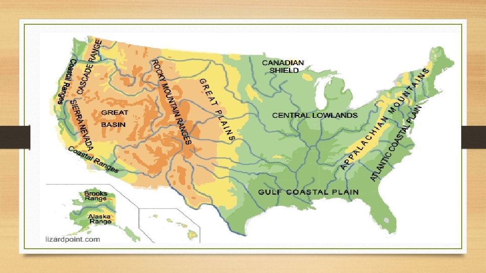
Types of Landforms • Landforms vary in size and shape from level plains extending as far as the eye can see, to low rounded hills that you could climb on foot, or jagged mountains that would take you many days to walk around. • 3 main types- plains, mountains, and plateaus
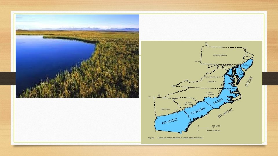
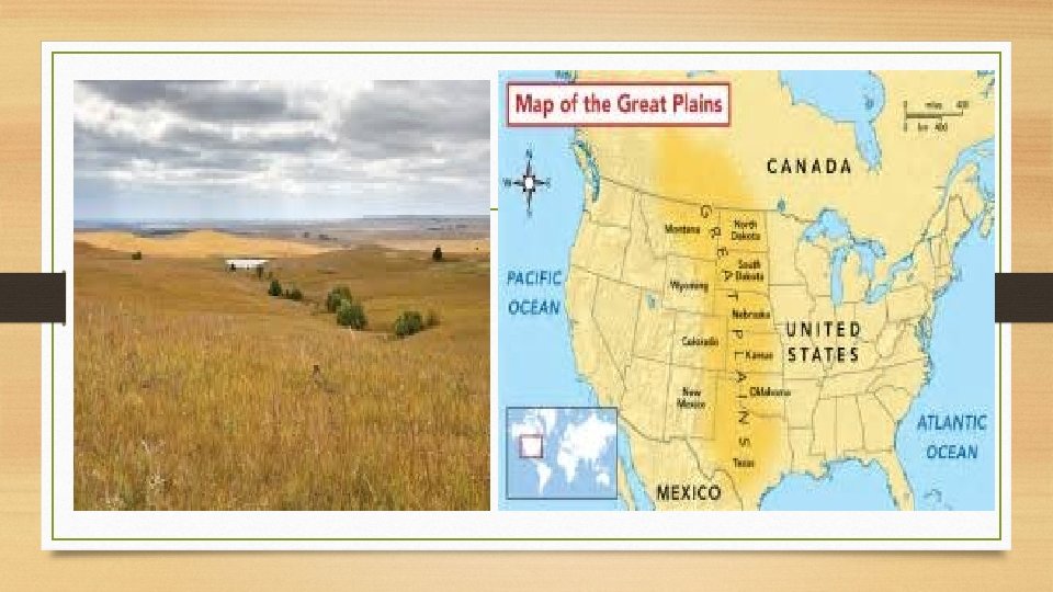
Plains • Plains-made up of nearly flat or gently rolling land with no relief • Coastal plain- lies along a seacoast. Have both low elevation and low relief • Interior plain- lies away from the coast. Have low relief, elevation can vary • Ex- Great Plains
Mountains • Mountain- landform with high elevation and high relief. • Usually occurs as part of a mountain range. • Mountain range- a group of mountains that are closely related in shape, structure, and age.
• Different mountain ranges in a region make up a mountain system • Bitteroot Mountains are a mountain range in mountain system knows as the Rocky Mountains
• Mountain belt- formed from a large connected chain of mountain ranges and mountain systems. • Rocky mountains part of a mountain belt that stretches down the western sides of North America and South America
Plateaus • Plateau- landform that has high elevation and a more or less level surface. • Rarely perfectly smooth on tops. • Streams and rivers may cut into the plateau’s surface
Colombian Plateau in Washington State Colombian River runs through 1, 500 meters thick
Landform regions • Landform region- large area of land where the topography is made up of mainly one type of landform. • Ex- Great Plains and Rocky Mountains • Upland is a region of hilly topography, lowland region of plain with low elevation, basin lower than the mountains around it.