Chapter 14 THUNDERSTORMS AND TORNADOES Wall Cloud associated


- Slides: 70
Chapter 14 THUNDERSTORMS AND TORNADOES
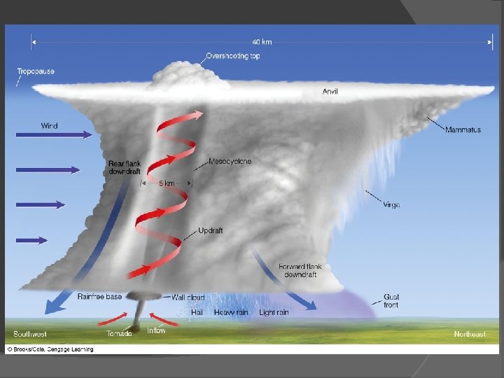
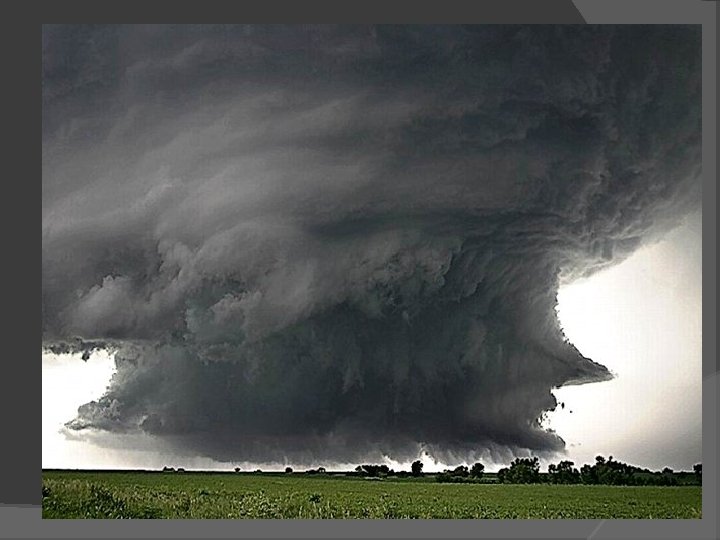
Wall Cloud associated with a super cell thunderstorm
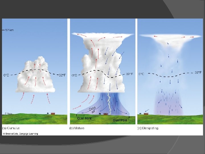
Thunderstorms A storm containing lightening and thunder; convective storms may have heavy rain hail Ordinary Cell Thunderstorms Air-mass thunderstorms: limited wind sheer Stages: cumulus, mature, dissipating Entrainment, downdraft, gust front
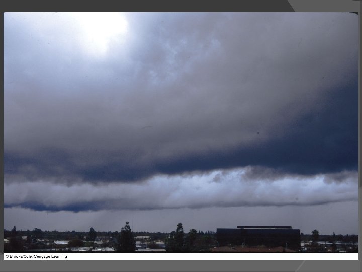
A dissipating thunderstorm
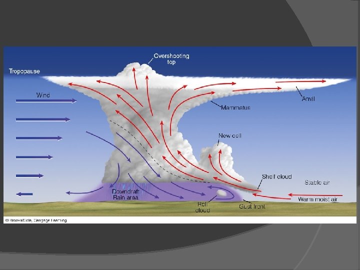
Thunderstorms Multi-cell Thunderstorms that contain a number of convection cells, each in a different stage of development, moderate to strong wind shear; tilt, over shooting top
Multicell storm
Thunderstorms Multi-cell Thunderstorms Micro-bursts: localized downdraft that hits the ground and spreads horizontally in a radial burst of wind; wind shear, virga
Dust clouds from microbursts
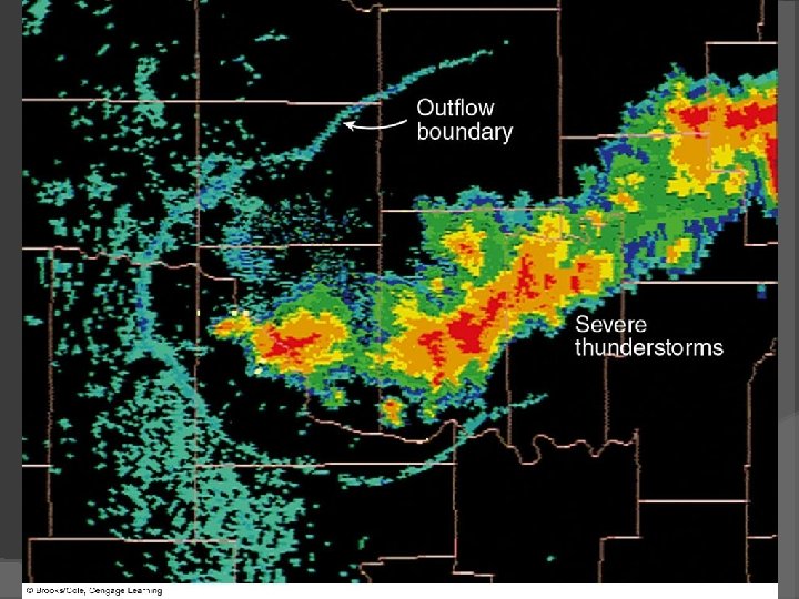
Thunderstorms Multi-cell Thunderstorms Gust Front: leading edge of the cold air out- flowing air; shelf cloud, roll cloud, outflow boundary
Thunderstorms Severe thunderstorms: one of large hail, wind gusts greater than or equal to 50 kts, or tornado, tilted updraft/downdraft
Shelf cloud
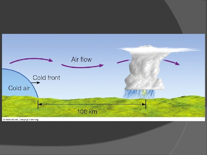
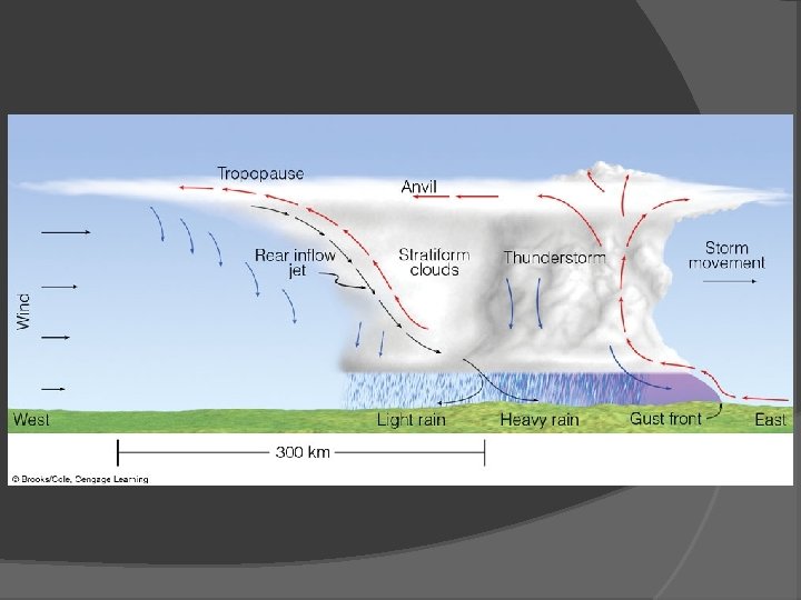
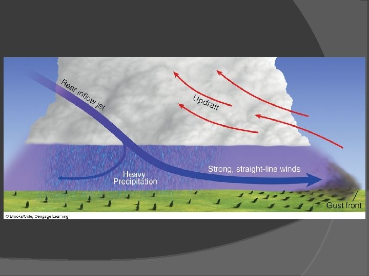
Thunderstorms Multi-cell Thunderstorms Squall-line thunderstorms; line of multi-cell thunderstorms, pre-frontal squall-line, derecho
Pre frontal Squall line
Pre frontal Squall line
The thunderstorms are producing strong straight-line winds called a derecho
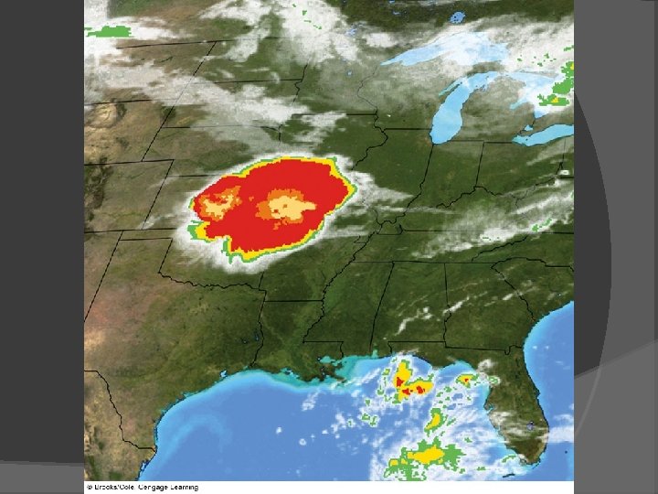
Thunderstorms Multi-cell Thunderstorms Meso-scale Convective Complex: a number of individual multi-cell thunderstorms grow in size and organize into a large circular convective weather system; summer, 10, 000 km 2
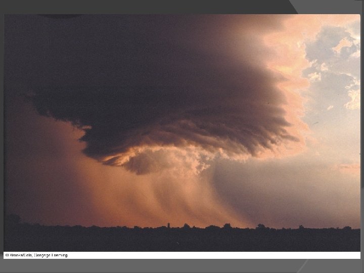
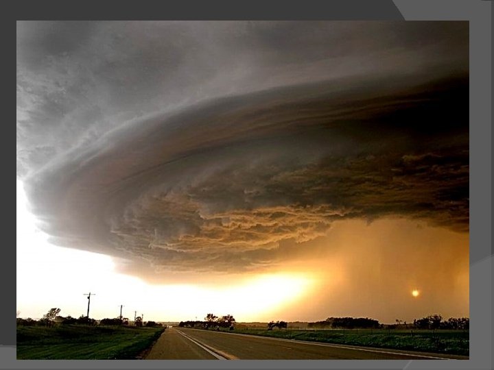
Thunderstorms Supercell thunderstorms Large, long-lasting thunderstorm with a single rotating updraft Strong vertical wind shear Outflow never undercuts updraft Classic, high precipitation and low precipitation supercells Rain free base
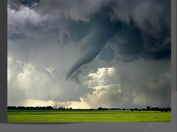
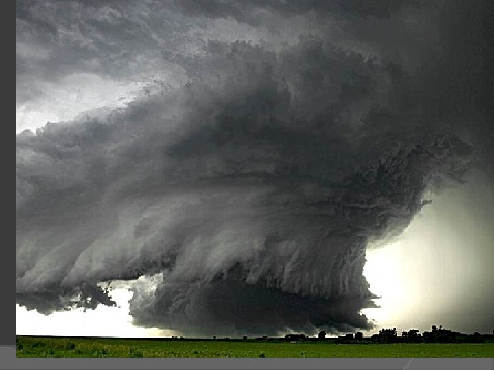
A supercell thunderstormwith a tornado sweeps over Texas
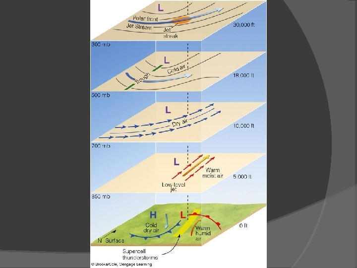
Thunderstorms Supercell thunderstorms Strong vertical wind shear Surface, 850 mb, 700 mb, 500 mb, 300 mb conditions low-level jet
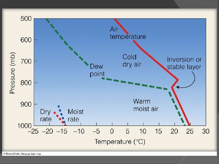
Thunderstorms Supercell thunderstorms Cap and convective instability
Thunderstorms and the Dryline Sharp, horizontal change in moisture Thunderstorms form just east of dryline c. P, m. T, c. T
Fig. 14 -23, p. 384
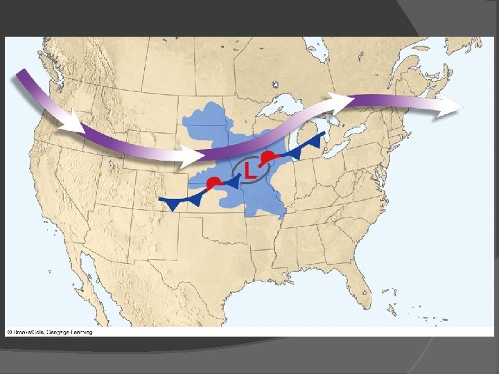
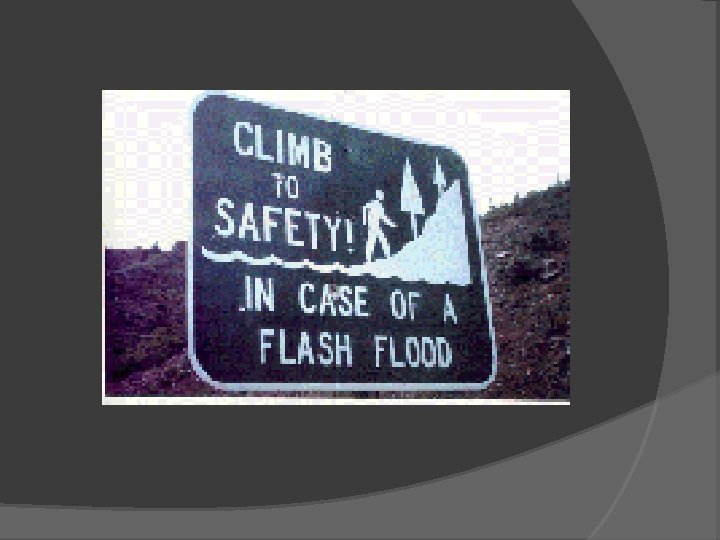
Thunderstorms Floods and Flash Floods Large floods can be created by training of storm systems, Great Flood of 1993 Flash floods rise rapidly with little or no advance warning; many times caused by stalled or slow thunderstorm
downtown Des Moines, Iowa, during July, 1993 Fig. 14 -25, p. 387
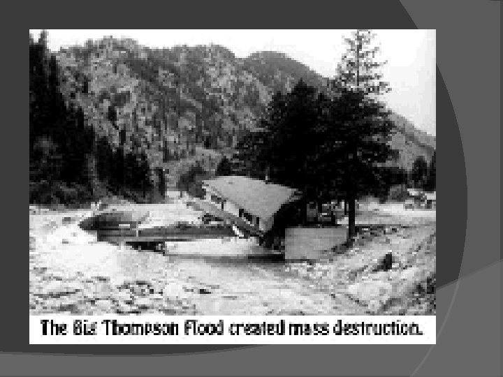
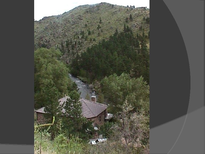
Thunderstorms Topic: Big Thompson Canyon July 31, 1976, 12 inches of rain in 4 hours created a flood associated with $35. 5 million in damage and 135 deaths
Fig. 1, p. 386
Flash Floods Slow moving or Stalled thunder Storm, especially in canyon areas 135 deaths in 1976 flood 12 inches of rain in 4 hours (normal ~16 inches /year)
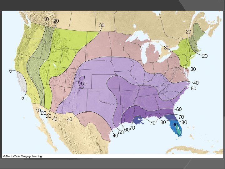
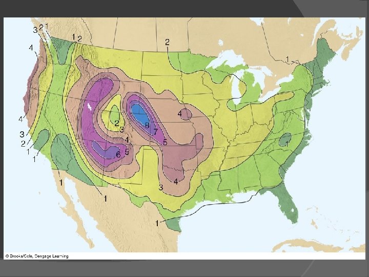
Thunderstorms Distribution of Thunderstorms Most frequent Florida, Gulf Coast, Central Plains Fewest Pacific coast and Interior valleys Most frequent hail Central Plains
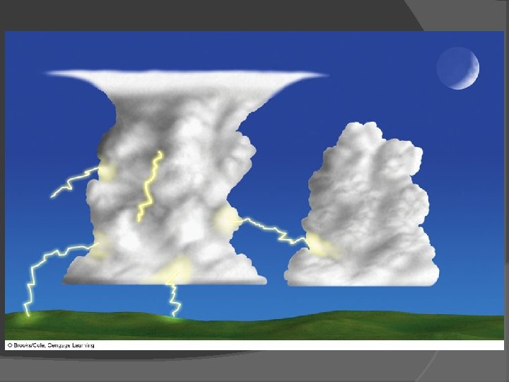
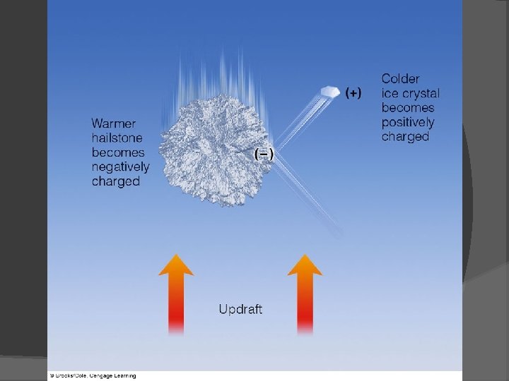
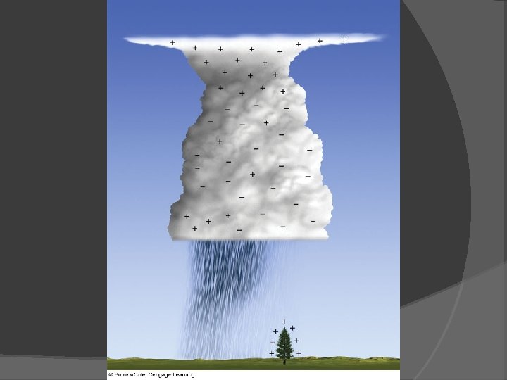
Thunderstorms Lightening and Thunder Lightening: discharge of electricity in mature storms (within cloud, cloud to ground) Thunder: explosive expansion of air due to heat from lightening Electrification of Clouds: graupel and hailstones fall through supercooled water, ice crystals become negatively charged Upper cloud positive, bottom cloud negative
Thunderstorms Observations: Elves Blue jets, red sprite, ELVES
Fig. 2, p. 390
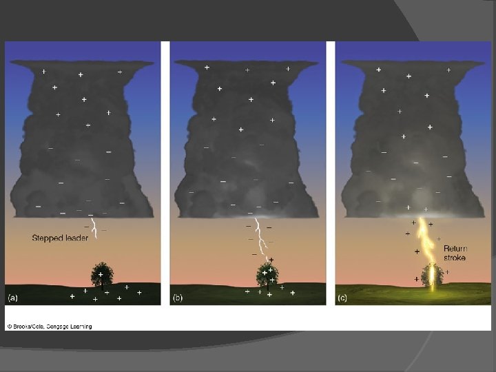
Thunderstorms The Lightening Stroke Positive charge typically on ground, cloud to ground lightening Stepped leader, ground stroke, forked lightening, ribbon lightening, bead lightening, corona discharge
Thunderstorms Observation: Apple tree DO NOT seek shelter during a thunderstorm under an isolated tree. Lightening Detection and Suppression Lightening direction finder detects radiowaves produced by lightening, spherics National Lightening Detection Network Suppression: seed clouds with aluminum
Fig. 3, p. 395
Fig. 14 -32, p. 392
Fig. 14 -33, p. 393
fulgurite Fig. 14 -34, p. 393
Fig. 14 -35, p. 394
sferics Fig. 14 -36, p. 394