Chapter 12 WEATHER Section 1 causes of weather


 origins are Canada and")
 develops over the Northern Pacific or Atlantic.")


- Slides: 44
Chapter 12 WEATHER
• Section 1 – causes of weather • Short term variation in atmospheric conditions are called weather. • Climate is the long-term average of variations in weather for a particular place. Climate takes into account the average of the past 30 years.
• The constant movement of air on Earth’s surface along with the oceanic currents, redistribute thermal energy around the Earth. Weather is part of the constant redistribution of Earth’s thermal energy.
• An air mass is a large volume of air that has the same characteristics as its source region. The source region is the area over which the air mass formed.
• There are 5 types of air masses. 1. ARCTIC – source region above 60 N latitude, results in cold, dry air.
2. Continental Polar – (continental means its occurs over land) origins are Canada and Alaska. Results in cold, dry weather.
3. Maritime Polar – (maritime means ocean) develops over the Northern Pacific or Atlantic. Results in cool to mild, humid weather.
4. Continental Tropical – develops over Southwestern U. S. and Mexico. Results in hot, dry weather.
5. Maritime Tropical – develops over tropical seas, results in warm, humid weather.
• Air mass modification – when an air mass travels over land or water that has different characteristics from where it developed, it can take on some of those characteristics.
• When an air mass undergoes modification it exchanges thermal energy and /or moisture with the surface over which it travels.
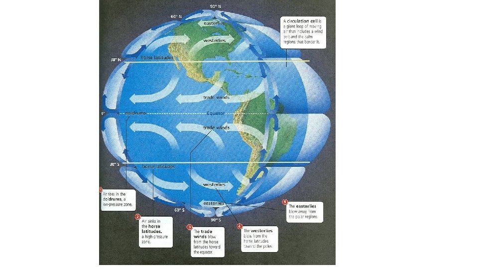
• Section 2 – Weather Systems • The direction of Earth’s winds are influenced by Earth’s rotation. This is called the Coriolis effect and results in fluids and objects moving in a curved path rather than a straight path.
• Global wind systems help equalize thermal energy on Earth.
• There are 3 basic wind systems. 1. Polar Easterlies – begins as cold air sinks and turns east, usually cold, weak and sporadic.
2. Prevailing westerlies – moves west toward the poles. Steady winds that move most of the weather across the U. S.
3. Trade Winds – air sinks and moves east toward the equator. The horse latitudes are a band of weak winds resulting from the sinking of the trade winds.
• The areas where the wind systems meet influence weather because of how air masses of different temp and pressure interact.
• Jet Stream – a narrow band of fast moving wind in the upper atmosphere. • The speed of the jet stream can reach 250 miles per hour.
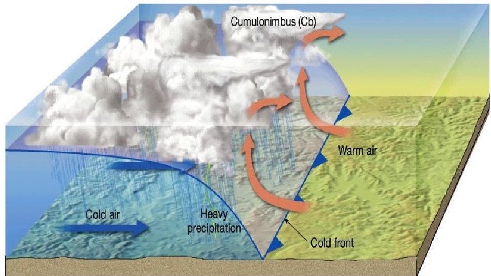
• Fronts – when two air masses collide Cold fronts – when cold, dense air displaces warm air which is less dense. Heavy precipitation and storms are associated with cold fronts.
• Warm front – when advancing warm air displaces cold air.
• Stationary front – when 2 air masses meet but neither advances.
• Occluded front – when a fast moving cold air mass pushes a warm air mass up because there is another cold air mass in front of it. Heavy rains and storms can occur.
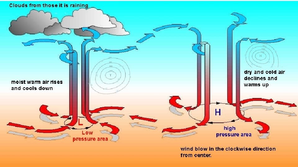
• Pressure Systems • Low Pressure systems – associated with rising air being replaced by air rushing in to take its place. Characterized by cloudy weather and rain. • Air spins counter clockwise.
• High pressure systems – sinking air pushes surface air out of the way. They are associated with fair weather. • Air spins clockwise.
• Section 3 – Gathering Weather Data • Thermometer – measures temperature • Barometer – measures air pressure • Anemometer – measures wind speed • Hygrometer – measures humididty
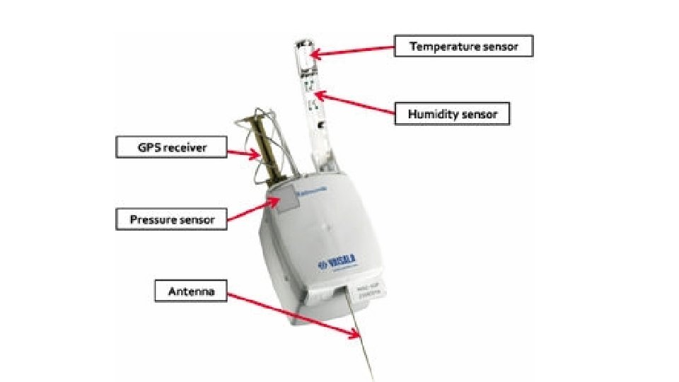
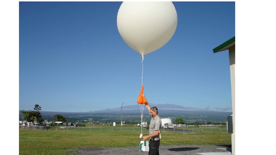
• A radiosonde is used to gather information from the upper atmosphere. It is a package of sensors and a battery powered radio transmitter suspended from a balloon.
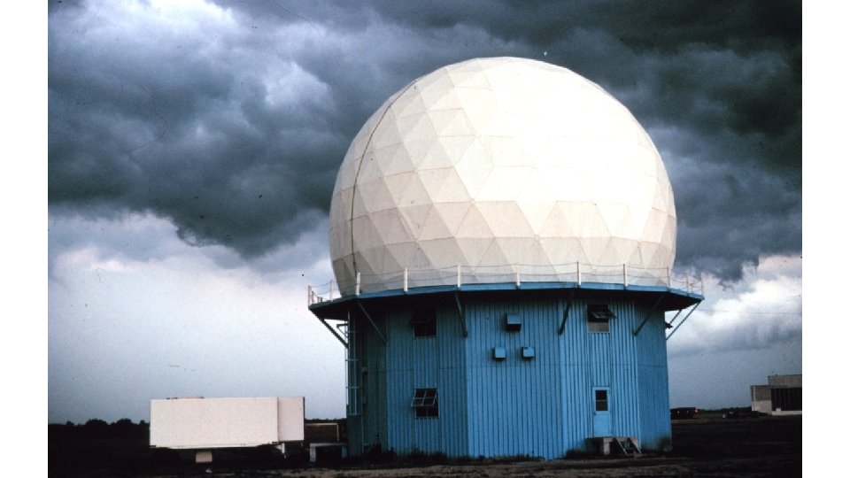
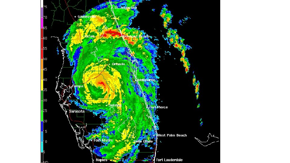
• Doppler radar – measures the speed at which precipitation moves toward or away from a radar station. Good at detecting rotation associated with tornados.
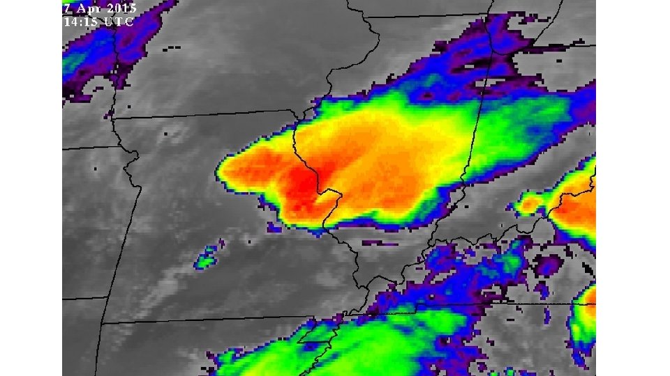
• Weather satellites – • Use infrared imagery to detect differences in thermal energy. • Also used to measure water vapor that help define and identify air currents.
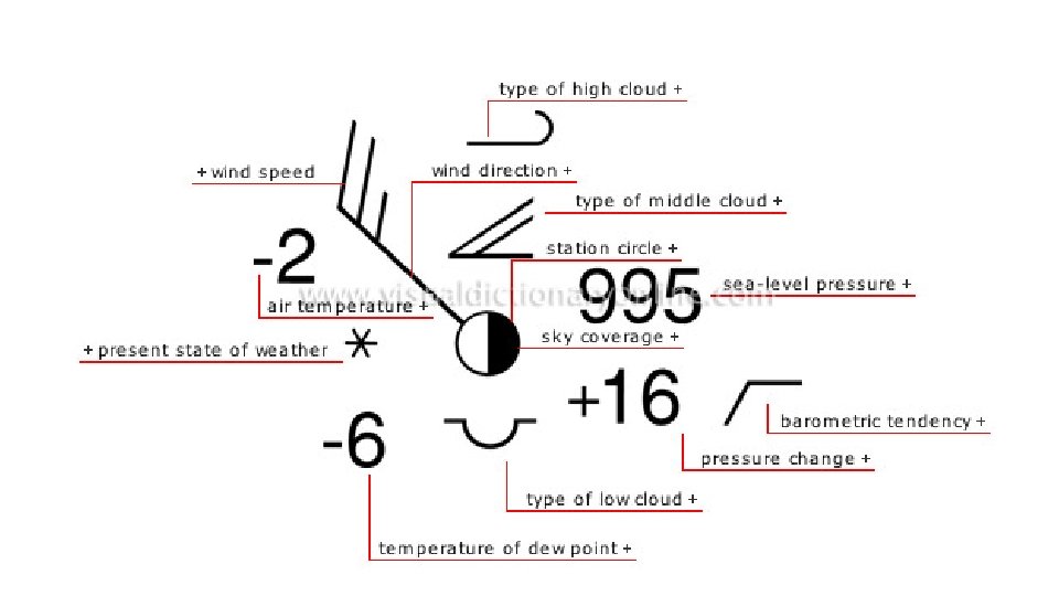
• Section 4 – Weather Analysis and Prediction • A station model is a record of weather data for a particular site at a particular time.
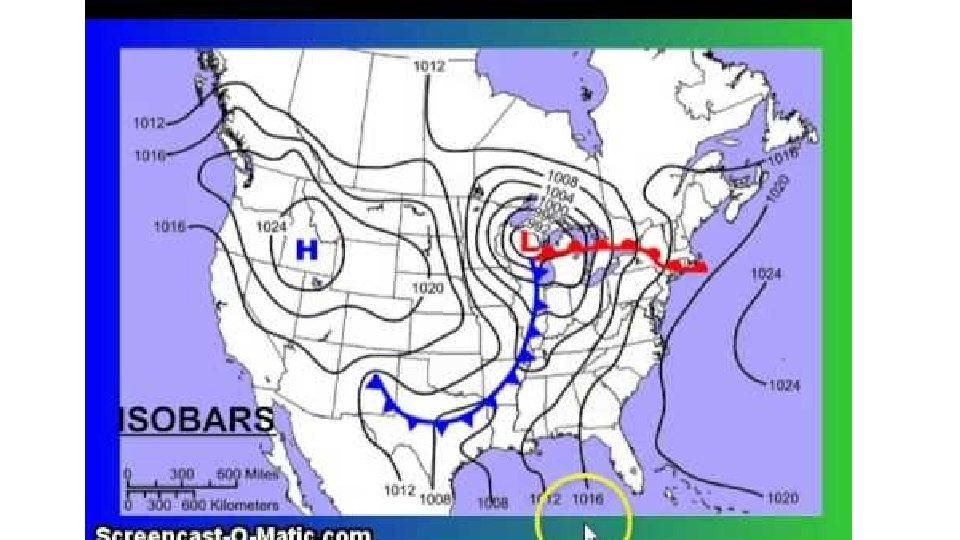
• Lines of equal pressure are called isobars. • Lines of equal temperature are called isotherms.
• Types of forecasting • Digital – created by applying physical principles and mathematics to the atmospheric variables and making predictions about how they will change over time. This is the main method used today.
• Analog – based on comparison of current weather patterns to similar patterns from the past. It is called analog because forecasters look for analogous patterns between past and current conditions.
• How good are forecasts? • A one to three day forecast is usually accurate for expected temperatures and for when and how much precipitation can be expected.