Chapter 11 Soil Resources its just dirt I


 oil fields • Discovered")
")


- Slides: 53
Chapter 11 - Soil Resources it’s just dirt!
I. Soils: Products of Weathering A. Soil loose surface materials composed of weathered rock and mineral materials with variable amounts of organic matter • can support growth of plants • resting upon bedrock
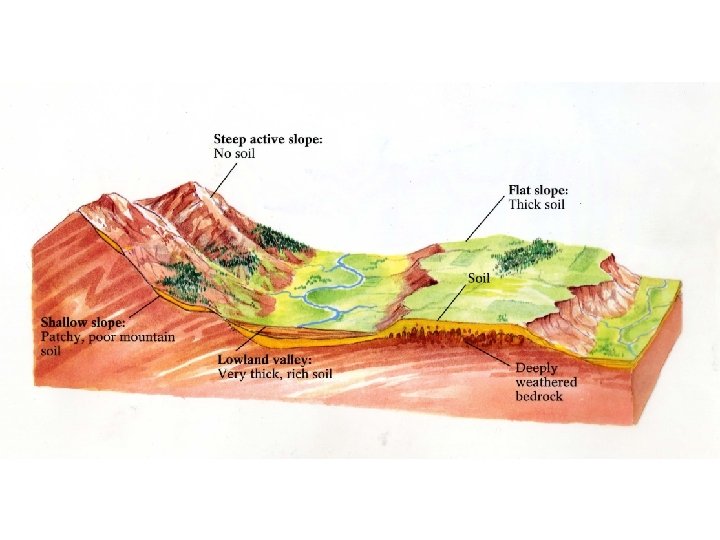
Soils B. Residual vs. Transported Soils • Residual formed “in situ” via weathering • Transported formed elsewhere & deposited alluvial, glacial, wind deposited Example loess soils & the Palouse
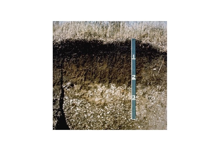
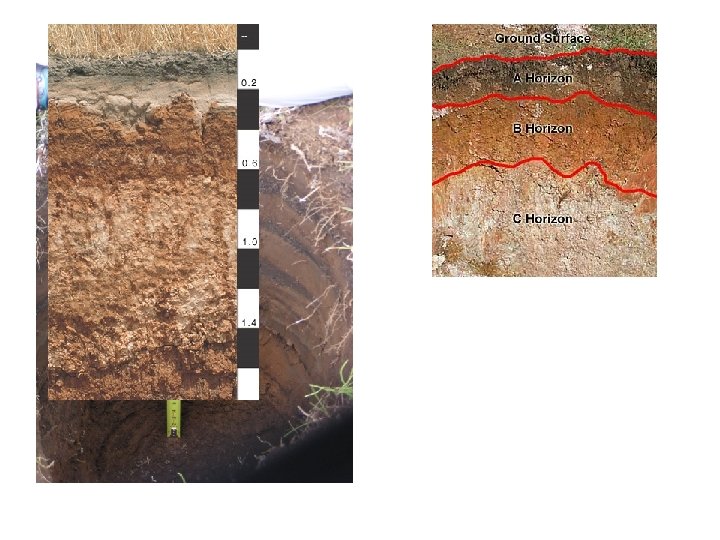
Soils C. Soil Profile vertical section of soil from surface to bedrock D. Soil Horizons layers of soil (in profile) distinguished by color, texture, structure & composition
Soil Profile & Horizons
Soils E. Color & Texture 1. Color indications of composition • Higher organics darker color • Higher iron redder color • Higher calcium or salts whitish colors
Soils 2. Texture • Grain sizes Sand, silt, clay • often determines physical properties -looseness/compactibility -drainage & moisture retention
Soil Texture
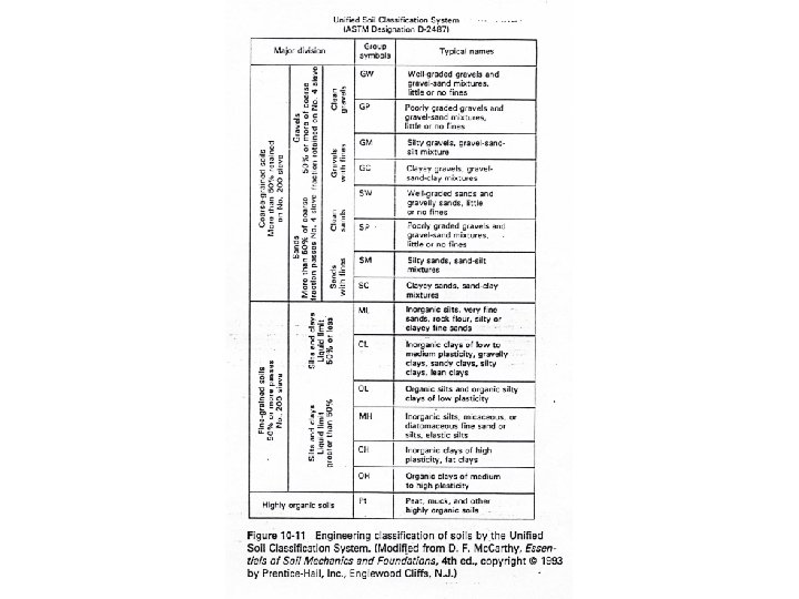
Soils F. Soil Classification “a pain in the _____!” • Early attempts Zonal classification based on climate controls, temp. vs. rainfall
Classification • “modern” classification soil science vs. engineering classification • Classified by physical characteristics • 14, 000 soil “series” now recognized! • Forgetaboutit!
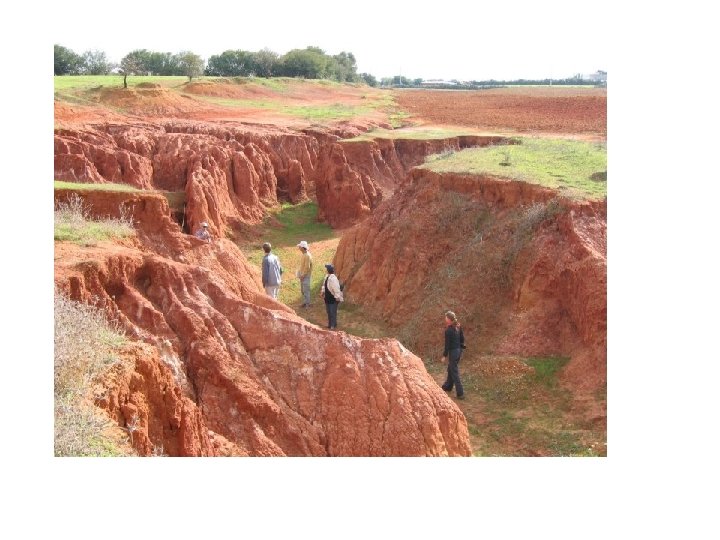
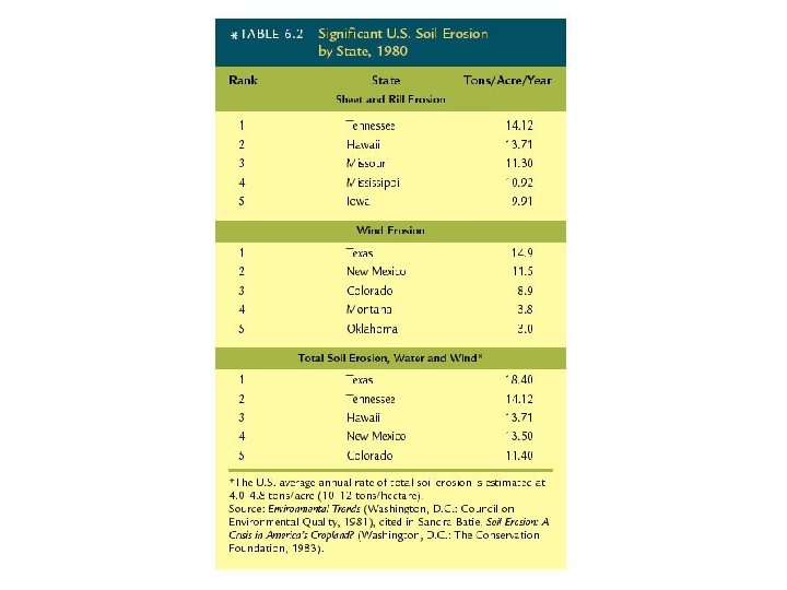
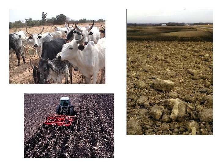
II. Soil Resources & Problems Soil a renewable resource? A. Soil Erosion • U. S. farmlands, 1992 = 2 billion tons • ~4. 8 tons/acre, average annual loss • ~1. 6 tons/acre, avg. annual formed • accumulated side effects!
Soil Erosion Styles of erosion • Sheet • Rill • Gullying • Wind
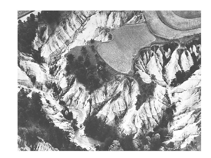
Global Soil Erosion
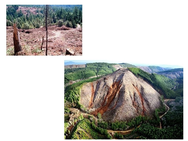
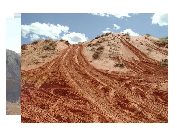
II. Soil Resources & Erosion B. Causes 1. Natural 2. Human-related • Overgrazing & bad agriculture techniques • Deforestation • Recreational activities
Case Study: Palouse soil erosion • Palouse region, eastern WA Go COUGS! • Loess soil wind blown silt
Case Study: Palouse soil erosion • Formed during Pleistocene glaciation • Several hundred feet thick in places • High fertility, important physical properties & agricultural potential • Interesting historical ramifications
Palouse soil & erosion issues
Palouse soil erosion • Up to 25 tons/acre/year erosion • Highest rates 200 tons/acre/year! steeper slopes • ~. 17 inches/year 8. 5 inches/50 years *Farm near Thornton, WA 4. 5 feet of soil lost in less than 50 years!
Palouse soil erosion • 20% + of cropland eroded to subsoils • Decreased yields • Increased fertilizers needed, decreased soil p. H (acidifying) Dirt: The Erosion of Civilizations, Civilizations 2007, David Montgomery, University of California Press
Palouse soil erosion Contributing factors to Palouse erosion? • Intensive mechanized farming tractor plowing began (1930’s) • Plowing on hillsides • Rain on freshly plowed land rilling/gullying • Wind storms age-dated lake cores 4 -fold increase in erosion w/modern plowing
II. Soil Resources B. Soil Contamination • Industrial pollution • Salinization
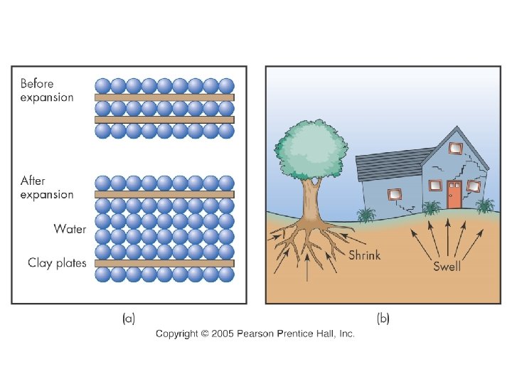
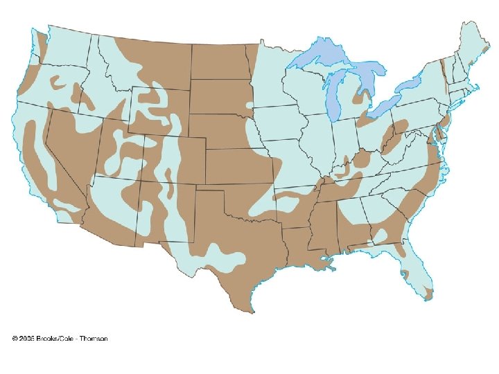
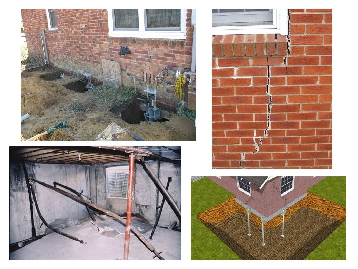
II. Soil Resources & Problems C. Expansive Soils • expansion upon water saturation • shrink when dried out • $6 billion/year damages • Clay-rich soils Why is clay the culprit?
Expansive Soils Mitigation • How to deal with expansive soils? • Hire a geoengineering firm & spend lots of $$$$ fixing the problem after, or…. . • Spend less $$$$$ before • http: //web. mst. edu/~rogersda/umrcourses/g e 341/
II. Soil Resources & Problems D. Settlement • Non-uniform settling and compaction • Differential settlement • Soils with strength & cohesion differences READ Leaning Tower of Pisa
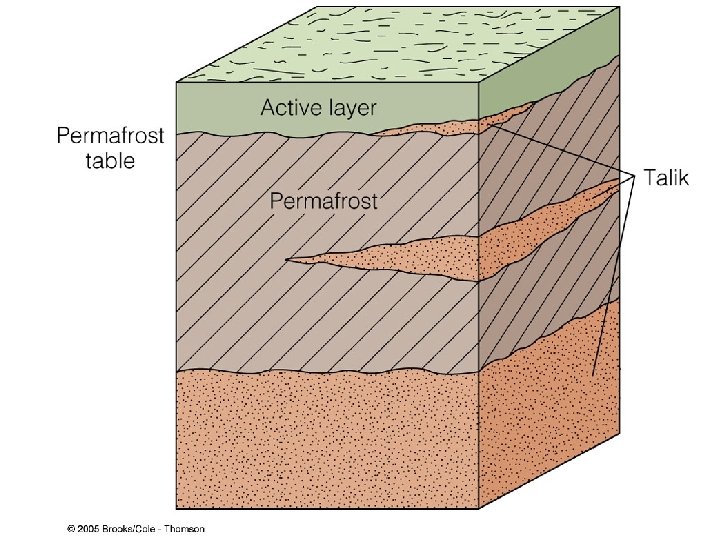
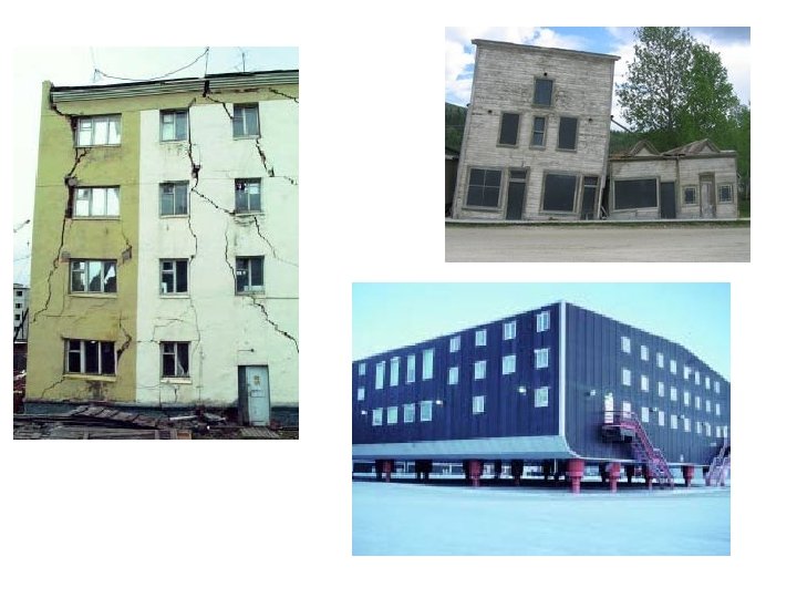
II. Soil Resources & Problems E. Permafrost • Permanently frozen ground • Northerly, polar latitudes • Freezing depth (winter) exceeds thaw depth (summer)
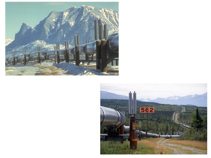
Case Study: The Trans-Alaska Pipeline A. Prudhoe Bay (North Slope) oil fields • Discovered 1968 – “world class field” • Remote location, cold water port • No oil tankers! How to get the oil to market? • 1300 km (~800 mi) pipeline
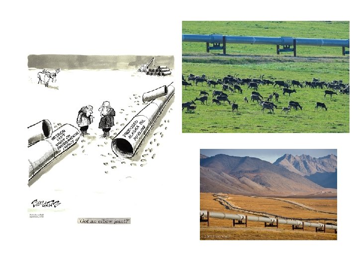
Trans Alaskan Pipeline B. Pipeline Route • Prudhoe Bay to Valdez (Prince William Sound) • Inaccessible wilderness • 2 mountain ranges, large river crossings • LARGE areas of permafrost
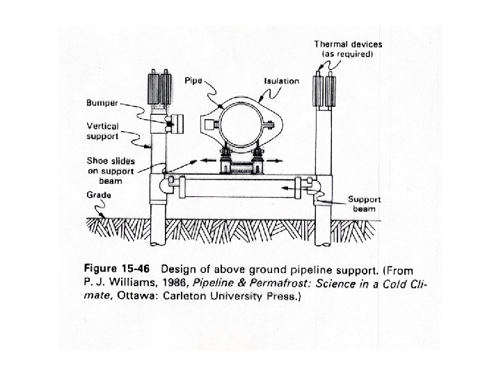
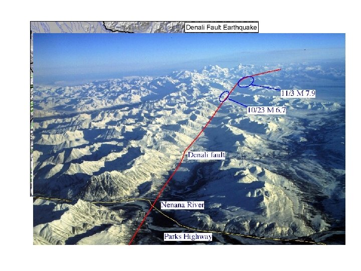
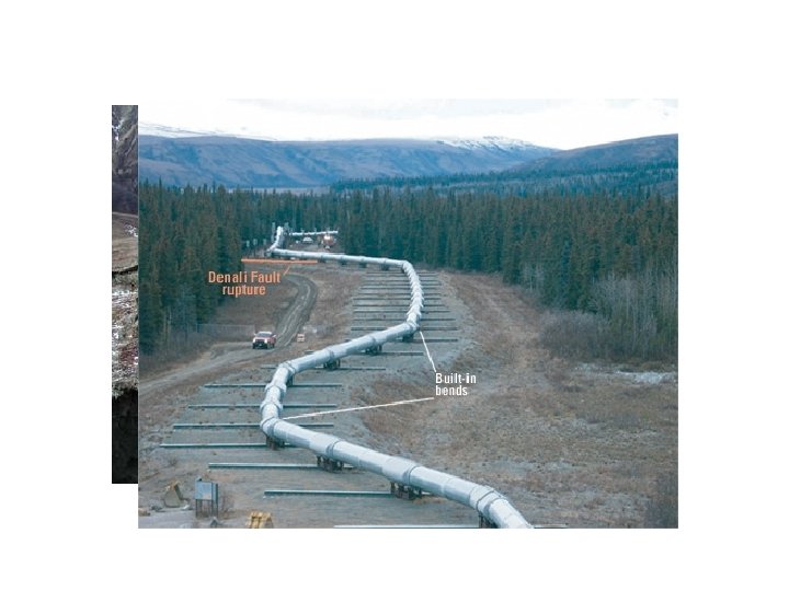
Trans Alaskan Pipeline C. Planning Studies, Designs, & Cost • Prefeasibility studies mapping & drilling bedrock vs. permafrost • Identified faults active Denali fault • Permafrost dilemma oil needs to flow @ 65 o. C in 48” pipeline *1/2 of pipeline must be above ground why?
Trans Alaskan Pipeline Above ground design MUST: • Dissipate heat away from ground • Allow for fault movements & earthquakes • Vertical support members (down to 60’) w/heat exchangers & refrigerant • Horizontal beam & jiggle joints for magnitude 8 quake
Building on permafrost
2002 Denali Fault Earthquake • 7. 9 magnitude • Remote section on Denali fault • Movement along fault ~14 feet! • Design specifications withstand quake!