CHAPTER 11 HURRICANES ANATOMY OF A HURRICANE Hurricane


- Slides: 27

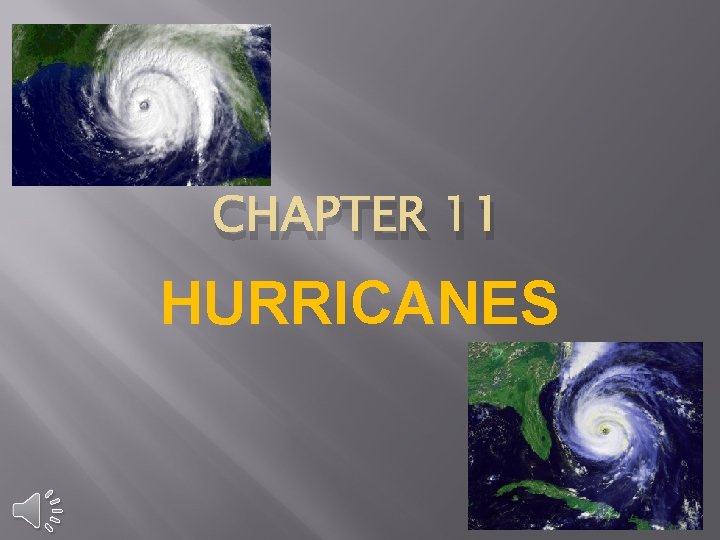
CHAPTER 11 HURRICANES

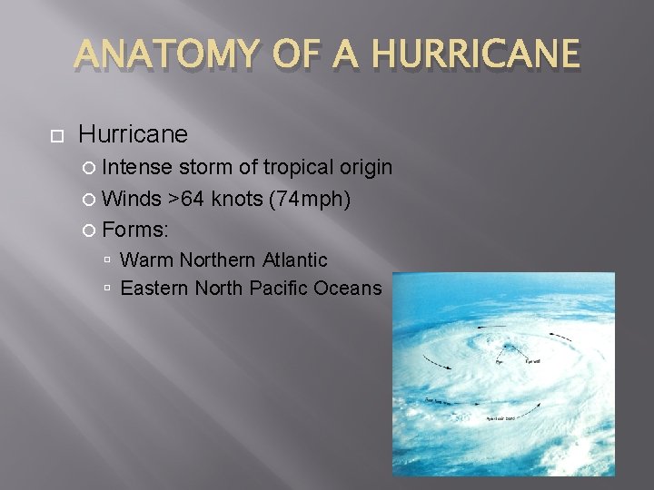
ANATOMY OF A HURRICANE Hurricane Intense storm of tropical origin Winds >64 knots (74 mph) Forms: Warm Northern Atlantic Eastern North Pacific Oceans

ANATOMY OF A HURRICANE Eye Wall Spiral Rain bands

ANATOMY OF A HURRICANE Eye: Calm As move into eye: Air temperature: Increases Wind speeds: Slow or Slacken Rainfall: Ceases or Stops Sky appearance: Sky brightens

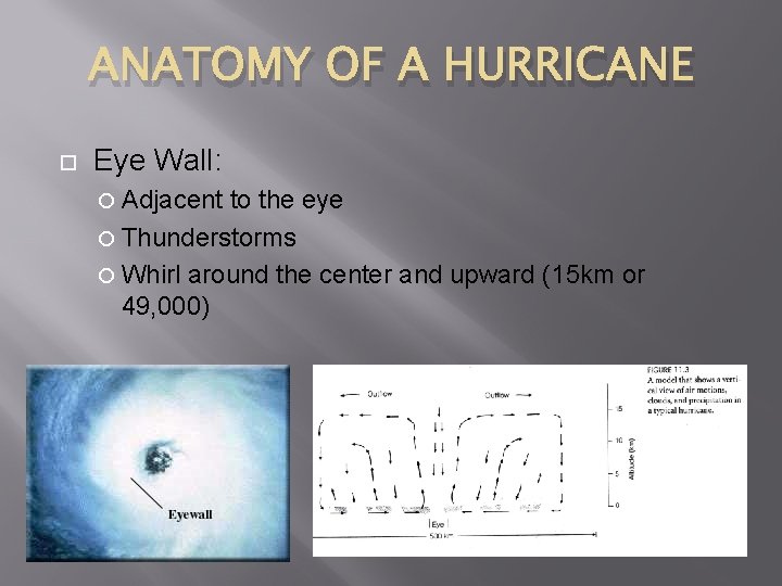
ANATOMY OF A HURRICANE Eye Wall: Adjacent to the eye Thunderstorms Whirl around the center and upward (15 km or 49, 000)

ANATOMY OF A HURRICANE Spiral Rain bands: Surface winds: Increase in speed Blow counterclockwise (Northern Hemisphere) Inward toward its center

IMPORTANT POINTS � Hurricanes form: � Over warm tropical waters � Light winds converge � Humidity is high in a deep layer � WINDS ALOFT ARE WEAK � Driving Force: latent heat � Hurricane strength: � Grow in strength � Decrease in strength

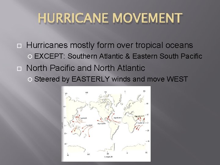
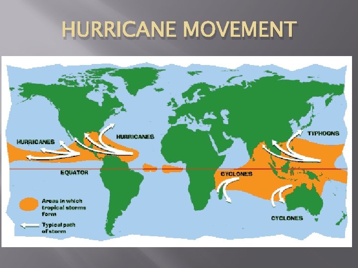
HURRICANE MOVEMENT Hurricanes mostly form over tropical oceans EXCEPT: Southern Atlantic & Eastern South Pacific North Pacific and North Atlantic Steered by EASTERLY winds and move WEST

HURRICANE MOVEMENT

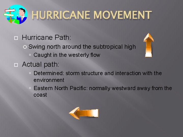
HURRICANE MOVEMENT Hurricane Path: Swing north around the subtropical high Caught in the westerly flow Actual path: Determined: storm structure and interaction with the environment Eastern North Pacific: normally westward away from the coast

HURRICANE MOVEMENT The Hawaiian Islands: Direct path of many eastern Pacific hurricanes and tropic storms Weaken before hits islands

HURRICANE MOVEMENT Question: Northward moving hurricane over the Atlantic survives longer than its counterpart at the same latitude over the Eastern Pacific The surface water over the Atlantic is much warmer

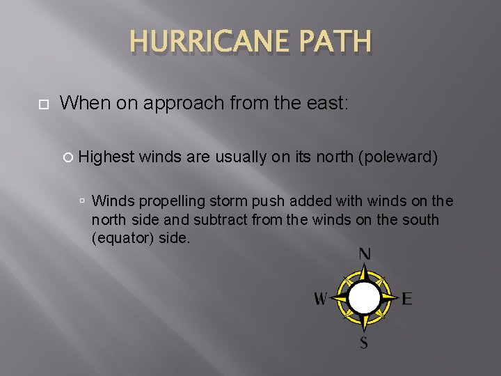
HURRICANE PATH When on approach from the east: Highest winds are usually on its north (poleward) Winds propelling storm push added with winds on the north side and subtract from the winds on the south (equator) side.

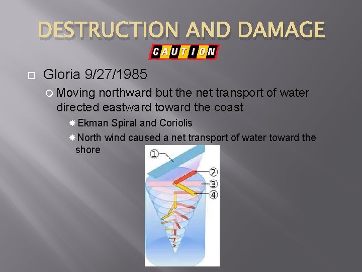
DESTRUCTION AND DAMAGE Gloria 9/27/1985 Moving northward but the net transport of water directed eastward toward the coast Ekman Spiral and Coriolis North wind caused a net transport of water toward the shore

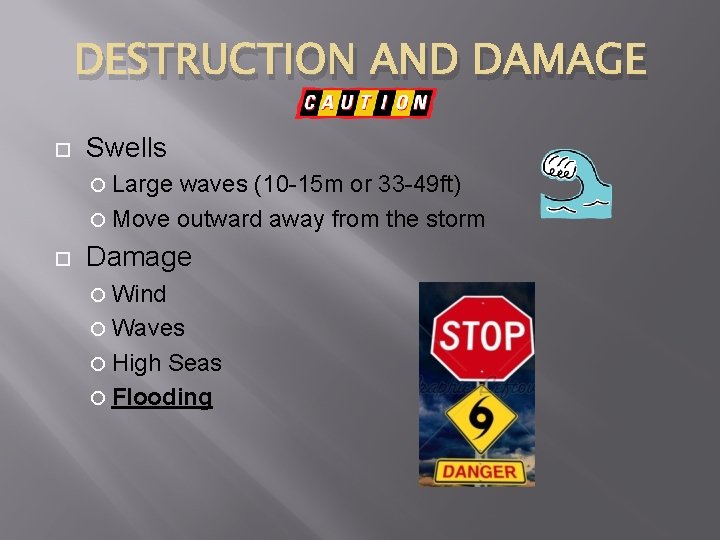
DESTRUCTION AND DAMAGE Swells Large waves (10 -15 m or 33 -49 ft) Move outward away from the storm Damage Wind Waves High Seas Flooding

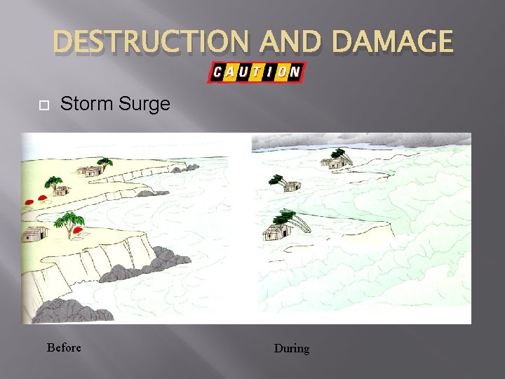
DESTRUCTION AND DAMAGE Flooding (Most destructive) Aided by the low pressure of the storm Low pressure regions ocean level rise ½ meter Storm Surge High water + high winds and the net transport of water toward the coast Storm Surge- abnormal rise of several meters in the ocean level, which engulfs low-lying areas

DESTRUCTION AND DAMAGE Storm Surge Before During

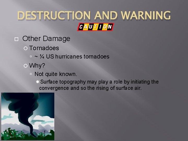
DESTRUCTION AND WARNING Other Damage Tornadoes ~ ¼ US hurricanes tornadoes Why? Not quite known. Surface topography may play a role by initiating the convergence and so the rising of surface air.

HURRICANE WARNING Hurricane Watch Poses a direct threat to an area 24 -48 hours before the storm arrives National Hurricane Center (Florida) Pacific Hurricane Center (Hawaii) Hurricane Warning Appears to strike an area within 24 hours

SAFFIR-SIMPSON SCALE Saffir-Simpson Scale “Tropical Depression” “Tropical Storm” (given name) Ranked from 1 -5 Category 1 - Lowest rank Category 3 - Major hurricane Category 5 - Severe damage

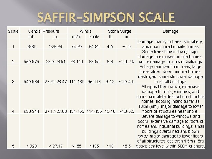
SAFFIR-SIMPSON SCALE Scale Central Pressure mb in. 1 ≥ 980 2 965 -979 3 945 -964 4 920 -944 5 < 920 Winds mi/hr knots Storm Surge ft m Damage mainly to trees, shrubbery, ≥ 28. 94 74 -95 64 -82 4 -5 ~1. 5 and unanchored mobile homes Some trees blown down; major damage to exposed mobile homes, 28. 5 -28. 91 96 -110 83 -95 6 -8 ~2. 0 -2. 5 some damage to roofs of buildings Foliage removed from trees; large trees blown down; mobile homes destroyed; some structural damage 27. 91 -28. 47 111 -130 96 -113 9 -12 ~2. 5 -4. 0 to small buildings All signs blown down; extensive damage to roofs, windows, and doors; complete destruction of mobile homes; flooding inland as far as 10 km (6 mi); major damage to lower 27. 17 -27. 88 131 -155 114 -135 13 -18 ~4. 0 -5. 5 floors of structures near shore. Severe damage to windows and doors, extensive damage to roofs of homes and industrial buildings; small buildings overturned and blown away; major damage to lower floors of all structures less than 4. 5 m (15 ft) < 27. 17 >155 >135 >18 >5. 5 above sea level within 500 m of shore.

NAMING HURRICANES Assigned “tropical storm” strength Previous naming methods: Latitudes and longitudes Letters of the alphabet (WWII) By 1953 Female names used using the alphabet

NAMING HURRICANES 1978 Eastern 1979 North Pacific used both male and female Atlantic began this alternating practice as well Names retired

WRAP UP HURRICANES Hurricanes are tropical cyclones with winds that exceed 64 knots (74 mph) Consists of a mass organized thunderstorms that spiral in toward the extreme low pressure of the storm’s eye Storms are given a name at the Tropical Storm category The energy source that drives hurricanes comes from primarily a release of latent heat

Wrap Up Hurricanes In the Northern Hemisphere Hurricanes blow counterclockwise around the eye In the eye the weather is calm, no rain, no wind, sunny Eye wall: Intense rain, wind, and thunderstorm Hurricanes develop in warm tropical waters Hurricanes can spawn tornadoes Weaken over cold water and land

Wrap Up Hurricanes Hurricane damage Storm Surge, Wind, Flooding Usually the most damage is caused by huge waves and flooding with the storm surge causes the most damage Difference between hurricane and typhoon Location: western North Pacific areas- typhoon Australia and India- cyclones

References: • http: //geology. com/hurricanes/named-hurricane-fran. gif • http: //ehsjournal. org/wp-content/uploads/2010/07/NOAA-Hurricane-Ivan-09 -15 -20041515 z. jpg • http: //www. broughton-jnr. lincs. sch. uk/_/rsrc/1248620248492/forchildren/geography/hurricanes/hurric 5. gif • http: //hurricanehazel. ca/test_hurricane_knowledge/eyewall. jpg • http: //www. nasa. gov/images/content/138612 main_okelley_graph_lg. jpg • http: //worldlywise. pbworks. com/f/1271536572/cyclone_map. gif • http: //www. mellofmjamaica. com/images/hurricane-preparedness-week. jpg • http: //cloud. graphicleftovers. com/24766/1020755/hurricane-warning-stop-sign. jpg • http: //upload. wikimedia. org/wikipedia/commons/thumb/3/3 b/Ekman_spirale. svg/200 px -Ekman_spirale. svg. png • http: //image. shutterstock. com/display_pic_with_logo/484810, 1274896595, 6/st ock-vector-hurricane-warning-icon-isolated-on-white-vector-53935906. jpg • http: //ttnewsflash. com/wp-content/uploads/2012/10/Hurricane-names. jpg • http: //images. fineartamerica. com/images-medium-large/the-eye-of-the-storm-tylermartin. jpg