Chapter 10 Development Theory Development Theory In this

- Slides: 44

Chapter 10 Development Theory

Development Theory Ø In this section I will discuss: - further aspects of the structure and dynamics of synoptic-scale disturbances, and - derive Sutcliffe's development theory, which provides a number of practical forecasting rules.

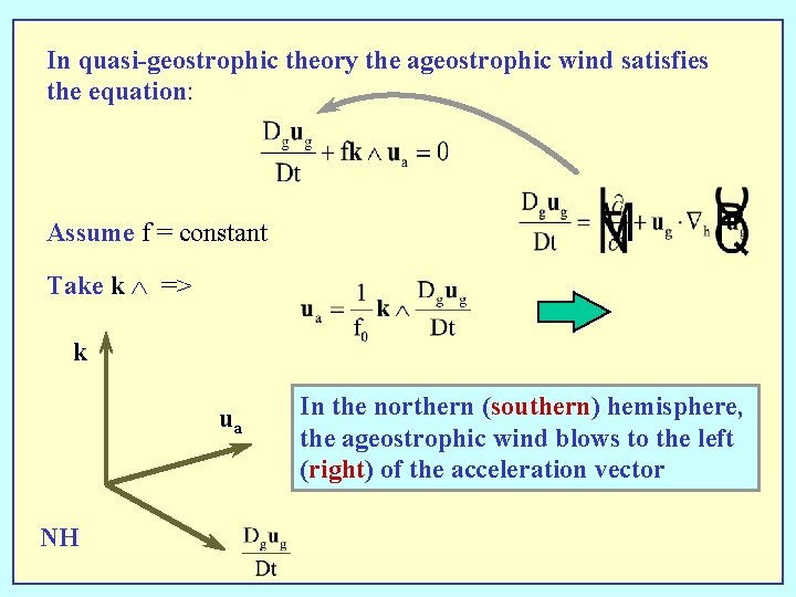
In quasi-geostrophic theory the ageostrophic wind satisfies the equation: Assume f = constant Take k => k ua NH In the northern (southern) hemisphere, the ageostrophic wind blows to the left (right) of the acceleration vector

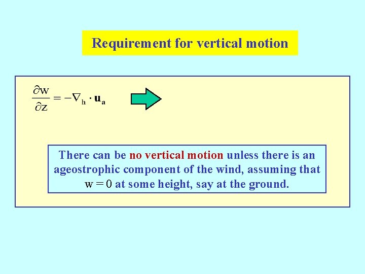
Requirement for vertical motion There can be no vertical motion unless there is an ageostrophic component of the wind, assuming that w = 0 at some height, say at the ground.

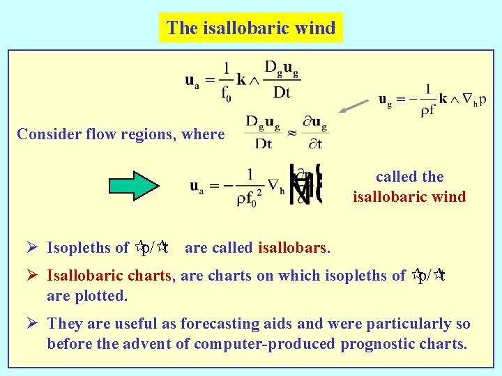
The isallobaric wind Consider flow regions, where called the isallobaric wind Ø Isopleths of ¶p/¶t are called isallobars. Ø Isallobaric charts, are charts on which isopleths of ¶p/¶t are plotted. Ø They are useful as forecasting aids and were particularly so before the advent of computer-produced prognostic charts.

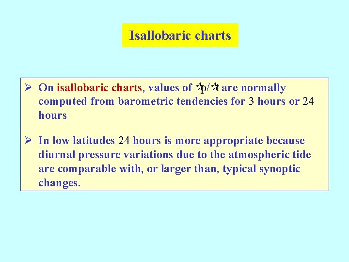
Isallobaric charts Ø On isallobaric charts, values of ¶p/¶t are normally computed from barometric tendencies for 3 hours or 24 hours Ø In low latitudes 24 hours is more appropriate because diurnal pressure variations due to the atmospheric tide are comparable with, or larger than, typical synoptic changes.

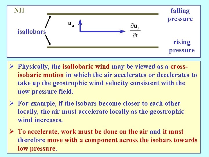
NH isallobars ua falling pressure rising pressure Ø Physically, the isallobaric wind may be viewed as a crossisobaric motion in which the air accelerates or decelerates to take up the geostrophic wind velocity consistent with the new pressure field. Ø For example, if the isobars become closer to each other locally, the air must accelerate locally as the geostrophic wind increases. Ø To accelerate, work must be done on the air and it must therefore move with a component across the isobars towards low pressure.

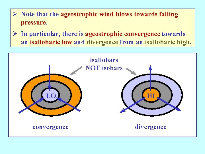
Ø Note that the ageostrophic wind blows towards falling pressure. Ø In particular, there is ageostrophic convergence towards an isallobaric low and divergence from an isallobaric high. isallobars NOT isobars LO HI convergence divergence

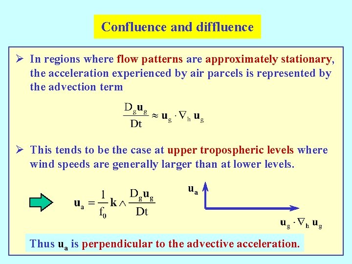
Confluence and diffluence Ø In regions where flow patterns are approximately stationary, the acceleration experienced by air parcels is represented by the advection term Ø This tends to be the case at upper tropospheric levels where wind speeds are generally larger than at lower levels. ua Thus ua is perpendicular to the advective acceleration.

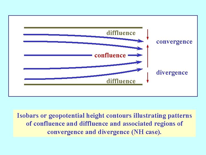
diffluence convergence confluence divergence diffluence Isobars or geopotential height contours illustrating patterns of confluence and diffluence and associated regions of convergence and divergence (NH case).

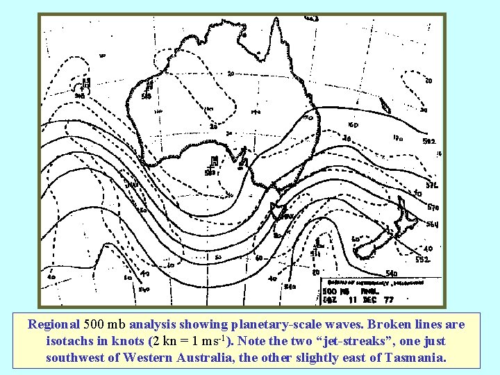
Jet streams Ø The foregoing results have application to an understanding of the circulations associated with jet streams. Ø These are relatively narrow currents of strong winds which occur in the upper troposphere in association with planetary and synoptic scale wave disturbances. Ø The jet stream core, the region of strongest wind, is evident from the distribution of isotachs, which are often superimposed on upper-level charts, for example, those corresponding with the 500 mb and 250 mb levels. Ø A typical example is the 500 mb chart shown in the next figure: =>

Regional 500 mb analysis showing planetary-scale waves. Broken lines are isotachs in knots (2 kn = 1 ms-1). Note the two “jet-streaks”, one just southwest of Western Australia, the other slightly east of Tasmania.

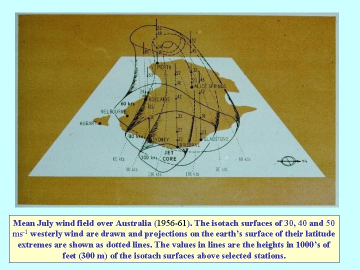
Mean July wind field over Australia (1956 -61). The isotach surfaces of 30, 40 and 50 ms-1 westerly wind are drawn and projections on the earth’s surface of their latitude extremes are shown as dotted lines. The values in lines are the heights in 1000’s of feet (300 m) of the isotach surfaces above selected stations.

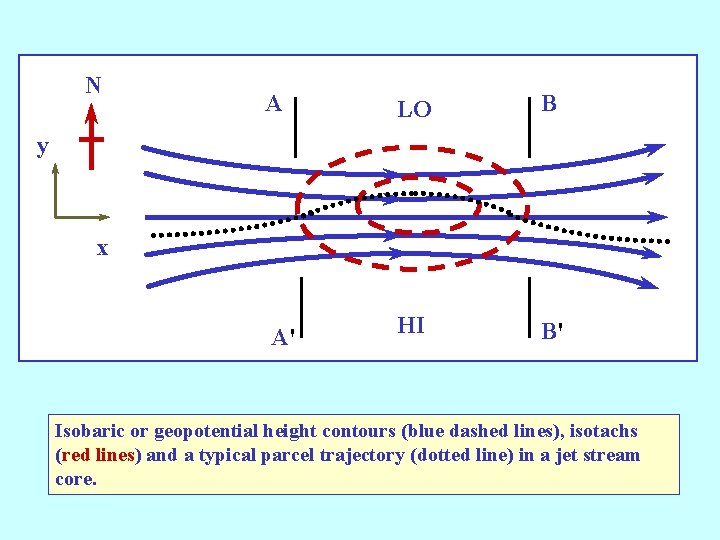
N A LO B A' HI B' y x Isobaric or geopotential height contours (blue dashed lines), isotachs (red lines) and a typical parcel trajectory (dotted line) in a jet stream core.

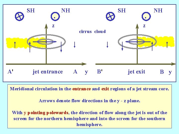
SH . NH SH . z NH z cirrus cloud A' jet entrance A y B' jet exit B y Meridional circulation in the entrance and exit regions of a jet stream core. Arrows denote flow directions in the y - z plane. With y pointing polewards, the direction of flow along the jet is out of the screen for the northern hemisphere and into the screen for the southern hemisphere.

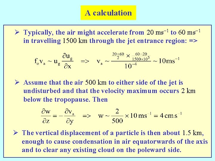
A calculation Ø Typically, the air might accelerate from 20 ms-1 to 60 ms-1 in travelling 1500 km through the jet entrance region: => Ø Assume that the air 500 km to either side of the jet is undisturbed and that the velocity maximum occurs 2 km below the tropopause. Then Ø The vertical displacement of a particle is then about 1. 5 km, enough to cause condensation in air equatorwards of the axis and to clear any existing cloud on the poleward side.

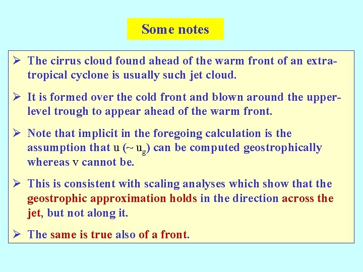
Some notes Ø The cirrus cloud found ahead of the warm front of an extratropical cyclone is usually such jet cloud. Ø It is formed over the cold front and blown around the upperlevel trough to appear ahead of the warm front. Ø Note that implicit in the foregoing calculation is the assumption that u (~ ug) can be computed geostrophically whereas v cannot be. Ø This is consistent with scaling analyses which show that the geostrophic approximation holds in the direction across the jet, but not along it. Ø The same is true also of a front.

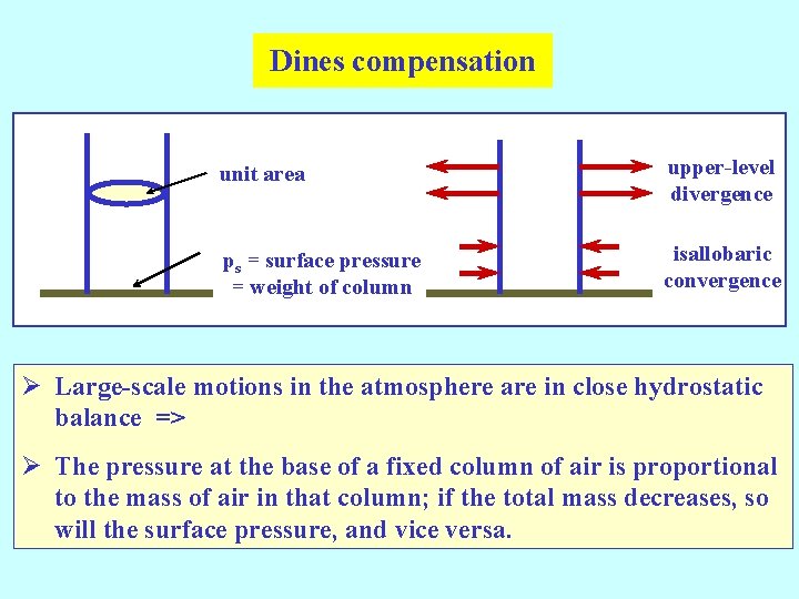
Dines compensation unit area upper-level divergence ps = surface pressure = weight of column isallobaric convergence Ø Large-scale motions in the atmosphere are in close hydrostatic balance => Ø The pressure at the base of a fixed column of air is proportional to the mass of air in that column; if the total mass decreases, so will the surface pressure, and vice versa.

Some notes Ø In a deepening low, the isallobaric wind, and to a lesser extent surface friction, will contribute to low-level convergence. Ø If there were no compensating upper-level divergence, the surface pressure would rise as mass accumulated in a column clearly a contradiction! Ø Dines showed that low-level convergence is very nearly equal to the divergence at upper levels. Ø He pointed out that upper divergence must exceed the low-level convergence when a low deepens. Ø Because the integrated divergence is a small residual of much larger, but opposing contributions at different levels, it is not practical to predict surface pressure changes by computing the integrated divergence.

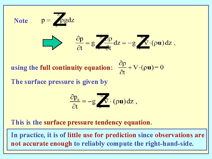
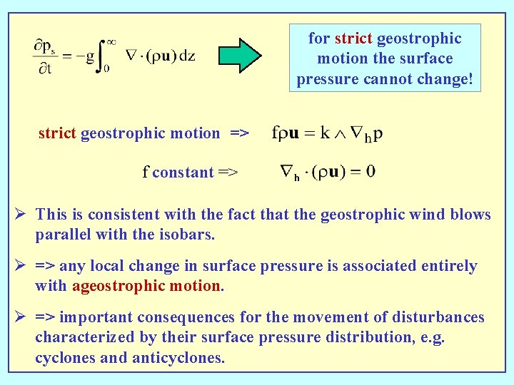
Note using the full continuity equation: The surface pressure is given by This is the surface pressure tendency equation. In practice, it is of little use for prediction since observations are not accurate enough to reliably compute the right-hand-side.

for strict geostrophic motion the surface pressure cannot change! strict geostrophic motion => f constant => Ø This is consistent with the fact that the geostrophic wind blows parallel with the isobars. Ø => any local change in surface pressure is associated entirely with ageostrophic motion. Ø => important consequences for the movement of disturbances characterized by their surface pressure distribution, e. g. cyclones and anticyclones.

Sutcliffe's development theory Ø Sutcliffe, an English meteorologist, computed the relative divergence between an upper and lower level in the troposphere using the vorticity equation. Ø From this he deduced the distribution of vertical motion. Ø A knowledge of the vertical motion at a low level can be used together with the vorticity equation at the surface to study the development of surface pressure systems such as middle latitude cyclones and anticyclones. Ø Sutcliffe's theory has proved extremely valuable in the practice of weather forecasting.

The essence of Sutcliffe's theory Ø If one can compute the difference between the fields of ageostrophic wind at a low level and at a middle or high tropospheric level, one can deduce the horizontal divergence, and hence the field of vertical motion which must exist between these levels. Ø Then one can locate the regions of falling surface pressure (over rising air) and of rising surface pressure (over subsiding air).

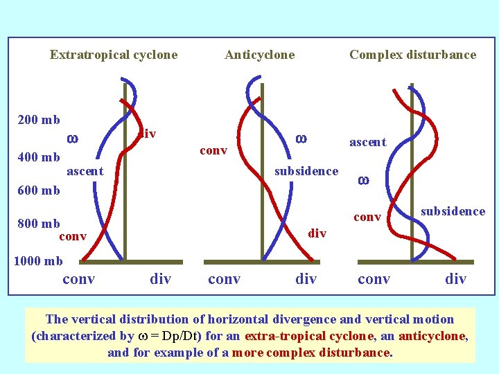
Extratropical cyclone 200 mb w 400 mb Anticyclone div conv ascent Complex disturbance w ascent subsidence 600 mb w conv 800 mb conv subsidence div 1000 mb conv div The vertical distribution of horizontal divergence and vertical motion (characterized by w = Dp/Dt) for an extra-tropical cyclone, an anticyclone, and for example of a more complex disturbance.

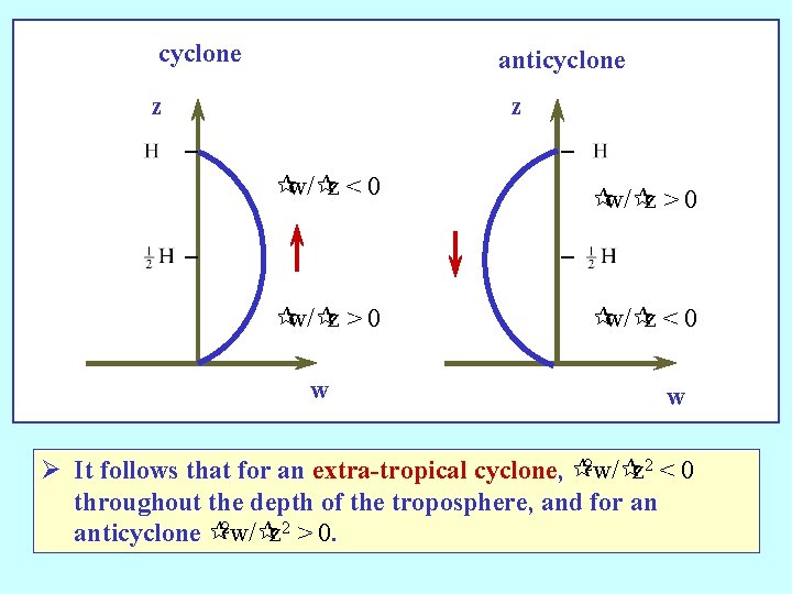
cyclone anticyclone z z ¶w/¶z < 0 ¶w/¶z > 0 ¶w/¶z < 0 w w Ø It follows that for an extra-tropical cyclone, ¶ 2 w/¶z 2 < 0 throughout the depth of the troposphere, and for an anticyclone ¶ 2 w/¶z 2 > 0.

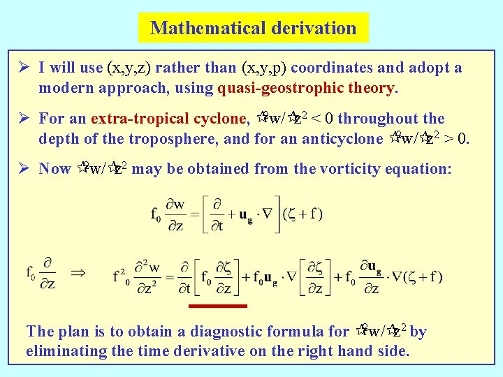
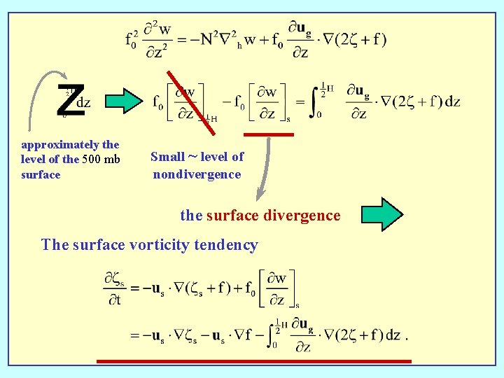
Mathematical derivation Ø I will use (x, y, z) rather than (x, y, p) coordinates and adopt a modern approach, using quasi-geostrophic theory. Ø For an extra-tropical cyclone, ¶ 2 w/¶z 2 < 0 throughout the depth of the troposphere, and for an anticyclone ¶ 2 w/¶z 2 > 0. Ø Now ¶ 2 w/¶z 2 may be obtained from the vorticity equation: The plan is to obtain a diagnostic formula for ¶ 2 w/¶z 2 by eliminating the time derivative on the right hand side.

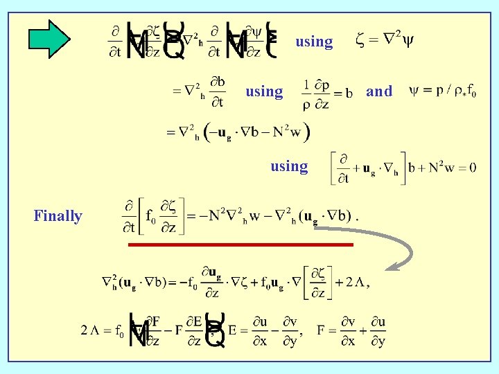
using Finally and

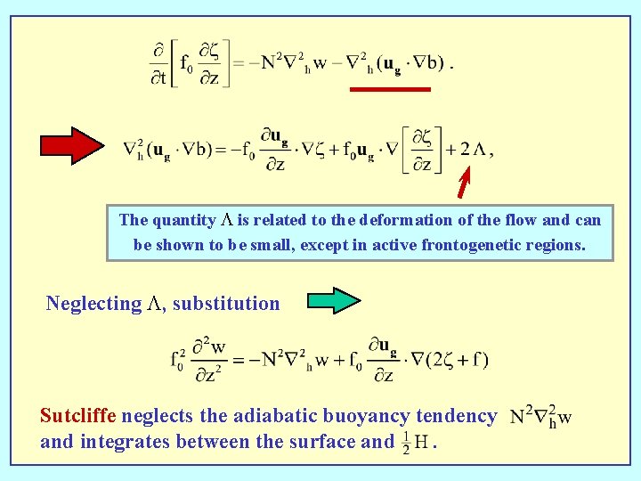
The quantity L is related to the deformation of the flow and can be shown to be small, except in active frontogenetic regions. Neglecting L, substitution Sutcliffe neglects the adiabatic buoyancy tendency and integrates between the surface and.

approximately the level of the 500 mb surface Small ~ level of nondivergence the surface divergence The surface vorticity tendency

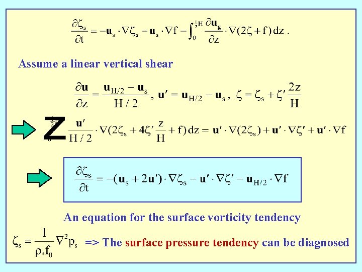
Assume a linear vertical shear An equation for the surface vorticity tendency => The surface pressure tendency can be diagnosed

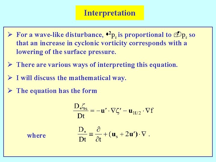
Interpretation Ø For a wave-like disturbance, s 2 ps is proportional to -ps so that an increase in cyclonic vorticity corresponds with a lowering of the surface pressure. Ø There are various ways of interpreting this equation. Ø I will discuss the mathematical way. Ø The equation has the form where

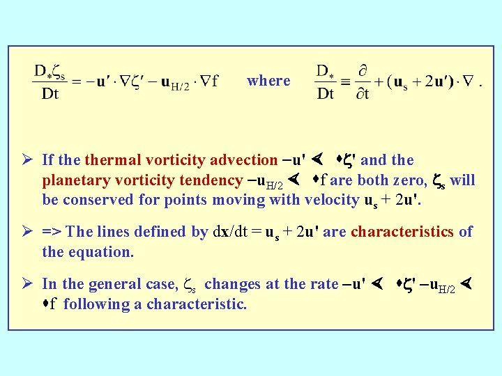
where Ø If thermal vorticity advection -u' × sz' and the planetary vorticity tendency -u. H/2 × sf are both zero, zs will be conserved for points moving with velocity us + 2 u'. Ø => The lines defined by dx/dt = us + 2 u' are characteristics of the equation. Ø In the general case, zs changes at the rate -u' × sz' -u. H/2 × sf following a characteristic.

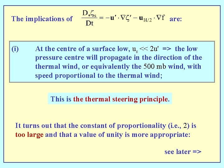
The implications of (i) are: At the centre of a surface low, us << 2 u' => the low pressure centre will propagate in the direction of thermal wind, or equivalently the 500 mb wind, with speed proportional to thermal wind; This is thermal steering principle. It turns out that the constant of proportionality (i. e. , 2) is too large and that a value of unity is more appropriate: see later =>

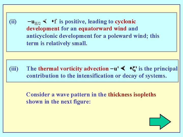
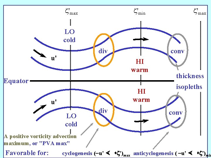
(ii) -u. H/2 × sf is positive, leading to cyclonic development for an equatorward wind anticyclonic development for a poleward wind; this term is relatively small. (iii) The thermal vorticity advection -u' × sz' is the principal contribution to the intensification or decay of systems. Consider a wave pattern in the thickness isopleths shown in the next figure:

z'max z'min z'max LO cold div u' conv HI warm Equator HI warm u' LO cold div thickness isopleths conv A positive vorticity advection maximum, or "PVA max" Favorable for: cyclogenesis (-u' × sz')max anticyclogenesis ( -u' × sz')min

Some notes Ø It follows from (i) and (iii) that the propagation and change in intensity of surface depressions can be judged from a thickness chart with a superimposed surface chart. Ø It is often the case that in most locations, |u´| >> |us|, => u 500 mb » u´ => Ø The thermal wind contribution to the flow at 500 mb mostly dominates that due to the surface wind. Ø This is why the thickness isopleths and the isopleths of geopotential at 500 mb have broadly similar features. Ø It means also that the 500 mb isopleths can be used instead of the thickness charts to give an indication as to how systems will be steered and whether or not they will grow or decay.

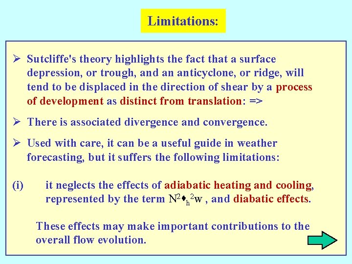
Limitations: Ø Sutcliffe's theory highlights the fact that a surface depression, or trough, and an anticyclone, or ridge, will tend to be displaced in the direction of shear by a process of development as distinct from translation: => Ø There is associated divergence and convergence. Ø Used with care, it can be a useful guide in weather forecasting, but it suffers the following limitations: (i) it neglects the effects of adiabatic heating and cooling, represented by the term N 2 sh 2 w , and diabatic effects. These effects may make important contributions to the overall flow evolution.

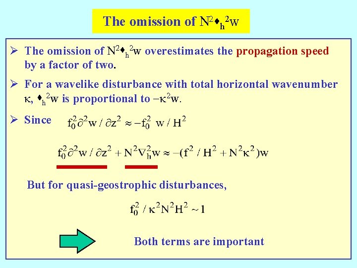
The omission of N 2 sh 2 w Ø The omission of N 2 sh 2 w overestimates the propagation speed by a factor of two. Ø For a wavelike disturbance with total horizontal wavenumber k, sh 2 w is proportional to -k 2 w. Ø Since But for quasi-geostrophic disturbances, Both terms are important

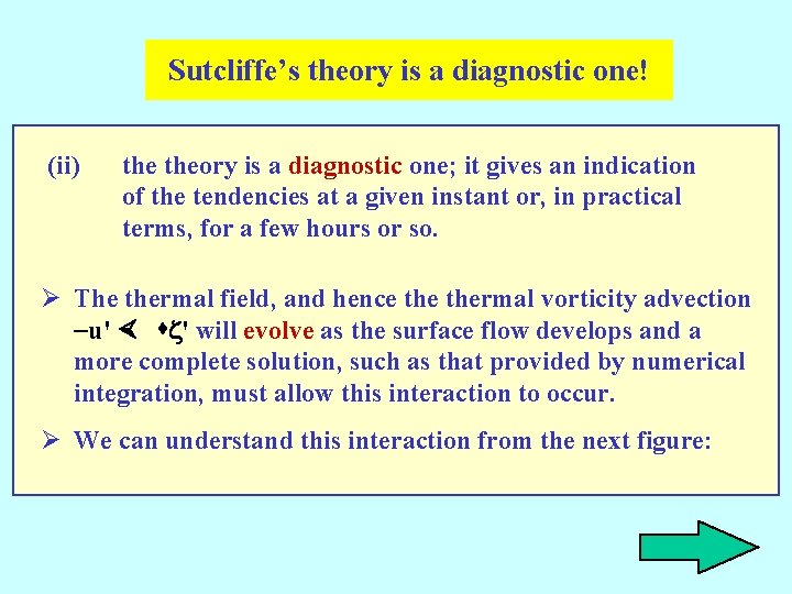
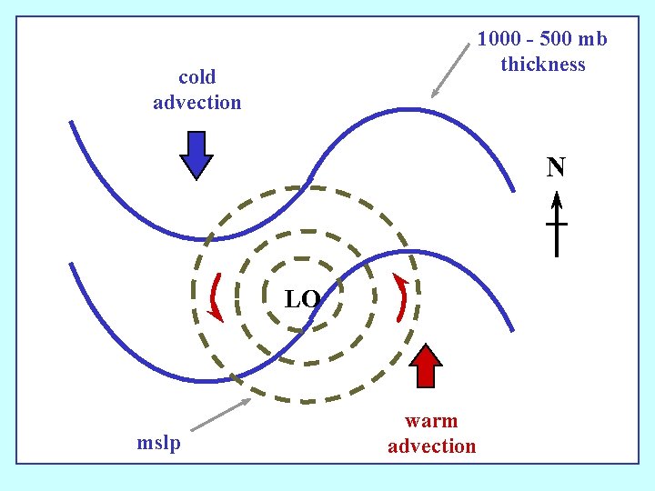
Sutcliffe’s theory is a diagnostic one! (ii) theory is a diagnostic one; it gives an indication of the tendencies at a given instant or, in practical terms, for a few hours or so. Ø The thermal field, and hence thermal vorticity advection -u' × sz' will evolve as the surface flow develops and a more complete solution, such as that provided by numerical integration, must allow this interaction to occur. Ø We can understand this interaction from the next figure:

1000 - 500 mb thickness cold advection N LO mslp warm advection

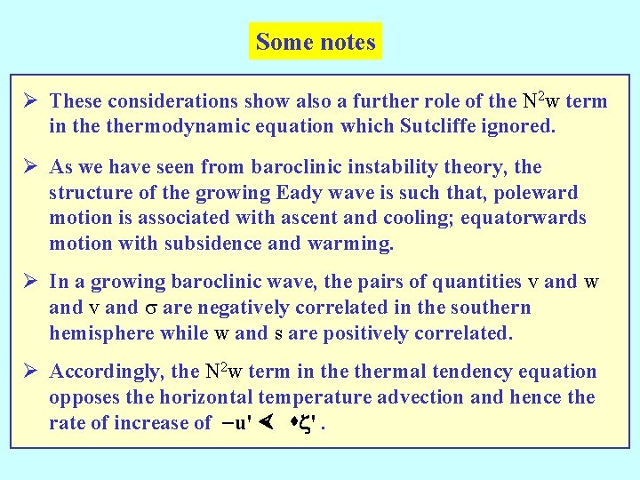
Some notes Ø These considerations show also a further role of the N 2 w term in thermodynamic equation which Sutcliffe ignored. Ø As we have seen from baroclinic instability theory, the structure of the growing Eady wave is such that, poleward motion is associated with ascent and cooling; equatorwards motion with subsidence and warming. Ø In a growing baroclinic wave, the pairs of quantities v and w and v and s are negatively correlated in the southern hemisphere while w and s are positively correlated. Ø Accordingly, the N 2 w term in thermal tendency equation opposes the horizontal temperature advection and hence the rate of increase of -u' × sz'.

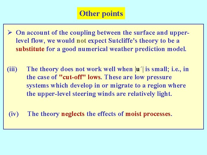
Other points Ø On account of the coupling between the surface and upperlevel flow, we would not expect Sutcliffe's theory to be a substitute for a good numerical weather prediction model. (iii) The theory does not work well when |u´| is small; i. e. , in the case of "cut-off" lows. These are low pressure systems which develop in or migrate to a region where the upper-level steering winds are relatively light. (iv) The theory neglects the effects of moist processes.

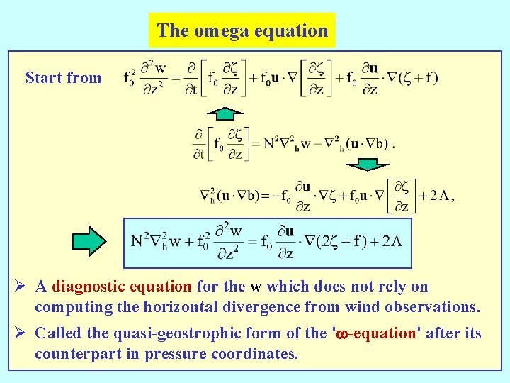
The omega equation Start from Ø A diagnostic equation for the w which does not rely on computing the horizontal divergence from wind observations. Ø Called the quasi-geostrophic form of the 'w-equation' after its counterpart in pressure coordinates.

The End