Centre for Health Geoinformatics www chg ie GIS


- Slides: 10
Centre for Health Geoinformatics www. chg. ie GIS to support Health in Poor Countries Jan Rigby [Department of Geography & Centre for Health Geoinformatics] How can geographic information best support effective decision making in the health arena?
Geographical Information Systems GIS: a system technology to describe, explain, predict and plan for patterns and processes at geographical scales How can geographic information best support effective decision making in the health arena?
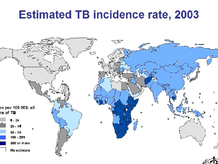
Cartogram of tuberculosis cases Source: www. worldmapper. org,
Ireland: access to service locations by travel time
Context When training health researchers in GIS skills in poor countries, there is an enormous problem in sustaining the expertise that is being developed. We can fall back on the usual culprits: people, data and technology. A major barrier in the technology phase has been software. We tend to train using software we know is robust, and that software is often a commercial project which is unaffordable to those we have trained.
GIS Health Research Open Source Develop sustainable training in GIS for health researchers in poor countries Minimal cost to those being trained Basic analysis – capturing and mapping point data, mapping area data Ongoing support
Leptospiros is Thailand 2011 GIS Health Research Open Source