Central California Circulation Study Purpose Use Models Surface

- Slides: 27

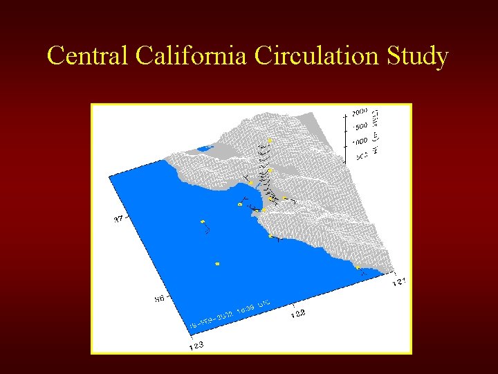
Central California Circulation Study

Purpose Use Models, Surface Obs. and Pt Sur Data to: • Analyze low-level cyclonic feature on 28 January. • Study diurnal variations and their extent • Model performance evaluation

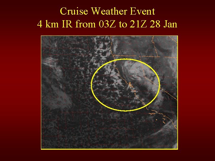
Cruise Weather Event 4 km IR from 03 Z to 21 Z 28 Jan

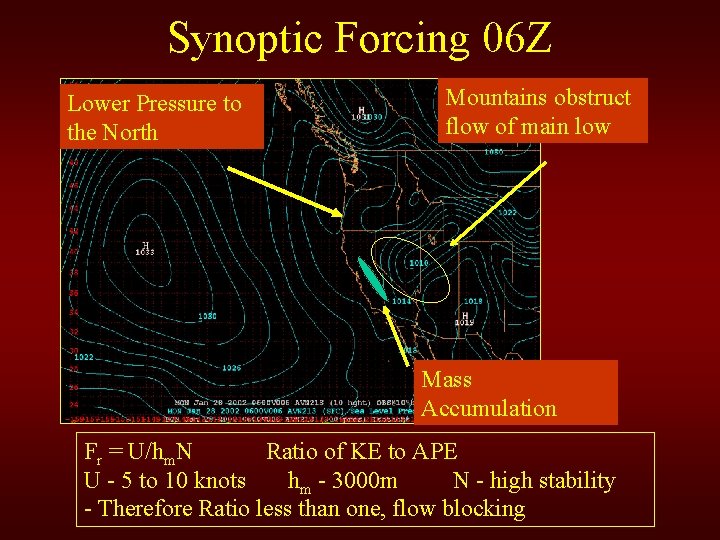
Synoptic Forcing 06 Z Lower Pressure to the North Mountains obstruct flow of main low Mass Accumulation Fr = U/hm. N Ratio of KE to APE U - 5 to 10 knots hm - 3000 m N - high stability - Therefore Ratio less than one, flow blocking

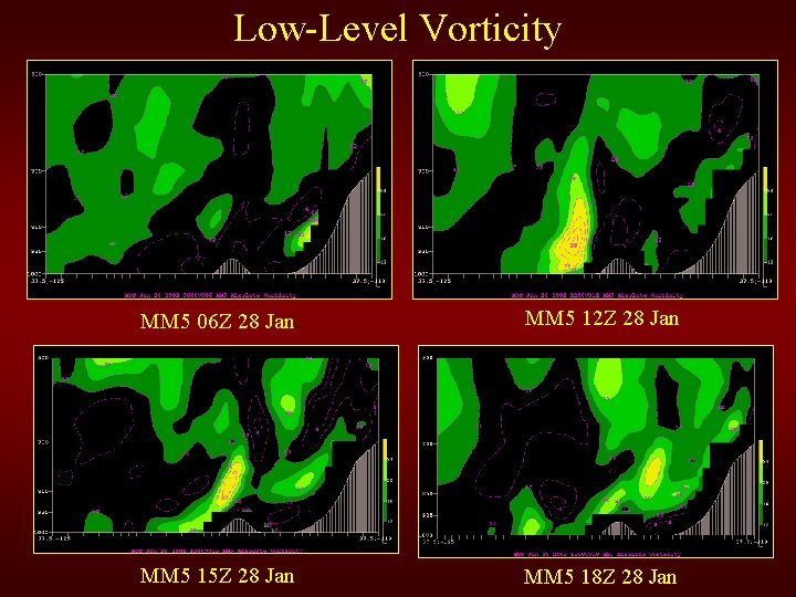
Low-Level Vorticity MM 5 06 Z 28 Jan. MM 5 12 Z 28 Jan MM 5 15 Z 28 Jan MM 5 18 Z 28 Jan

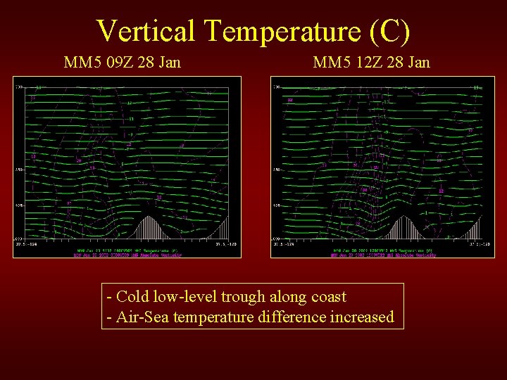
Vertical Temperature (C) MM 5 09 Z 28 Jan MM 5 12 Z 28 Jan - Cold low-level trough along coast - Air-Sea temperature difference increased

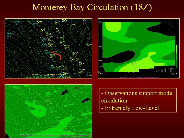
Monterey Bay Circulation (18 Z) - Observations support model circulation - Extremely Low-Level

Diurnal Circulation - Nocturnal Phase • • • Unusually Strong Land Breeze for this area Land must be colder than water Typically stable conditions Nightime/early morning phenomena Need light winds, clear skies and low moisture.

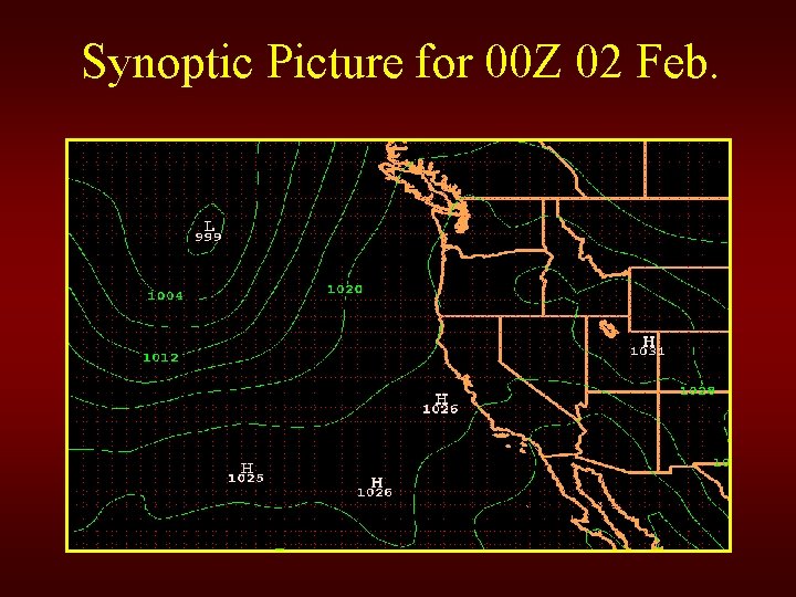
Synoptic Picture for 00 Z 02 Feb.

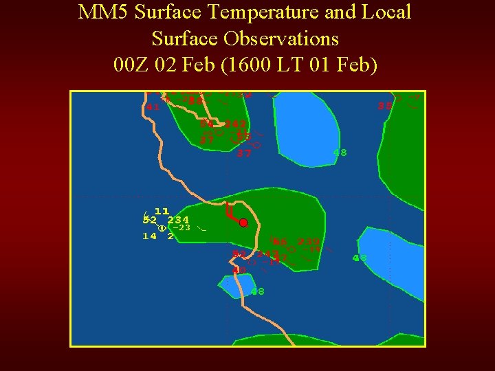
MM 5 Surface Temperature and Local Surface Observations 00 Z 02 Feb (1600 LT 01 Feb)

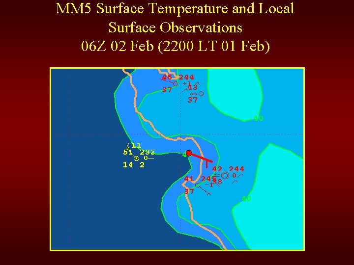
MM 5 Surface Temperature and Local Surface Observations 06 Z 02 Feb (2200 LT 01 Feb)

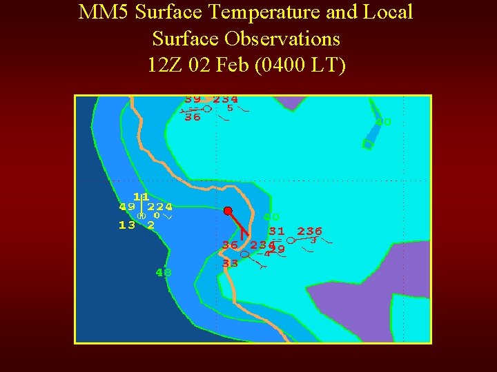
MM 5 Surface Temperature and Local Surface Observations 12 Z 02 Feb (0400 LT)

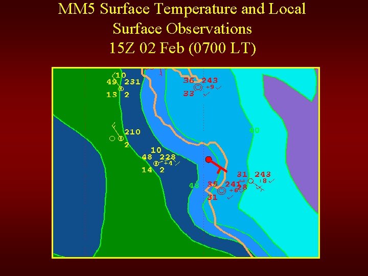
MM 5 Surface Temperature and Local Surface Observations 15 Z 02 Feb (0700 LT)

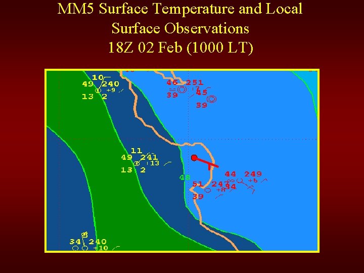
MM 5 Surface Temperature and Local Surface Observations 18 Z 02 Feb (1000 LT)

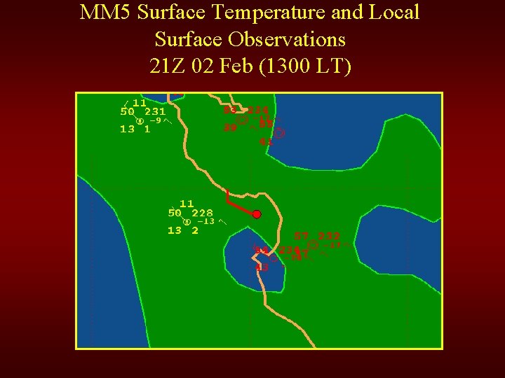
MM 5 Surface Temperature and Local Surface Observations 21 Z 02 Feb (1300 LT)

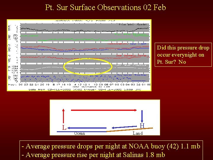
Pt. Surface Observations 02 Feb Did this pressure drop occur everynight on Pt. Sur? No L H Ocean Land - Average pressure drops per night at NOAA buoy (42) 1. 1 mb - Average pressure rise per night at Salinas 1. 8 mb

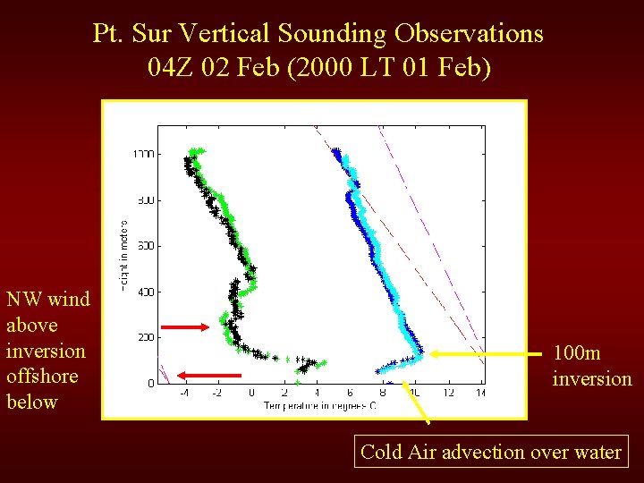
Pt. Sur Vertical Sounding Observations 04 Z 02 Feb (2000 LT 01 Feb) NW wind above inversion offshore below 100 m inversion Cold Air advection over water

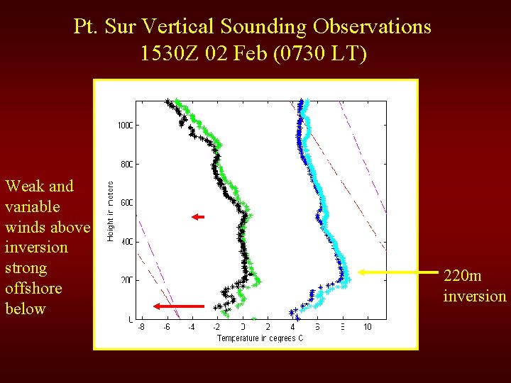
Pt. Sur Vertical Sounding Observations 1530 Z 02 Feb (0730 LT) Weak and variable winds above inversion strong offshore below 220 m inversion

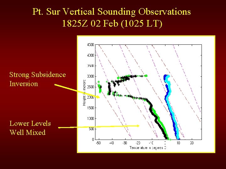
Pt. Sur Vertical Sounding Observations 1825 Z 02 Feb (1025 LT) Strong Subsidence Inversion Lower Levels Well Mixed

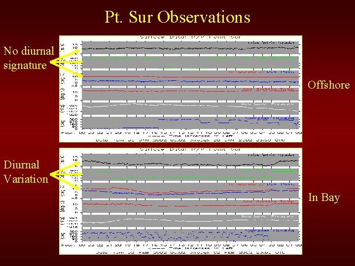
Pt. Sur Observations No diurnal signature Offshore Diurnal Variation In Bay

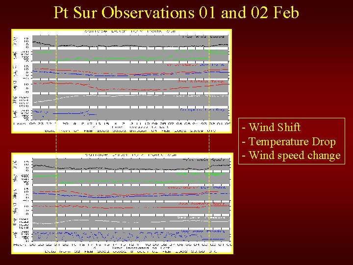
Pt Sur Observations 01 and 02 Feb - Wind Shift - Temperature Drop - Wind speed change

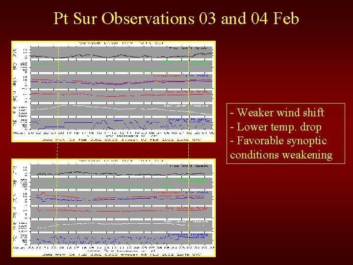
Pt Sur Observations 03 and 04 Feb - Weaker wind shift - Lower temp. drop - Favorable synoptic conditions weakening

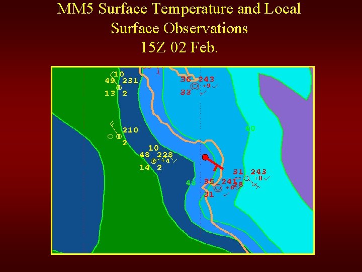
MM 5 Surface Temperature and Local Surface Observations 15 Z 02 Feb.

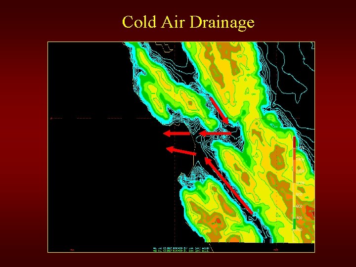
Cold Air Drainage

Why are Diurnal Variations Capture so poorly by Models? • Good Thermodynamics • Coarse topography information • More uniform weak flow instead of localized intense valley flow

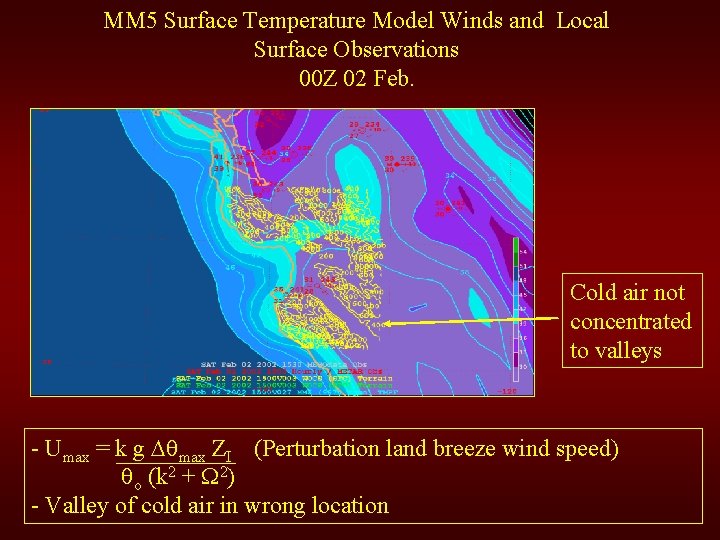
MM 5 Surface Temperature Model Winds and Local Surface Observations 00 Z 02 Feb. Cold air not concentrated to valleys - Umax = k g max ZI (Perturbation land breeze wind speed) o (k 2 + 2) - Valley of cold air in wrong location

Questions?