
CENTENNIAL COLLEGE SCHOOL OF ENGINEERING APPLIED SCIENCE VS
- Slides: 17
CENTENNIAL COLLEGE SCHOOL OF ENGINEERING & APPLIED SCIENCE VS 361 Introduction to GIS CARTOGRAPHIC COMMUNICATIONS COURSE NOTES 1
CARTOGRAPHIC COMMUNICATIONS. . 80% OF ALL BUSINESS IS SPATIALLY DEPENDENT! • Inventory as a way of recording and storing information • Analysis as a means of analysing locational distributions and spatial patterns • Communication as a method of presenting information and findings-- the art of persuasion! Communication. . . • Cartographic product presents the results of the GIS analysis as a map. • • Maps can inform and persuade. • Know your audience. Cartographer must lay out the map(s) to tell the story. 2
Maps and Cartography • Map – ‘digital or analog output from a GIS showing information using well established cartographic conventions’ • Cartography is the art, science and techniques of making maps The Need for Design n To appear professional and avoid errors, GIS maps should reflect cartographic knowledge about map design. A map has a visual grammar or structure that must be understood and used if the best map design is desired. Cartographic conventions should be followed (e. g. forests should be green). To be effective, a map must be correctly designed and constructed. 3
Map Design and GIS • When a GIS map is the result of a complex analytical or modeling process, good design is essential for understanding. • The map is what distinguishes GIS as a different approach to the management of information, so extra care should be taken to improve the final maps that a GIS generates in a GIS task. Limitations of Paper Maps • • • Fixed scale Fixed extent Static view Flat and hence limited for 3 D visualization Only presents ‘complete’ world view Map producer-centric 4
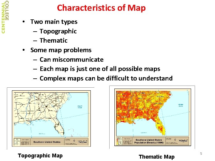
Characteristics of Map • Two main types – Topographic – Thematic • Some map problems – Can miscommunicate – Each map is just one of all possible maps – Complex maps can be difficult to understand Topographic Map Thematic Map 5
ELEMENTS OF MAPS CARTOGRAPHIC COMMUNICATION. . . • SCALE • DIRECTION • METADATA • LEGEND • MAP BODY (active frame) • TITLE 6
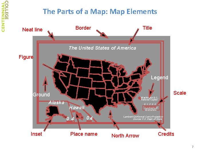
The Parts of a Map: Map Elements Border Neat line Title The United States of America Figure Legend Scale Ground Alaska Washington, D. C. National Capital Hawaii 0 4 Inset 0 1 2 3 4 hundreds of kilometers 04 Place name Lambert Conformal Conic Projection Source: U. S. Dept. of State North Arrow Credits 7
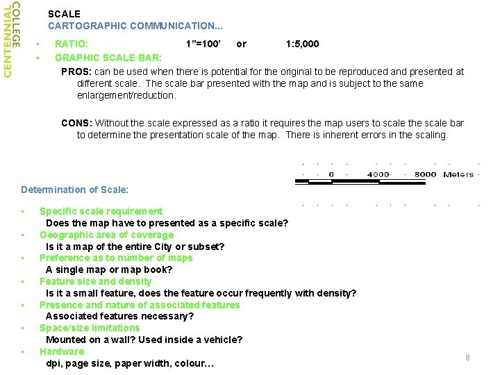
SCALE CARTOGRAPHIC COMMUNICATION. . . • • RATIO: 1”=100’ or 1: 5, 000 GRAPHIC SCALE BAR: PROS: can be used when there is potential for the original to be reproduced and presented at different scale. The scale bar presented with the map and is subject to the same enlargement/reduction. CONS: Without the scale expressed as a ratio it requires the map users to scale the scale bar to determine the presentation scale of the map. There is inherent errors in the scaling. Determination of Scale: • • Specific scale requirement Does the map have to presented as a specific scale? Geographic area of coverage Is it a map of the entire City or subset? Preference as to number of maps A single map or map book? Feature size and density Is it a small feature, does the feature occur frequently with density? Presence and nature of associated features Associated features necessary? Space/size limitations Mounted on a wall? Used inside a vehicle? Hardware dpi, page size, paper width, colour… 8
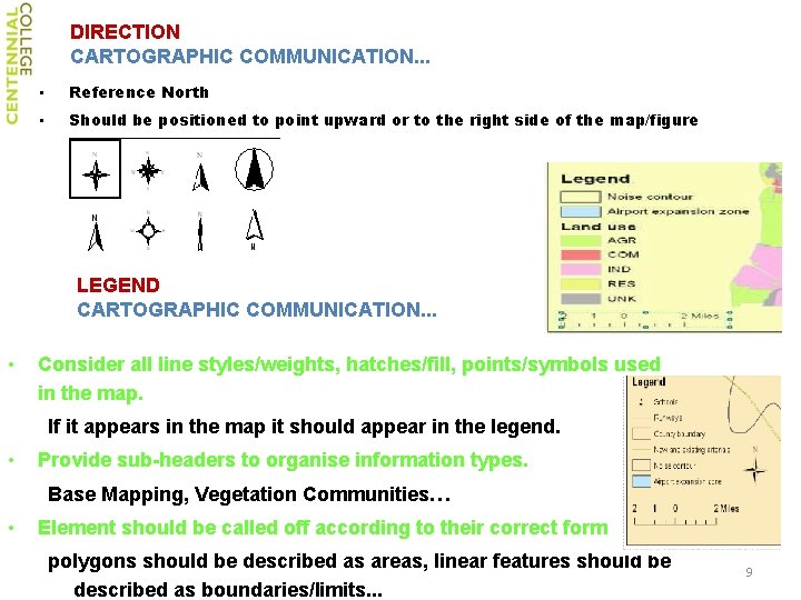
DIRECTION CARTOGRAPHIC COMMUNICATION. . . • Reference North • Should be positioned to point upward or to the right side of the map/figure LEGEND CARTOGRAPHIC COMMUNICATION. . . • Consider all line styles/weights, hatches/fill, points/symbols used in the map. If it appears in the map it should appear in the legend. • Provide sub-headers to organise information types. Base Mapping, Vegetation Communities… • Element should be called off according to their correct form polygons should be described as areas, linear features should be described as boundaries/limits. . . 9
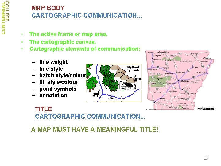
MAP BODY CARTOGRAPHIC COMMUNICATION. . . • • • The active frame or map area. The cartographic canvas. Cartographic elements of communication: – – – line weight line style hatch style/colour fill style/colour point symbols annotation TITLE CARTOGRAPHIC COMMUNICATION. . . A MAP MUST HAVE A MEANINGFUL TITLE! 10
METADATA CARTOGRAPHIC COMMUNICATION. . . • • Sources of Information Accuracy Currency References to Statutes, Bylaws. . . Limitations of Use Warranties/disclaimers Project Number 11
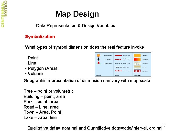
Map Design Data Representation & Design Variables Symbolization What types of symbol dimension does the real feature invoke • Point • Line • Polygon (Area) • Volume Geographic representation of dimension can vary with map scale Tree – point or volumetric Building – point, area Park – point, area Road – Line, area Town – Area, Point Lake – Area, line Qualitative data= nominal and Quantitative data=ratio/interval, ordinal 12
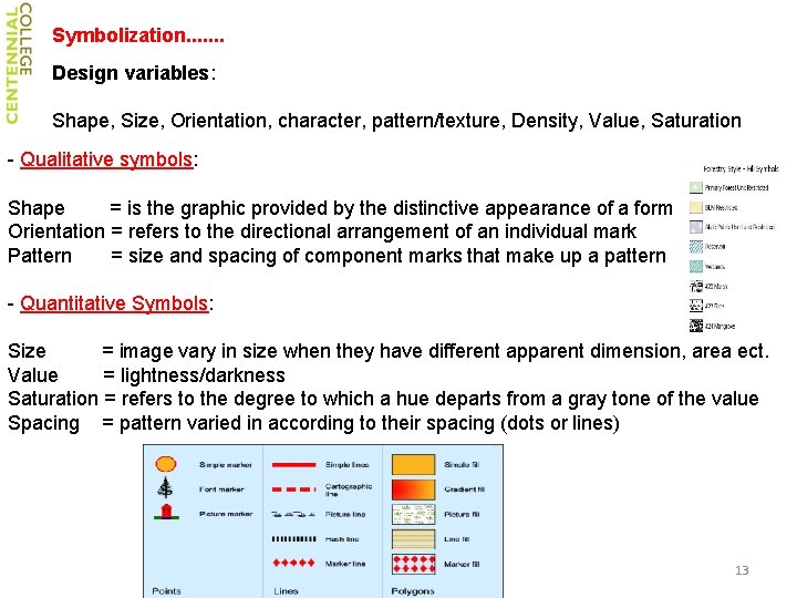
Symbolization. . . . Design variables: Shape, Size, Orientation, character, pattern/texture, Density, Value, Saturation - Qualitative symbols: Shape = is the graphic provided by the distinctive appearance of a form Orientation = refers to the directional arrangement of an individual mark Pattern = size and spacing of component marks that make up a pattern - Quantitative Symbols: Size = image vary in size when they have different apparent dimension, area ect. Value = lightness/darkness Saturation = refers to the degree to which a hue departs from a gray tone of the value Spacing = pattern varied in according to their spacing (dots or lines) 13
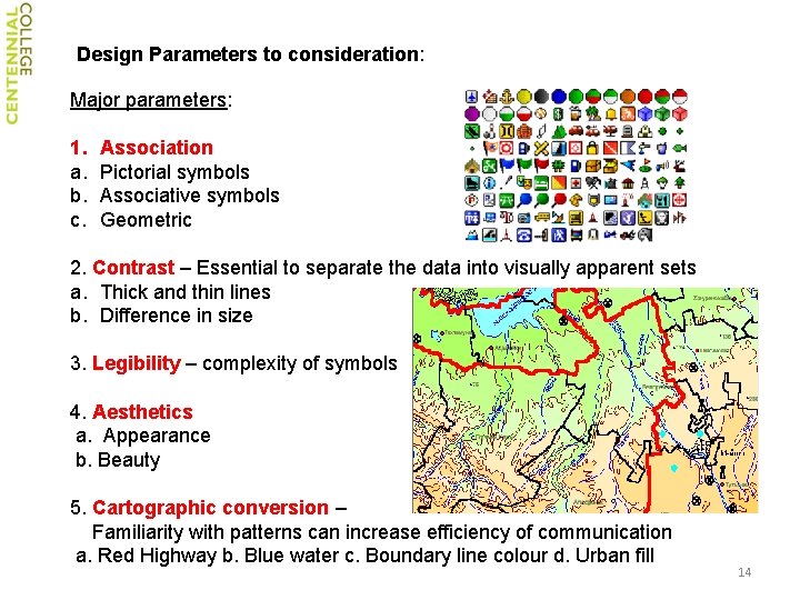
Design Parameters to consideration: Major parameters: 1. a. b. c. Association Pictorial symbols Associative symbols Geometric 2. Contrast – Essential to separate the data into visually apparent sets a. Thick and thin lines b. Difference in size 3. Legibility – complexity of symbols 4. Aesthetics a. Appearance b. Beauty 5. Cartographic conversion – Familiarity with patterns can increase efficiency of communication a. Red Highway b. Blue water c. Boundary line colour d. Urban fill 14
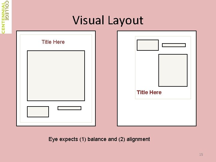
Visual Layout Title Here Eye expects (1) balance and (2) alignment 15
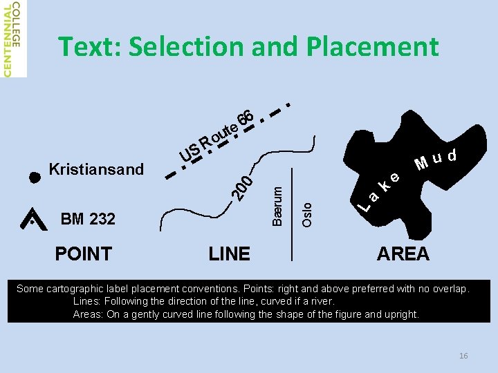
Text: Selection and Placement POINT LINE e d u M La k Oslo BM 232 Bærum 20 0 Kristiansand US 6 6 e t u Ro AREA Some cartographic label placement conventions. Points: right and above preferred with no overlap. Lines: Following the direction of the line, curved if a river. Areas: On a gently curved line following the shape of the figure and upright. 16
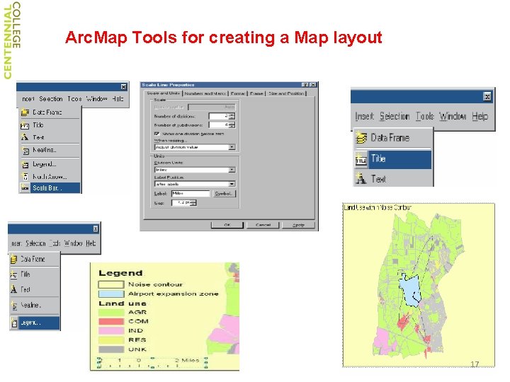
Arc. Map Tools for creating a Map layout 17