
Case Study Autonomous Cars 1 1222022 Sebastian Thruns
Case Study Autonomous Cars 1 1/22/2022
� Sebastian Thrun’s TED Talk describing Google’s driverless car � www. ted. com/talks/sebastian_thrun_google_s_driverless_car. html 2 1/22/2022

� Junior: The Stanford Entry in the Urban Challenge � http: //robots. stanford. edu/papers/junior 08. pdf 3 1/22/2022
DARPA Urban Challenge � November 3, 2007 � 6 hours to complete a 96 km urban area course � multiple robotic vehicles carrying out missions on the same course at the same time � basic rules: � stock vehicle � obey California driving laws � entirely autonomous � avoid collisions with objects typical to urban environment � must also be able to operate in parking lots � DARPA supplied environment map with information on lanes, lane markings, stop signs, parking lots, and special checkpoints 4 1/22/2022
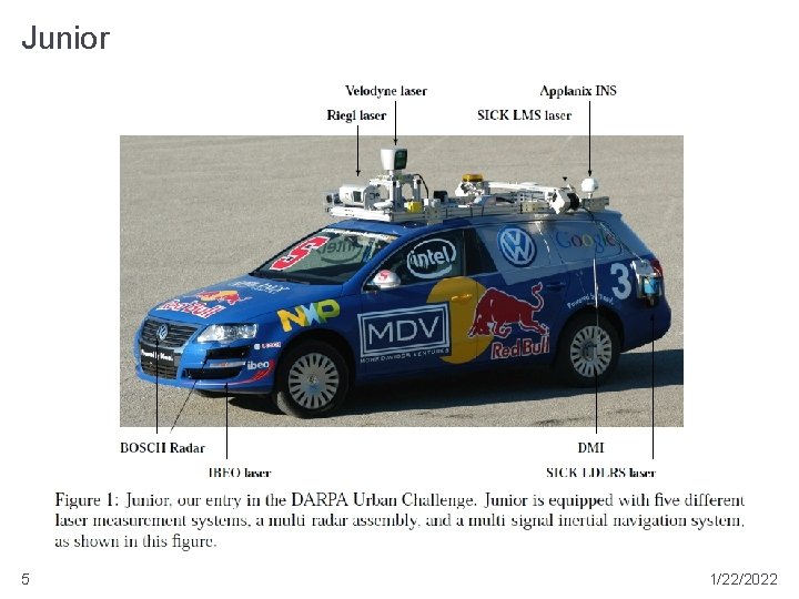
Junior 5 1/22/2022
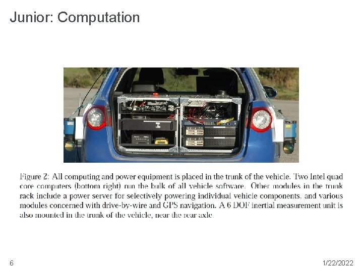
Junior: Computation 6 1/22/2022
Junior: Sensors � Applanix POS LV 420 position and orientation system � multiple GPS receivers, GPS heading measurement, inertial measurement, distance measurement, Omnistar Virtual Base Station � position and orientation errors less than 100 cm and 0. 1 degrees � 2 side facing SICK LMS laser range finders � 1 forward facing RIEGL LMS-Q 120 laser range finder � 1 roof mounted Velodyne HDL-64 E laser range finder � 2 rear mounted SICK LDLRS laser range finders � 2 front mounted IBEO ALASCA XT laser range finders � 5 BOSCH radars mounted in front grill 7 1/22/2022
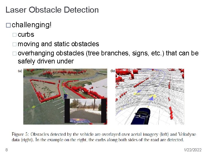
Laser Obstacle Detection � challenging! � curbs � moving and static obstacles � overhanging obstacles (tree branches, signs, etc. ) that can be safely driven under 8 1/22/2022
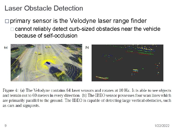
Laser Obstacle Detection � primary sensor is the Velodyne laser range finder � cannot reliably detect curb-sized obstacles near the vehicle because of self-occlusion 9 1/22/2022
Laser Obstacle Detection � curbs near the vehicle detected using the 2 front facing IBEO laser range finders and 2 rear facing SICK laser range finders � only obstacles close to the vehicle (5 m in front and 15 m in back) considered 10 1/22/2022
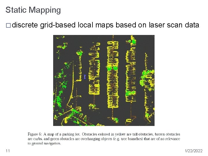
Static Mapping � discrete 11 grid-based local maps based on laser scan data 1/22/2022
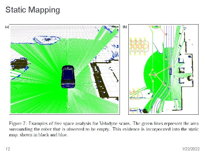
Static Mapping 12 1/22/2022
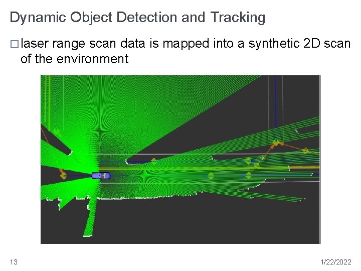
Dynamic Object Detection and Tracking � laser range scan data is mapped into a synthetic 2 D scan of the environment 13 1/22/2022
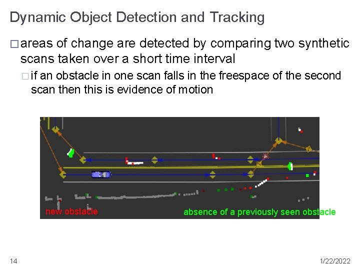
Dynamic Object Detection and Tracking � areas of change are detected by comparing two synthetic scans taken over a short time interval � if an obstacle in one scan falls in the freespace of the second scan then this is evidence of motion new obstacle 14 absence of a previously seen obstacle 1/22/2022
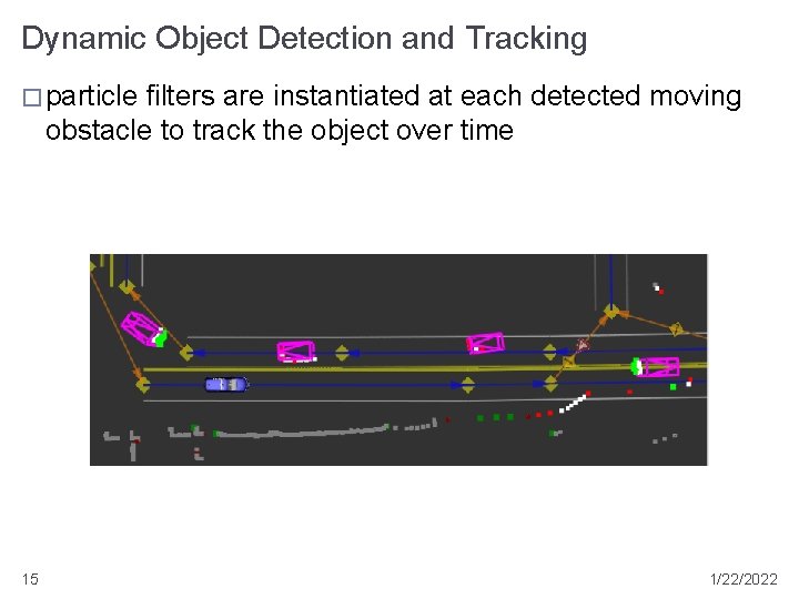
Dynamic Object Detection and Tracking � particle filters are instantiated at each detected moving obstacle to track the object over time 15 1/22/2022
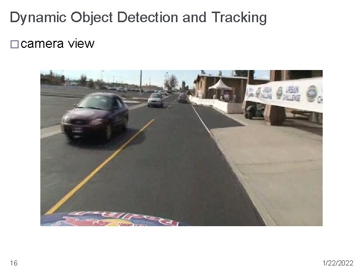
Dynamic Object Detection and Tracking � camera 16 view 1/22/2022
Precision Localization � high precision GPS and inertial measurements are not sufficiently precise to achieve single lane localization in the DARPA supplied map � DARPA map is also inaccurate! � high precision localization within the lane is achieved using curb measurements and road reflectivity � 2 side facing SICK LMS and the forward facing RIEGL LMSQ 120 laser range finders pointed downward to measure infrared reflectivity change between road surface and painted lane markers � offsets greater than 1 m relative to GPS were common observed 17 1/22/2022

Precision Localization 18 1/22/2022
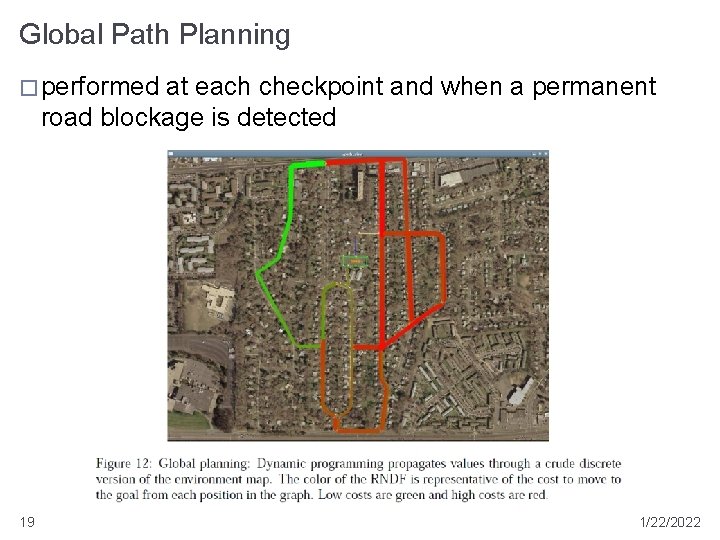
Global Path Planning � performed at each checkpoint and when a permanent road blockage is detected 19 1/22/2022

Global Path Planning � performed using dynamic programming on a discrete version of the map � cost function weights choices (which way to turn at an intersection, lane changes, etc. ) probabilistically � tends to perform lane changes earlier rather than later � will avoid passing a slow moving car in the right lane if a right hand turn is up coming � may decide against left hand turns at intersections if an alternate route is not much longer 20 1/22/2022
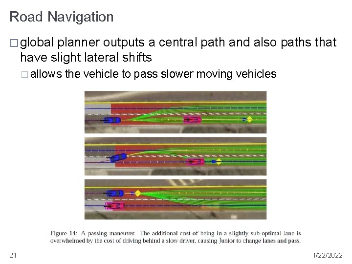
Road Navigation � global planner outputs a central path and also paths that have slight lateral shifts � allows 21 the vehicle to pass slower moving vehicles 1/22/2022
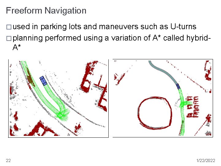
Freeform Navigation � used in parking lots and maneuvers such as U-turns � planning performed using a variation of A* called hybrid. A* 22 1/22/2022
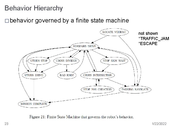
Behavior Hierarchy � behavior governed by a finite state machine not shown *TRAFFIC_JAM *ESCAPE 23 1/22/2022
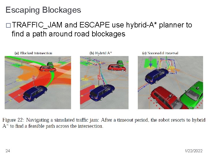
Escaping Blockages � TRAFFIC_JAM and ESCAPE use hybrid-A* planner to find a path around road blockages 24 1/22/2022

Results � all 3 missions accomplished � 55. 96 miles in 4 hrs 5 mins 6 secs (22 km per hour) � good for 2 nd place � notable race events � travel over a dirt road � passing a disabled competitor � avoiding a head on collision with a competitor driving partially in the wrong lane � braking in reaction to an aggressive merge � guilty of pulling alongside a competitor stopped at a stop sign (mistaken for a parked car) 25 1/22/2022
- Slides: 25