Bryan Lyttle Planning Policy Manager White Paper Planning

Bryan Lyttle Planning Policy Manager

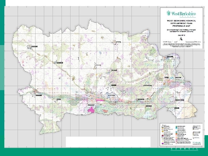
White Paper: Planning for the Future WHAT THE WHITE PAPER MEANS FOR WEST BERKSHIRE

Purpose q This consultation seeks any views on each part of a package of proposals for reform of the planning system in England to streamline and modernise the planning process, improve outcomes on design and sustainability, reform developer contributions and ensure more land is available for development where it is needed.

q q q q q It is too complex Planning decisions are discretionary rather than rules-based+ It takes too long to adopt a Local Plan Assessments of housing need, viability and environmental impacts are too complex and opaque It has lost public trust It is based on 20 th-century technology The process for negotiating developer contributions to affordable housing and infrastructure is complex, protracted and unclear There is not enough focus on design, and little incentive for high quality new homes and places: It simply does not lead to enough homes being built

So – wish is to q q q q q be more ambitious for the places we create move the democracy forward improve the user experience of the planning system support home ownership increase the supply of land available for new homes where it is needed help businesses to expand support innovative developers and housebuilders, promote the stewardship and improvement of our precious countryside and environment, create a virtuous circle of prosperity in our villages, towns and cities

Proposals

q 1 q 2 q q 3 4 q 5 streamline the planning process with more democracy taking place more effectively at the plan making stage; a radical, digital-first approach to modernise the planning process. This means moving from a process based on documents to a process driven by data; a new focus on design and sustainability; improve infrastructure delivery in all parts of the country & ensure developers play their part; to ensure more land is available for the homes and development people and communities need, and to support renewal of our town and city centres

What does this mean for local plans? Allocate enough land for development Provide certainty of land for applicants Provide certainty to communities Communicate this information clearly and visually • More details to follow on digital maps • Produced to a standard format • Ensure more democracy takes place at the plan making stage • Set clear expectations on what is required so future growth facilitates beautiful and sustainable places. • •

What does this mean for local plans? Local authorities and the Planning Inspectorate will be required through legislation to meet a statutory timetable for key stages of the process Stage 1 [6 months]: The local planning authority “calls for” suggestions for areas under the three categories, including comprehensive “best in class” ways of achieving public involvement at this plan-shaping stage for where development should go and what it should look like. Stage 2 [12 months]: The local planning authority draws up its proposed Local Plan, and produces any necessary evidence to inform and justify the plan. “Higher-risk” authorities will receive mandatory Planning Inspectorate advisory visits, in order to ensure the plan is on track prior to submission.
![What does this mean for local plans? Stage 3 [6 weeks]: The local planning](http://slidetodoc.com/presentation_image_h/1cde31bf702958778eb6b23a77f19a34/image-10.jpg "What does this mean for local plans? Stage 3 [6 weeks]: The local planning")
What does this mean for local plans? Stage 3 [6 weeks]: The local planning authority simultaneously (i) submits the Plan to the Secretary of State for Examination together with a Statement of Reasons to explain why it has drawn up its plan as it has; and (ii) publicises the plan for the public to comment on. Comments seeking change must explain how the plan should be changed and why. Again, this process would embody ‘best in class’ ways of ensuring public involvement. Responses will have a word count limit.
![What does this mean for local plans? Stage 4 [9 months]: A planning inspector](http://slidetodoc.com/presentation_image_h/1cde31bf702958778eb6b23a77f19a34/image-11.jpg "What does this mean for local plans? Stage 4 [9 months]: A planning inspector")
What does this mean for local plans? Stage 4 [9 months]: A planning inspector appointed by the Secretary of State considers whether the three categories shown in the proposed Local Plan are “sustainable” as per the statutory test and accompanying national guidance and makes binding changes which are necessary to satisfy the test. The plan-making authority and all those who submitted comments would have the right to be “heard” by the inspector (whether face to face, by video, phone or in writing – all at the inspector’s discretion). The inspector’s report can, as relevant, simply state agreement with the whole or parts of the council’s Statement of Reasons, and/or comments submitted by the public. • Stage 5 [6 weeks]: Local Plan map, key and text are finalised, and come into force

Growth areas “suitable for substantial development” The term substantial development be defined in policy to remove any debate. would include land suitable for comprehensive development, including new settlements and urban extension sites, and areas for redevelopment, such as former industrial sites or urban regeneration sites. Sites annotated in the Local Plan under this category would have outline approval for development. Areas of flood risk would be excluded from this category (as would other important constraints), unless any risk can be fully mitigated;

Renewal areas “suitable for development” – this would cover existing built areas where smaller scale development is appropriate. It could include the gentle densification and infill of residential areas, development in town centres, and development in rural areas that is not annotated as Growth or Protected areas, such as small sites within or on the edge of villages. There would be a statutory presumption in favour of development being granted for the uses specified as being suitable in each area. Local authorities could continue to consider the case for resisting inappropriate development of residential gardens;

Areas that are Protected – this would include sites and areas which, as a result of their particular environmental and/or cultural characteristics, would justify more stringent development controls to ensure sustainability. This would include areas such as Green Belt, Areas of Outstanding Natural Beauty (AONBs), Conservation Areas, Local Wildlife Sites, areas of significant flood risk and important areas of green space. At a smaller scale it can continue to include gardens in line with existing policy in the National Planning Policy Framework. It would also include areas of open countryside outside of land in or areas. Some areas would be defined nationally, others locally on the basis of national policy

What does this mean for local plans? Cont. . With the primary focus of plan-making on identifying areas for development and protection, development management policy contained in the plan would be restricted to clear and necessary site or area-specific requirements, including broad height limits, scale and/or density limits for land included in Growth areas and Renewal areas, established through the accompanying text. The National Planning Policy Framework would become the primary source of policies for development management; Local planning authorities and neighbourhoods (through Neighbourhood Plans) would play a crucial role in producing required design guides and codes to provide certainty and reflect local character and preferences about the form and appearance of development.

What does this mean for local plans? Cont. . abolish the Sustainability Appraisal system and develop a simplified process for assessing the environmental impact of plans; Remove the Duty to Cooperate test and a slimmed down assessment of deliverability for the plan would be incorporated into the “sustainable development” test. Imposition of a housing number on the authority. Although if you combine with other authorities you can redistribute the overall need via a joint planning agreement. Still have the housing delivery test and presumption in favour of development.

What does this mean for Development Management? Where the Local Plan has identified – Growth areas – an outline permission for the principle of development would be conferred by adoption of the Local Plan. Detailed planning permission would be secured by: reformed reserve matters process; or a local development order; or Development Corporation (New Towns etc)

In Renewal areas, there would be a general presumption in favour of development established in legislation. Consent for development would be granted in one of three ways: automatic consent if the scheme meets design and other prior approval requirements; or for other types of development, a faster planning application process where a planning application for the development would be determined in the context of the Local Plan description, for what development the area or site is appropriate for, and with reference to the National Planning Policy Framework ; or a Local or Neighbourhood Development Order

In both the and areas it would still be possible for a proposal which is different to the plan to come forward (if, for example, local circumstances had changed suddenly, or an unanticipated opportunity arose), but this would require a specific planning application. We expect this to be the exception rather than the rule. In areas where development is restricted (areas) any development proposals would come forward as now through planning applications being made to the local authority (except where they are subject to permitted development rights or development orders), and judged against policies set out in the National Planning Policy Framework.

For all types of planning applications a much more streamlined and digitally enabled end to end process which is proportionate to the scale and nature of the development proposed, to ensure decisions are made faster. But For Spending Review, the Government will prepare a specific, investable proposal for modernising planning systems in local government; We will work with tech companies and local planning authorities to modernise the software used for case-managing a planning application to improve the user-experience for those applying and reduce the errors and costs currently experienced by planning authorities; For major development, relevant drawings and plans, only be one key standardised planning statement of no more than 50 pages to justify the development proposals in relation to the Local Plan and National Planning Policy Framework;

the delegation of detailed planning decisions to planning officers where the principle of development has been established, as detailed matters for consideration should be principally a matter for professional planning judgment. Possibility of refunding planning application fee if not decided within 8 or 13 weeks or an automatic permission Also fewer appeals, by ensuring greater certainty about the principle of development however to promote proper consideration of applications by planning committee if refused the applicant will be entitled to automatic rebate of application fee if successful at appeal.

Neighbourhood Plans should be retained in the reformed planning system, but we will want to consider whether their content should become more focused but with greater use of digital tools so that possibly individual streets can set their own rules for the form of development which they are happy to see.

Pillar Two – Planning for beautiful and sustainable places a National Model Design Code to supplement the guide, setting out more detailed parameters for development in different types of location: issues such as the arrangement and proportions of streets and urban blocks, positioning and hierarchy of public spaces, successful parking arrangements, placement of street trees, and high quality cycling and walking provision, in line with our wider vision for cycling and walking in England As national guidance, we will expect the National Design Guide, National Model Design Code and the revised Manual for Streets to have a direct bearing on the design of new communities Where locally-produced guides and codes are not in place, we also propose to make clear in policy that the National Design Guide, National Model Design Code and Manual for Streets should guide decisions on the form of development

Fast-track for beauty National Planning Policy Framework, we will make clear that schemes which comply with local design guides and codes have a positive advantage and greater certainty about their prospects of swift approval Where plans identify areas for significant development, will require a masterplan and site-specific code are agreed as a condition of the permission in principle which is granted through the plan. This should be in place prior to detailed proposals coming forward, to direct and expedite those detailed matters. These masterplans and codes could be prepared by the local planning authority alongside or subsequent to preparing its plan, at a level of detail commensurate with the size of site and key principles to be established Propose to widen and change the nature of permitted development, so that it enables popular and replicable forms of development to be approved easily and quickly

EFFECTIVE STEWARDSHIP AND ENHANCEMENT OF OUR NATURAL AND HISTORIC ENVIRONMENT Nationally, the Environment Bill currently before Parliament will legislate for mandatory net gains for biodiversity as a condition of most new development. And the Local Nature Recovery Strategies which it will also introduce will identify opportunities to secure enhancements through development schemes and contributions. Processes for environmental assessment and mitigation need to be quicker and speed up decision-making and the delivery of development projects. The environmental aspects of a plan or project should be considered early in the process, and to clear timescales. National and local level data, made available to authorities, communities and applicants in digital form, should make it easier to re- use and update information and reduce the need for site-specific surveys.

EFFECTIVE STEWARDSHIP AND ENHANCEMENT OF OUR NATURAL AND HISTORIC ENVIRONMENT Requirements for environmental assessment and mitigation need to be simpler to understand consolidated in one place so far as possible, so that the same impacts and opportunities do not need to be considered twice. Any new system will need to ensure that we take advantage of opportunities for environmental improvements while also meeting our domestic and international obligations for environmental protection. This will be the subject of a separate and more detailed consultation in the autumn. Local Plans will clearly identify the location of internationally, nationally and locally designated heritage assets, such as World Heritage Sites and conservation areas, as well locally important features such as protected views.

Pillar Three – Planning for infrastructure and connected places Securing necessary infrastructure and affordable housing alongside new development is central to our vision for the planning system. We want to bring forward reforms to make sure that developer contributions are: • responsive to local needs, to ensure a fairer contribution from developers for local communities so that the right infrastructure and affordable housing is delivered; • transparent, so it is clear to existing and new residents what new infrastructure will accompany development; • consistent and simplified, to remove unnecessary delay and support competition in the housebuilding industry; • buoyant, so that when prices go up the benefits are shared fairly between developers and the local community, and when prices go down there is no need to re-negotiate agreements.

A CONSOLIDATED INFRASTRUCTURE LEVY a flat-rate, valued-based charge, set nationally, at either a single rate, or at area-specific rates. charged on the final value of a development (or to an assessment of the sales value where the development is not sold, e. g. for homes built for the rental market), based on the applicable rate at the point planning permission is granted be levied at point of occupation, with prevention of occupation being a potential sanction for non-payment; include a value-based minimum threshold below which the levy is not charged, to prevent low viability development becoming unviable, reflecting average build costs per square metre, with a small, fixed allowance for land costs. ; and provide greater certainty for communities and developers about what the level of developer contributions are expected alongside new development.

A CONSOLIDATED INFRASTRUCTURE LEVY To better support the timely delivery of infrastructure, we would also allow local authorities to borrow against Infrastructure Levy revenues so that they could forward fund infrastructure. Enabling borrowing combined with a shift to levying developer contributions on completion, would incentivise local authorities to deliver enabling infrastructure, in turn helping to ensure development can be completed faster. As with all volatile borrowing streams, local authorities should assure themselves that this borrowing is affordable and suitable. extended to better capture changes of use which require planning permission, even where there is no additional floorspace, and for some permitted development rights including office to residential conversions and new demolition and rebuild permitted development rights.

A CONSOLIDATED INFRASTRUCTURE LEVY With Section 106 planning obligations removed, we propose that under the Infrastructure Levy, authorities would be able to use funds raised through the levy to secure affordable housing This could be secured through in-kind delivery on-site, which could be made mandatory where an authority has a requirement, capability and wishes to do so. Local authorities would have a means to specify the forms and tenures of the on-site provision, working with a nominated affordable housing provider. More freedom could be given to local authorities over how they spend the Infrastructure Levy
- Slides: 32