British Isles and Nordic Region Map Work pgs
 Label countries and")
British Isles and Nordic Region Map Work (pgs 103, 107, 109) Label countries and capitals • • • England Scotland Northern Ireland Wales Ireland Iceland Denmark Norway Sweden Finland Label bodies of water • • Atlantic Ocean Arctic Ocean Baltic Sea Gulf of Bothnia North Sea Norwegian Sea Celtic Sea Map quiz on Friday!!!

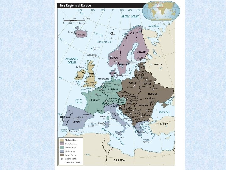
The British Isles and the Nordic Region

British Isles Geography • Make up of two island nations: Ireland the United Kingdom. • The U. K. is made up of England, Scotland, Wales and Northern Ireland.
. •")
British Isles: People • First inhabitants were the Celts (pronounced with a K). • These people came to the islands about 3000 years ago.

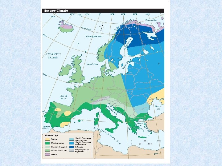
British Isles Climate • Climate is temperate which means cool winters and hot summers. It does rain quite a bit. • The North Atlantic Drift of the Gulf Stream allows for warm water flow that keeps the islands warmer despite their location.

British Isles: Water • The English Channel separates the isles from the main land. There is a tunnel built under it so that people can actually drive to France. • The River Thames makes London a major port.

Nordic Region Geography • Five countries that make up the region are Iceland, Finland, Norway, Sweden, and Denmark.

North Atlantic Drift • Gulf stream flows around the British Isles and into the North Sea and along the Norwegian Coast. • This creates a moderate climate. • The winds that blow off the drift allow for cool summers and mild winters.

Important Vocabulary • Fjord=inlet with steep sides formed by huge glaciers • Scandinavian Peninsula= Norway, Sweden, and Finland

People of the Nordic Region • Vikings= warriors from the Nordic region that raided towns in Europe • Finland is different because it is a mixture of Swedish, Norwegian, and Russian ancestry.

Lapland • Area in Finland, Norway and Sweden that is north of the Artic Circle (above the 55 degree latitude line). • Samis= original inhabitants of this land.

Water in this region • Is a major way of transportation • The Gulf of Bothnia separates Finland Sweden and is used to ship resources from one area to the other

Denmark: Peninsula • Surrounded by Germany, the North Sea and the Baltic Sea.

Iceland: Land of Fire and Ice • Two major landforms that make up this island are Volcanoes and Glaciers.

Ice • Glaciers are really just frozen rivers. They still move, just very slowly.

British Isles and Nordic Region History

British Isles
- Slides: 19