
Brian Resor Albuquerque Soaring Club Moriarty NM WEATHER
Brian Resor Albuquerque Soaring Club - Moriarty, NM WEATHER & FORECASTING FOR CROSS COUNTRY SOARING
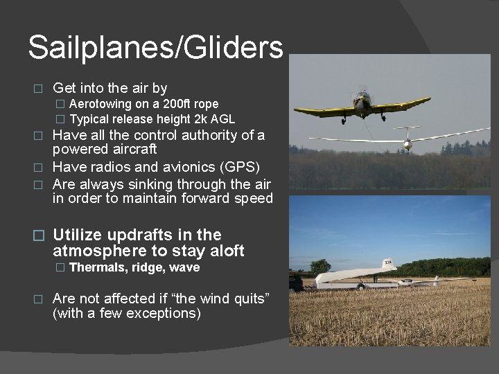
Sailplanes/Gliders � Get into the air by � Aerotowing on a 200 ft rope � Typical release height 2 k AGL Have all the control authority of a powered aircraft � Have radios and avionics (GPS) � Are always sinking through the air in order to maintain forward speed � � Utilize updrafts in the atmosphere to stay aloft � Thermals, ridge, wave � Are not affected if “the wind quits” (with a few exceptions)
Outline � Define cross country soaring � Define soaring weather � Resources for soaring weather � Forecasting soaring weather � Examples of special weather
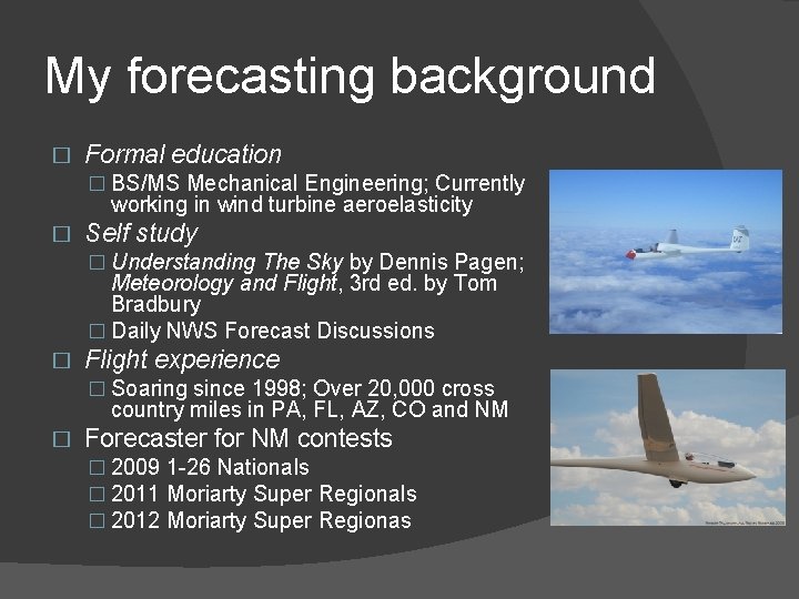
My forecasting background � Formal education � BS/MS Mechanical Engineering; Currently working in wind turbine aeroelasticity � Self study � Understanding The Sky by Dennis Pagen; Meteorology and Flight, 3 rd ed. by Tom Bradbury � Daily NWS Forecast Discussions � Flight experience � Soaring since 1998; Over 20, 000 cross country miles in PA, FL, AZ, CO and NM � Forecaster for NM contests � 2009 1 -26 Nationals � 2011 Moriarty Super Regionals � 2012 Moriarty Super Regionas
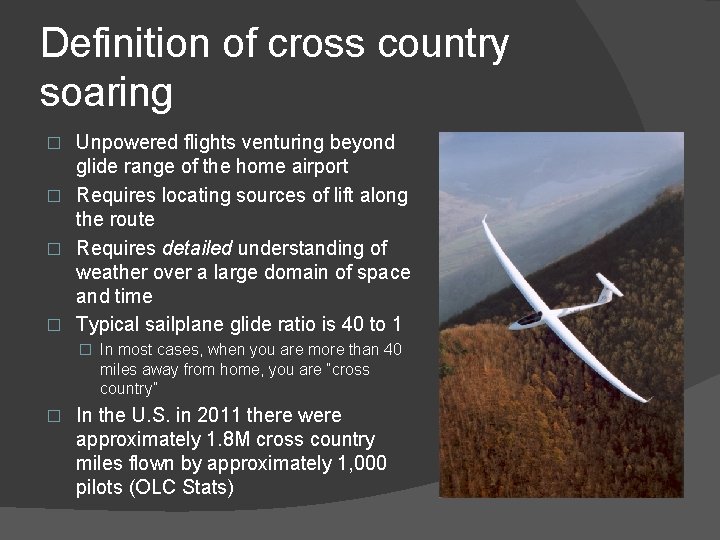
Definition of cross country soaring Unpowered flights venturing beyond glide range of the home airport � Requires locating sources of lift along the route � Requires detailed understanding of weather over a large domain of space and time � Typical sailplane glide ratio is 40 to 1 � � In most cases, when you are more than 40 miles away from home, you are “cross country” � In the U. S. in 2011 there were approximately 1. 8 M cross country miles flown by approximately 1, 000 pilots (OLC Stats)
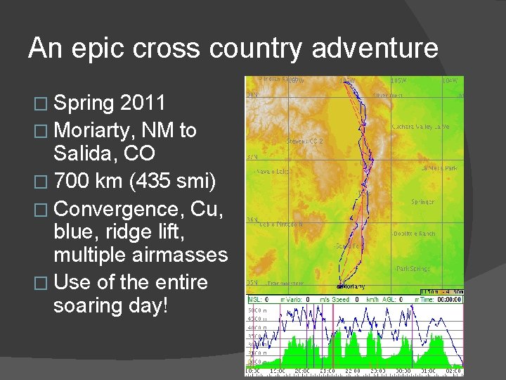
An epic cross country adventure � Spring 2011 � Moriarty, NM to Salida, CO � 700 km (435 smi) � Convergence, Cu, blue, ridge lift, multiple airmasses � Use of the entire soaring day!
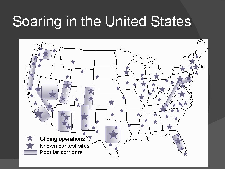
Soaring in the United States Gliding operations Known contest sites Popular corridors
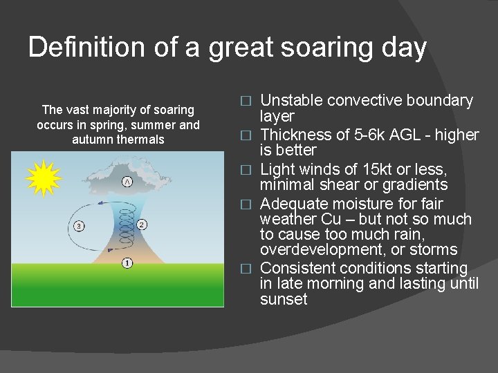
Definition of a great soaring day The vast majority of soaring occurs in spring, summer and autumn thermals � � � Unstable convective boundary layer Thickness of 5 -6 k AGL - higher is better Light winds of 15 kt or less, minimal shear or gradients Adequate moisture for fair weather Cu – but not so much to cause too much rain, overdevelopment, or storms Consistent conditions starting in late morning and lasting until sunset
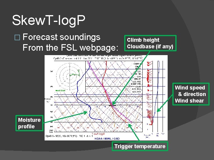
Skew. T-log. P � Forecast soundings From the FSL webpage: Climb height Cloudbase (if any) Wind speed & direction Wind shear Moisture profile Trigger temperature
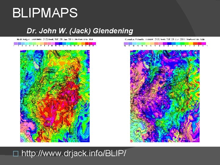
BLIPMAPS Dr. John W. (Jack) Glendening � http: //www. drjack. info/BLIP/
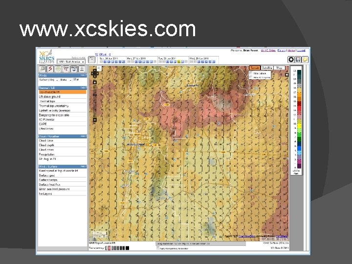
www. xcskies. com
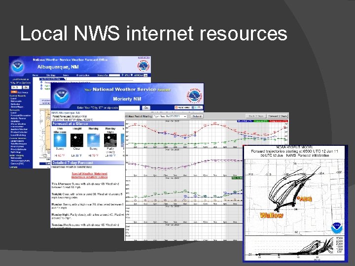
Local NWS internet resources
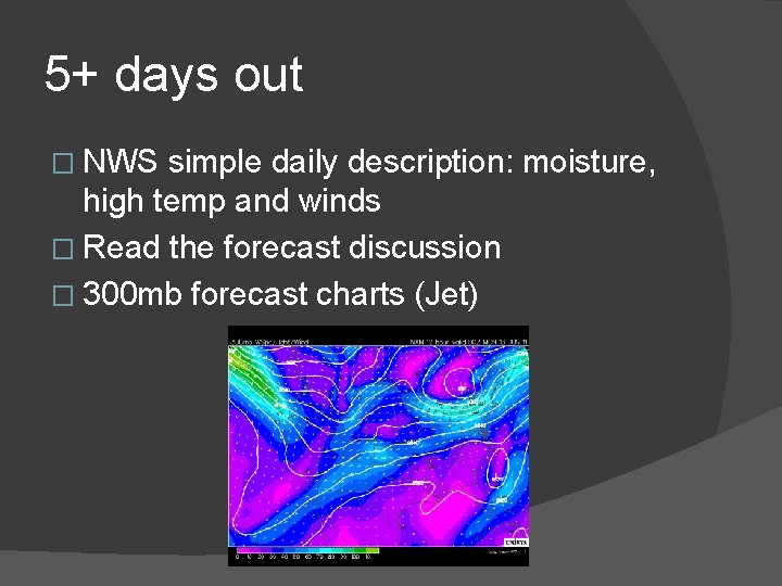
5+ days out � NWS simple daily description: moisture, high temp and winds � Read the forecast discussion � 300 mb forecast charts (Jet)
2 -3 days out � NWS simple daily description: moisture, high temp and winds � Read the forecast discussion � 300 mb forecast charts (Jet) � NWS Hourly weather graphs � BLIPMAPS – NAM forecast model
Day of flight � NWS simple daily description: moisture, high temp and winds � Read the forecast discussion � Check hourly weather graphs as needed � Study BLIPMAPS � NWS Hourly weather graphs � Study the Java-based forecast sounding � Check visible satellite and water vapor images
The goal � Pilots want to walk away from a briefing with ACCURATE: �Thermal heights and type of clouds, if any �Winds at surface and aloft �Expected average climb rates �Sense of how the day will develop – good or bad
Special conditions � Convergence � Wave
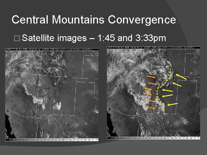
Central Mountains Convergence � Satellite images – 1: 45 and 3: 33 pm
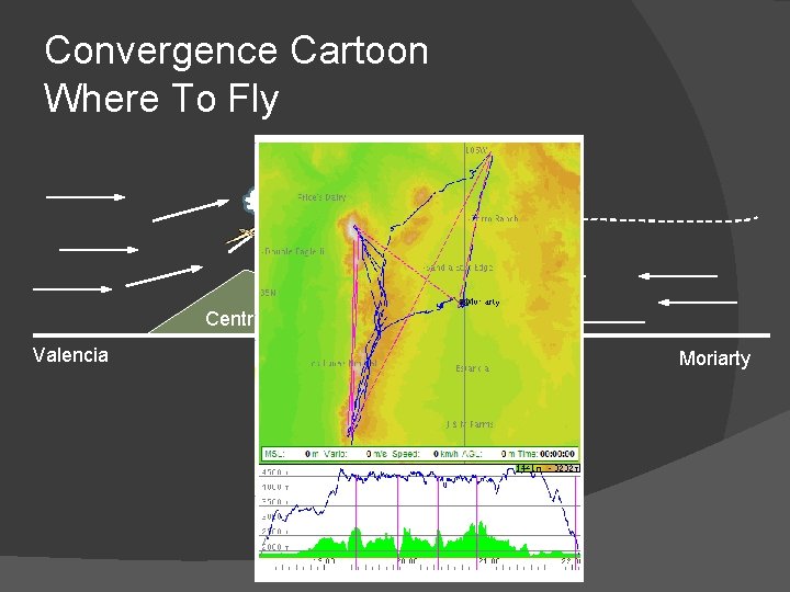
Convergence Cartoon Where To Fly Central Mountains Valencia Chilili Moriarty
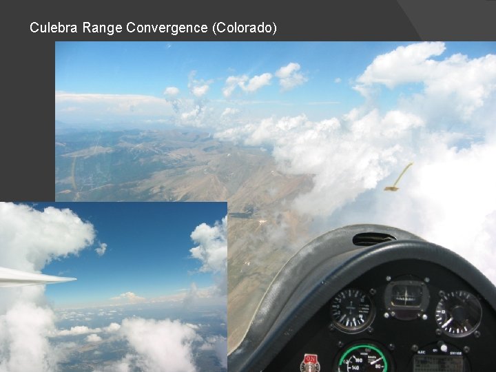
Culebra Range Convergence (Colorado)
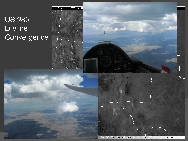
US 285 Dryline Convergence
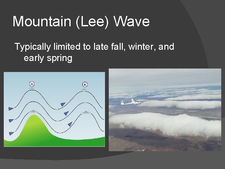
Mountain (Lee) Wave Typically limited to late fall, winter, and early spring
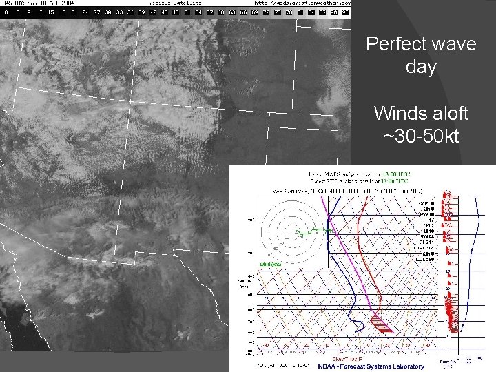
Perfect wave day Winds aloft ~30 -50 kt
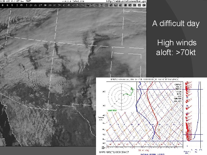
A difficult day High winds aloft: >70 kt
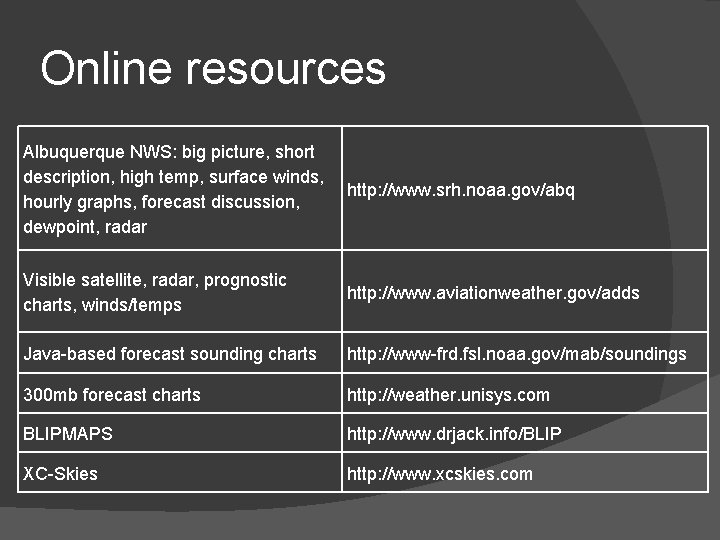
Online resources Albuquerque NWS: big picture, short description, high temp, surface winds, hourly graphs, forecast discussion, dewpoint, radar http: //www. srh. noaa. gov/abq Visible satellite, radar, prognostic charts, winds/temps http: //www. aviationweather. gov/adds Java-based forecast sounding charts http: //www-frd. fsl. noaa. gov/mab/soundings 300 mb forecast charts http: //weather. unisys. com BLIPMAPS http: //www. drjack. info/BLIP XC-Skies http: //www. xcskies. com
Thanks for listening! More info: brian. resor@gmail. com

Backup slides
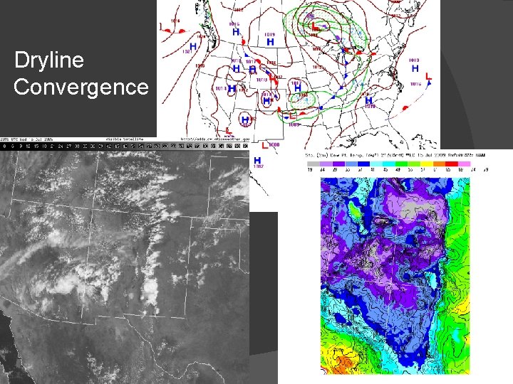
Dryline Convergence
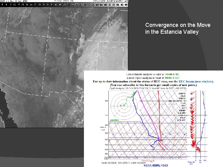
Convergence on the Move in the Estancia Valley
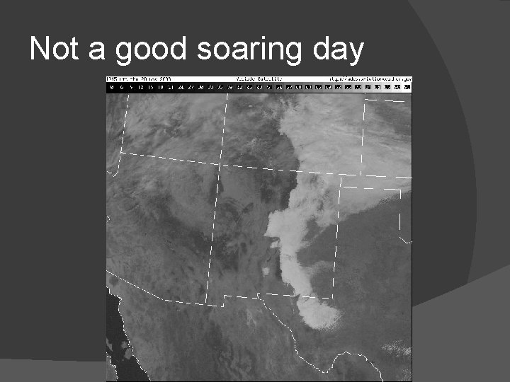
Not a good soaring day
- Slides: 31