Blencathra Field Studies Course 2017 Where are we

Blencathra Field Studies Course 2017

Where are we staying? Field studies council centre Blencathra, Lake District

Blencathra Centre The Blencathra Centre occupies a dramatic setting at 300 m on a south facing slope of Blencathra in the Lake District National Park and offers an unparalleled panorama across the Keswick, Helvellyn and Skiddaw areas. We are easily accessible by train to Penrith, where the M 6 and adjoining A 66 also offer quick road links to the centre. Fieldwork opportunities at Blencathra take place in and amongst the rugged fells, magnificent glaciated valleys, and nestling towns and villages creating this view. The Centre generates its own hydro-electric power and has a Biomass District Heating system. Purposely converted from a former Sanatorium, these unique buildings are equipped with interactive whiteboards, visualisers, access to laptops and tablets, and Wi. Fi throughout the centre, offering excellent facilities for schools and universities at all levels.

Blencathra Centre

Facilities • • • Games room – pool table, table tennis TV room Drying room Library Walking boot hire Computer suite Fieldwork labs Classrooms with digital projectors Two hectares of wooded grounds Facilities for hot and cold drinks (bring snacks)

Fieldwork Requirements • All students are required to undertake fieldwork in relation to processes in both physical and human geography. Students must undertake four days of fieldwork during their A-level course. • Fieldwork can be completed in a number of ways: locally or further afield, on full days or on part days. Schools and colleges will be required to confirm that all A-level geography students have been given an opportunity to fulfil this requirement. • Schools and colleges are required to provide a fieldwork statement that confirms each student has undertaken four days of geographical fieldwork in relation to processes in both physical and human geography. Schools and colleges must provide the fieldwork statement by 15 May in the year of entry. Any failure to provide this statement in a timely manner will be treated as malpractice or maladministration (under Ofqual's General Condition A 8 (Malpractice and maladministration)).

Fieldwork Requirements Independence is compulsory in the following stages of the investigation: • defining and developing a question or issue to address aims, questions and/or hypotheses relating to any aspect of the specification • drawing on research, including field data and if relevant, secondary data which must be sourced by the student • contextualising, analysing and summarising findings and data • presenting data and drawing conclusions. Collaboration is allowed in the following stages of the investigation: • exploring the focus of potential investigations • collecting field data and/or evidence from field investigations.

Geographical Skills Students should develop the following with respect to qualitative data: • use and understanding of a mixture of methodological approaches, including interviews • interpretation and evaluation of a range of source material including textual and visual sources • understanding of the opportunities and limitations of qualitative techniques such as coding and sampling, and appreciation of how they actively create particular geographical representations • understanding of the ethical and socio-political implications of collecting, studying and representing geographical data about human communities. Students should develop the following with respect to quantitative data: • understanding of what makes data geographical and the geospatial technologies (eg GIS) that are used to collect, analyse and present geographical data • an ability to collect and use digital and geo-located data, and understand a range of approaches to use and analyse such data • understanding of the purposes and difference between the following and to use them in appropriate contexts: • descriptive statistics of central tendency and dispersion • descriptive measures of difference and association, inferential statistics and the foundations of relational statistics • measurement, measurement errors, and sampling • understanding of the ethical and socio-political implications of collecting, studying and representing geographical data about human communities.

Glacial Fieldwork Monday and Tuesday Day Session Follow up Aim: To interpret the origin and formation of glacial depositional landforms through analysis of sediments in a post-glacial landscape. Students will visit sites in the Northern Lake District where sediments can be examined. Through collecting data on the size, shape, geology and orientation of sediments, students will learn and practise skills to enable them to identify the provenance of changing glacial and fluvio-glacial sediments. The fieldwork will take in Borrowdale in the heart of the Lake District. The evening session will be the introduction the following day’s corrie investigation. Tuesday 4 th April Glacial Landforms Aim: To investigate glacial landforms and analyse the characteristics of corries in the Lake District. Through fieldwork in a glaciated landscape, students will gain a sense of the scale of glacial land systems, as well as beginning to understand the formation of these features, and identifying some of the causes of differences in landform morphology and orientation. Students will visit different corries, collecting data on their orientation, altitude, width, length and back wall height. The fieldwork will take place in Easedale in the central Lake District. The day will involve walking from Grasmere through the valley up to the spectacular Easedale Tarn. Corrie data collected in the field can be added to data relating to all 157 corries of the Lake District. Students can analyse the data using statistical methods to look for patterns and relationships

Urban Fieldwork Wednesday Day Session Follow up Option one Aim: To investigate the characteristics of two contrasting urban areas within Carlisle. Students will visit the contrasting wards of inner city St Aidan’s, and Stanwix, a suburbanised village, most of which was built between 1934 and 1951. They will examine the physical environmental conditions of the two areas, collecting data on housing age, upkeep and environmental quality. Patterns of economic and social wellbeing will be assessed by examining access to services and employment. Option two Aim: To investigate changing urban characteristics from the city centre to the suburbs of Carlisle Students will start in the suburb of Upperby and follow a transect into the city centre. Along the way they will investigate changes in services, housing, environmental quality and quality of life. Once in the city centre students will investigate the structure of the city centre through land use mapping and clone town surveys. There is also the opportunity of look at urban microclimates along the transect and within the city centre. Historical maps and imagery will allow students to contextualise their study in the light of patterns of urbanisation since 1945. Students will explore their data using GIS, providing a tool for them to view and interrogate their data spatially and graphically. They will consider the implications of urbanisation, with particular reference to environmental sustainability.

Water cycle Fieldwork Thursday Day Session Follow up The Water Cycle and local river catchment case study Aim: To investigate the Water Cycle inputs, flows and stores within the River Derwent catchment. The River Derwent and its tributaries drain most of the northern Lake District. The investigation will take place at Low Bridge End Farm. The farm is located along St John’s Beck in the upper reaches of the River Derwent catchment. This provides a wide range of land uses in a small location. Various methods will be used to quantify water flow at a local scale. Students will investigate run off, infiltration, interception and river discharge through a range of experiments. Long term interception plots will give students data on the influence of different types of woodland on interception rates. Infiltration and run off rates will be measured in different areas to compare the effect of different land uses within the river catchment. Appropriate graphical techniques will be used to present infiltration and run off data Catchment data from the National Rivers Flow Archive will be combined with students’ data to look at the impact of human management forestry and farming within the catchment. Statistical analysis will be used to analyse the difference in interception between different woodlands.

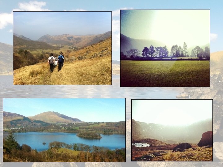
Contrasting weather on the field course. All photographs were taken in March This is why it pays not to take chances with clothing. Too much is better than too little. Bring it, hire or borrow it!

Carbon cycle Fieldwork Thursday Day Session Follow up Aim: To investigate the Carbon Cycle in the River Derwent catchment. Students will collect data to calculate the amount of carbon stored with in the Derwent catchment. This is will involve looking at secondary data of land uses within the catchment and primary data collection measuring the amount of carbon stored in the catchment by soil and trees. The investigation will take place around the Blencathra Centre grounds which is located in the upper reaches of the River Derwent catchment. This provides a wide range of land uses in a small location such as woodland, open fell and fields. . Students will analyse their data and calculate the amount of carbon stored across the catchment to answer the hypotheses set in the morning. Students will also work out which environment is the greatest store of carbon for a given area and consider how it should be managed in the future

Daily schedule 8. 00 Breakfast 7. 45 -9. 30 Make packed lunches 9. 30 Teaching followed by fieldwork 3. 30 -5. 00 Follow up work 6. 00 Evening meal 7. 00 -8. 30 (approx) Follow-up work 10. 30 In rooms 11. 00 Lights out/quiet Please can students be at the bus turning circle for 8. 15 so we can leave promptly on the Monday. We aim to return 4. 30/5 pm.

Important information • The order of days and location of study sites may be varied due to the weather, and to avoid equipment/transport clashes. • Students are requested to bring a pen, pencil and paper. They may also find a camera, memory stick, calculator, protractor, folder in which to keep their work, colouring pencils and graph paper useful. • Students will undertake activities outdoors for extended periods of time and should therefore be dressed appropriately for the weather conditions. They will need a rucksack, walking boots with ankle support, wellies, a waterproof jacket with hood and waterproof trousers. If students don’t own these items, they can hire these from the centre upon arrival.

Suggested equipment • • • Layers of clothing to suit variable weather Trousers which dry easily (not jeans) Waterproof jackets and trousers Walking boots (not shoes, trainers or Uggs!) Wellies Torch/iphone torch Camera/phone Relevant textbooks and stationery A football or games for the evening, table tennis balls, money for pool etc.

Health and safety The most important thing for students to remember is that we will be in a fairly remote area so any trip to hospital is a major concern. It needs to be avoided. Think first!

Rules/sharing with other schools • Drugs and alcohol are not permitted in the centre • Climbing is not allowed on any of the rock faces on the estate • Smoking is not allowed onsite • Respect other centre visitors and staff • Follow the country code • No aerosols Students will be sent home by the centre if they break these rules.

Notes from past students: • Make sure you get work for other subjects beforehand as it’s a big job to catch up. • Bring table tennis balls and money for pool table. • Bring crisp/chocolate for pack up and money for food in Carlisle. • Bring a lunch box/drinks bottle. • Don’t bring a handbag or expensive clothes as chances are they will be ruined! • Enjoy it because it’s a really good opportunity. • Make sure you take your notes home with you….

Thank you!
- Slides: 21