Bighorn River Side channel Investigations downstream of Yellowtail

Bighorn River Side channel Investigations downstream of Yellowtail Dam and Afterbay
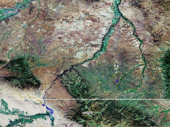

Bighorn River downstream of Yellowtail Dam and Afterbay • Characteristics: • Single thread to braided channel morphology; numerous side channel complexes • Alluvial valley bounded by high bluffs and older stream terraces • Study focus: • Side channel formation and loss

Why are side channels important? • Side channel: – secondary channel connected to the main channel on upstream and downstream ends – narrower in width and shallower in depth with slower velocities than the main channel • Provides: – Critical habitat for spawning and rearing – Typically more stable flows and temperature regimes compared to main channel – Habitat for a variety of wildlife • Amphibians, birds, reptiles, mammals, mollusks
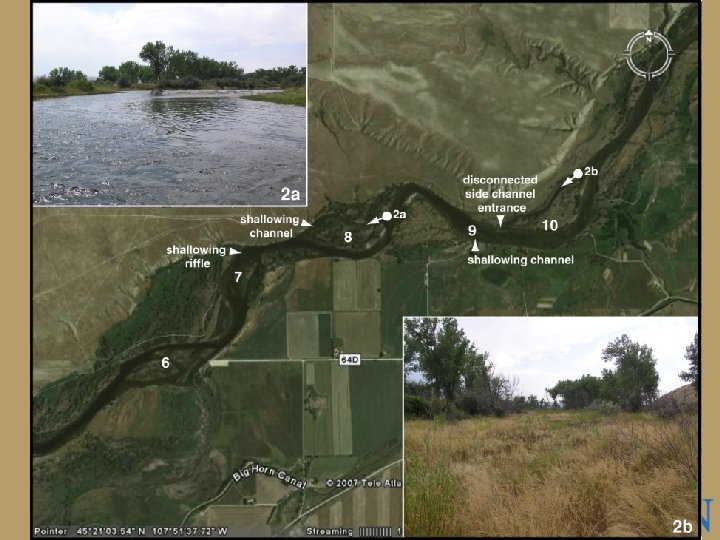
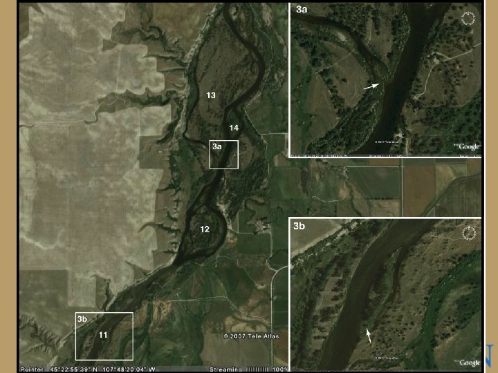

Statement of problem • Progressive side channel abandonment • Loss of habitat in side channels – Changes from 1939 to 1974 (from Koch et al 1977): • • Vegetated Islands 23. 1% Loss (1, 469 acres) Island Gravel Bars 77. 2% Loss (1, 401 acres) Lateral Gravel Bars 34. 0% Loss (131 acres) Water Area 7. 8% Loss (374 acres), corresponding increase in riparian areas – Side channel loss appears to be continuing today (based on field observations) – Side channel loss attributed to the construction of Yellowtail Dam ©Bighorn Trout Shop
")
Bighorn River near St. Xavier, MT (#06287000)
 Boysen Dam (1952) Buffalo Bill Dam (1910)")
Yellowtail Dam (1966) Boysen Dam (1952) Buffalo Bill Dam (1910)

Study objectives • Investigate loss of side channels downstream of Yellowtail Dam and Afterbay by documenting history of channel changes • Provide solutions for the restoration of critical side channel complexes ©Bighorn Trout Shop

Study Components • • Geomorphic Analysis Hydraulic Modeling Analysis Sediment Transport Analysis Evaluation of Alternatives

Geomorphic Analysis • Geomorphology: Geo=earth; morph=form – the study of the classification, description, nature, origin, processes, and development of present landforms… and the history of geologic changes recorded by these surface features (from Nuendorf et al. 2005). – Fluvial Geomorphology: the study of the physical form of rivers and the processes that create and shape river features. Songha River, China
 Geomorphic study • Geomorphic map of current and")
From Mc. Dowell & Hughes (2003) Geomorphic study • Geomorphic map of current and historical channel features – Main channel extent – active and abandoned side channels – gravel bars – vegetated islands – floodplain – stream terraces and geologic units • Controls on channel form – Geologic constraints – Human constructs

• Historical trends in channel morphology – Vertical trends • Cross sectional area, bed elevation changes – Lateral trends • Channel position, width, islands, gravel bars, side channel extents • Identification of critical side channel complexes for alternatives evaluation – Input from results of geomorphic analysis and stakeholders

Hydraulic Modeling • Will provide information on flows that will activate side channels • Inputs: – River geometry • Bathymetric survey • Topographic survey – Channel roughness • Index of surface roughness; resistance of surface to water flow – Discharge • Range of flow values required to wet and inundate side channels to specified depths and velocities

2 -Dimensional Modeling Example of Mesh generation • Benefits: – Able to model split channel flow and complex flow dynamics – Can specify varying roughness values for different areas of model – Allows user to examine conditions at any point on the river rather than just at measured cross sections

Evaluation of Alternatives • Input for Alternative Evaluation – Geomorphic Analysis • I. D. of critical side channel complexes – Hydraulic Modeling • Discharges required to inundate side channels to desired depths and velocities – Sediment Transport Modeling • IF needed, will provide information on sediment transport, predicted erosion or sediment deposition in specified reaches – Stakeholder meetings • Discussions to establish preferred alternatives • Conceptual evaluation of preferred alternatives – Possibilities include no action, flow prescriptions, gravel augmentation, in-stream structures. …… ©Bighorn Trout Shop

Anticipated Study Deliverables • Comprehensive history of side channel formation and loss • Associated channel changes before and after the construction of Yellowtail Dam and Afterbay • Identification of critical side channels for restoration • Quantitative information on the magnitude of flows needed to inundate side channels at depths and velocities suitable for salmonid habitat • Alternatives for critical side channel restoration • Feasibility of alternatives
- Slides: 18