Beyond Quik SCAT TPCNHC Requirements for Satellite Retrievals

Beyond Quik. SCAT TPC/NHC Requirements for Satellite Retrievals of Ocean Surface Vector Winds Richard Knabb 6 June 2006

Needs vs Wants

Key Forecast Parameters n Tropical Cyclone Intensity: Maximum sustained surface wind (1 minute average, 10 m altitude, unobstructed exposure), associated with the circulation of the tropical cyclone at a given point in time. n Tropical Cyclone Wind Radius: Largest distance from the center of the tropical cyclone of a particular sustained surface wind speed threshold (e. g. , 34, 50, 64 kt) somewhere in a particular quadrant (NE, SW, NW) surrounding the center and associated with the circulation at a given point in time.
 Event Activities/Comments 1200 Forecast cycle begins Review late models,")
Advisory Forecast Cycle Time (UTC) Event Activities/Comments 1200 Forecast cycle begins Review late models, synoptic obs, microwave data, scatterometer, etc. ; begin determining wind radii 1230 Receive fix information Analyze recon or satellite fix data, update the best track, determine compute parameters (initial position, motion, intensity, size) 1245 Submit computes Review model fields [submit invest computes, 2 nd storm? ] 1250 Retrieve guidance Examine guidance, re-evaluate initial radii, make track, intensity, radii forecasts, fill out worksheet 1340 Prepare for conference call Watches/warnings, begin writing forecast discussion, [make aircraft tasking requests for following day] 1400 -1410 Conference call Coordinate forecast, watches/warnings. 1410 -1430 Prepare products [New fix], Write Public Advisory, Discussion 1430 -1500 edit/xmit products Also update web graphics
 Event Activities/Comments 1500 Clean up workspace Enter fixes, file")
Advisory Forecast Cycle Time (UTC) Event Activities/Comments 1500 Clean up workspace Enter fixes, file paperwork 1510 -1530 Prepare ATL TWO Examine models (0 -36 h), imagery, scatterometer, microwave 1530 -1600 Prepare for Long. Range Coordination call Examine models (120 -168 h) 1600 LRCC-HPC Look out for tours! 1630 -1650 Prepare EPAC TWO Examine models, imagery, microwave, scatterometer 1715 -1745 Prepare intermediate advisory? 1745 -1800 Examine 12 Z model fields 1800 Begin next forecast cycle
")
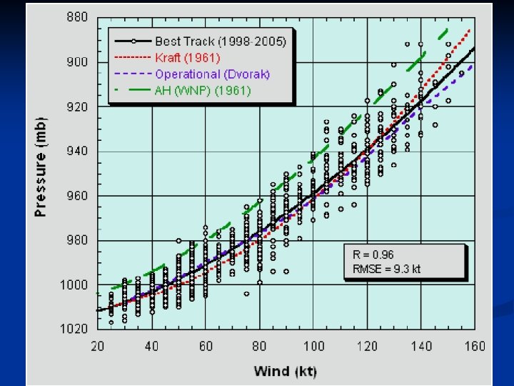
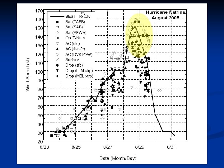
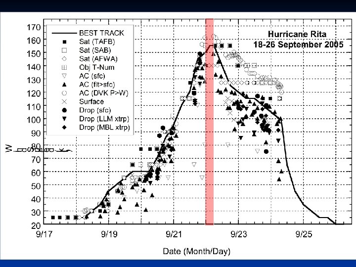
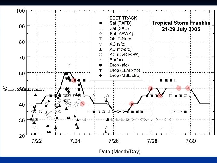
HOW DO WE ESTIMATE INTENSITY? • Satellites – Geostationary IR and VIS (Dvorak technique) – AMSU – Quik. SCAT • Surface observations – ships, buoys, land stations (limited) • WSR-88 D (near land) • Aircraft reconnaissance – flight-level winds – GPS dropsondes – Stepped Frequency Microwave Radiometer (SFMR) – Airborne doppler radar

90 kt 95 kt 105 kt 90 kt RECON FLIGHT-LEVEL WINDS HURRICANE GEORGES 9/20/98 20 -23 Z

Quik. SCAT Limitations 1. Rain contamination a. Rain-induced bias in retrieved wind speeds that varies with rain rate and actual wind speeds b. Lack of collocated rain rate data 2. Inability to measure max winds in most hurricanes a. Rain attenuation, signal saturation, resolution 3. Directional ambiguities a. TC center fixing and identification 4. Availability and timeliness

Requirements 1. Greatly reduced or even non-existent sensitivity to rain n Provide accurate wind speed and direction retrievals regardless of rain rate (no rain, light rain, or heavy rain)

Requirements 2. Capability to measure entire range of sustained surface wind speeds in TCs n n n 0 to 165 kt, accurate to within 1 -2 kt Finer horizontal resolution (1 -4 km), and increased sensitivity at extreme wind speeds Fill in some gaps left by aircraft recon n Does not fly into every major hurricane (e. g. , east Atlantic, east Pacific) Provides data only along a line during each flight leg Recon gaps even in “well-sampled” storms

Requirements 3. Elimination of the directional ambiguity problem n n Need much more accurate position fixing for TCs Determining if closed circulation exists (key factor in determining if cyclogenesis has occurred)

Requirements 4. More timely data n Reduce time between satellite overpass and receipt of data to a few minutes

Requirements 5. More continuous monitoring of systems n n Especially needed in the Tropics where gaps in POES data are largest Increase frequency of retrievals over each system of interest n At least 3 -hourly to ensure data is timely for next advisory
- Slides: 17