
Avian Hazard Advisory System AHAS 1 Avian Hazard


- Slides: 22
Avian Hazard Advisory System (AHAS) 1
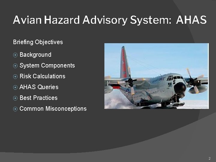
Avian Hazard Advisory System: AHAS Briefing Objectives ⦿ Background ⦿ System Components ⦿ Risk Calculations ⦿ AHAS Queries ⦿ Best Practices ⦿ Common Misconceptions 2
AHAS ⦿ BACKGROUND ⦿ 1985 – 2005 25% of all reported bird strikes (USAF) were on LL Routes/Ranges ⦿ 1987 loss of B-1 b (Dyess) renewed concerns on bird avoidance ⦿ Bird Avoidance Models (BAM) ⦿ GIS technology (1990’s) ⦿ Nationwide system of radars that could “detect” biological targets in atmosphere ⦿ Affordable computer systems ⦿ INTERNET distribution capability ⦿ 1998 - AHAS pilot program 3
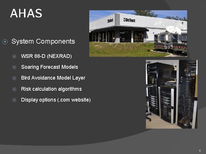
AHAS ⦿ System Components ⦿ WSR 88 -D (NEXRAD) ⦿ Soaring Forecast Models ⦿ Bird Avoidance Model Layer ⦿ Risk calculation algorithms ⦿ Display options (. com website) 4
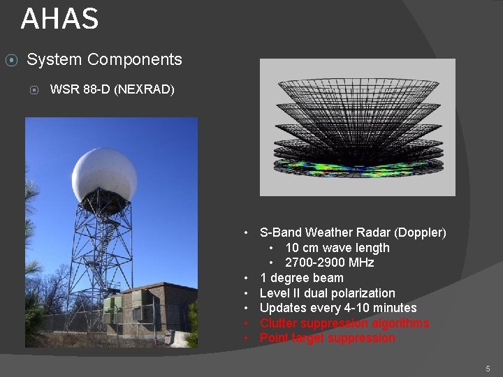
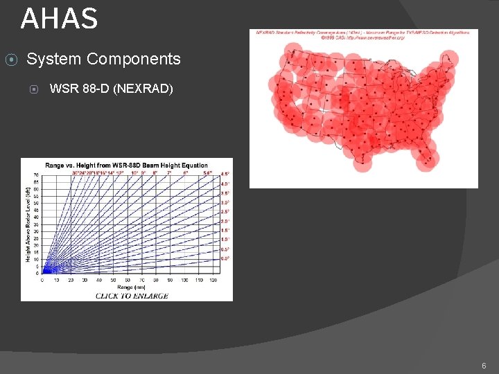
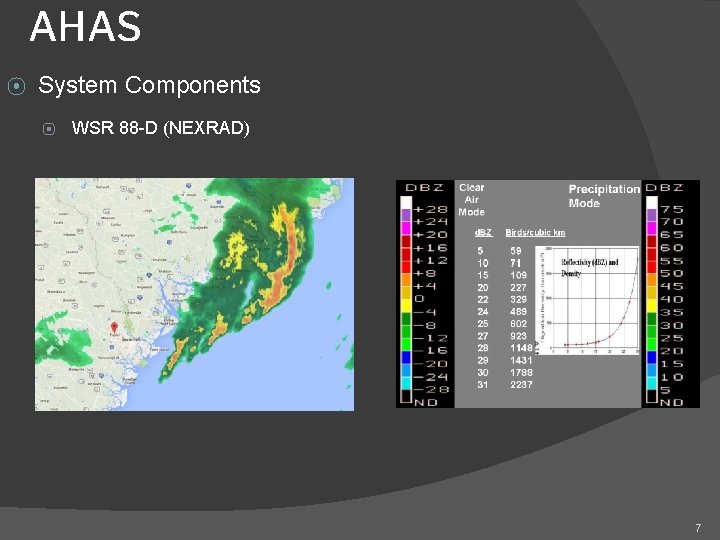
AHAS ⦿ System Components ⦿ WSR 88 -D (NEXRAD) • S-Band Weather Radar (Doppler) • 10 cm wave length • 2700 -2900 MHz • 1 degree beam • Level II dual polarization • Updates every 4 -10 minutes • Clutter suppression algorithms • Point target suppression 5
AHAS ⦿ System Components ⦿ WSR 88 -D (NEXRAD) 6
AHAS ⦿ System Components ⦿ WSR 88 -D (NEXRAD) 7
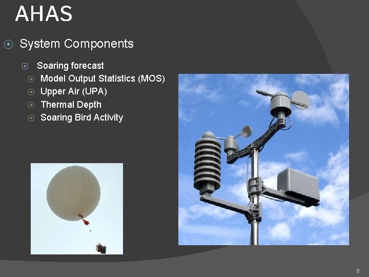
AHAS ⦿ System Components Soaring forecast ⦿ Model Output Statistics (MOS) ⦿ Upper Air (UPA) ⦿ Thermal Depth ⦿ Soaring Bird Activity ⦿ 8
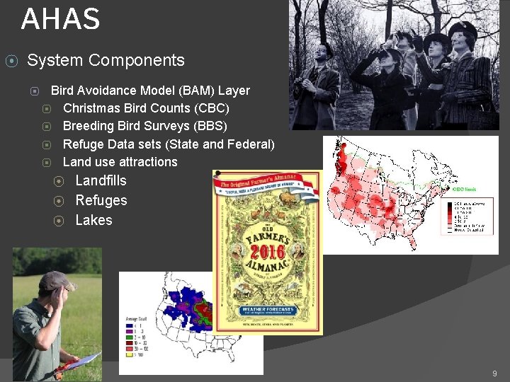
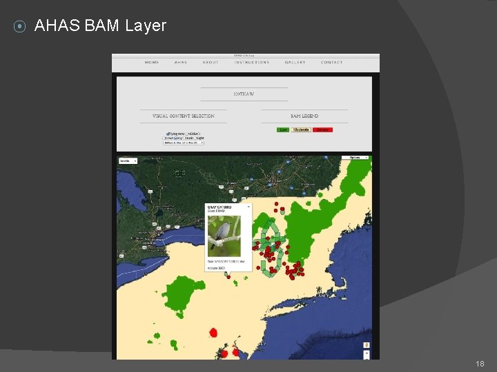
AHAS ⦿ System Components ⦿ Bird Avoidance Model (BAM) Layer ⦿ Christmas Bird Counts (CBC) ⦿ Breeding Bird Surveys (BBS) ⦿ Refuge Data sets (State and Federal) ⦿ Land use attractions ⦿ ⦿ ⦿ Landfills Refuges Lakes 9
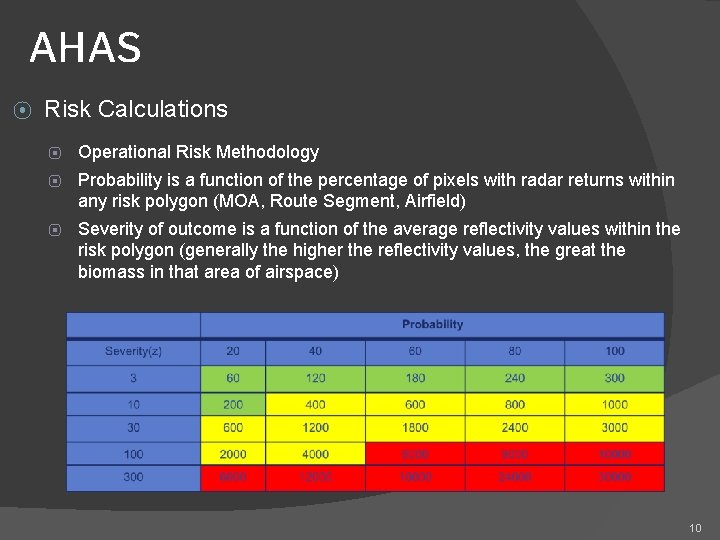
AHAS ⦿ Risk Calculations ⦿ Operational Risk Methodology ⦿ Probability is a function of the percentage of pixels with radar returns within any risk polygon (MOA, Route Segment, Airfield) ⦿ Severity of outcome is a function of the average reflectivity values within the risk polygon (generally the higher the reflectivity values, the great the biomass in that area of airspace) 10
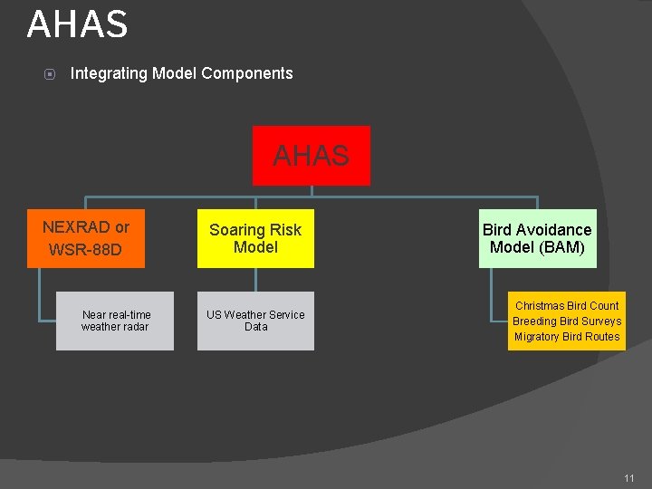
AHAS ⦿ Integrating Model Components AHAS NEXRAD or WSR-88 D Near real-time weather radar Soaring Risk Model US Weather Service Data Bird Avoidance Model (BAM) Christmas Bird Count Breeding Bird Surveys Migratory Bird Routes 11
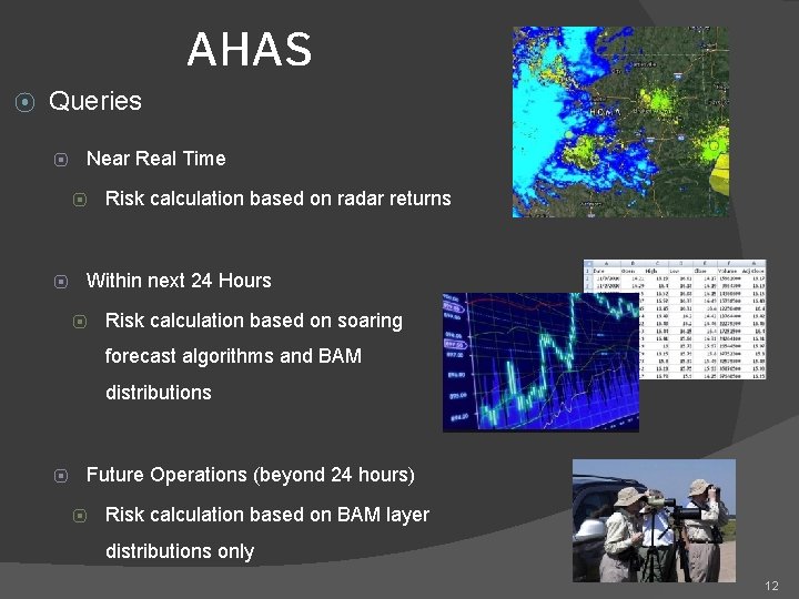
AHAS ⦿ Queries ⦿ Near Real Time ⦿ ⦿ Risk calculation based on radar returns Within next 24 Hours ⦿ Risk calculation based on soaring forecast algorithms and BAM distributions ⦿ Future Operations (beyond 24 hours) ⦿ Risk calculation based on BAM layer distributions only 12
AHAS ⦿ Common Misconceptions ⦿ Looking “back” at previous time intervals beyond last month does NOT bring up radar-based advisories……only the BAM information ⦿ AHAS advisory conditions for past dates are available upon request from AHAS contractor (mishap investigations) ⦿ Using AHAS for BWC should only be one tool in the box, and is not recommended to be used solely to determine BWC (beam height, update rate, and point target suppression) ⦿ NEXRAD data are NOT used forecast algorithms 13
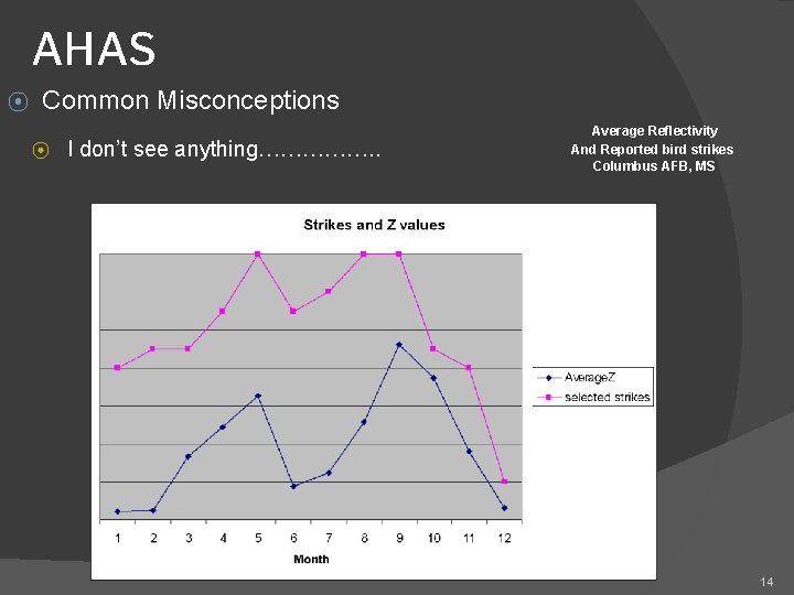
AHAS ⦿ Common Misconceptions ⦿ I don’t see anything……………. . Average Reflectivity And Reported bird strikes Columbus AFB, MS 14
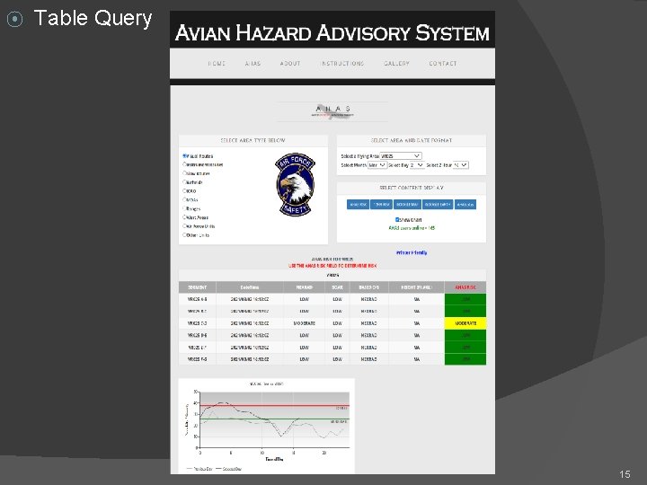
⦿ Table Query 15
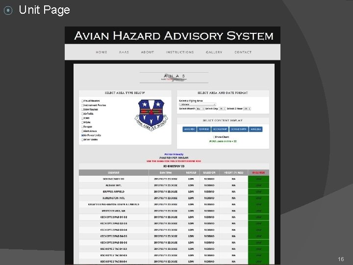
⦿ Unit Page 16
⦿ Google Maps/Earth 17
⦿ AHAS BAM Layer 18
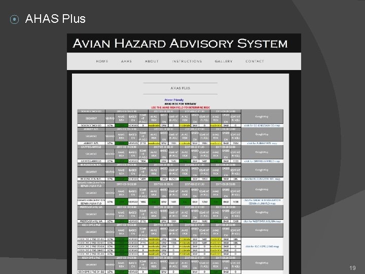
⦿ AHAS Plus 19
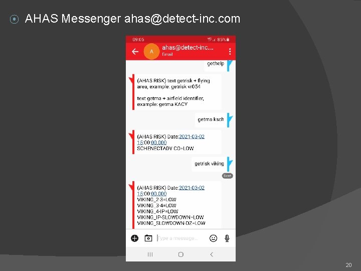
⦿ AHAS Messenger ahas@detect-inc. com 20
AHAS ⦿ Best Practices and other stuff you should know ⦿ Establish a unit page to consolidate airspace options ⦿ Check AHAS during mission planning ⦿ Check AHAS during “the step” (SOF briefing or at ops desk) ⦿ If available, check in with range operations for AHAS update enroute ⦿ If possible check route with AHAS messenger ⦿ AHAS may queue operations staff about bird activity in the vicinity of the airport as PART of establishing Bird Watch Condition Codes (BWC), but must not replace other airfield observations! ⦿ AHAS “system” operated under contract, monitors all “hits” on the system and keeps records of queries. 21
CONTACT INFORMATION ▣ USAF BASH Team � Mr. Dan Sullivan, Branch Chief daniel. sullivan. 26@us. af. mil, DSN 246 -5674 � ▣ Commercial prefix is (505) 846 -xxxx AHAS Personnel � Mr. Ron White ahas@detect-inc. com 850 -763 -7200 22