
Authoring Serving and Consuming CAP with Arc GIS

- Slides: 10
Authoring, Serving, and Consuming CAP with Arc. GIS Anak Agung Gde Agung ESRI
Spatially Aware CAP • In almost all cases, geography is one of the most essential information of an alert • For us, some of the important questions are: – How GIS can refine geographic definition in an alert? – How GIS can be closely tied with the workflow of generating CAP – How GIS can serve CAP that can be easily leveraged to be a more useful information for analysis
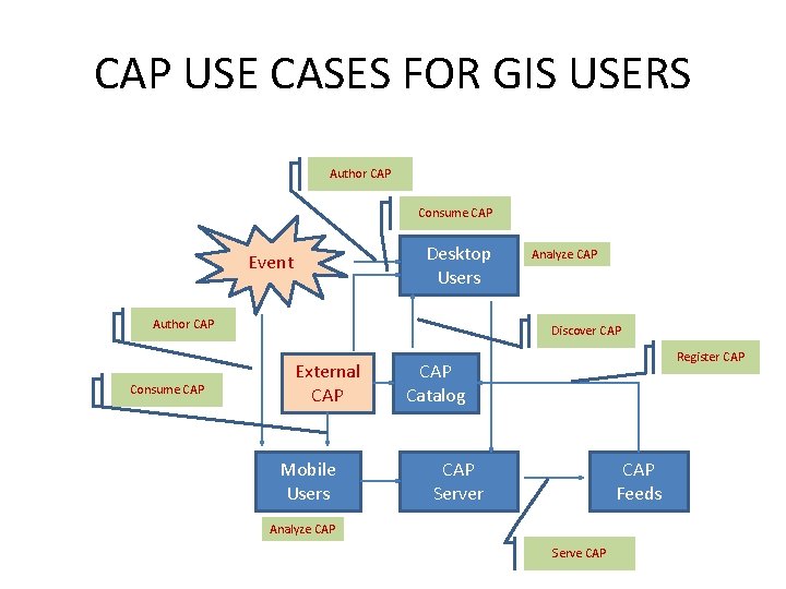
CAP USE CASES FOR GIS USERS Author CAP Consume CAP Desktop Users Event Author CAP Consume CAP Analyze CAP Discover CAP External CAP Mobile Users Register CAP Catalog CAP Server CAP Feeds Analyze CAP Serve CAP
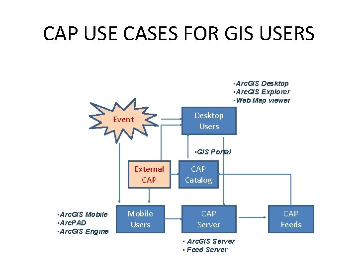
CAP USE CASES FOR GIS USERS • Arc. GIS Desktop • Arc. GIS Explorer • Web Map viewer Desktop Users Event • GIS Portal External CAP • Arc. GIS Mobile • Arc. PAD • Arc. GIS Engine Mobile Users CAP Catalog CAP Server • Arc. GIS Server • Feed Server CAP Feeds
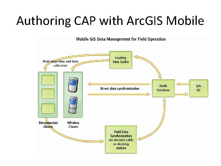
Authoring CAP with Arc. GIS Mobile
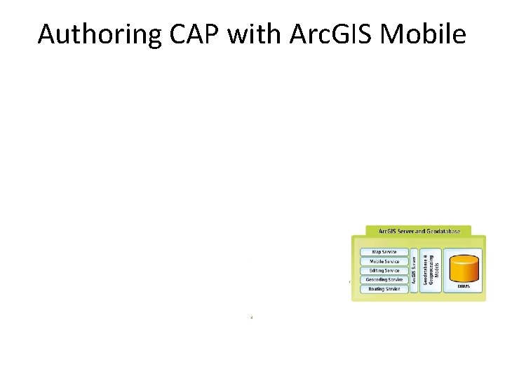
Authoring CAP with Arc. GIS Mobile
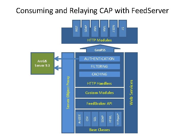
JS J SON KML XML SOAP REST Consuming and Relaying CAP with Feed. Server HTTP Modules Geo. RSS AUTHENTICATION Arc. GIS Server 9. 3 FILTERING Web Services Server Object Proxy CACHING HTTP Handlers Custom Modules Base Classes Y! Pipes* HTML SOAP SQL CSV Arc. SDE Feed. Broker API
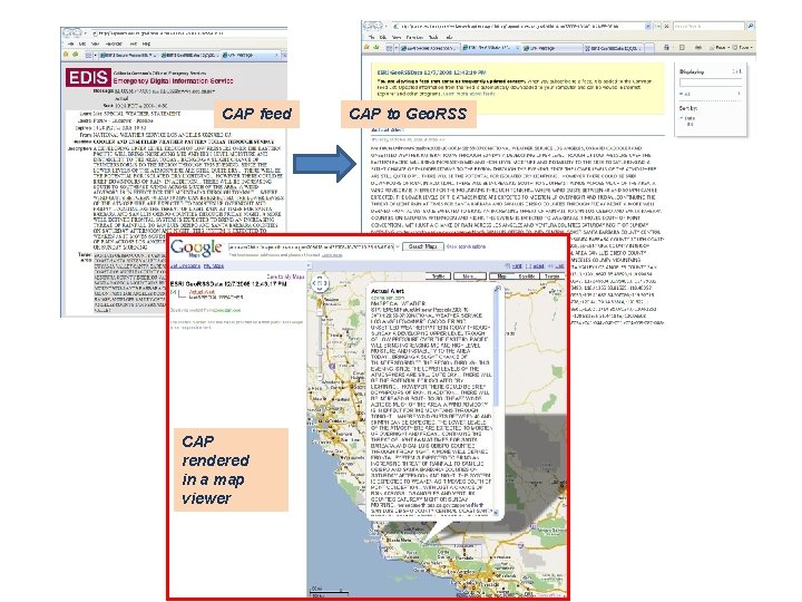
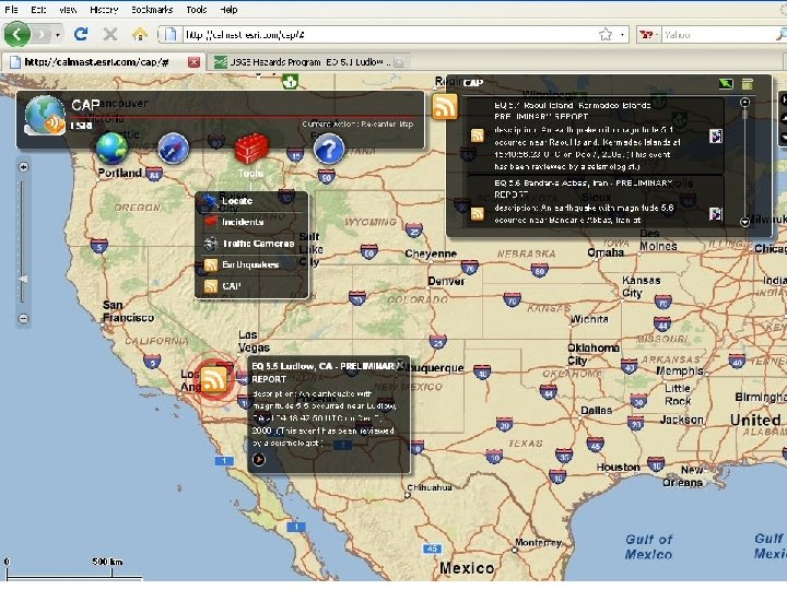
CAP feed CAP rendered in a map viewer CAP to Geo. RSS
Demonstration