
August 4 2015 Two Rare High End Severe

- Slides: 41
August 4, 2015: Two Rare High End Severe Weather Events Inside 12 Hours In Southern New England Hayden Frank and Joe Delli. Carpini NOAA/National Weather Service Taunton, MA
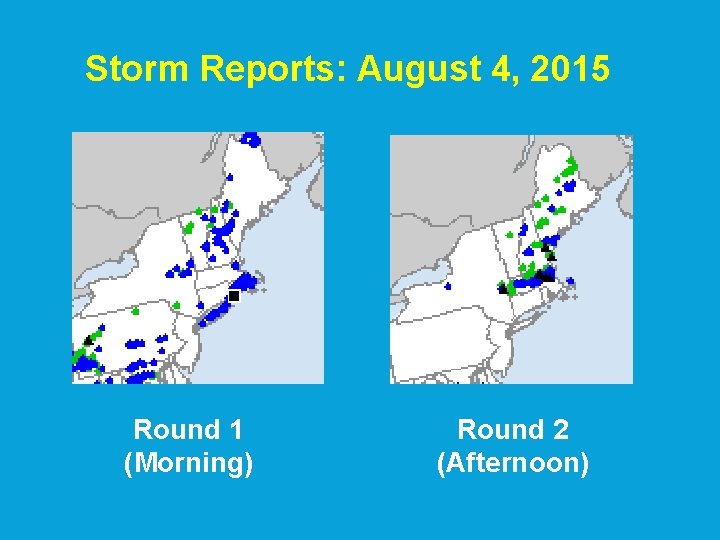
Storm Reports: August 4, 2015 Round 1 (Morning) Round 2 (Afternoon)
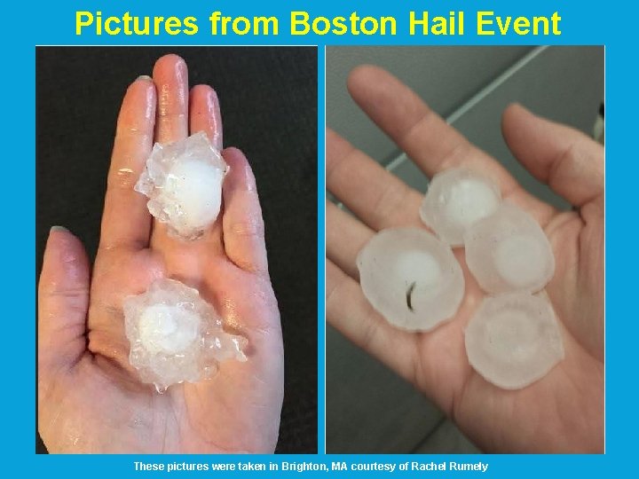
Overview First Event: Rhode Island Southeast MA 6: 00 -8: 30 am • • Widespread damaging wind gusts of 60 to 80 mph Rhode Island hardest hit, including Cranston and Providence • Roads/rail blocked by fallen trees making for a horrific rush hour • 25 percent of Rhode Island lost power (over 121, 000 people) • • More power outages in RI than Hurricane Sandy! 10 minor injuries at Burlingame Campground in Charlestown, RI Second Event: Massachusetts (along/north of Mass Pike) 12: 30 -4: 30 pm • • • Reports of golf ball to 2 inch diameter hail • 2 inch diameter hail in Boston (Suffolk County: largest recorded) Wind gusts of 50 -60 mph • Some tree damage and isolated power outages No injuries reported
Damage in Rhode Island
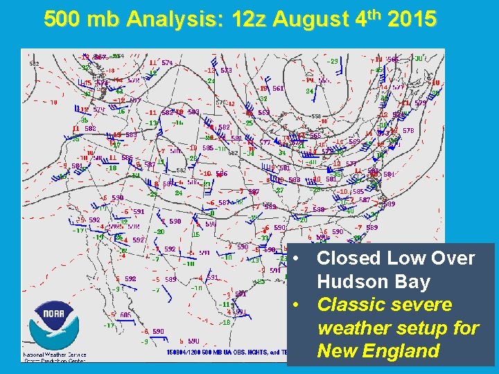
500 mb Analysis: 12 z August 4 th 2015 • Closed Low Over Hudson Bay • Classic severe weather setup for New England
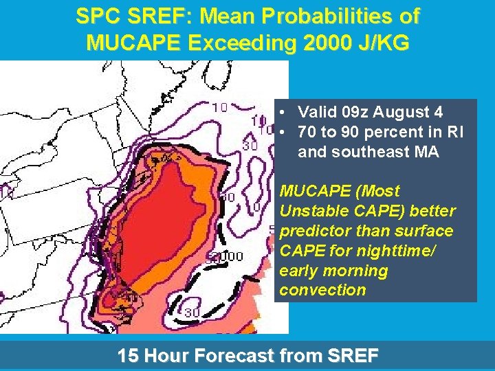
SPC SREF: Mean Probabilities of MUCAPE Exceeding 2000 J/KG • Valid 09 z August 4 • 70 to 90 percent in RI and southeast MA MUCAPE (Most Unstable CAPE) better predictor than surface CAPE for nighttime/ early morning convection 15 Hour Forecast from SREF
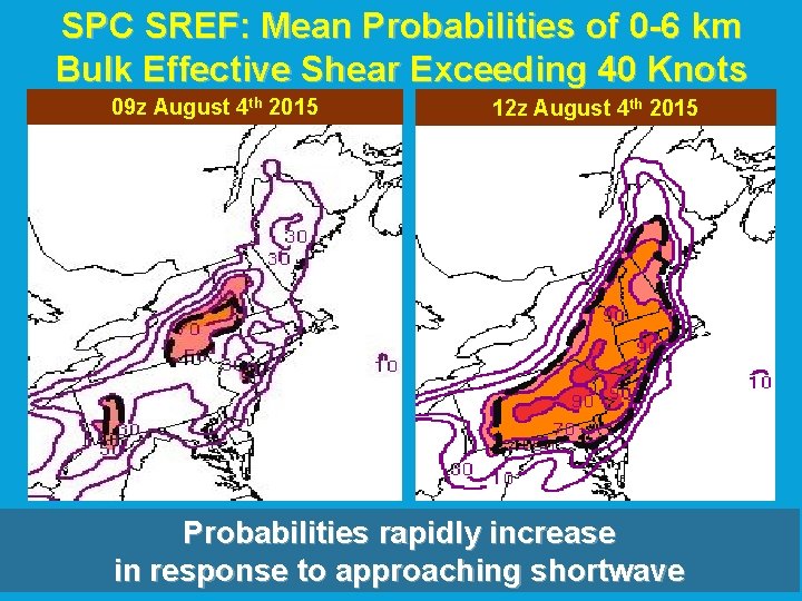
SPC SREF: Mean Probabilities of 0 -6 km Bulk Effective Shear Exceeding 40 Knots 09 z August 4 th 2015 12 z August 4 th 2015 Probabilities rapidly increase in response to approaching shortwave
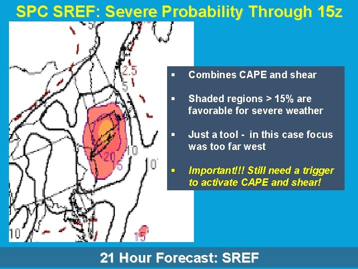
SPC SREF: Severe Probability Through 15 z § Combines CAPE and shear § Shaded regions > 15% are favorable for severe weather § Just a tool - in this case focus was too far west § Important!!! Still need a trigger to activate CAPE and shear! 21 Hour Forecast: SREF
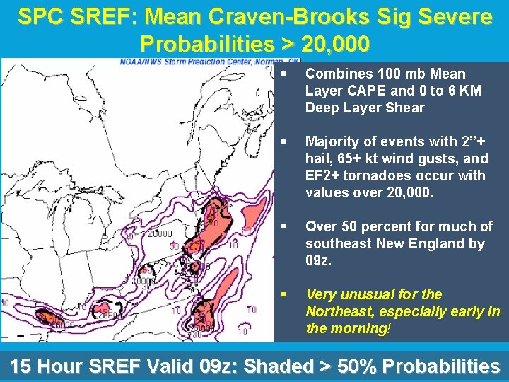
SPC SREF: Mean Craven-Brooks Sig Severe Probabilities > 20, 000 § Combines 100 mb Mean Layer CAPE and 0 to 6 KM Deep Layer Shear § Majority of events with 2”+ hail, 65+ kt wind gusts, and EF 2+ tornadoes occur with values over 20, 000. § Over 50 percent for much of southeast New England by 09 z. § Very unusual for the Northeast, especially early in the morning! 15 Hour SREF Valid 09 z: Shaded > 50% Probabilities
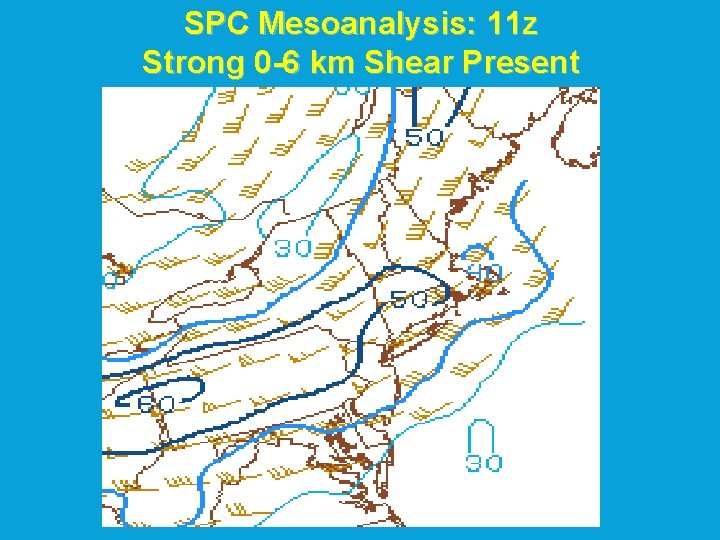
SPC Mesoanalysis: 11 z Strong 0 -6 km Shear Present
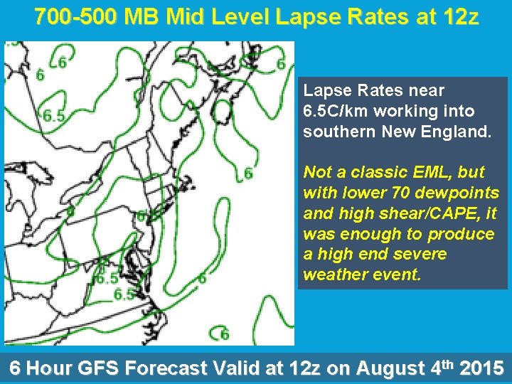
700 -500 MB Mid Level Lapse Rates at 12 z Lapse Rates near 6. 5 C/km working into southern New England. Not a classic EML, but with lower 70 dewpoints and high shear/CAPE, it was enough to produce a high end severe weather event. 6 Hour GFS Forecast Valid at 12 z on August 4 th 2015
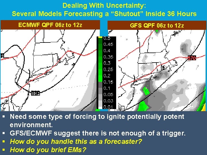
Forecast Uncertainty: Early Morning on August 4 th, 2015 • Anomalous instability co-located with deep shear/moisture across southern New England. • Potential for rare high end severe weather event across Southeast New England. • Still need a trigger, otherwise all the above parameters will not be utilized.
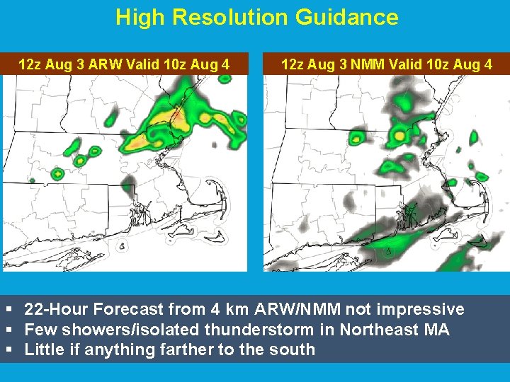
BOX Area Forecast Discussion (4 AM August 3 rd – Day Before) § TRAILING SHORT WAVE TROUGH APPROACHES SOUTHERN NEW ENGLAND FROM THE WEST. THIS IS QUITE EVIDENT IN WIND FIELDS ALOFT WHERE 500 MB SPEEDS APPROACH 50 KTS! THIS SHORT WAVE TROUGH COOLS H 5 TEMPS TO -11 C/-12 C. THIS COMBINED WITH SURFACE DEW PTS INCREASING INTO THE U 60 S AND L 70 S PROVIDES MUCAPES GREATER THAN 2000 J/KG AND MID LEVEL LAPSE RATES BETWEEN 6. 5 AND 7. 0 C/KM BY 12 Z TUE ACROSS RI AND EASTERN MA PER 00 Z EC AND 00 Z GFS. ONLY UNCERTAINTY IS WILL THERE BE ENOUGH FORCING FOR ASCENT TO UNLEASH THIS STRONG INSTABILITY. MIXED SIGNALS WITHIN THE GUIDANCE WITH THE GFS AND ECMWF NOT GENERATING MUCH QPF TONIGHT WHILE THE HI RES GUID NMM AND ARW HAVE CONVECTION BUT WEAKENING AS IT CROSSES THE AREA FROM WEST TO EAST.
Dealing With Uncertainty: Several Models Forecasting a “Shutout” Inside 36 Hours ECMWF QPF 06 z to 12 z GFS QPF 06 z to 12 z § Need some type of forcing to ignite potentially potent environment. § GFS/ECMWF suggest there is not enough of a trigger. § How do you handle this as a forecaster? § How do you brief EMs?
High Resolution Guidance 12 z Aug 3 ARW Valid 10 z Aug 4 12 z Aug 3 NMM Valid 10 z Aug 4 § 22 -Hour Forecast from 4 km ARW/NMM not impressive § Few showers/isolated thunderstorm in Northeast MA § Little if anything farther to the south
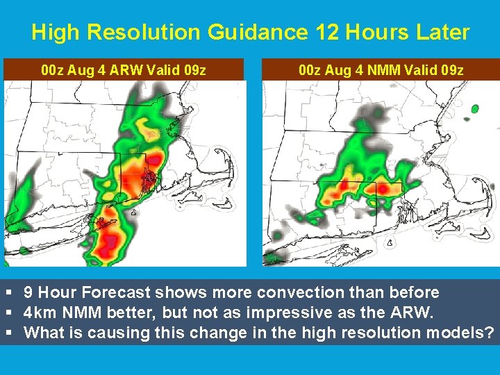
High Resolution Guidance 12 Hours Later 00 z Aug 4 ARW Valid 09 z 00 z Aug 4 NMM Valid 09 z § 9 Hour Forecast shows more convection than before § 4 km NMM better, but not as impressive as the ARW. § What is causing this change in the high resolution models?
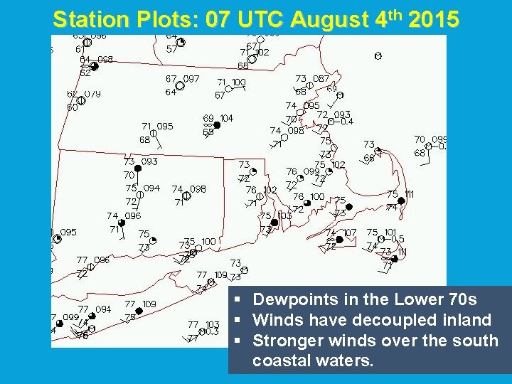
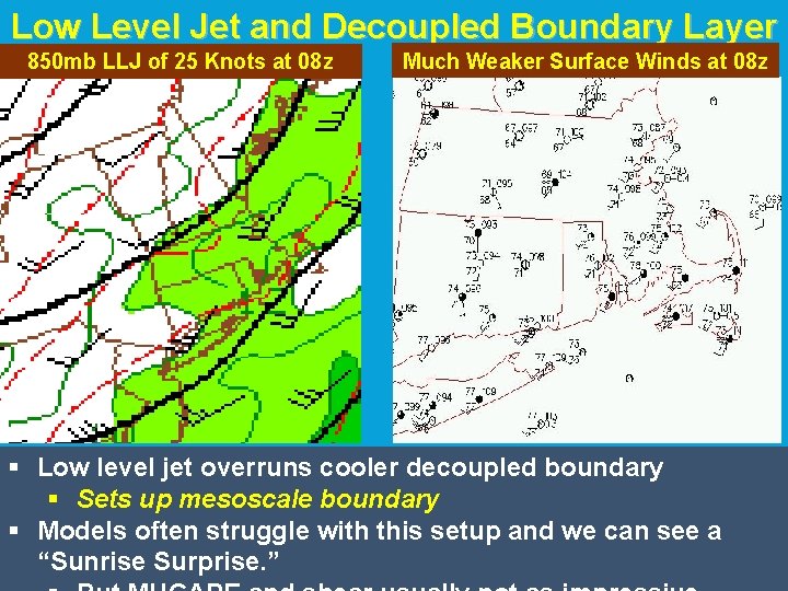
Station Plots: 07 UTC August 4 th 2015 § Dewpoints in the Lower 70 s § Winds have decoupled inland § Stronger winds over the south coastal waters.
Low Level Jet and Decoupled Boundary Layer 850 mb LLJ of 25 Knots at 08 z Much Weaker Surface Winds at 08 z § Low level jet overruns cooler decoupled boundary § Sets up mesoscale boundary § Models often struggle with this setup and we can see a “Sunrise Surprise. ”
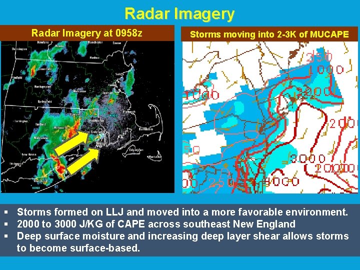
Radar Imagery at 0958 z Storms moving into 2 -3 K of MUCAPE § Storms formed on LLJ and moved into a more favorable environment. § 2000 to 3000 J/KG of CAPE across southeast New England § Deep surface moisture and increasing deep layer shear allows storms to become surface-based.
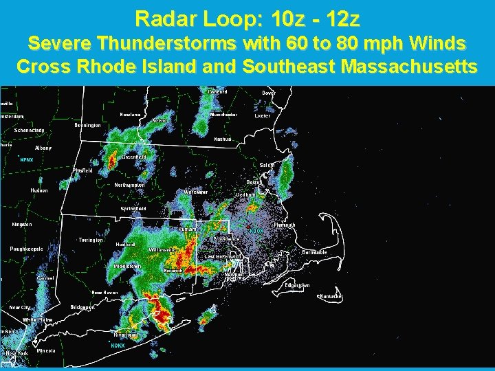
Radar Loop: 10 z - 12 z Severe Thunderstorms with 60 to 80 mph Winds Cross Rhode Island Southeast Massachusetts
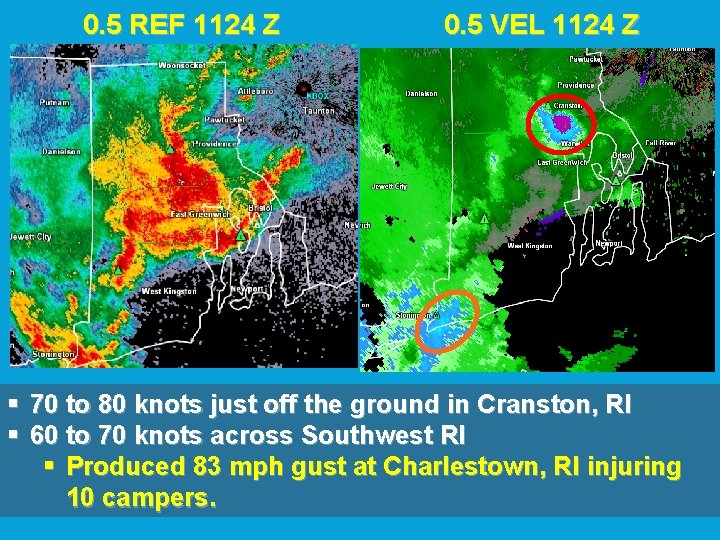
0. 5 REF 1124 Z 0. 5 VEL 1124 Z § 70 to 80 knots just off the ground in Cranston, RI § 60 to 70 knots across Southwest RI § Produced 83 mph gust at Charlestown, RI injuring 10 campers.
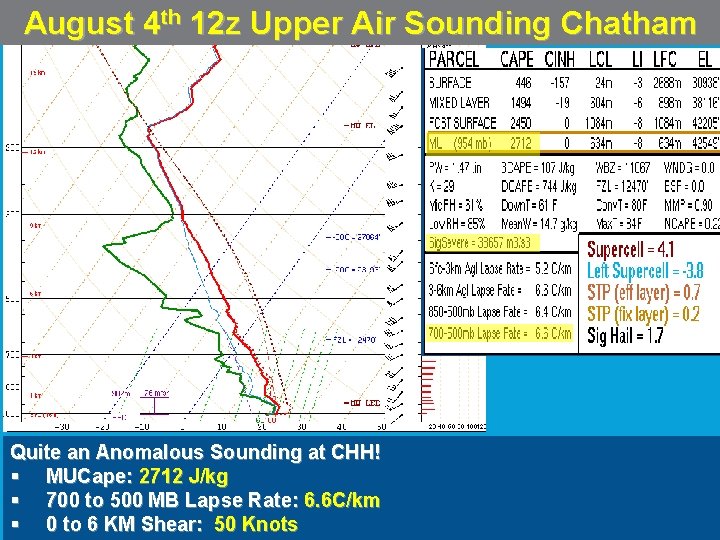
August 4 th 12 z Upper Air Sounding Chatham Quite an Anomalous Sounding at CHH! § MUCape: 2712 J/kg § 700 to 500 MB Lapse Rate: 6. 6 C/km § 0 to 6 KM Shear: 50 Knots
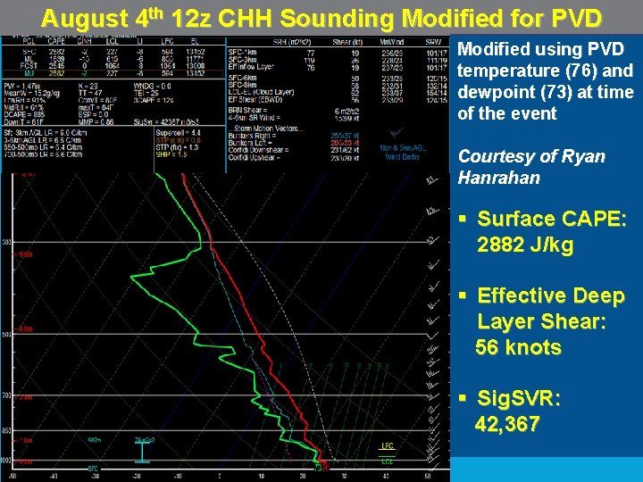
August 4 th 12 z CHH Sounding Modified for PVD Modified using PVD temperature (76) and dewpoint (73) at time of the event Courtesy of Ryan Hanrahan § Surface CAPE: 2882 J/kg § Effective Deep Layer Shear: 56 knots § Sig. SVR: 42, 367
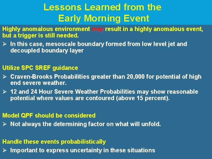
Lessons Learned from the Early Morning Event Highly anomalous environment may result in a highly anomalous event, but a trigger is still needed. Ø In this case, mesoscale boundary formed from low level jet and decoupled boundary layer Utilize SPC SREF guidance Ø Craven-Brooks Probabilities greater than 20, 000 for potential of high end severe weather. Ø 12 and 24 Hour Severe Weather Probabilities may show reasonable potential where values are contoured (above 15 percent). Model QPF should be considered Ø Not always the determining factor on what will unfold. Handle these events probabilistically Ø Important to express uncertainty in these situations
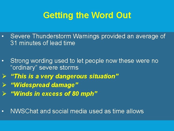
Getting the Word Out • Severe Thunderstorm Warnings provided an average of 31 minutes of lead time • Strong wording used to let people now these were no “ordinary” severe storms Ø “This is a very dangerous situation” Ø “Widespread damage” Ø “Winds in excess of 80 mph” • NWSChat and social media used as time allows
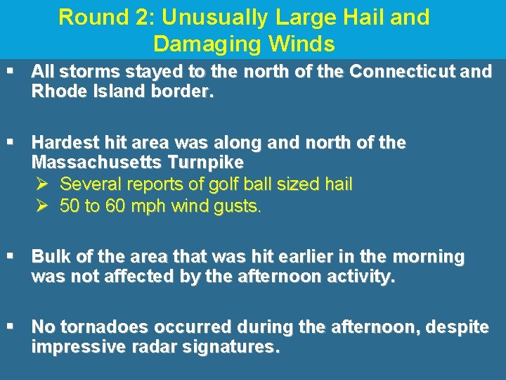
Round 2: Unusually Large Hail and Damaging Winds § All storms stayed to the north of the Connecticut and Rhode Island border. § Hardest hit area was along and north of the Massachusetts Turnpike Ø Several reports of golf ball sized hail Ø 50 to 60 mph wind gusts. § Bulk of the area that was hit earlier in the morning was not affected by the afternoon activity. § No tornadoes occurred during the afternoon, despite impressive radar signatures.
Pictures from Boston Hail Event These pictures were taken in Brighton, MA courtesy of Rachel Rumely
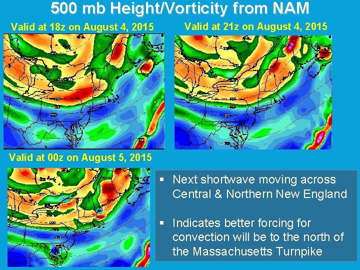
500 mb Height/Vorticity from NAM Valid at 18 z on August 4, 2015 Valid at 21 z on August 4, 2015 Valid at 00 z on August 5, 2015 § Next shortwave moving across Central & Northern New England § Indicates better forcing for convection will be to the north of the Massachusetts Turnpike
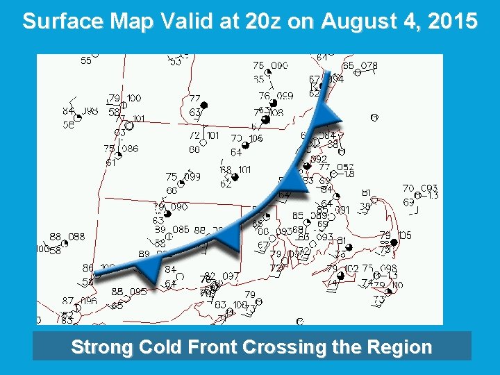
Surface Map Valid at 20 z on August 4, 2015 Strong Cold Front Crossing the Region
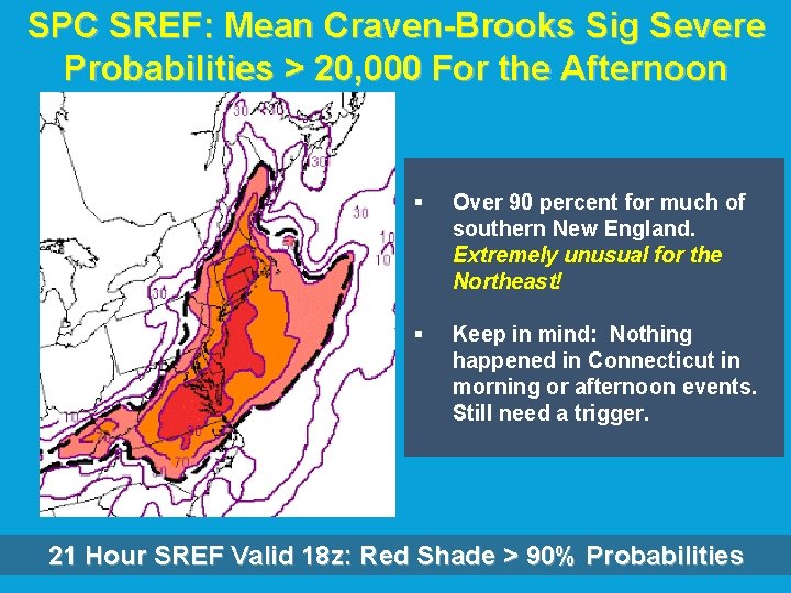
SPC SREF: Mean Craven-Brooks Sig Severe Probabilities > 20, 000 For the Afternoon § Over 90 percent for much of southern New England. Extremely unusual for the Northeast! § Keep in mind: Nothing happened in Connecticut in morning or afternoon events. Still need a trigger. 21 Hour SREF Valid 18 z: Red Shade > 90% Probabilities
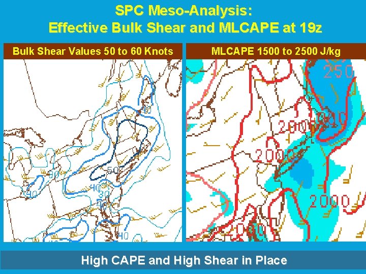
SPC Meso-Analysis: Effective Bulk Shear and MLCAPE at 19 z Bulk Shear Values 50 to 60 Knots MLCAPE 1500 to 2500 J/kg High CAPE and High Shear in Place
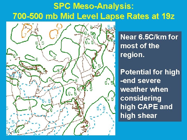
SPC Meso-Analysis: 700 -500 mb Mid Level Lapse Rates at 19 z Near 6. 5 C/km for most of the region. Potential for high -end severe weather when considering high CAPE and high shear
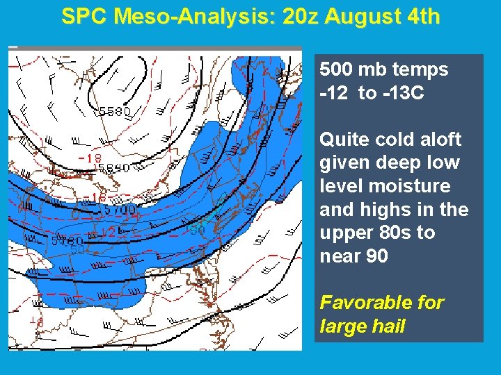
SPC Meso-Analysis: 20 z August 4 th 500 mb temps -12 to -13 C Quite cold aloft given deep low level moisture and highs in the upper 80 s to near 90 Favorable for large hail
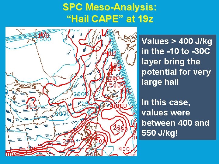
SPC Meso-Analysis: “Hail CAPE” at 19 z Values > 400 J/kg in the -10 to -30 C layer bring the potential for very large hail In this case, values were between 400 and 550 J/kg!
Forecast Uncertainty During the Afternoon • Anomalously High CAPE/High Shear in place during the afternoon with 6. 5 C/KM mid level lapse rates ØVery cold aloft with >400 J/kg of Hail CAPE • High Probabilities of Craven-Brooks Significant Severe Weather Exceeding 20, 000. • Approaching Shortwave/Cold Front would be the potential trigger for another round of high end severe weather • Biggest uncertainty was amount of mid level dry air that would work into the region behind earlier convection. ØSome mid level dry air can increase lapse rates and promote risk for severe wind and hail. ØToo much mid level dry air will cutoff thunderstorm updrafts and prevent severe weather. Ø It’s a very delicate balance!
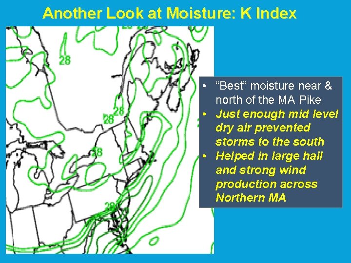
Another Look at Moisture: K Index Valid at 21 z • “Best” moisture near & north of the MA Pike • Just enough mid level dry air prevented storms to the south • Helped in large hail and strong wind production across Northern MA
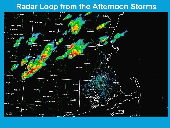
Radar Loop from the Afternoon Storms
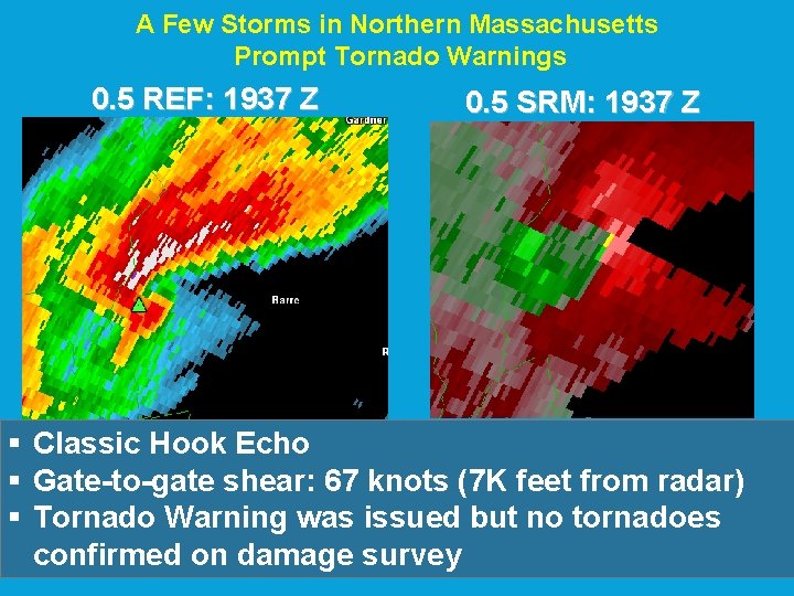
A Few Storms in Northern Massachusetts Prompt Tornado Warnings 0. 5 REF: 1937 Z 0. 5 SRM: 1937 Z § Classic Hook Echo § Gate-to-gate shear: 67 knots (7 K feet from radar) § Tornado Warning was issued but no tornadoes confirmed on damage survey
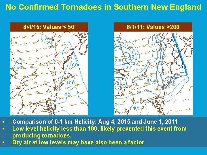
No Confirmed Tornadoes in Southern New England 8/4/15: Values < 50 § § § 6/1/11: Values >200 Comparison of 0 -1 km Helicity: Aug 4, 2015 and June 1, 2011 Low level helicity less than 100, likely prevented this event from producing tornadoes. Dry air at low levels may have also been a factor
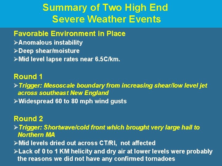
Summary of Two High End Severe Weather Events Favorable Environment in Place ØAnomalous instability ØDeep shear/moisture ØMid level lapse rates near 6. 5 C/km. Round 1 ØTrigger: Mesoscale boundary from increasing shear/low level jet across southeast New England ØWidespread 60 to 80 mph wind gusts Round 2 ØTrigger: Shortwave/cold front which brought very large hail to Northern MA ØMid levels dried out across CT/RI, not affected ØLack of 0 to 1 KM helicity and dry air at lower levels were probably the reasons we did not have any confirmed tornadoes
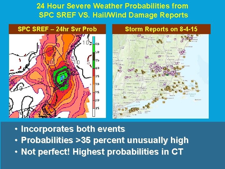
24 Hour Severe Weather Probabilities from SPC SREF VS. Hail/Wind Damage Reports SPC SREF – 24 hr Svr Prob Storm Reports on 8 -4 -15 • Incorporates both events • Probabilities >35 percent unusually high • Not perfect! Highest probabilities in CT