Atmospheric Pressure Air Masses Fronts and Cloud Formation


- Slides: 40

Atmospheric Pressure, Air Masses, Fronts and Cloud Formation Cold Fronts Warm Fronts & Weather Maps

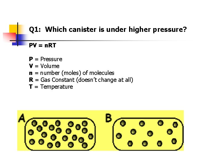
Q 1: Which canister is under higher pressure? PV = n. RT P = Pressure V = Volume n = number (moles) of molecules R = Gas Constant (doesn’t change at all) T = Temperature

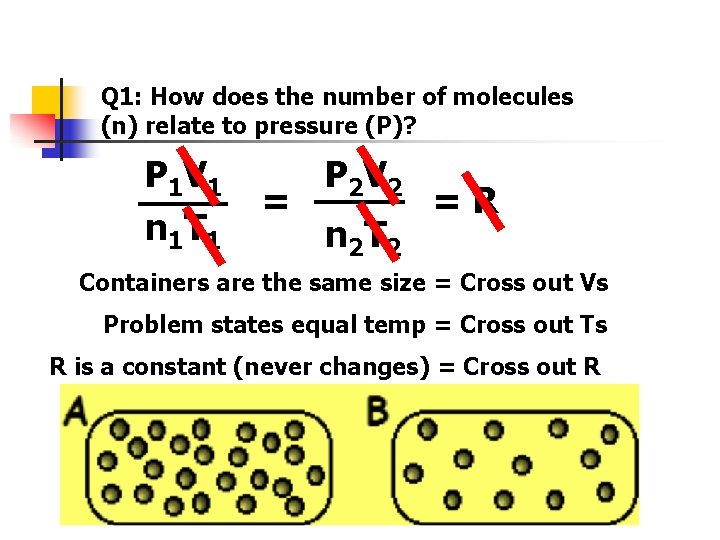
Q 1: How does the number of molecules (n) relate to pressure (P)? P 1 V 1 n 1 T 1 = P 2 V 2 n 2 T 2 =R Containers are the same size = Cross out Vs Problem states equal temp = Cross out Ts R is a constant (never changes) = Cross out R

Q 1: How does the number of molecules (n) relate to pressure (P)? P 1 V 1 n 1 T 1 = P 2 V 2 n 2 T 2 =R Containers are the same size = Cross out Vs Problem states equal temp = Cross out Ts R is a constant (never changes) = Cross out R

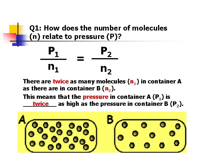
Q 1: How does the number of molecules (n) relate to pressure (P)? P 1 n 1 = P 2 n 2 There are twice as many molecules (n 1) in container A as there are in container B (n 2). This means that the pressure in container A (P 1) is _____ as high as the pressure in container B (P 2). twice

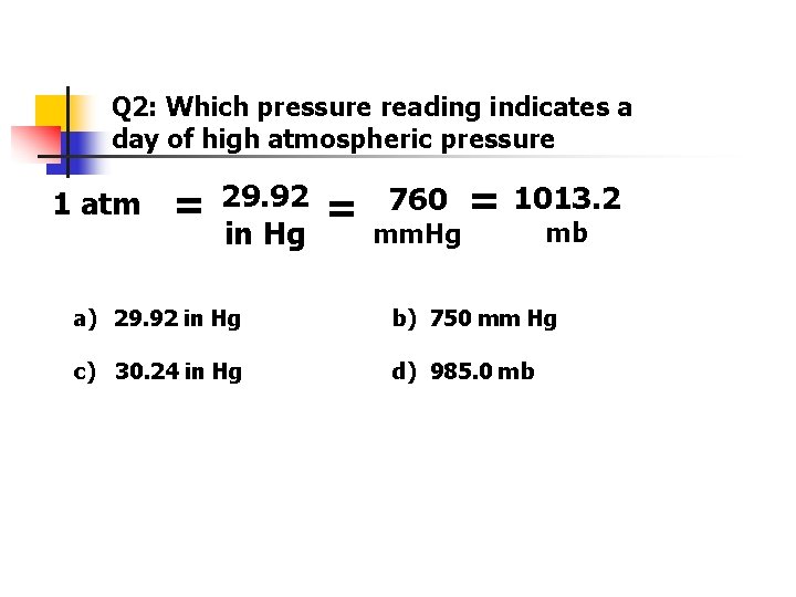
Q 2: Which pressure reading indicates a day of high atmospheric pressure 1 atm = 29. 92 in Hg = 760 mm. Hg = 1013. 2 mb a) 29. 92 in Hg b) 750 mm Hg c) 30. 24 in Hg d) 985. 0 mb

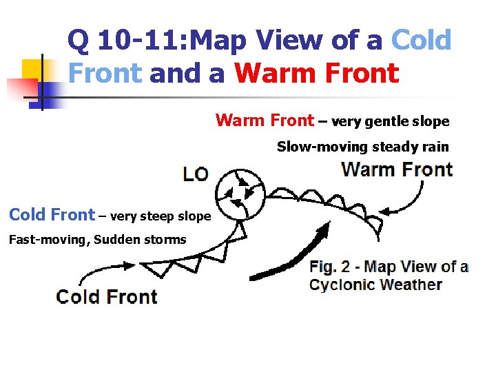
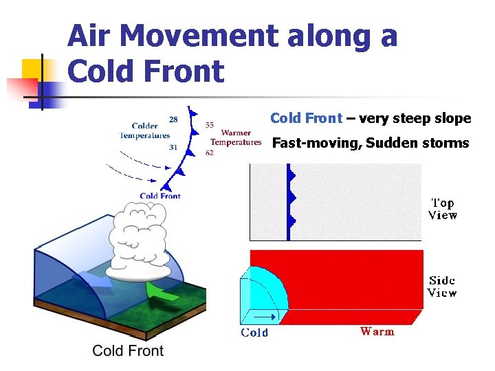
Q 10 -11: Map View of a Cold Front and a Warm Front – very gentle slope Slow-moving steady rain Cold Front – very steep slope Fast-moving, Sudden storms

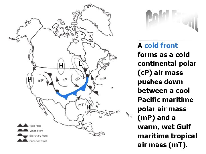
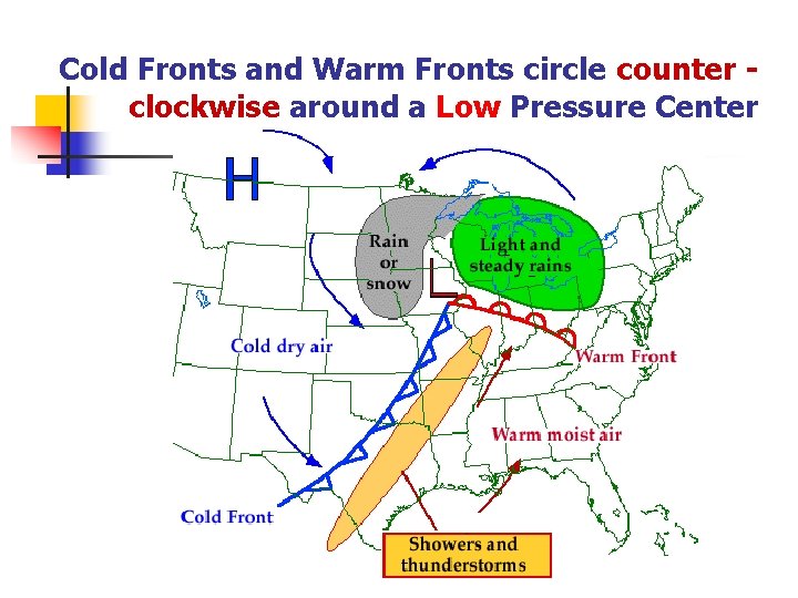
A cold front forms as a cold continental polar (c. P) air mass pushes down between a cool Pacific maritime polar air mass (m. P) and a warm, wet Gulf maritime tropical air mass (m. T).

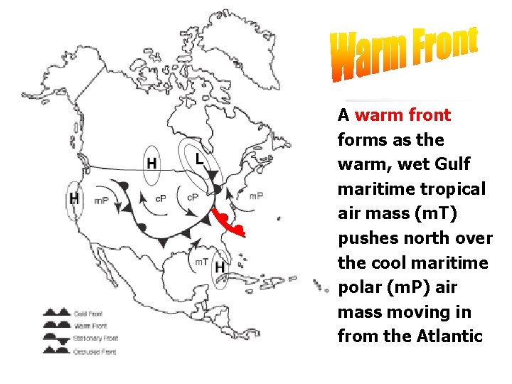
A warm front forms as the warm, wet Gulf maritime tropical air mass (m. T) pushes north over the cool maritime polar (m. P) air mass moving in from the Atlantic

Cold Fronts and Warm Fronts circle counter clockwise around a Low Pressure Center

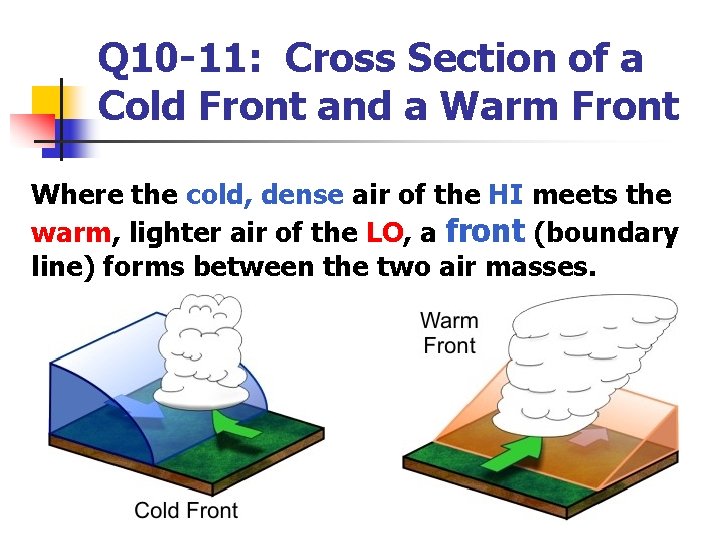
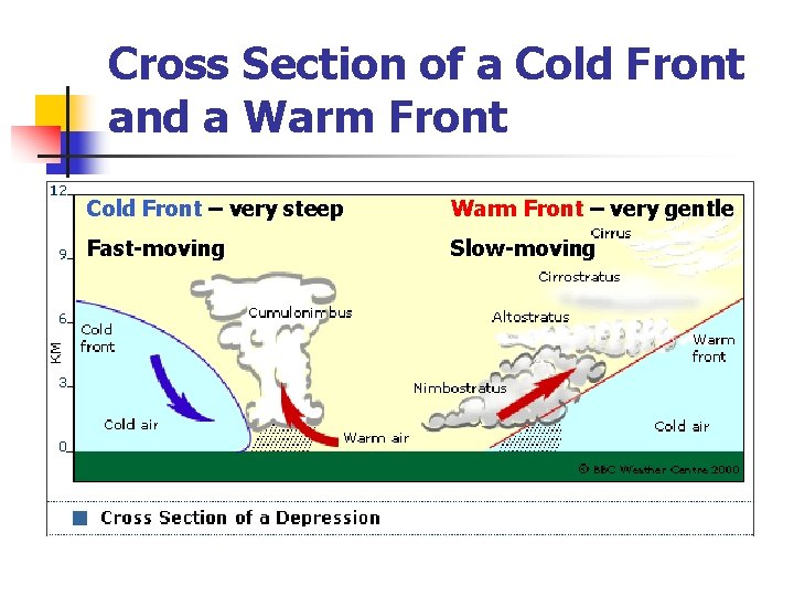
Q 10 -11: Cross Section of a Cold Front and a Warm Front Where the cold, dense air of the HI meets the warm, lighter air of the LO, a front (boundary line) forms between the two air masses.

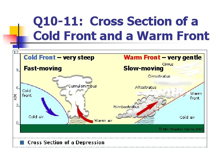
Q 10 -11: Cross Section of a Cold Front and a Warm Front Cold Front – very steep Warm Front – very gentle Fast-moving Slow-moving

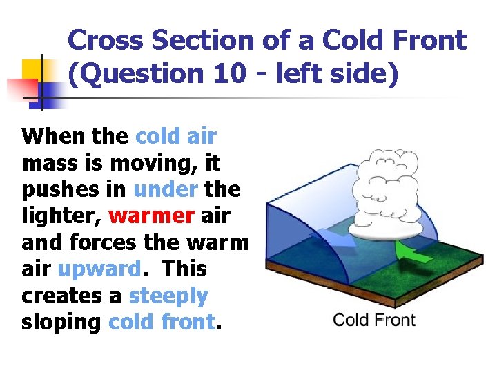
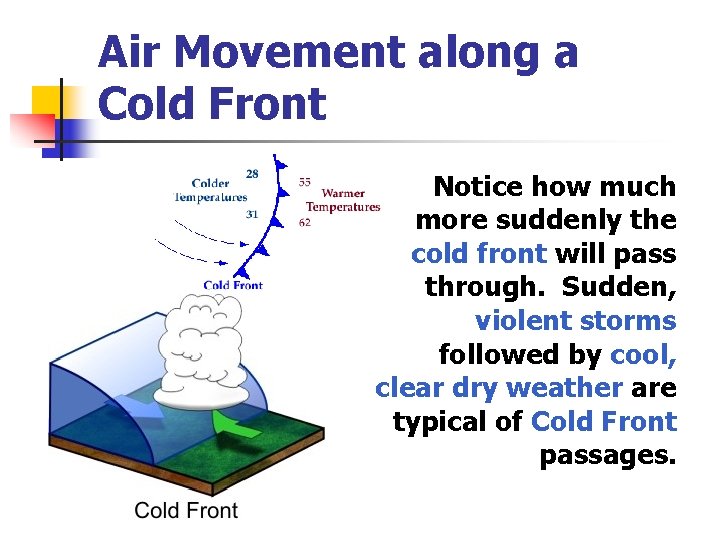
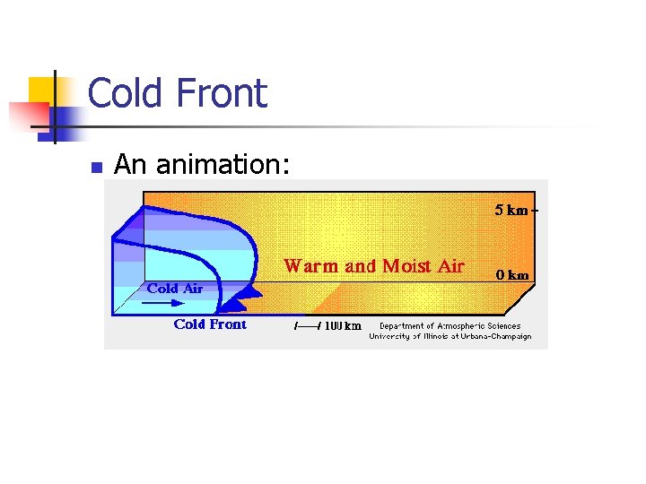
Cross Section of a Cold Front (Question 10 - left side) When the cold air mass is moving, it pushes in under the lighter, warmer air and forces the warm air upward. This creates a steeply sloping cold front.

Air Movement along a Cold Front – very steep slope Fast-moving, Sudden storms

Air Movement along a Cold Front Notice how much more suddenly the cold front will pass through. Sudden, violent storms followed by cool, clear dry weather are typical of Cold Front passages.

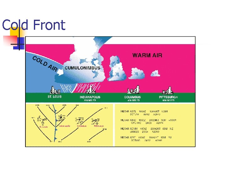
Cold Front

Cold Front n An animation:

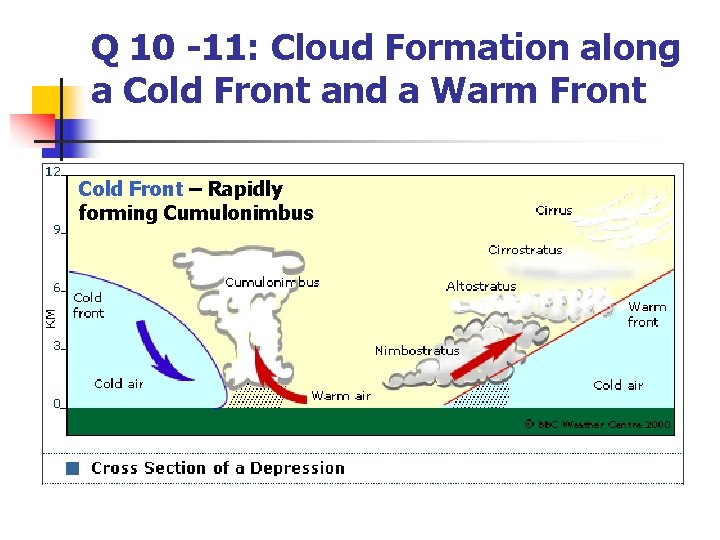
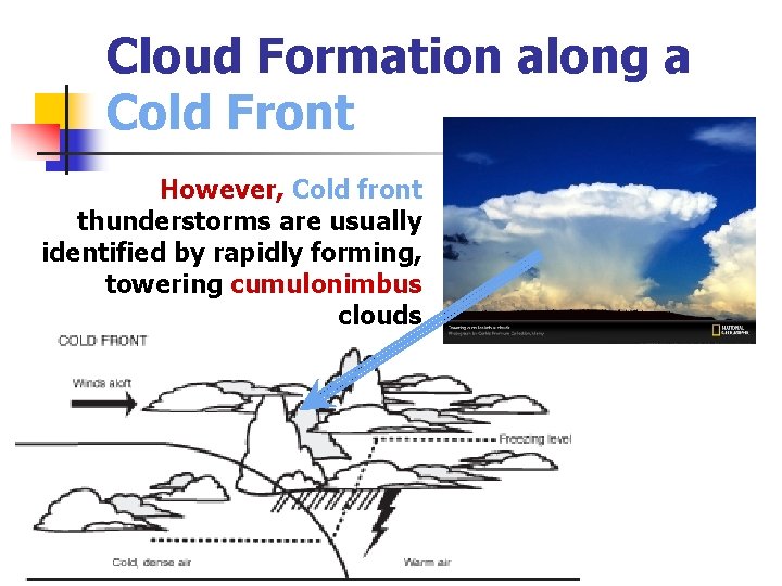
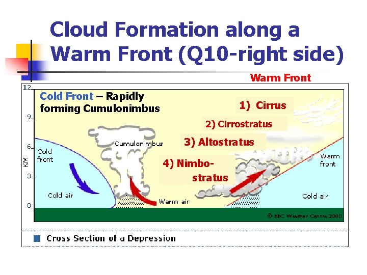
Q 10 -11: Cloud Formation along a Cold Front and a Warm Front Cold Front – Rapidly forming Cumulonimbus

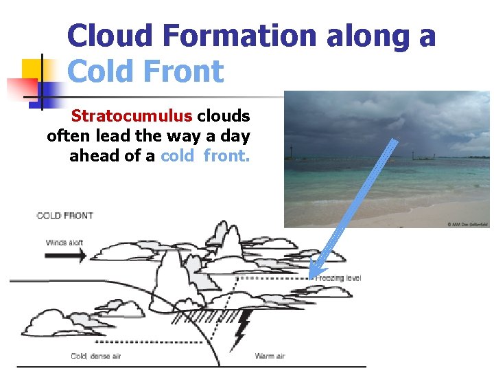
Cloud Formation along a Cold Front Stratocumulus clouds often lead the way a day ahead of a cold front.

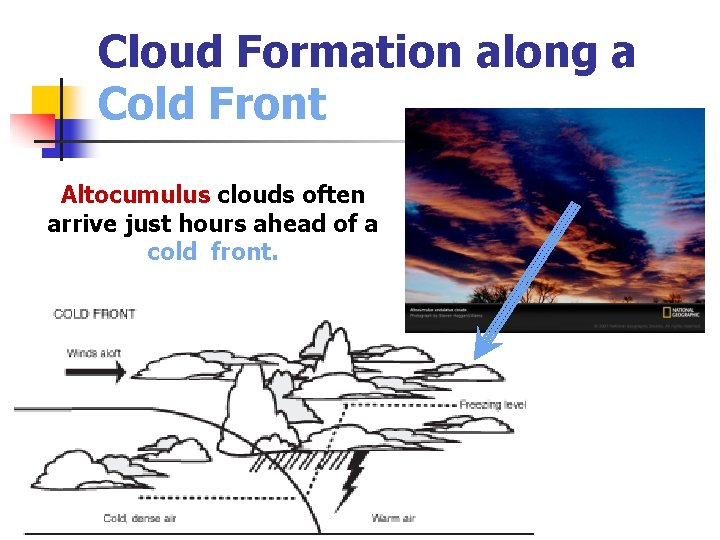
Cloud Formation along a Cold Front Altocumulus clouds often arrive just hours ahead of a cold front.

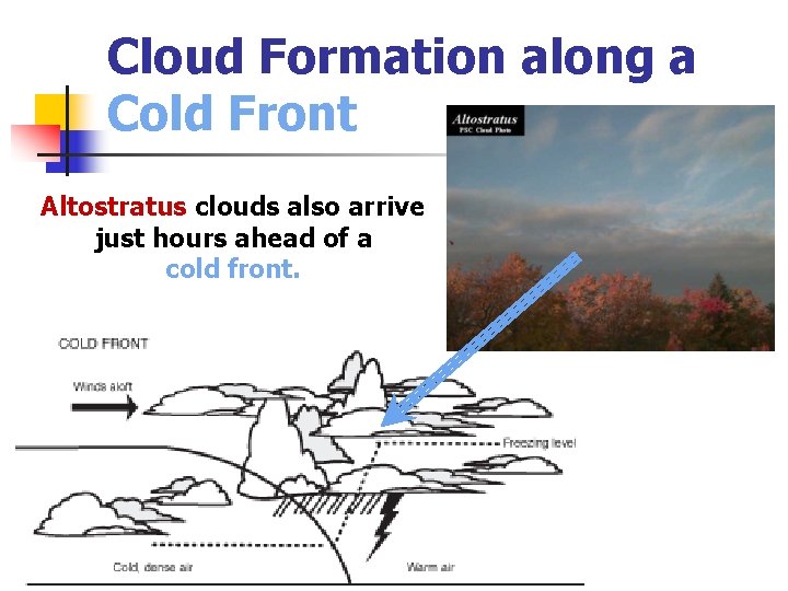
Cloud Formation along a Cold Front Altostratus clouds also arrive just hours ahead of a cold front.

Cloud Formation along a Cold Front However, Cold front thunderstorms are usually identified by rapidly forming, towering cumulonimbus clouds

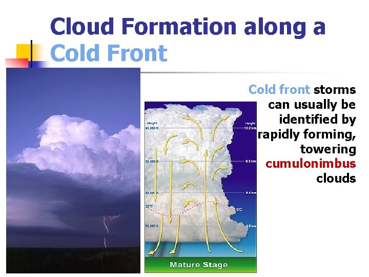
Cloud Formation along a Cold Front Cold front storms can usually be identified by rapidly forming, towering cumulonimbus clouds

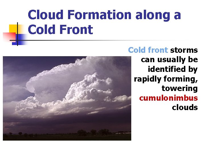
Cloud Formation along a Cold Front Cold front storms can usually be identified by rapidly forming, towering cumulonimbus clouds

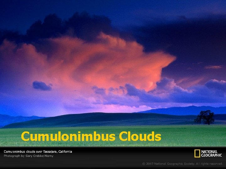
Cumulonimbus Clouds

Cross Section of a Cold Front and a Warm Front Cold Front – very steep Warm Front – very gentle Fast-moving Slow-moving

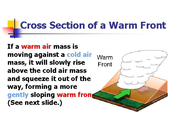
Cross Section of a Warm Front If a warm air mass is moving against a cold air mass, it will slowly rise above the cold air mass and squeeze it out of the way, forming a more gently sloping warm front (See next slide. )

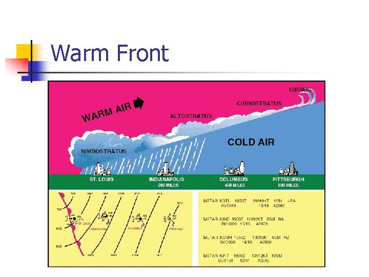
Warm Front

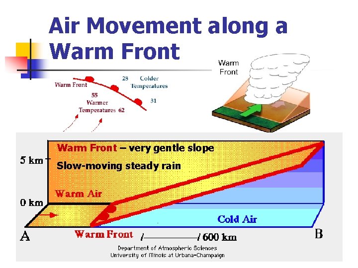
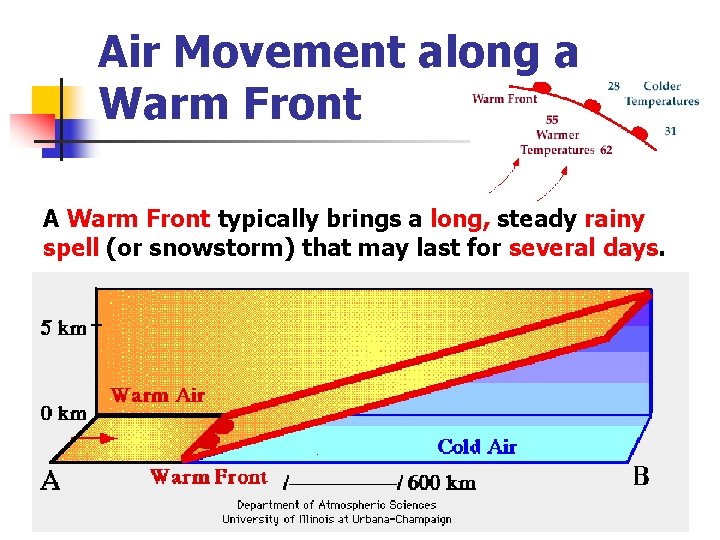
Air Movement along a Warm Front – very gentle slope Slow-moving steady rain

Air Movement along a Warm Front A Warm Front typically brings a long, steady rainy spell (or snowstorm) that may last for several days.

Cloud Formation along a Warm Front (Q 10 -right side) Warm Front Cold Front – Rapidly forming Cumulonimbus 1) Cirrus 2) Cirrostratus 3) Altostratus 4) Nimbostratus

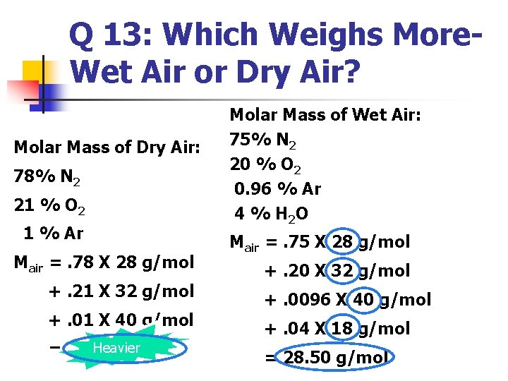
Q 13: Which Weighs More. Wet Air or Dry Air? Molar Mass of Dry Air: 78% N 2 21 % O 2 1 % Ar Mair =. 78 X 28 g/mol +. 21 X 32 g/mol +. 01 X 40 g/mol Heavier = 28. 96 g/mol Molar Mass of Wet Air: 75% N 2 20 % O 2 0. 96 % Ar 4 % H 2 O Mair =. 75 X 28 g/mol +. 20 X 32 g/mol +. 0096 X 40 g/mol +. 04 X 18 g/mol = 28. 50 g/mol

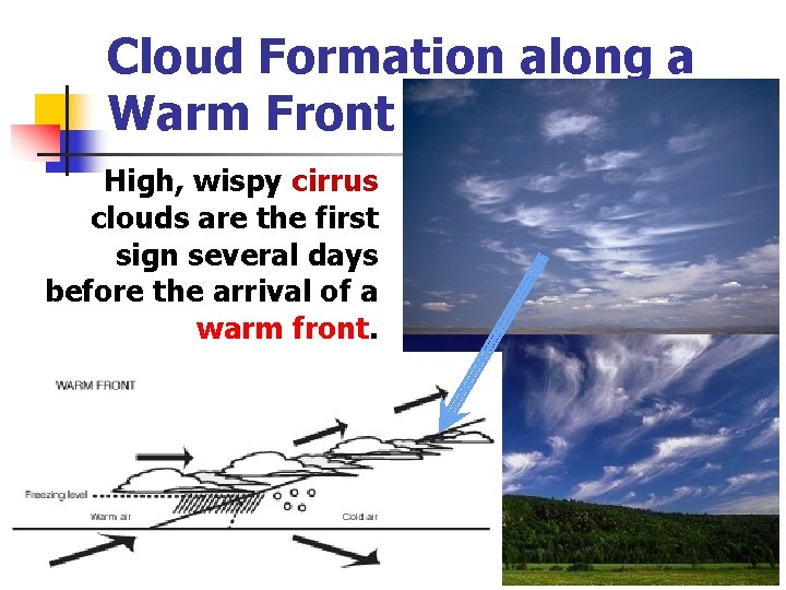
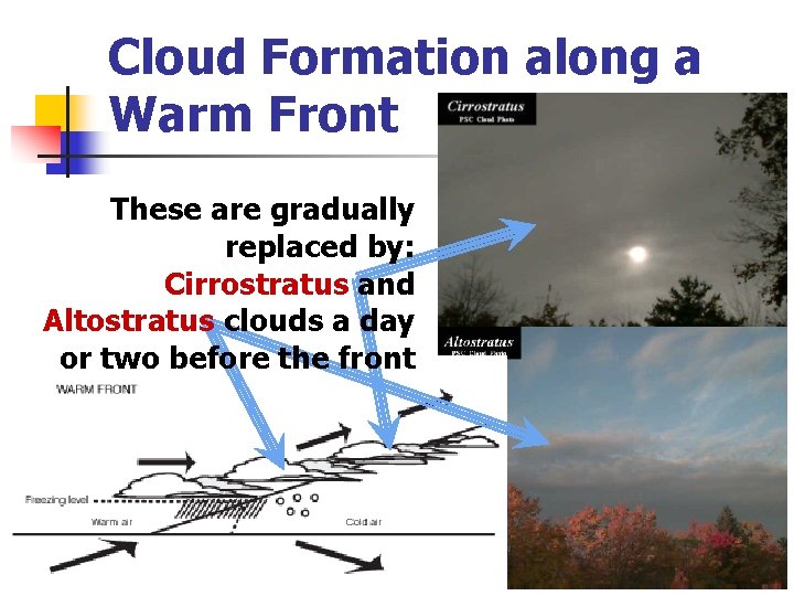
Cloud Formation along a Warm Front High, wispy cirrus clouds are the first sign several days before the arrival of a warm front.

Cloud Formation along a Warm Front These are gradually replaced by: Cirrostratus and Altostratus clouds a day or two before the front

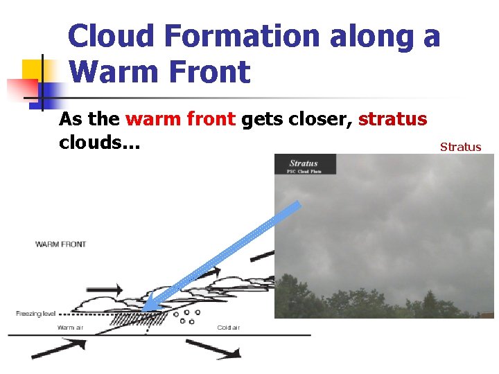
Cloud Formation along a Warm Front As the warm front gets closer, stratus clouds… Stratus

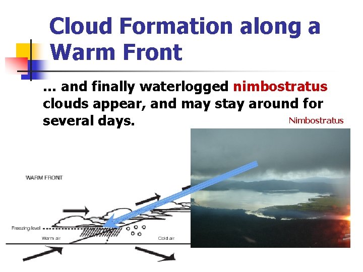
Cloud Formation along a Warm Front … and finally waterlogged nimbostratus clouds appear, and may stay around for Nimbostratus several days.


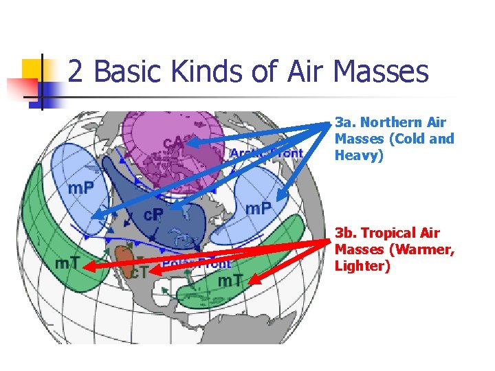
2 Basic Kinds of Air Masses 3 a. Northern Air Masses (Cold and Heavy) 3 b. Tropical Air Masses (Warmer, Lighter)

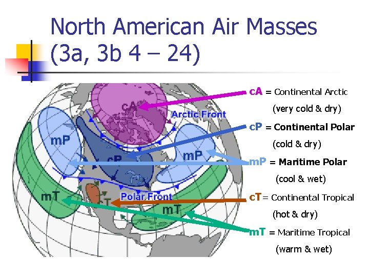
North American Air Masses (3 a, 3 b 4 – 24) c. A = Continental Arctic (very cold & dry) c. P = Continental Polar (cold & dry) m. P = Maritime Polar (cool & wet) c. T = Continental Tropical (hot & dry) m. T = Maritime Tropical (warm & wet)

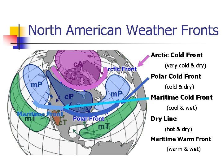
North American Weather Fronts Arctic Cold Front (very cold & dry) Polar Cold Front (cold & dry) Maritime Cold Front Maritime Front (cool & wet) Dry Line (hot & dry) Maritime Warm Front (warm & wet)