Aquatic Biodiversity Chapter 6 Chapter Overview Questions What

Aquatic Biodiversity Chapter 6

Chapter Overview Questions What are the basic types of aquatic life zones and what factors influence the kinds of life they contain? What are the major types of saltwater life zones, and how do human activities affect them? What are the major types of freshwater life zones, and how do human activities affect them?
 • Characterized by amount of Na. Cl dissolved in")
Aquatic Life Zones (Aquatic Biomes) • Characterized by amount of Na. Cl dissolved in the water. • Saltwater (marine) and freshwater cover ~ 71% of the earth’s surface. • Food chains and webs are more complex and longer than terrestrial ones.

AQUATIC ENVIRONMENTS Figure 6 -3

AQUATIC ENVIRONMENTS Saltwater and freshwater aquatic life zones cover almost three-fourths of the earth’s surface Figure 6 -2

Organisms & Aquatic Life Zones 1. Plankton: free floating - Phytoplankton: ex: algae - Zooplankton: animal plankton. ex: protozoans (amoeba, paramecia) -Ultraplankton: autotrophic bacteria 2. Nekton: freeswimming. ex: fish, turtles, whales 3. Benthos: bottom dwellers. Ex: barnacles, lobsters 4. Decomposers: ex: bacteria, water molds
 in the surface, middle, and bottom layers are")
Limiting Factors Life (numbers and diversity) in the surface, middle, and bottom layers are determined by: Temperature Sunlight penetration (for photosynthesis): upper layers or Euphotic zone Amount of dissolved oxygen: at lower levels Nutrient availability (CO 2, NO 3 -, PO 43 -): shallow waters lots of nutrients ocean- nutrients, areas with upwelling have nutrients.

Marine Ecosystems Scientists estimate that marine systems provide $21 trillion in goods and services per year – 70% more than terrestrial ecosystems. Figure 6 -4

Oceans • Largest of all ecosystems • High biodiversity • 2 zones: 1. Coastal- warm and nutrient rich area 90% of all marine species! NPP 2. Open sea- cooler and less species

Biological Zones in the Open Sea: Light Rules Euphotic zone: brightly lit surface layer. Nutrient levels low, dissolved O 2 high, photosynthetic activity. Bathyal zone: dimly lit middle layer. No photosynthetic activity, zooplankton and fish live there and migrate to euphotic zone to feed at night. Abyssal zone: dark bottom layer. Very cold, little dissolved O 2.

The Coastal Zone Figure 6 -5

Estuaries • Enclosed body of water formed where seawater mixes with freshwater from rivers & streams. • Called “ Marine nurseries”- habitats for many juvenile fish species. • Temperature and salinity vary due to the daily tides and seasonal flow of freshwater • Estuaries and coastal wetlands include inlets, mangrove forest swamps, & salt marshes

Estuaries Con’t • Extremely fertile due to constant movement of water. • Stressful conditions and abundant nutrients result in low species diversity, but great abundance of the species present. • Helpful in filtering pollutants and sediments. • Humans are constantly destroying and degrading these ecosytems.

Estuaries and Coastal Wetlands: Centers of Productivity Estuaries and coastal marshes provide ecological and economic services. Filter toxic pollutants, excess plant nutrients, sediments, and other pollutants. Reduce storm damage by absorbing waves and storing excess water produced by storms and tsunamis. Provide food, habitats and nursery sites for many aquatic species.

Herring gulls Peregrine falcon Snowy Egret Cordgrass Short-billed Dowitcher Marsh Periwinkle Phytoplankton Smelt Soft-shelled clam Zooplankton and small crustaceans Clamworm Bacteria Producer to primary consumer Primary to secondary consumer Secondary to higher-level consumer All consumers and producers to decomposers Fig. 6 -7 a, p. 131

Mangrove Forests Are found along about 70% of gently sloping sandy and silty coastlines in tropical and subtropical regions. Are a type of coastal wetland Figure 6 -8

Credit: © Theo Allofs/Visuals Unlimited A Mangrove forest at Cape Tribulation, Daintree National Park, Queensland, Australia. 275778

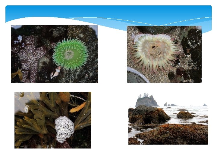
Intertidal Zone • Where the ocean meets the land. • Sometimes submerged and other times exposed. • Communities are constantly changing in this area. • Rocky shores- areas pounded by waves, varieties of algae, snails, crabs, etc. • Sandy shores- no plants or algae, but insects, shorebirds, crabs, and worms found

Intertidal Zone Shi Beach, Olympic Nat Park, WA Gary A. Ritchie

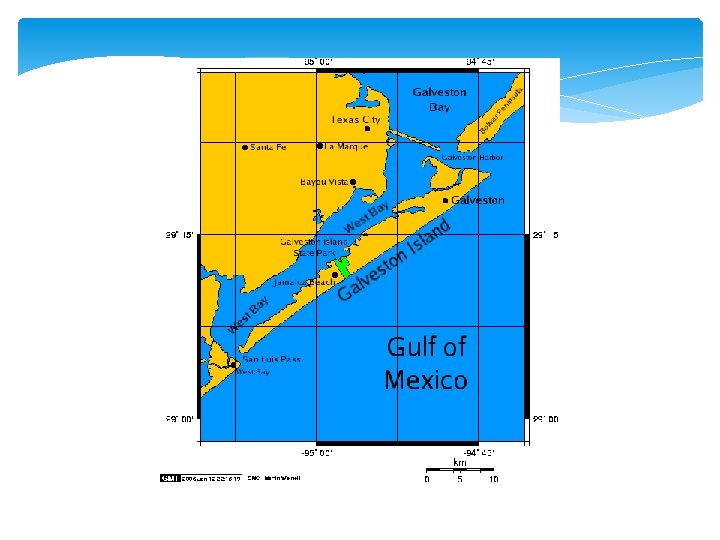
Barrier Islands • Long, narrow, offshore deposits of sand or sediments that parallel the coast line. • Aid in protecting mainland, estuaries, & coastal wetlands. • Found along eastern coasts and Gulf of Mexico • Lots of development

Ocean Beach Intensive recreation, no building Primary Dune Trough Secondary Dune No direct Limited passage recreation or building and walkways or building Grasses or shrubs Taller shrubs Back Dune Most suitable for development Bay or Lagoon Intensive recreation Bay shore No filling Taller shrubs and trees Fig. 6 -10, p. 133

Damage to barrier islands A single home is left standing among debris from Hurricane Ike September 14, 2008 in Gilchrist, Texas. Floodwaters from Hurricane Ike were reportedly as high as eight feet in some areas causing widespread damage across the coast of Texas. (David J. Phillip-Pool/Getty Images) Damage from Hurricane Ike

Barrier Islands and the coast along Long Island during Hurricane Sandy

Coral Reefs • Structure that is formed by coral polyps (small invertebrates that live in colonies). • Typically found in warm coastal waters of the tropics and subtropics. • Coral polyps form a hard, stony, branching structure made of limestone. • New polyps attach to old coral and gradually build the reef.

Coral Reefs Climate • Usually found near land in shallow, warm salt water. • Lots of light • Tropical temperatures, averaging 70°-85° F
 dividing. 36771")
Credit: © David Wrobel/Visuals Unlimited Aggregating Anemones (Anthopleura elegantissima) dividing. 36771
 builds stony skeletons of")
Credit: © Daniel Gotshall/Visuals Unlimited A Fluted Bryozoan (Hippodiplosia insculpta) builds stony skeletons of calcium carbonate, superficially similar to coral in colonies. 51903

Credit: © Marty Snyderman/Visuals Unlimited A group of Star Coral polyps feeding. 38051

Credit: © Hal Beral/Visuals Unlimited Purple Tube Sponge. 97245

Importance of Coral Reefs • High biodiversity- considered the most diverse and productive • Grow very slowly • Complex relationships that exist between many organisms.

Example of Food Chain

Video: Giant Clam PLAY VIDEO

Damage to Coral Reefs • Very sensitive to environmental changes. • Natural disturbances: hurricanes or typhoons, and predation by a large starfish-Acanthaster • Anthropogenic disturbances (human)sediment run off, pollution, reef fishing, bleaching… • 300+ reefs are protected as reserves or parks.

Effects of Human Activities on Marine Systems: Red Alert Human activities are destroying or degrading many ecological and economic services provided by the world’s coastal areas. Figure 6 -13

Freshwater Life Zones • Cover less than 1% of earth’s surface. • Low salt concentration- < 1% • Types: Flowing (lotic) - streams, and rivers Standing (lentic) - ponds, lakes, inland wetlands

Natural Capital Freshwater Systems Ecological Services Economic Services Climate moderation Food Nutrient cycling Drinking water Waste treatment Irrigation water Flood control Hydroelectricity Groundwater recharge Transportation corridors Habitats for many species Recreation Genetic resources and biodiversity Scientific information Employment Fig. 6 -14, p. 136

Lakes and Ponds Zones • divided into four different “zones” determined by depth and distance from the shoreline: 1. Littoral zone- top layer, shallow/near shore, biodiversity. aquatic plants, grazing snails, clams, insects, crustaceans, fishes, and amphibians 2. Limnetic zone-sunlit water surface layer, main photosynthetic layer. plankton, fishes 3. Profundal zone-cool and dark layer, O 2 4. Benthic zone-bottom layer, decomposers and detritivores.

Lakes: Water-Filled Depressions During summer and winter in deep temperate zone lakes the become stratified into temperature layers and will overturn. This equalizes the temperature at all depths. Oxygen is brought from the surface to the lake bottom and nutrients from the bottom are brought to the top. What causes this overturning?


Lake Classification Classified by: nutrient content and primary productivity Oligotrophic Newly formed Poorly nourished Little sediment Deep water Clear water color Low net primary prod. Trout, smallmouth bass Eutrophic Excess supply of nutrients (Phosphates & nitrates) Shallow water Murky water color High net prod. Lots of plants, fish, plankton MESOTROPHIC LAKES- intermediate between oligotrophic and eutrophic

Effects of Plant Nutrients on Lakes: Too Much of a Good Thing Plant nutrients from a lake’s environment affect the types and numbers of organisms it can support. Figure 6 -16

Effects of Plant Nutrients on Lakes: Too Much of a Good Thing Cultural eutrophication: Human inputs of nutrients from the atmosphere and urban and agricultural areas can accelerate the eutrophication process.

Terminology Surface water- precipitation that does not sink into ground or evaporate Runoff- surface water that flows into streams Watershed (Drainage basin)- The region draining into a river, river system, or other body of water.

Characteristics of Rivers and Streams • bodies of flowing water moving in one direction • found everywhere—they get their start at headwaters, which may be springs, snowmelt or even lakes • travel all the way to their mouths, usually another water channel or the ocean

Zones of Down Hill Water Flow • Characteristics of river/stream change as water moves through these zones. 1. Source zone- narrow headwaters. water moves rapidly, clear water, D. O. 2. Transition zone- wider and deeper. Slower and warmer water, Lower D. O. than source zone 3. Floodplain zone- stream join into rivers. Warmer water and lower D. O. , muddy water

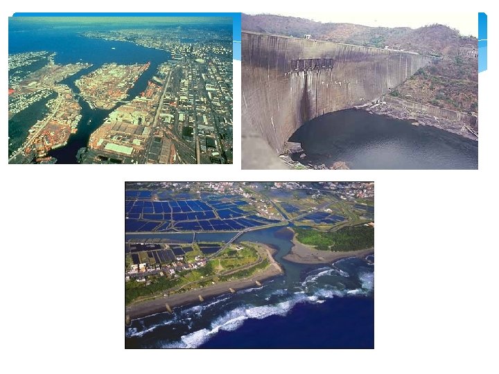
Freshwater Streams and Rivers: From the Mountains to the Oceans Water flowing from mountains to the sea creates different aquatic conditions and habitats. Figure 6 -17

Freshwater Inland Wetlands: Vital Sponges Inland wetlands act like natural sponges that absorb and store excess water from storms and provide a variety of wildlife habitats. Figure 6 -18

Freshwater Inland Wetlands • Lands that are covered with fresh water year round or seasonally and located away from coastal areas. • High biodiversity • Ex: Marshes, Swamps, Floodplains, and Artic tundra (summers) • Vary in size- small to large • Important in filtering pollutants, absorbing excess water from storms, & providing habitats

Impacts of Human Activities on Freshwater Systems Dams, cities, farmlands, and filled-in wetlands alter and degrade freshwater habitats. Dams, diversions and canals have fragmented about 40% of the world’s 237 large rivers. Flood control levees and dikes alter and destroy aquatic habitats. Cities and farmlands add pollutants and excess plant nutrients to streams and rivers. Many inland wetlands have been drained or filled for agriculture or (sub)urban development.
- Slides: 54