AP Human Geography darth parsons UNIT 1 GEOGRAPHY


 The study of how people make places, how we organize space")


 More Developed Countries (MDCs)")


 Security (9/11)")


 Region Movement")
 Place – specific geographic settings with distinctive physical, social, and cultural attributes")


 a people abandoned their land (the Maya)")
 a people were conquered and dominated by invaders (Islamic expansion)")
 a culture was gradually supplanted (ethnic neighborhoods in America)")
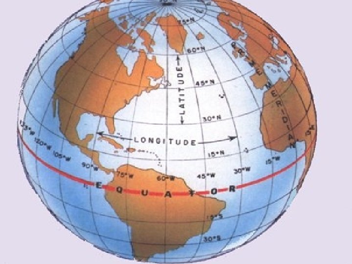
 Location-position on the earth’s surface Absolute Location: use of grids – (i.")

 WHOOPS! That’s Alien-Environment Interaction Wrong one. Sorry.")
 Interaction (Human/Environment)")


")
 Regions 1. Formal/Uniform region: defined by a common similarity, typically a cultural")


 Movement Spatial analysis: the study of geography phenomena on the earth’s surface")


")

 – Global Warming")


")

- Slides: 123
AP Human Geography darth parsons UNIT 1: GEOGRAPHY AND ITS PERSPECTIVES
UNIT 1: GEOGRAPHY AND ITS PERSPECTIVES
Questions that “Geography” addresses: Where are things located? Why are they important? How are places related? How are places connected? How are humans affected by these locations?
Definition of Geography scientific and systematic study of both the physical and cultural features of the earth’s surface. It is a spatial perspective looking at patterns and distributions on the earth’s surface The word geography was invented by the Greek scholar Eratosthenes. It is based on 2 Greek words: -Geo – “Earth” -graphy – “to write”
Difference between “Physical Geography” and “Human or Cultural Geography: Physical Geography is the study of the four spheres (Lithosphere, Atmosphere, Hydrosphere, and Biosphere) – (what the earth does) Human (or Cultural) Geography is the study of the spatial differentiation and organization of human activity on the earth’s
Approaches to the Study of Geography Latin America Regional (Latin America, Sub-Saharan Africa, Southeast Asia)Southeast Asia Sub-Saharan Africa Systematic (Human Geography, Physical Geography, Historical Geography)
More specific! What is Physical Geography?
The different disciplines in Physical Geography. Geomorphology: studies the form and structure of the surface of the earth Climatology: involves the study of long term weather conditions on the earth Hydrography: concerns the distribution of water (oceans, rivers, lakes, and their uses) Biogeography: studies the flora (plant life) and the fauna (animal life) Pedology: study of the soils Ecology: studies the interactions between life forms and the environment Geology: study of rocks and the earth’s interior
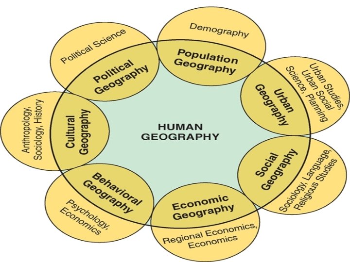
Key Question! What is Human Geography ?
Human Geography (Definitions) The study of how people make places, how we organize space and society, how we interact with each other in places and across space, and how we make sense of others and ourselves in our locality, region, and world. (De Blij) The scientific study of the location of people & activities on the Earth’s surface, where & why human activities are located where they are, reasons geographers look at the world from a spatial perspective & interaction, and diffusion of people & ideas. (Rubenstein)
Population Geography POPULATION PYRAMIDS More Developed Country Less Developed Country
Urban Geography Since 2008, more people in the world live in CITIES than in the country.
Social Geography
Economic Geography Less Developed Countries (LDCs) More Developed Countries (MDCs)
Behavioral Geography
Cultural Geography
Political Geography
GLOBALIZATION Globalization Definition: the development of an increasingly integrated global economy marked especially by free trade, free flow of money, and the usage of cheaper foreign labor markets.
Globalization A set of processes that A set of outcomes that are: - increasing interactions - unevenly distributed - deepening - MDCs influencing relationships LDCs - heightening - clashing cultures interdependence or - improving need for one another development without regard to country borders. throughout the world.
Affect of Communication and Transportation Buggy's are slow and cars can at higher speeds. Therefore, travel information and goods can reach destinations faster. We are more interconnected as modes of communication and transportations become The advances in more advanced. technology make our world more The advances in these two things have interconnected. made us more interconnected. � Example: Buggy's ----> Cars Sailboats ----> Steamboats Postal mail ----> e-mail
Negative Issues Associated with Globalization Environmental Health Issues (HIV/AIDS, SARS) Security (9/11)
1 st – Hyperglobalization view Open markets and Free Trade are good for everyone in the long run and will allow everyone to share in economic prosperity Work will eventually become borderless as national governments become meaningless, government’s only role will be to foster trade
2 nd – Skeptical View Globalization is exaggerated The world has been to this point before = Gold Standard Accentuate Regionalization (Europe, N. America, Japan)
3 rd – Transformationalist View globalization as a powerful force that is changing the world not just a repeat of the 19 th Century. However, they make no assumptions to the effect of globalization on the nation state
DED WORD OF THE DAY ACCULTURATION Talk in your groups about: �Definition �Examples in the world �Different challenges created by it Process of adopting only certain customs that will be to one’s advantage
Four Traditions of Geography The Four Traditions were outlined by William Pattison at the NCGE Opening Session on November 29, 1963. Tradition Core Concepts Spatial Tradition Mapping, Spatial Analysis, Boundaries & Densities, Movement & Transportation, Central Place Theory, Areal Distribution. Spatial Patterns Area Studies Descriptions of Regions & Areas, World Regional Geography, International Trends & Relationships, Regional Differences, Chorographic Tradition Man-Land Human impact on Nature, Nature impact on Humans, Natural Hazards, Perception of Environment, Environmentalism, Cultural, Political and Population Geography Earth Science Physical Geography, The Spheres – litho, hydro, atmo, & bio. Earth-Sun interaction, Earth as Home, Geology, mineralogy, paleontology, glaciology, geomorphology & meteorology
Five Themes of Geography Place Location Interaction (Human-Environment) Region Movement
1. ) Place – specific geographic settings with distinctive physical, social, and cultural attributes Sense of place: infusing a place with meaning and emotion. Perception of place: belief or understanding of what a place is like, often based on books, movies, stories, or pictures.
Perception of Place Where Pennsylvanian students prefer to live Where Californian students prefer to live
The Cultural Landscape The visible expression of human activity The natural landscape as modified by human activities and bearing the imprint of a culture group Can also be called the “Built Environment” Religion and cremation practices diffuse with Hindu migrants from India to Kenya.
PLACE CHANGES OVER TIME…
Sequent Occupance 1. ) a people abandoned their land (the Maya)
Sequent Occupance 2. ) a people were conquered and dominated by invaders (Islamic expansion)
Sequent Occupance 3. ) a culture was gradually supplanted (ethnic neighborhoods in America)
2. ) Location-position on the earth’s surface Absolute Location: use of grids – (i. e. latitude and longitude) Relative Location: a way of expressing a location in relation to another site
Site and Situation Site-the physical character of a place. (climate, water sources, topography, soil, vegetation, latitude, elevation) the combination of physical features gives each place distinctive character. Situation– the location of a place relative to other places. Fig. 1 -7: Singapore is situated at a key location for international trade.
Interaction (Human/Environment) WHOOPS! That’s Alien-Environment Interaction Wrong one. Sorry.
3. ) Interaction (Human/Environment)
Old Approaches to • Human-Environment Questions: – Environmental Determinism (has been rejected by many geographers) – Possibilism (more accepted today) • Human-Environment Questions: – Cultural ecology – Political ecology
Environmental Determinism The belief that the physical environment has played a major role in the cultural development of a people or locale. In previous years, environmental determinism was popular and it was acceptable to believe that cultures were ruled by their environment and truly unable to overcome those restrictions. Their environment and what they did with it also showed their cultural and intellectual capacity. The well-known contrast between the energetic people of the most progressive parts of the temperate zone and the inert inhabitants of the tropics and even of intermediate regions, such as Persia, is largely due to climate. . . the people of the cyclonic regions rank so far above those of the other parts of the world that they are the natural leaders. Ellsworth Huntington, Principles of Human Geography, 1940
Environmental Possibilism A philosophy seen in contrast to environmental determinism that declares that although environmental conditions do have an influence on human and cultural development, people have varied possibilities in how they decide to live within a given environment. Even possibilism has its limitations, for it encourages a line of inquiry that starts with the physical environment and asks what it allows. Yet human cultures have frequently pushed the boundaries of what was once thought to be environmentally possible by virtue of their own ideas and ingenuity. Harm de Blij, Human Geography, 7 th ed. , page 33.
Interaction (Human/Environment)
4. ) Regions 1. Formal/Uniform region: defined by a common similarity, typically a cultural linkage or a physical characteristic. e. g. Religions in America OR The Corn Belt
Regions 2. Functional/Nodal region: defined by a set of social, political, or economic activities or the interactions that occur within it. e. g. an urban area, magazine circulation, radio station
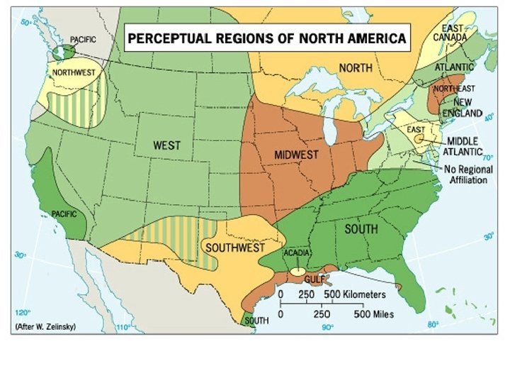
Regions 3. Perceptual Region/Vernacular: ideas in our minds, based on accumulated knowledge of places and regions, that define an area of “sameness” or “connectedness. ” � e. g. the South the Mid-Atlantic the Middle East
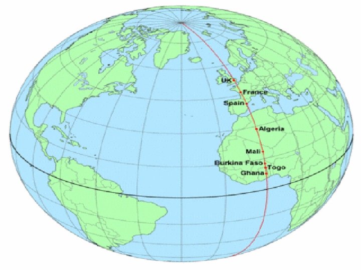
Toponyms are place names…. The meanings of regions are often contested. In Montgomery, Alabama, streets named after Confederate President Jefferson Davis and Civil Rights leader Rosa Parks intersect.
4. ) Movement Spatial analysis: the study of geography phenomena on the earth’s surface - how are things organized on Earth? - how do they appear on the landscape? - Why of where? and so what?
Geographic inquiry focuses on the SPATIAL: 1. Distance 2. Accessibility 3. Connectivity
Distance Decay Tobler’s First law of geography: Everything is related to everything else, but near things are more related than distant things. Therefore the interaction between places diminishes in intensity and frequency as distance between them increases
Distance Decay
Friction of distance The deterrent or inhibitory effects of distance on human activity �- The farther people have to travel, the less likely they are to do so. �- Examples?
Utility Utility: refers to a place’s usefulness to a particular person or group. � 1. Maximize the overall utility of places at � minimum effort � 2. Maximize connections between places at � minimum cost � 3. Locate related activities as close together � as possible
Accessibility The opportunity for contact or interaction from a given point in relation to other points �-“How easy or difficult is it to overcome the friction of distance? ” �-Is the “Place” isolated or easily accessible? Levels of Accessibility have changed throughout time
Connectivity Contact or interaction depends on channels of communication and transportation The tangible and intangible ways in which places are connected Ex: Telephone Lines, streets, pipelines, radio and TV broadcast
4 Basic Concepts of Spatial Interaction 1. Complementarity: There must be some form of Supply and Demand that match between places • • - world resources: oil, division of labor
4 Basic Concepts of Spatial Interaction 2. Transferability: Factors = the Cost of moving a particular item and the ability of the item to bear the cost - coal, fruits/vegetables, information - changes over time
4 Basic Concepts of Spatial Interaction 3. Intervening Opportunity: Alternative origins and destinations that arise between two points Principle of Intervening Opportunity “Spatial Interaction between an origin and a destination will be proportional to the number of opportunities at that destination and inversely proportional to the number or opportunities at alternative destinations”
4 Basic Concepts of Spatial Interaction 4. Spatial Diffusion: the way that things spread through space and over time Diffusion occurs as a function of statistical probability, based on principles of distance and movement Typically follows an S-curve: Slow Build, Rapid Spread, and Leveling Off
S-Curve for Diffusion
Culture is an all-encompassing term that identifies not only the whole tangible lifestyle of peoples, but also their prevailing values and beliefs. - cultural trait - cultural complex - cultural hearth
Diffusion - the process of dissemination, the spread of an idea or innovation from its hearth to other areas. What slows/prevents diffusion? - time-distance decay - cultural barriers
Types of Diffusion 1. Expansion Diffusion – idea or innovation spreads outward from the heart
Expansion Diffusion a. Contagious – spreads adjacently b. Hierarchical – spreads to most linked people or places first, often supersedes socioeconomic status. (ie. Rap music) c. Stimulus – idea promotes a local experiment or change in the way people do things.
Stimulus Diffusion Example: Because Hindus believe cows are holy, cows often roam the streets in villages and towns. The Mc. Donalds restaurants in India feature veggie burgers.
Types of Diffusion 2. Relocation Diffusion – movement of individuals who carry an idea or innovation with them to a new, perhaps distant locale. Kenya Paris, France
Example: Spatial distribution What processes create and sustain the pattern of a distribution? Map of Cholera Victims in London’s Soho District in 1854. The patterns of victim’s homes and water pump locations helped uncover the source of the disease.
Spatial Distribution The arrangement of items on the earth’s surface Analyzed by the elements common to all spatial distributions Density, Dispersion, and Pattern
Density The measure of the number or quantity of anything within a defined unit of area Always number in relation to area Normally used comparatively
Density GA pop. Density = 141 per/sq mi Is that a high density? Who knows… we must look comparatively � Ohio = 283, Michigan = 175, � New Jersey = 1210 Therefore GA has a low Density Wyoming = 6 League City? 1, 596 Houston? 3, 371 Texas? 102
Dispersion Spread of a phenomenon over an area Not how many or how much but how far things are spread out 1. Clustered/Agglomerated = spatially close together 2. Dispersed/Scattered = spread out �- Dispersion can change depending on scale
Pattern The geometric arrangement of objects in space Pattern refers to distribution, but the reference emphasizes design rather than spacing Types of Patterns: Linear, Centralized, and Random
Linear Pattern • Linear Patterns typically depict houses along a street or towns along a railroad
Centralized Pattern • Centralized Patterns typically involve items concentrated around a single node • Ex: Center City with surrounding
Random Pattern • An unstructured irregular distribution
Key Question: What are Geographic Questions?
Key Question: Why do Geographers use Maps, and What do Maps Tell Us?
Two Types of Maps: Reference Maps - Show locations of places and geographic features - Absolute locations What are reference maps used for? Thematic Maps (MĀĀĀPS) - Tell a story about the degree of an attribute, the pattern of its distribution, or its movement. - Relative locations What are thematic maps used for?
Reference Map
Thematic Maps Thematic Maps: a map depicting a specific spatial distribution or statistical variation of abstract objects (e. g. unemployment) in space TYPES: Graduated Circle, Dot-Distribution, Isopleth, and Choropleth
Thematic Map What story about median income in the Washington, DC area is this map telling?
• • Graduate Circle Map Uses circles of different sizes to show the frequency of occurrence of a certain topic
• • Dot-distribution Map A single of specified number of occurrences are recorded by a single dot
• • • Isopleth Map Calculation refers not to a point but to an areal statistic The isoline connects average values per unit
• • Choropleth Map Present average value of the data studied per preexisting areal unit
MAPS HAVE DISTORTION!! Some parts aren’t accurate, because the world is not flat.
Area To compare geographical data on a level playing field, pick a projection that maintains the correct proportions among the sizes of Earth’s landmasses. ► Such a map, often called an equal-area projection, would be useful to demographers. ► The price of getting the sizes right, however, is distortion in the shapes of the continents. ►
Shape Preserving the shape of a landmass—an important concern for those wanting to see what Earth “really” looks like—gets harder as the area covered gets larger. ► A world map can only preserve the continents’ shapes by distorting their sizes. Maps that stress shape are called conformal. ►
Distance Geometry students the world over learn that the shortest distance between two points is a line. Not on most maps. ► If distance is the focus of your map, choose a projection centered on a key point. Lines radiating from the middle will be equidistant. ► Shapes and sizes will be distorted, however, especially at the outer edges. ►
Direction Many navigational charts rely on projections focused on direction. Such maps, usually centered on one place, allow mariners to plot a journey they can actually sail without constant course corrections. ► That ability matters far more at sea than shapes and sizes, which can get distorted. ►
Globe Directions—True Distances—True Shapes—True Areas—True Great circles—The shortest distance between any two points on the surface of the Earth can be found quickly and easily along a great circle. Disadvantages: Even the largest globe has a very small scale and shows relatively little detail. Costly to reproduce and update. Difficult to carry around. Bulky to store.
Mercator Used for navigation or maps of equatorial regions. Any straight line on the map is a rhumb line (line of constant direction). Directions along a rhumb line are true between any two points on map, but a rhumb line is usually not the shortest distance between points. Distances are true only along Equator, but are reasonably correct within 15° of Equator; special scales can be used to measure distances along other parallels. Areas and shapes of large areas are distorted. Distortion increases away from Equator and is extreme in polar regions. Map, however, is conformal in that angles and shapes within any small area (such as that shown by USGS topographic map) is essentially true. The map is not perspective, equal area, or equidistant. Equator and other parallels are straight lines (spacing increases toward poles) and meet meridians (equally spaced straight lines) at right angles.
Robinson Uses tabular coordinates rather than mathematical formulas to make the world "look right. " Better balance of size and shape of high-latitude lands than in Mercator. Soviet Union, Canada, and Greenland truer to size, but Greenland compressed. Directions true along all parallels and along central meridian. Distances constant along Equator and other parallels, but scales vary. Distortion: All points have some. Very low along Equator and within 45° of center. Greatest near the poles. Used in Goode's Atlas, adopted for National Geographic's world maps in 1988, appears in growing number of other publications, may replace Mercator in many classrooms. Presented by Arthur H. Robinson in 1963.
Peters Arno Peters writes in The New Cartography: “Philosophers, astronomers, historians, popes and mathematicians have all drawn global maps long before cartographers as such existed. Cartographers appeared in the "Age of Discovery", which developed into the Age of European Conquest and Exploitation and took over the task of making maps. By the authority of their profession they have hindered its development. Since Mercator produced his global map over four hundred years ago for the age of Europeans world domination, cartographers have clung to it despite its having been long outdated by events. They have sought to render it topical by cosmetic corrections. . The European world concept, as the last expression of a subjective global view of primitive peoples, must give way to an objective global concept. The cartographic profession is, by its retention of old precepts based on the Eurocentric global concept, incapable of developing this egalitarian world map which alone can demonstrate the parity of all peoples of the earth” Sometimes referred to as the Gall-Peters map. Created 1967.
The true size of Africa
Mental Maps: • maps we carry in our minds of places we have been and places we have heard of. – can see: terra incognita, landmarks, paths, and accessibility Activity Spaces: • the places we travel to routinely in our rounds of daily activity. – How are activity spaces and mental maps related?
terra incognita
Geographic Information System: a collection of computer hardware and software that permits storage and analysis of layers of spatial data.
Remote Sensing: a method of collecting data by instruments that are physically distant from the area of study.
Key Question: Why are Geographers Concerned with Scale and Connectedness?
Scale is the territorial extent of something. The observations we make and the context we see vary across scales, such as: - local - regional - national - global
Scal e
Scale is a powerful concept because: Processes operating at different scales influence one another. What is occurring across scales provides context for us to understand a phenomenon. People can use scale politically to change involved or how an issue is perceived. who is
THE IMPORTANCE OF “PHYSICAL GEOGRAPHY” TO “HUMAN GEOGRAPHY” (ENVIRONMENT)
Koppen Classification System of Climates http: //www. uwsp. edu/geo/faculty/ritter/geog 101/textbook/climate_systems/climate_classification. html Climate Types 1. Humid Equatorial Climates (Tropical: Class A) Af – no dry season Am – Short dry season Aw – dry winters (S. W. Florida) 2. Dry Climates (Dry: Class B) Bs – Semiarid Bw – Arid 3. Humid Temperate Climates (Temperate: Class C) Cf – no dry season Cw – dry winter Cs – dry summer 4. Humid Cold Climates (Cold: Class D) Df – no dry season Dw – dry winter 5. Cold Polar (tundra and ice) (Polar: Class E)
Other ideas related to climate… Greenhouse Effects (anthropogenic – human caused) – Global Warming caused by the release of greenhouse gases ENSO – (El Nino Southern Oscillation) – areas of regional warming Soils – (fertility and degradation) Global Distribution of Precipitation � Monsoons – system of low-level winds blowing into a continent in Summer and out of it in the winter (Southern Asia) � Intensity – Regularity
Ecosystems or Ecological Systems Ecosystems are living communities of plants and animals that share common characteristics – primarily related to climate, soil, and vegetation � Abiotic Elements – those that are non-living but that affect systems (water, heat, relief, nutrients, rocks, atmosphere) � Biotic Elements – those living elements of the ecosystem (plants and animals) Food Chains (sequences of consumption) Biomes (large subdivisions of terrestrial ecosystems found in the world)
Major Biomes and Desertification of the Sahel Major Biomes � Tundra � Boreal Forest or Taiga � Temperate Broadleaf Deciduous Forest � Tropical Broadleaf Evergreen Forest � Tropical Savanna � Desertscrub � Temperate Grasslands � Mediterranean Scrub Desertification of the Sahel �A semiarid region of north-central Africa south of the Sahara Desert. Since the 1960 s it has been afflicted by prolonged periods of extensive drought.
The Management of Global Ecosystems sustainability – main method of management Major Problems � Tropical Rainforests – Removal of trees results in removal of nutrients for soil, less oxygen produced and more CO 2 remains in the atmosphere � Acid Rain – sulfur dioxides and nitrogen oxides emitted from power stations are carried by winds and when precipitation occurs it pollutes lakes and rivers (pollution from Britain and Western Europe has damaged Scandinavia and Eastern European countries: also, pollution from the Midwestern states has damaged the Great Lakes and Eastern Canada
Absolute Location Mathematical location �Latitude & Longitude degrees, �Township minutes, seconds & Range (1785 Land Ordinance) Subdivision: parallels & meridians Topographic quadrangle, US Geological Survey �Metes is & Bounds a system or method of describing land, 'real' property (in contrast to personal property) or
Latitude & Longitude Hong Kong 22º N, 114º E
Longitude and Latitude Meridian: an arc drawn between North and South Poles Parallel: circle drawn around the globe parallel to the equator and at right angles to the Meridians
Longitude and Latitude Location of Meridians are determined by a numbering system known as Longitude � 0° Longitude = Greenwich England � The Prime Meridian
Longitude and Latitude: numbering system used to represent parallels Equator = 0° N. Pole = 90 °N S. Pole = 90 °S
Longitude and Latitude Longitude: numbering system used to represent meridians Optimus Prime Meridian = 0 ° Longitude Lines in 15 ° intervals either East or West
Physical Characteristics
Development of Geographic Thought “Four Traditions of Geography” Earth Science Tradition (physical geography approach) Locational Tradition (use of satellite imagingmapping) Cultural-Environment Tradition (impact of deforestation) Area-Analysis Tradition (regional patterns of development)
Development of Geographic African Thought Union Why Geography Matters [De. Blij’s address to NCGE (National Council of Geographic European Education) – 1999] European Economic Union Age of Exploration (China, European, Islamic) Commission Globalization (expansion of economic and political activities aided by information technology and transportation) Devolution (regions within countries demanding autonomy) Supranationalism (E. E. C. , A. U. , E. U. ) Environmental Degradation Remote Sensing (spy satellites – used in Iraq and Afghanistan)