AN OVERVIEW OF TROPICAL CYCLONE PREDICTION AT THE




- Slides: 25

AN OVERVIEW OF TROPICAL CYCLONE PREDICTION AT THE MET OFFICE Julian Heming International workshop on measuring high-wind speeds over the ocean 17 November 2016

Outline • Why is the Met Office interested in tropical cyclones? • Timeline of tropical cyclone prediction at the Met Office • Forecast products • Data assimilation and initialisation • Observations (measurements!) • Moving to higher resolution • Summary © Crown copyright Met Office

Why is the Met Office interested in tropical cyclones?

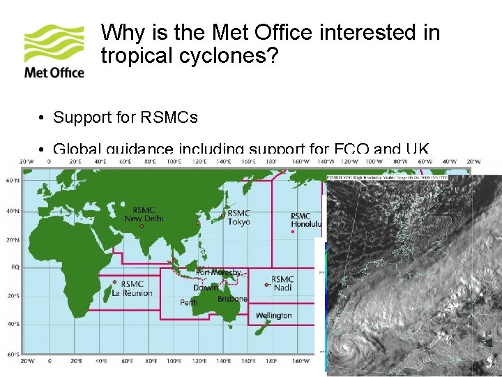
Why is the Met Office interested in tropical cyclones? • Support for RSMCs • Global guidance including support for FCO and UK interests overseas • Global Model development • Unified Model partners and collaborators in tropics • Extratropical transition © Crown copyright Met Office

Timeline of tropical cyclone prediction at the Met Office

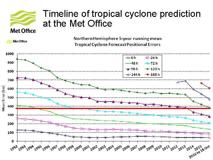
Timeline of tropical cyclone prediction at the Met Office • Early 1990 s started verifying model performance • Mid-1990 s initialisation scheme reduced track forecast errors by 30% • Mid-1990 s issuing ‘guidance messages’ worldwide • Large impact changes in last 15 years • New Dynamics, 4 D-Var, ENDGame • Removal of old initialisation scheme • Assimilation of central pressure • Track forecast errors on a long-term downwards trend © Crown copyright Met Office

Forecast products

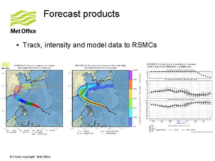
Forecast products • Track, intensity and model data to RSMCs © Crown copyright Met Office

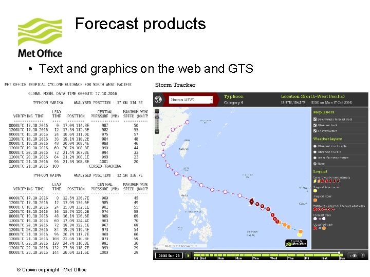
Forecast products • Text and graphics on the web and GTS © Crown copyright Met Office

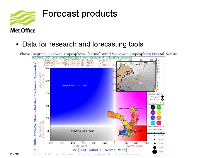
Forecast products • Data for research and forecasting tools © Crown copyright Met Office

Data assimilation and initialisation

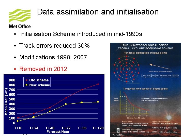
Data assimilation and initialisation • Initialisation Scheme introduced in mid-1990 s • Track errors reduced 30% • Modifications 1998, 2007 • Removed in 2012 © Crown copyright Met Office

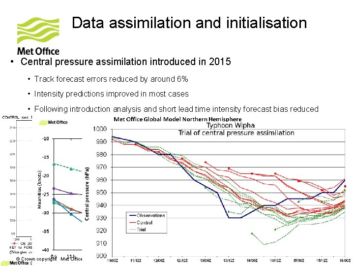
Data assimilation and initialisation • Central pressure assimilation introduced in 2015 • Track forecast errors reduced by around 6% • Intensity predictions improved in most cases • Following introduction analysis and short lead time intensity forecast bias reduced 2014 © Crown copyright Met Office 2015

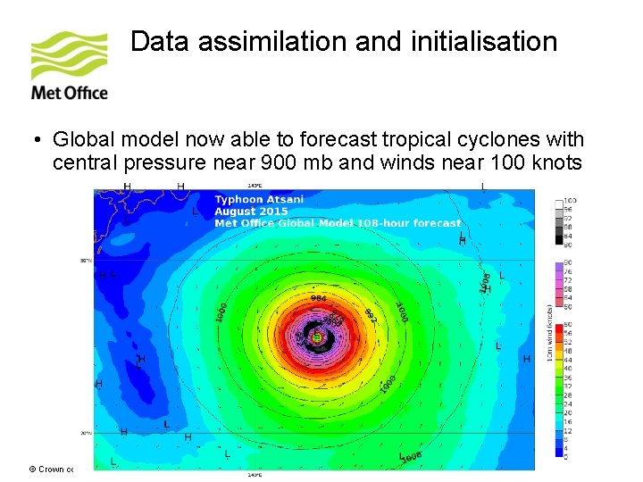
Data assimilation and initialisation • Global model now able to forecast tropical cyclones with central pressure near 900 mb and winds near 100 knots © Crown copyright Met Office

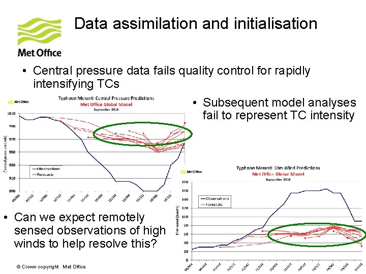
Data assimilation and initialisation • Central pressure data fails quality control for rapidly intensifying TCs • Subsequent model analyses fail to represent TC intensity • Can we expect remotely sensed observations of high winds to help resolve this? © Crown copyright Met Office

Observations

Observations • Increasing requirement to initialise, forecast and verify structure of tropical cyclones in models • Remotely sensed wind observations contribute by: • Direct assimilation into models • Feeding objective methodologies (e. g. John Knaff’s talk on Tuesday) • Informing tropical cyclone warning centre analysis © Crown copyright Met Office

Observations • Joint Typhoon Warning Center (JTWC) recent comments on the usefulness of remotely sensed winds around tropical cyclones: • Without aerial reconnaissance, remotely sensed measurements of winds are absolutely critical to our mission • A good scatterometer pass provides more than just the location and intensity of a tropical cyclone low level centre, it helps us characterise the wind structure • Even with a readily apparent well defined eye, tropical cyclone structure analysis from products like scatterometer, SSMI winds and GCOM winds help us estimate the radius of maximum winds and 34 and 50 knot winds • Getting an accurate analysis is not only essential for producing a good forecast, but as we report these data to modelling centres, it also impacts the quality of numerical weather prediction © Crown copyright Met Office

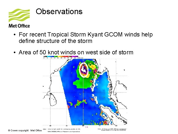
Observations • For recent Tropical Storm Kyant GCOM winds help define structure of the storm • Area of 50 knot winds on west side of storm © Crown copyright Met Office

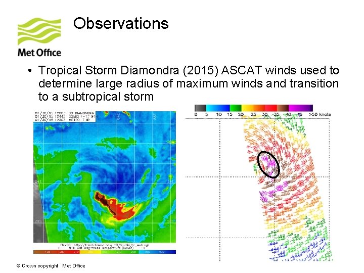
Observations • Tropical Storm Diamondra (2015) ASCAT winds used to determine large radius of maximum winds and transition to a subtropical storm © Crown copyright Met Office

Moving to higher resolution

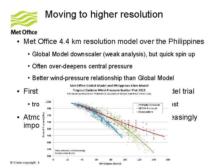
Moving to higher resolution • Met Office 4. 4 km resolution model over the Philippines • Global Model downscaler (weak analysis), but quick spin up • Often over-deepens central pressure • Better wind-pressure relationship than Global Model • First results from 10 km resolution Global Model trial • tropical cyclones more intense, particularly in forecast • Atmosphere-ocean coupling will become increasingly important for tropical cyclone modeling © Crown copyright Met Office

Summary

Summary • Met Office tropical cyclone track forecasts still improving • Intensity predictions also improving, but a weak bias present in the analysis and short period forecast • Analysis of tropical cyclone structure by warning centres benefits greatly from remotely sensed observations • Forecast models (even global) increasingly able to handle high intensity tropical cyclones with tight gradients • Models need observations and data assimilation techniques to better analyse intense tropical cyclones and improve forecasts further © Crown copyright Met Office

THE END © Crown copyright Met Office