An interactive WebGIS application for identifying flood vulnerable
An interactive Web-GIS application for identifying flood vulnerable areas based on GNSS meteorology Hoda Tahami, Jihye Park, Majidreza Farahani School of Civil and Construction Engineering Oregon State University August 2019
Presenter Info • Hoda Tahami is a Ph. D candidate and gradaute research assistant in Geomatics program at Oregon State University working under supervision of Dr. Park. • She received her Master of Science in Geospatial Information System with mainly focus on web and mobile GIS applications. • Her Ph. D research focuses mainly involve space geodetic techniques for atmospheric monitoring/prediction • Sample of her web GIS and geovisualization projects can be found at: https: //hodatahami. github. io/bootstrapreposi toriesdesign/
Outline • Background in Severe Weather Study • The Preliminary Study on prediction of a storm path using GNSS • A short-term forecasting for storm-induced Precipitation using GNSS-Meteorology • A web-GIS perspective on meteorological hazard monitoring using GNSS remote sensing • Conclusion
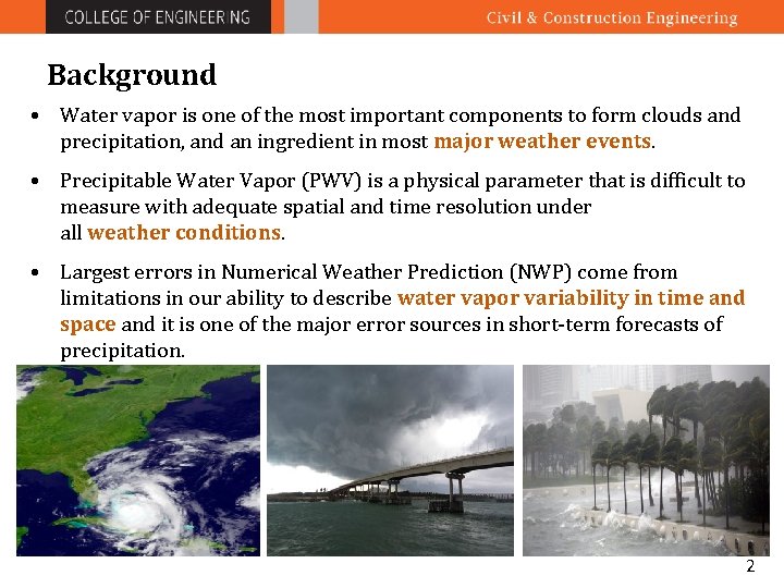
Background • Water vapor is one of the most important components to form clouds and precipitation, and an ingredient in most major weather events. • Precipitable Water Vapor (PWV) is a physical parameter that is difficult to measure with adequate spatial and time resolution under all weather conditions. • Largest errors in Numerical Weather Prediction (NWP) come from limitations in our ability to describe water vapor variability in time and space and it is one of the major error sources in short-term forecasts of precipitation. 2
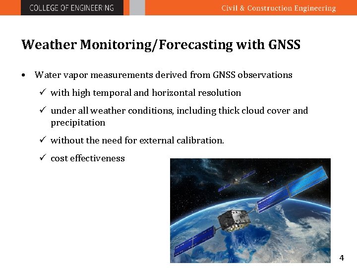
Weather Monitoring/Forecasting with GNSS • Water vapor measurements derived from GNSS observations ü with high temporal and horizontal resolution ü under all weather conditions, including thick cloud cover and precipitation ü without the need for external calibration. ü cost effectiveness 4
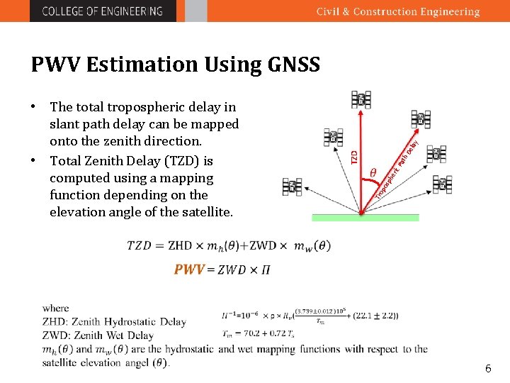
th De po sp he ric Tro Pa TZD • The total tropospheric delay in slant path delay can be mapped onto the zenith direction. • Total Zenith Delay (TZD) is computed using a mapping function depending on the elevation angle of the satellite. lay PWV Estimation Using GNSS 6
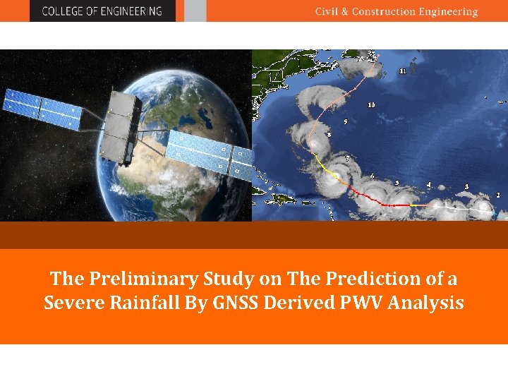
The Preliminary Study on The Prediction of a Severe Rainfall By GNSS Derived PWV Analysis
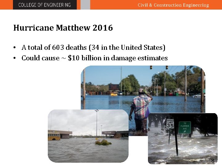
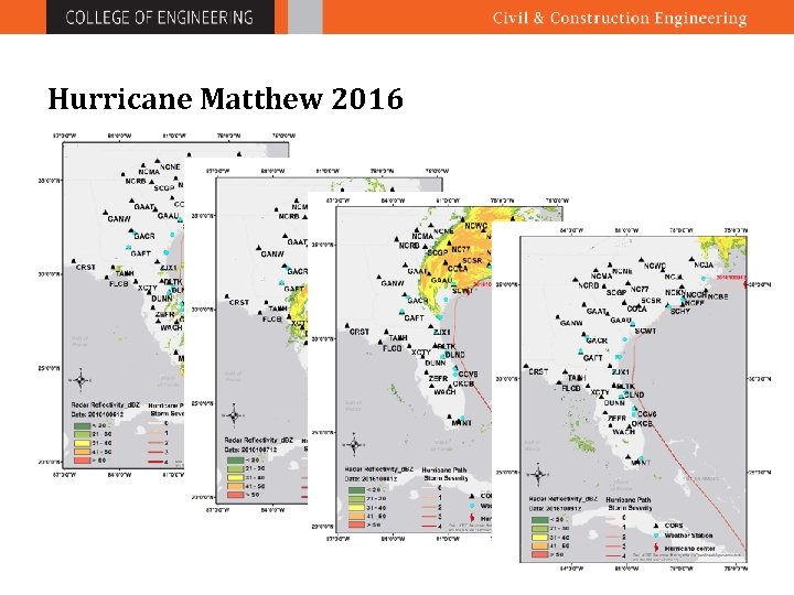
Hurricane Matthew 2016 • A total of 603 deaths (34 in the United States) • Could cause ~ $10 billion in damage estimates 8
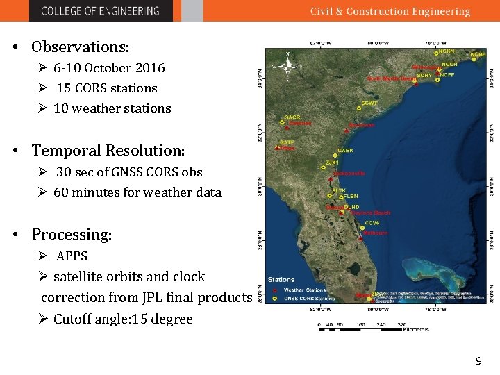
• Observations: Ø 6 -10 October 2016 Ø 15 CORS stations Ø 10 weather stations • Temporal Resolution: Ø 30 sec of GNSS CORS obs Ø 60 minutes for weather data • Processing: Ø APPS Ø satellite orbits and clock correction from JPL final products Ø Cutoff angle: 15 degree 9
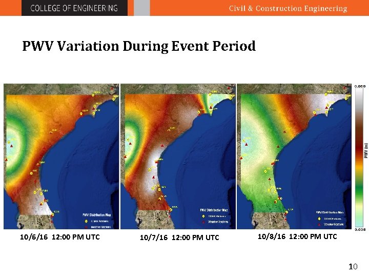
PWV Variation During Event Period 10/6/16 12: 00 PM UTC 10/7/16 12: 00 PM UTC 10/8/16 12: 00 PM UTC 10
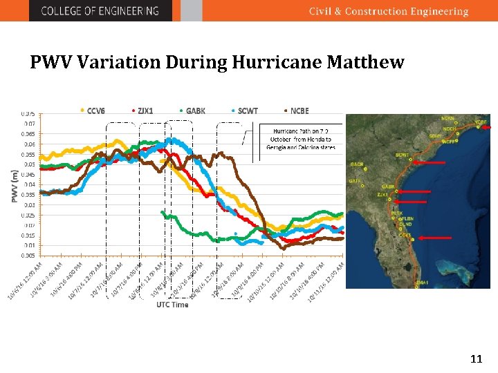
PWV Variation During Hurricane Matthew 11
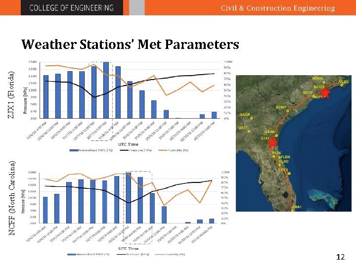
NCFF (North Carolina) ZJX 1 (Florida) Weather Stations’ Met Parameters 12
A Short-term Forecasting For Hurricane-induced Precipitation Using GNSS Meteorology
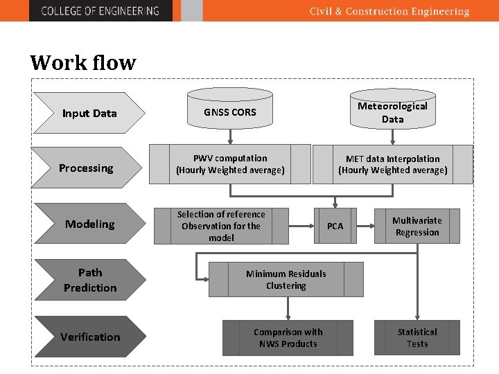
Work flow Input Data Processing Modeling GNSS CORS Meteorological Data PWV computation (Hourly Weighted average) MET data Interpolation (Hourly Weighted average) Selection of reference Observation for the model Path Prediction Minimum Residuals Clustering Verification Comparison with NWS Products PCA Multivariate Regression Statistical Tests

Case Study • Hurricane Matthew • Observations: Ø 5 -11 October 2016 Ø 38 CORS stations Ø 14 weather stations • Temporal Resolution: Ø 5 minutes for CORS Ø 60 minutes for weather data The blue circles shows the stations used for deriving the model’s coefficients.
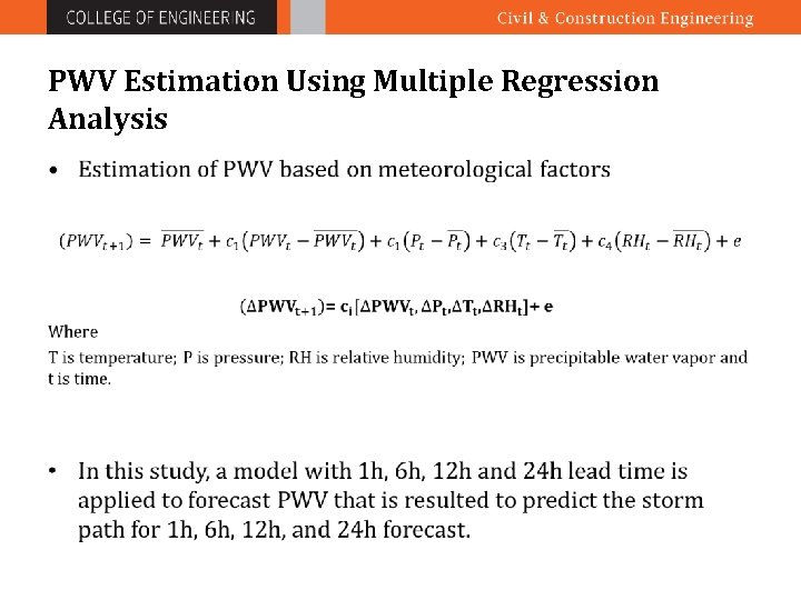
PWV Estimation Using Multiple Regression Analysis •
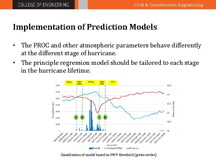
Implementation of Prediction Models • The PROC and other atmospheric parameters behave differently at the different stage of hurricane. • The principle regression model should be tailored to each stage in the hurricane lifetime. Classification of model based on PWV threshold (green circles)
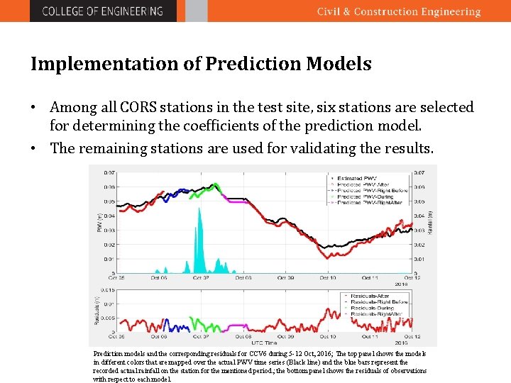
Implementation of Prediction Models • Among all CORS stations in the test site, six stations are selected for determining the coefficients of the prediction model. • The remaining stations are used for validating the results. Prediction models and the corresponding residuals for CCV 6 during 5 -12 Oct, 2016; The top panel shows the models in different colors that are mapped over the actual PWV time series (Black line) and the blue bars represent the recorded actual rainfall on the station for the mentioned period. ; the bottom panel shows the residuals of observations with respect to each model.
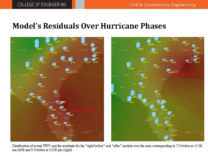
Model’s Residuals Over Hurricane Phases Distribution of actual PWV and the residuals for the “right before” and “after” models over the area corresponding to 7 October at 11: 00 am (left) and 8 October at 12: 00 pm (right).
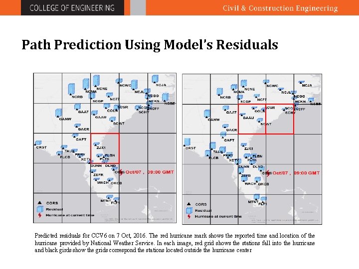
Path Prediction Using Model’s Residuals Predicted residuals for CCV 6 on 7 Oct, 2016. The red hurricane mark shows the reported time and location of the hurricane provided by National Weather Service. In each image, red grid shows the stations fall into the hurricane and black girds show the grids correspond the stations located outside the hurricane center
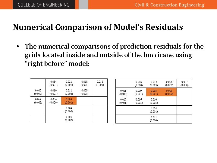
Numerical Comparison of Model’s Residuals • The numerical comparisons of prediction residuals for the grids located inside and outside of the hurricane using “right before” model:
Hurricane Matthew 2016
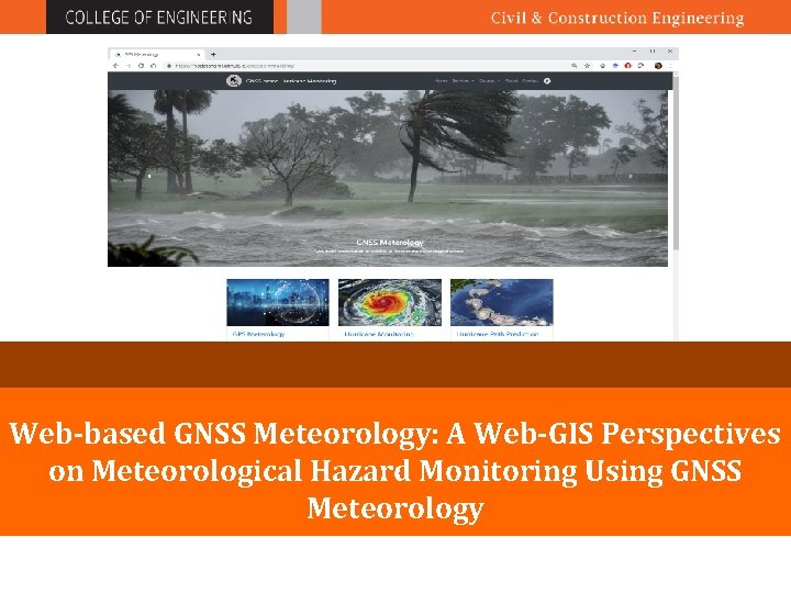
Web-based GNSS Meteorology: A Web-GIS Perspectives on Meteorological Hazard Monitoring Using GNSS Meteorology
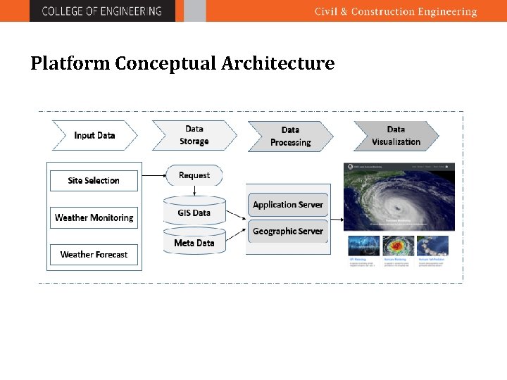
Platform Conceptual Architecture
Web map libraries Development of the responsive web thematic map is done by applying several java scripts libraries including: • Bootstrap • Carto. DB, • Leaflet • D 3 • Spatial. Sankey
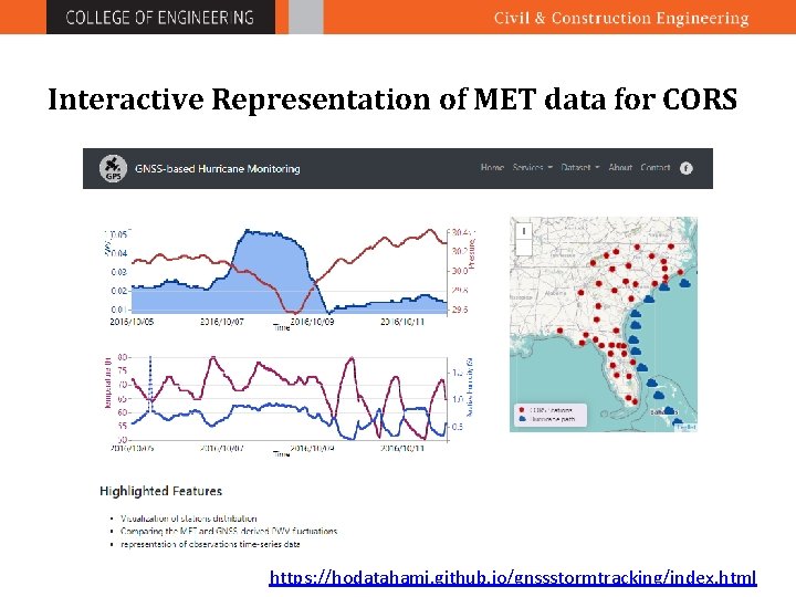
Interactive Representation of MET data for CORS https: //hodatahami. github. io/gnssstormtracking/index. html
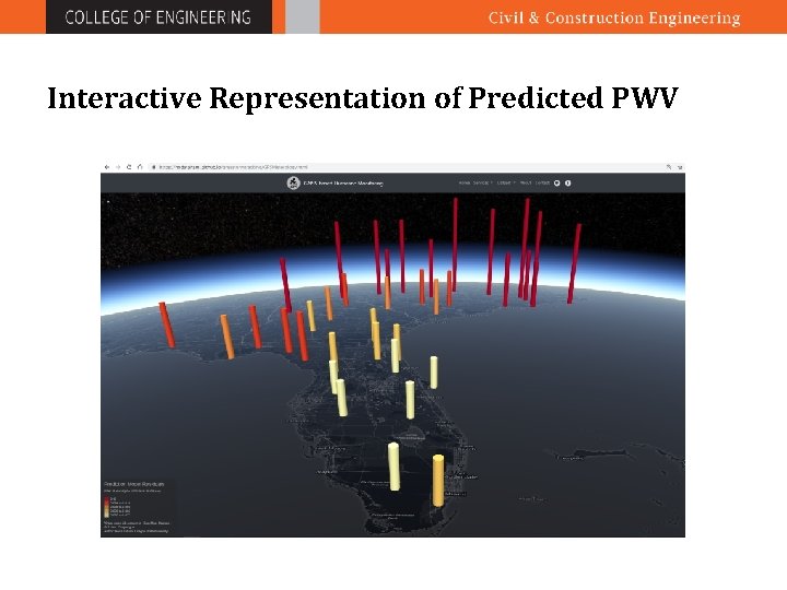
Interactive Representation of Predicted PWV
Conclusion • In ground-based GNSS meteorology, by using the spatial- temporal variability of PWV derived from GNSS observations and meteorological variables, a short-term forecasting method is established to track the hurricane and its intensity using Principle Component Regression (PCR) • The distribution pattern of the predicted PWV residual, and its magnitude in the region can be used for storm tracking. • By combining geo-visualization technique with predicted GNSSderived PWV, the vulnerability to flooding due to potential sever rainfall are effectively provided in near real-time.

Thank you Questions? !
- Slides: 29