An Analysis Of Some Tropical Cyclone Boundary Layer
An Analysis Of Some Tropical Cyclone Boundary Layer Wind Observations Jeff Kepert Bureau of Meteorology Research Centre Acknowledgements: Data from NOAA/HRD and NOAA/NHC, profile code from Hugh Willoughby, guidance from James Franklin, Greg Holland, Dale Hess and Yuqing Wang. This work was partially supported by the U. S. Office of Naval Research under grant N-0014094 -1 -0493.
Introduction • Purpose is to test predictions from earlier numerical and analytical modelling work against observations. Outline • Summarize theoretical and modelling results • Compare with data from several tropical cyclones. • Conclusions
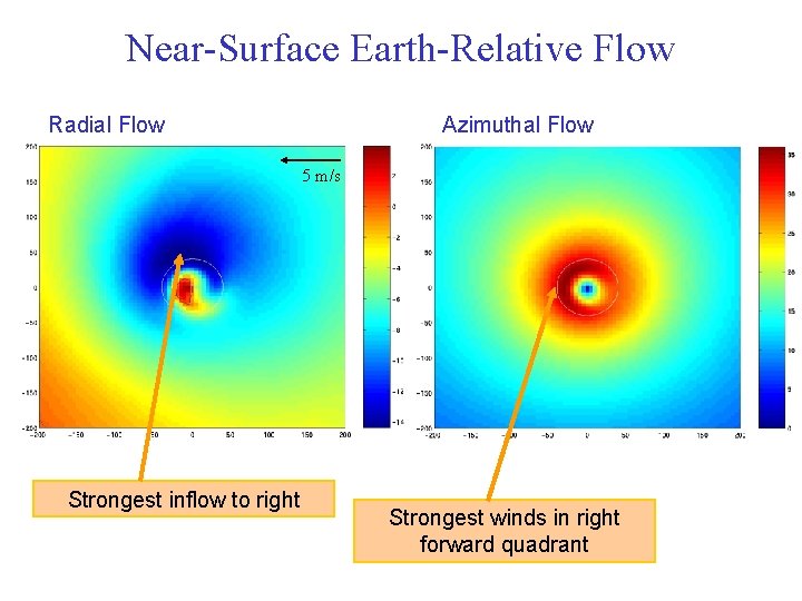
Near-Surface Earth-Relative Flow Radial Flow Azimuthal Flow 5 m/s Strongest inflow to right Strongest winds in right forward quadrant
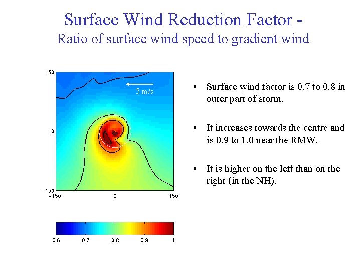
Surface Wind Reduction Factor Ratio of surface wind speed to gradient wind 5 m/s • Surface wind factor is 0. 7 to 0. 8 in outer part of storm. • It increases towards the centre and is 0. 9 to 1. 0 near the RMW. • It is higher on the left than on the right (in the NH).
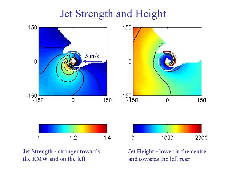
Jet Strength and Height 5 m/s Jet Strength - stronger towards the RMW and on the left Jet Height - lower in the centre and towards the left rear.
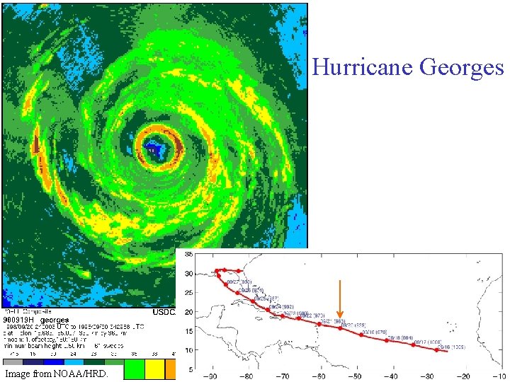
Hurricane Georges Image from NOAA/HRD.
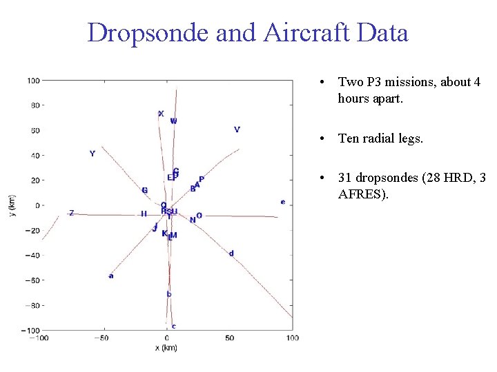
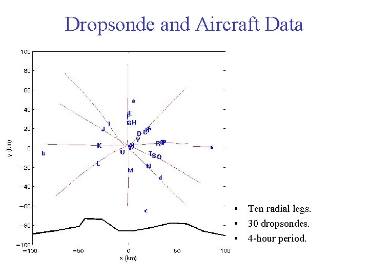
Dropsonde and Aircraft Data • Two P 3 missions, about 4 hours apart. • Ten radial legs. • 31 dropsondes (28 HRD, 3 AFRES).
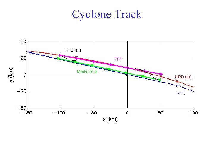
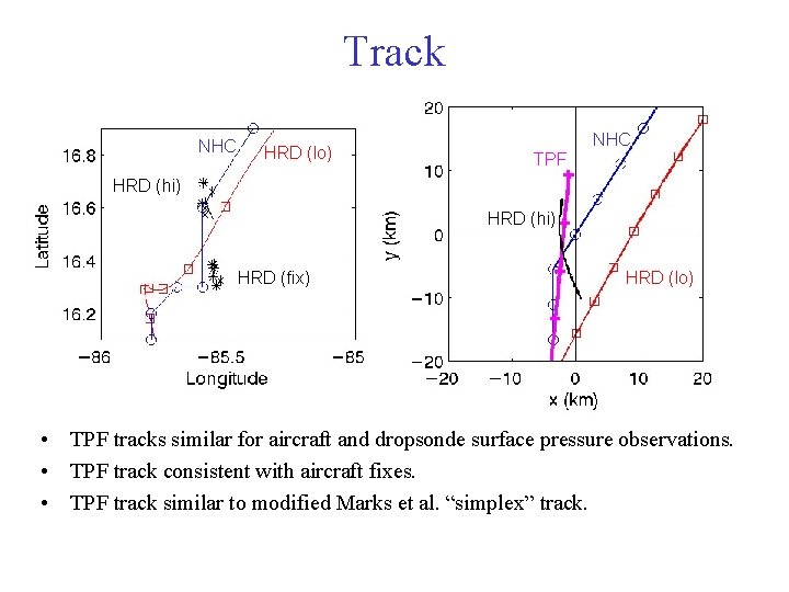
Cyclone Track HRD (hi) TPF Marks et al. HRD (lo) NHC
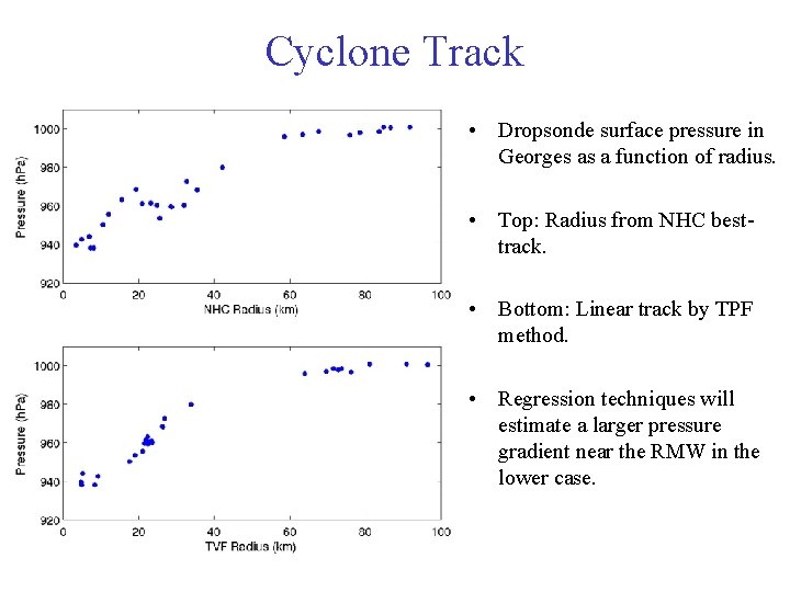
Cyclone Track • Dropsonde surface pressure in Georges as a function of radius. • Top: Radius from NHC besttrack. • Bottom: Linear track by TPF method. • Regression techniques will estimate a larger pressure gradient near the RMW in the lower case.
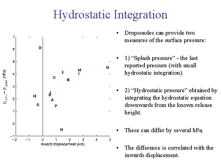
Hydrostatic Integration • Dropsondes can provide two measures of the surface pressure: • 1) “Splash pressure” - the last reported pressure (with small hydrostatic integration). • 2) “Hydrostatic pressure” obtained by integrating the hydrostatic equation downwards from the known release height. • These can differ by several h. Pa. • The difference is correlated with the inwards displacement.
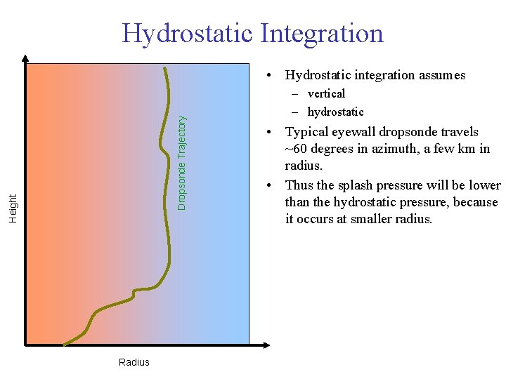
Hydrostatic Integration Height Dropsonde Trajectory • Hydrostatic integration assumes Radius – vertical – hydrostatic • Typical eyewall dropsonde travels ~60 degrees in azimuth, a few km in radius. • Thus the splash pressure will be lower than the hydrostatic pressure, because it occurs at smaller radius.
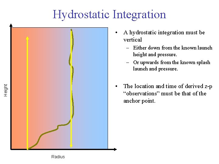
Hydrostatic Integration • A hydrostatic integration must be vertical – Either down from the known launch height and pressure. – Or upwards from the known splash launch and pressure. Height • The location and time of derived z-p “observations” must be that of the anchor point. Radius
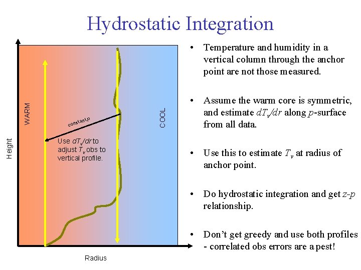
Hydrostatic Integration Height tant cons p Use d. Tv/dr to adjust Tv obs to vertical profile. COOL WARM • Temperature and humidity in a vertical column through the anchor point are not those measured. • Assume the warm core is symmetric, and estimate d. Tv/dr along p-surface from all data. • Use this to estimate Tv at radius of anchor point. • Do hydrostatic integration and get z-p relationship. • Don’t get greedy and use both profiles - correlated obs errors are a pest! Radius
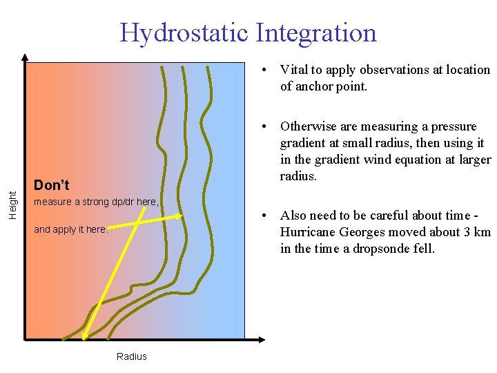
Hydrostatic Integration Height • Vital to apply observations at location of anchor point. • Otherwise are measuring a pressure gradient at small radius, then using it in the gradient wind equation at larger radius. Don’t measure a strong dp/dr here, • Also need to be careful about time Hurricane Georges moved about 3 km in the time a dropsonde fell. and apply it here. Radius
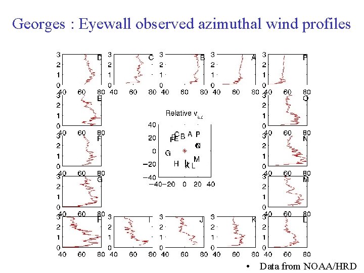
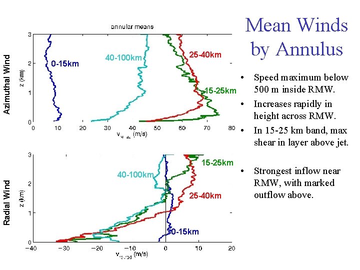
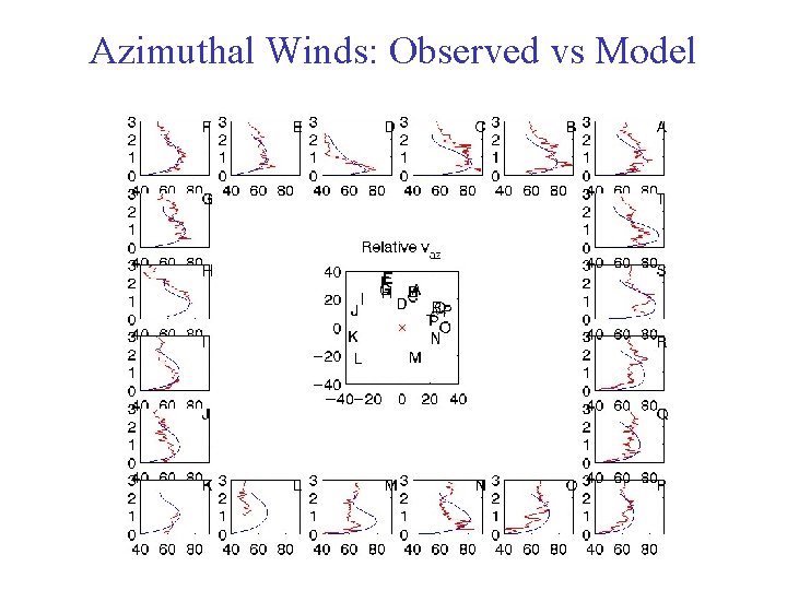
Georges : Eyewall observed azimuthal wind profiles • Data from NOAA/HRD
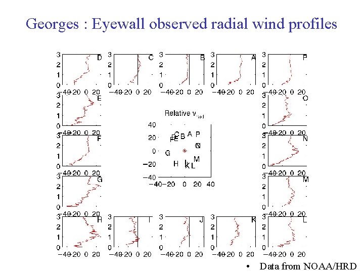
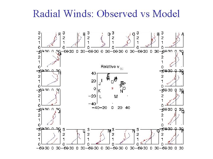
Georges : Eyewall observed radial wind profiles • Data from NOAA/HRD
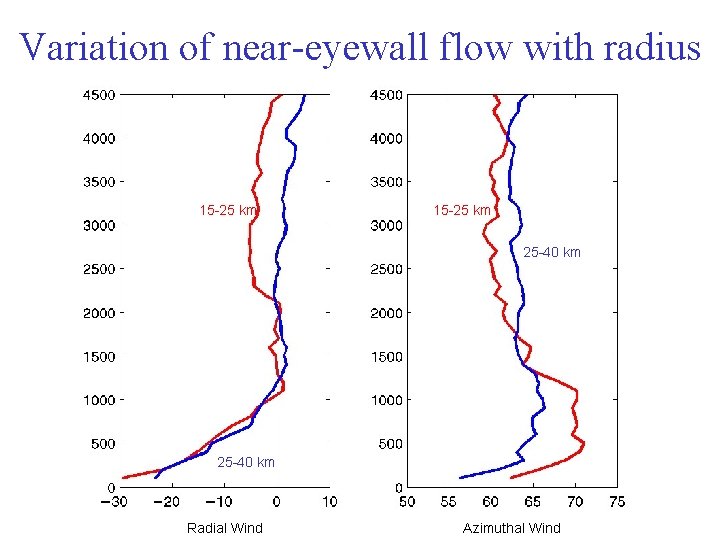
Variation of near-eyewall flow with radius 15 -25 km 25 -40 km Radial Wind Azimuthal Wind
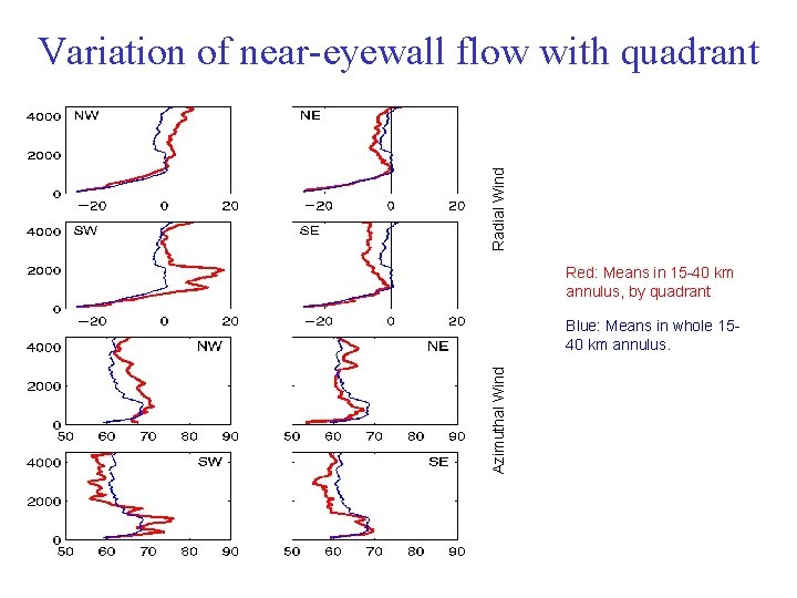
Radial Wind Variation of near-eyewall flow with quadrant Red: Means in 15 -40 km annulus, by quadrant Azimuthal Wind Blue: Means in whole 1540 km annulus.
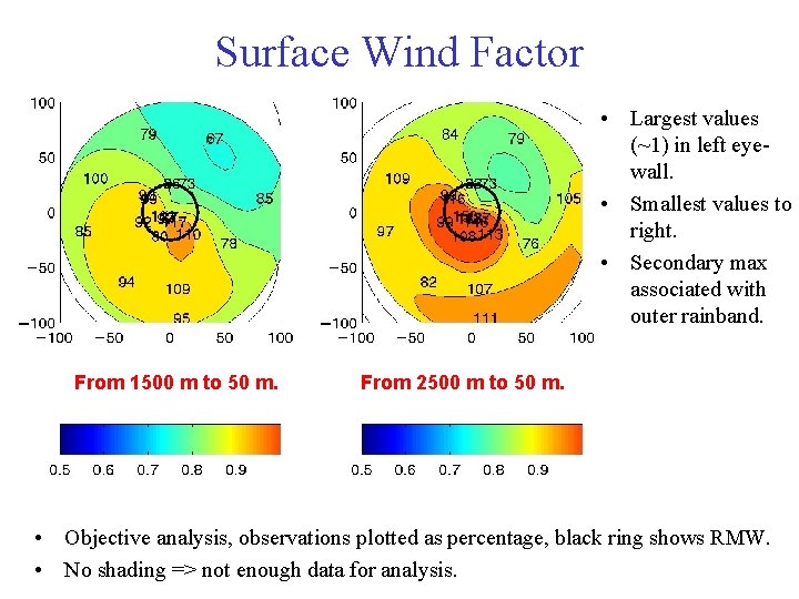
Surface Wind Factor • Largest values (~1) in left eyewall. • Smallest values to right. • Secondary max associated with outer rainband. From 1500 m to 50 m. From 2500 m to 50 m. • Objective analysis, observations plotted as percentage, black ring shows RMW. • No shading => not enough data for analysis.
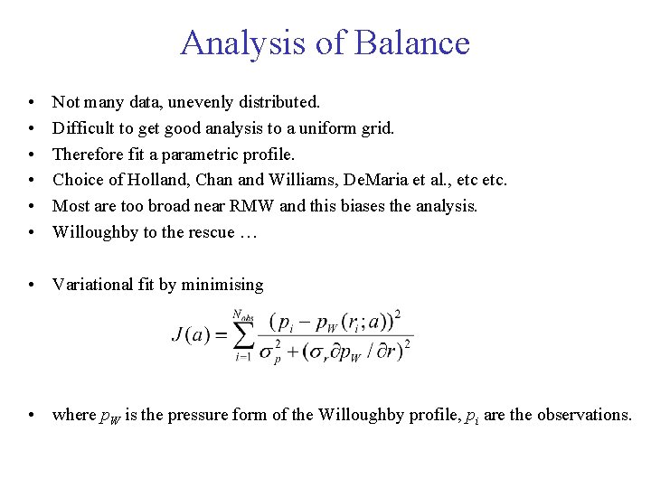
Analysis of Balance • • • Not many data, unevenly distributed. Difficult to get good analysis to a uniform grid. Therefore fit a parametric profile. Choice of Holland, Chan and Williams, De. Maria et al. , etc. Most are too broad near RMW and this biases the analysis. Willoughby to the rescue … • Variational fit by minimising • where p. W is the pressure form of the Willoughby profile, pi are the observations.
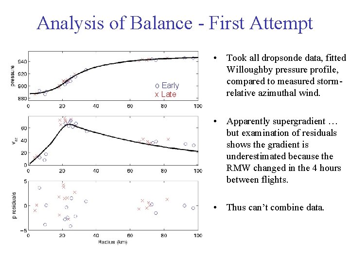
Analysis of Balance - First Attempt o Early x Late • Took all dropsonde data, fitted Willoughby pressure profile, compared to measured stormrelative azimuthal wind. • Apparently supergradient … but examination of residuals shows the gradient is underestimated because the RMW changed in the 4 hours between flights. • Thus can’t combine data.
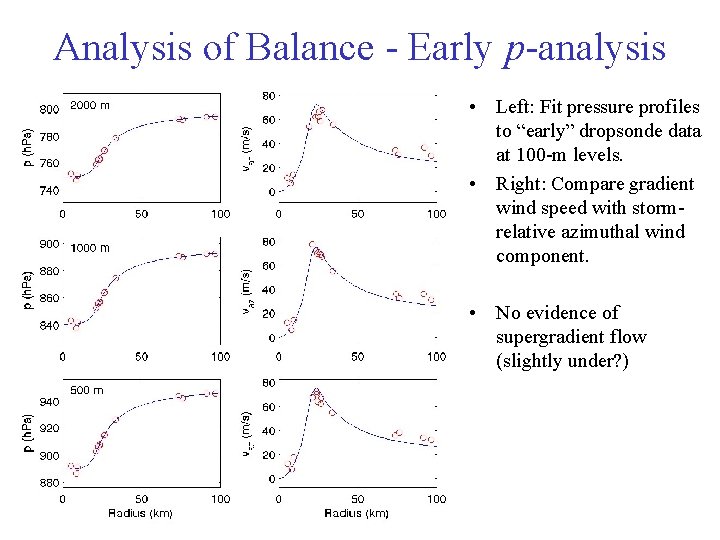
Analysis of Balance - Early p-analysis • Left: Fit pressure profiles to “early” dropsonde data at 100 -m levels. • Right: Compare gradient wind speed with stormrelative azimuthal wind component. • No evidence of supergradient flow (slightly under? )
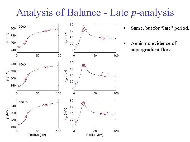
Analysis of Balance - Late p-analysis • Same, but for “late” period. • Again no evidence of supergradient flow.
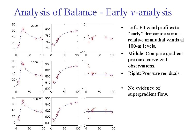
Analysis of Balance - Early v-analysis • Left: Fit wind profiles to “early” dropsonde stormrelative azimuthal winds at 100 -m levels. • Middle: Compare gradient pressure curve with observations. • Right: Pressure residuals. • No evidence of supergradient flow.
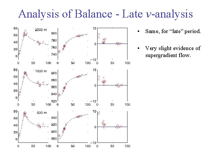
Analysis of Balance - Late v-analysis • Same, for “late” period. • Very slight evidence of supergradient flow.
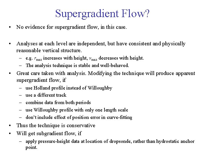
Supergradient Flow? • No evidence for supergradient flow, in this case. • Analyses at each level are independent, but have consistent and physically reasonable vertical structure. – e. g. rmax increases with height, vmax decreases with height. – The analysis technique is stable and well-behaved. • Great care taken with analysis. Modifying the technique will produce apparent supergradient flow, if – – – use Holland profile instead of Willoughby use a different track combine data from both periods use Willoughby profile with only one length scale don’t include effect of position error in curve-fitting • Thus the technique is conservative • Will get subgradient flow, if – apply pressure-height data at location of dropsonde, rather than hydrostatic anchor point.
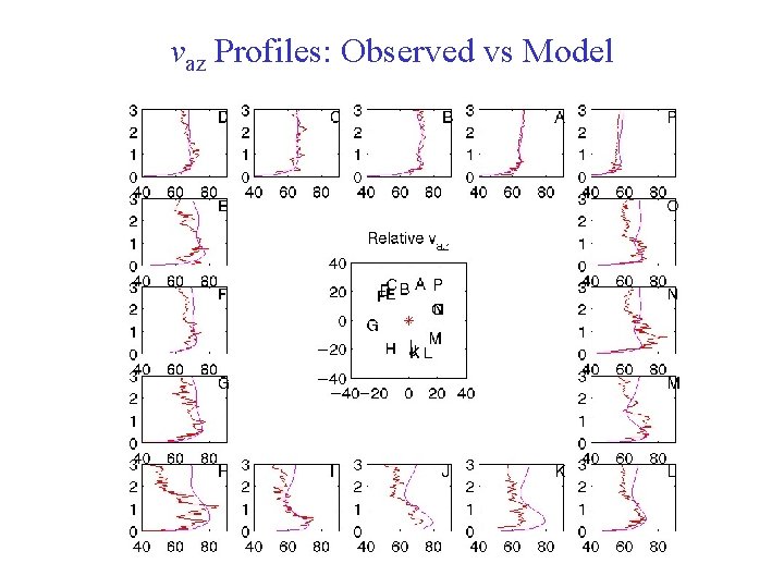
vaz Profiles: Observed vs Model
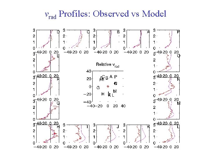
vrad Profiles: Observed vs Model
Hurricane Mitch Data courtesy of NOAA/HRD
Dropsonde and Aircraft Data • Ten radial legs. • 30 dropsondes. • 4 -hour period.
Track NHC HRD (lo) NHC TPF HRD (hi) HRD (fix) HRD (lo) • TPF tracks similar for aircraft and dropsonde surface pressure observations. • TPF track consistent with aircraft fixes. • TPF track similar to modified Marks et al. “simplex” track.
Azimuthal Wind 0 -15 km 40 -100 km 25 -40 km 15 -25 km Radial Wind 40 -100 km 25 -40 km 0 -15 km Mean Winds by Annulus • Speed maximum below 500 m inside RMW. • Increases rapidly in height across RMW. • In 15 -25 km band, max shear in layer above jet. • Strongest inflow near RMW, with marked outflow above.
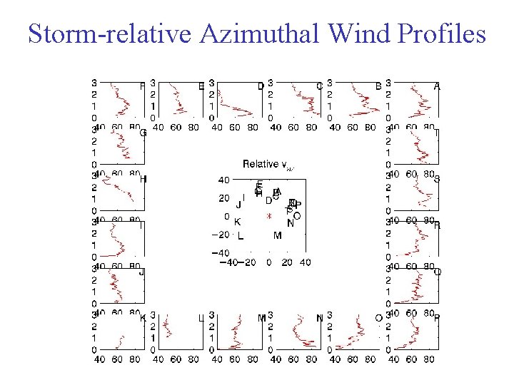
Storm-relative Azimuthal Wind Profiles
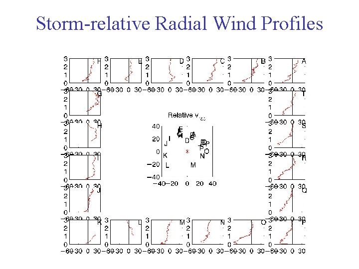
Storm-relative Radial Wind Profiles
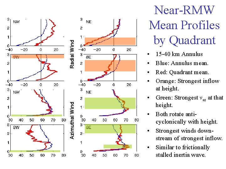
Radial Wind Near-RMW Mean Profiles by Quadrant • • Azimuthal Wind • • 15 -40 km Annulus Blue: Annulus mean. Red: Quadrant mean. Orange: Strongest inflow at height. Green: Strongest vaz at that height. Both rotate anticyclonically with height. Strongest winds downstream of strongest inflow. Similar to frictionally stalled inertia wave.
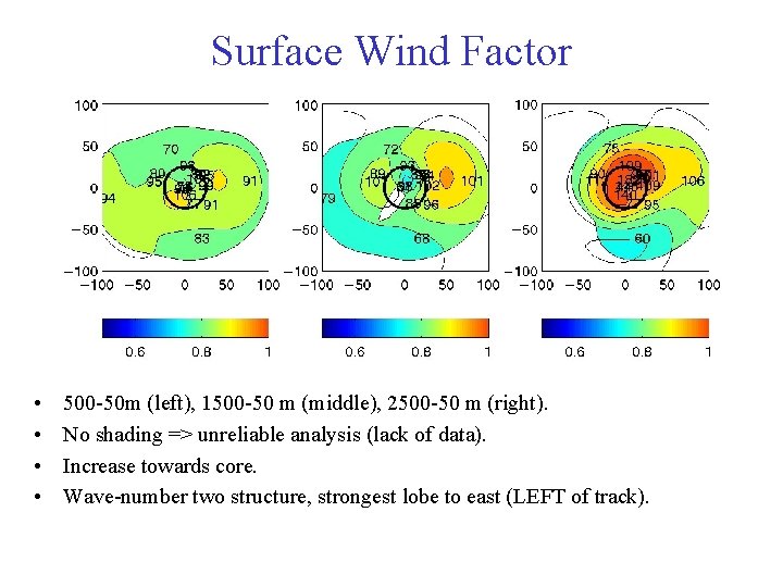
Surface Wind Factor • • 500 -50 m (left), 1500 -50 m (middle), 2500 -50 m (right). No shading => unreliable analysis (lack of data). Increase towards core. Wave-number two structure, strongest lobe to east (LEFT of track).
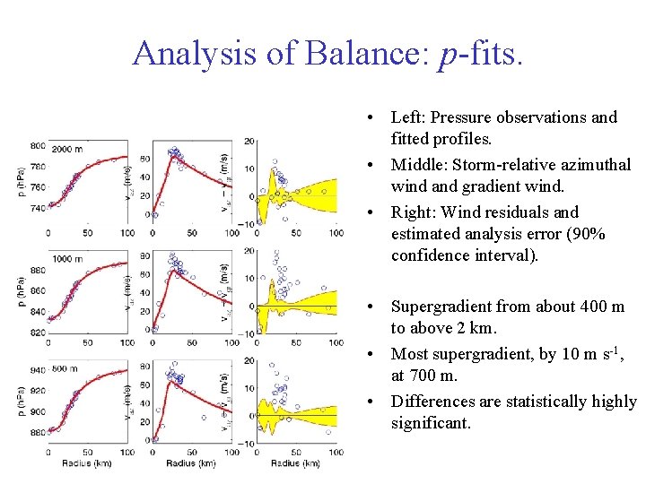
Analysis of Balance: p-fits. • Left: Pressure observations and fitted profiles. • Middle: Storm-relative azimuthal wind and gradient wind. • Right: Wind residuals and estimated analysis error (90% confidence interval). • Supergradient from about 400 m to above 2 km. • Most supergradient, by 10 m s-1, at 700 m. • Differences are statistically highly significant.
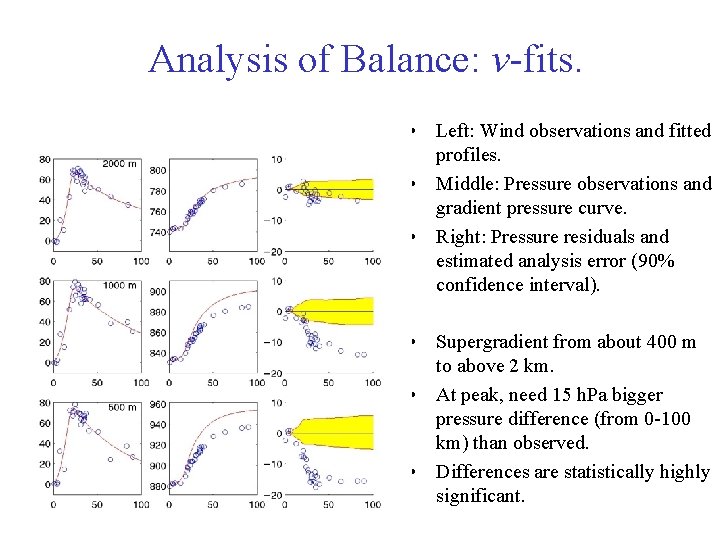
Analysis of Balance: v-fits. • Left: Wind observations and fitted profiles. • Middle: Pressure observations and gradient pressure curve. • Right: Pressure residuals and estimated analysis error (90% confidence interval). • Supergradient from about 400 m to above 2 km. • At peak, need 15 h. Pa bigger pressure difference (from 0 -100 km) than observed. • Differences are statistically highly significant.
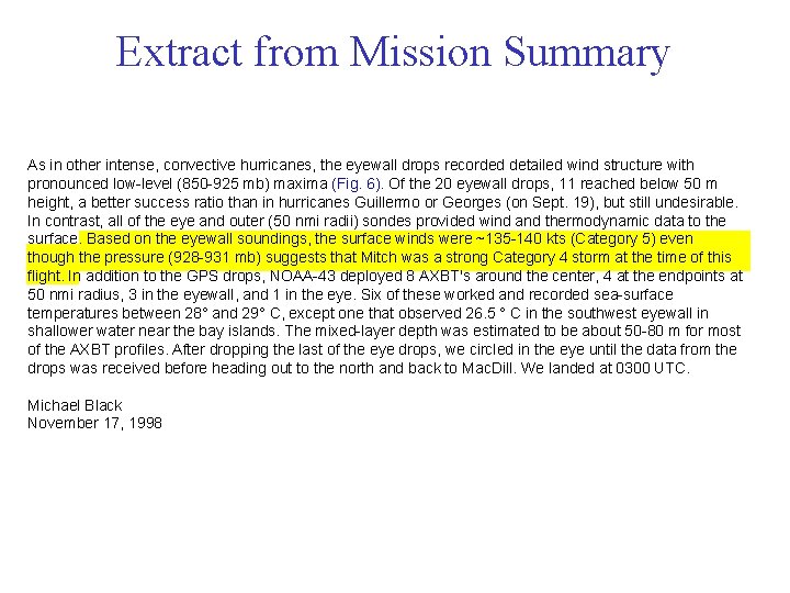
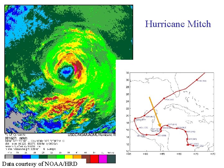
Extract from Mission Summary As in other intense, convective hurricanes, the eyewall drops recorded detailed wind structure with pronounced low-level (850 -925 mb) maxima (Fig. 6). Of the 20 eyewall drops, 11 reached below 50 m height, a better success ratio than in hurricanes Guillermo or Georges (on Sept. 19), but still undesirable. In contrast, all of the eye and outer (50 nmi radii) sondes provided wind and thermodynamic data to the surface. Based on the eyewall soundings, the surface winds were ~135 -140 kts (Category 5) even though the pressure (928 -931 mb) suggests that Mitch was a strong Category 4 storm at the time of this flight. In addition to the GPS drops, NOAA-43 deployed 8 AXBT's around the center, 4 at the endpoints at 50 nmi radius, 3 in the eyewall, and 1 in the eye. Six of these worked and recorded sea-surface temperatures between 28° and 29° C, except one that observed 26. 5 ° C in the southwest eyewall in shallower water near the bay islands. The mixed-layer depth was estimated to be about 50 -80 m for most of the AXBT profiles. After dropping the last of the eye drops, we circled in the eye until the data from the drops was received before heading out to the north and back to Mac. Dill. We landed at 0300 UTC. Michael Black November 17, 1998
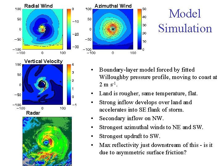
Radial Wind Azimuthal Wind Model Simulation Vertical Velocity Radar • Boundary-layer model forced by fitted Willoughby pressure profile, moving to coast at 2 m s-1. • Land is rougher, same temperature, flat. • Strong inflow develops over land accelerates into SE flank of storm. • Secondary inflow on NW. • Strongest azimuthal winds to NE and SW. • Strongest updraft to SW. • Max reflectivity just downstream of this - is it due to asymmetric surface friction?
Azimuthal Winds: Observed vs Model
Radial Winds: Observed vs Model
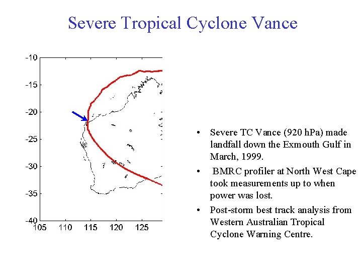
7 m/s Severe Tropical Cyclone Vance • Severe TC Vance (920 h. Pa) made landfall down the Exmouth Gulf in March, 1999. • BMRC profiler at North West Cape took measurements up to when power was lost. • Post-storm best track analysis from Western Australian Tropical Cyclone Warning Centre.
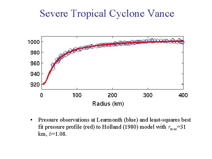
7 m/s Severe Tropical Cyclone Vance Radius (km) • Pressure observations at Learmonth (blue) and least-squares best fit pressure profile (red) to Holland (1980) model with rmax=31 km, b=1. 08.
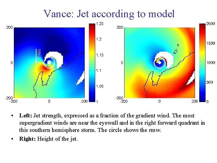
7 m/s Vance: Jet according to model • Left: Jet strength, expressed as a fraction of the gradient wind. The most supergradient winds are near the eyewall and in the right forward quadrant in this southern hemisphere storm. The circle shows the rmw. • Right: Height of the jet.
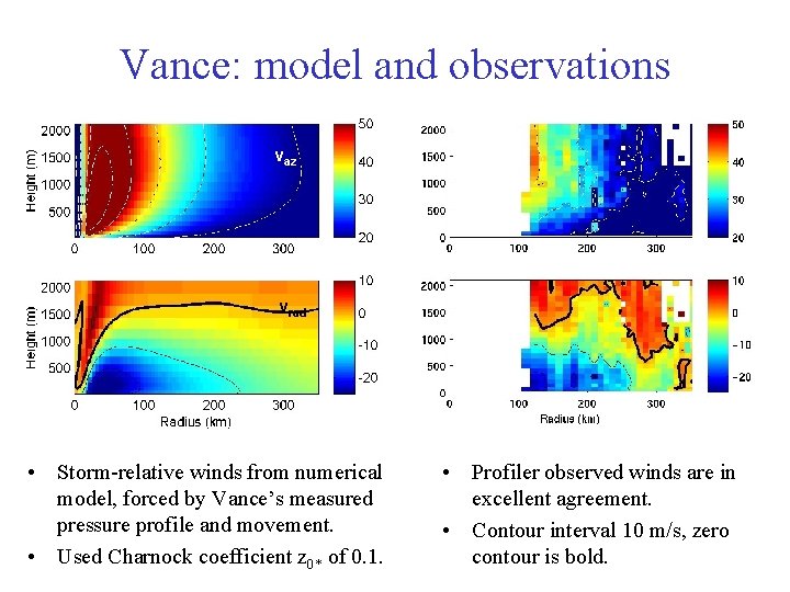
Vance: model and observations vaz vrad • Storm-relative winds from numerical model, forced by Vance’s measured pressure profile and movement. • Used Charnock coefficient z 0* of 0. 1. • Profiler observed winds are in excellent agreement. • Contour interval 10 m/s, zero contour is bold.
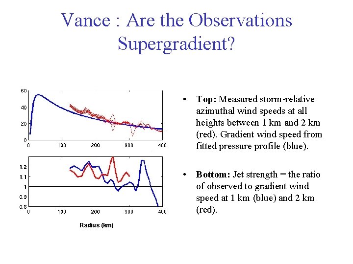
Vance : Are the Observations Supergradient? • Top: Measured storm-relative azimuthal wind speeds at all heights between 1 km and 2 km (red). Gradient wind speed from fitted pressure profile (blue). • Bottom: Jet strength = the ratio of observed to gradient wind speed at 1 km (blue) and 2 km (red). Radius (km)
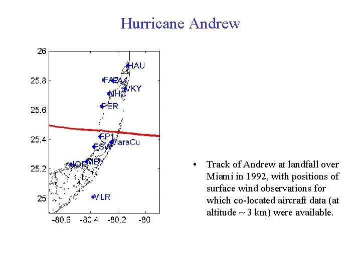
Hurricane Andrew • Track of Andrew at landfall over Miami in 1992, with positions of surface wind observations for which co-located aircraft data (at altitude ~ 3 km) were available.
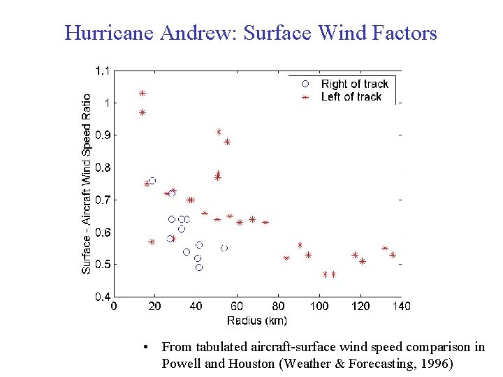
Hurricane Andrew: Surface Wind Factors • From tabulated aircraft-surface wind speed comparison in Powell and Houston (Weather & Forecasting, 1996)
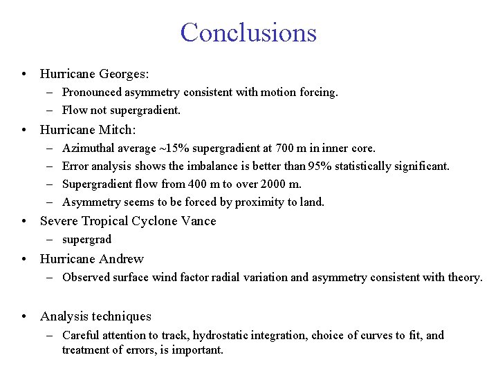
Conclusions • Hurricane Georges: – Pronounced asymmetry consistent with motion forcing. – Flow not supergradient. • Hurricane Mitch: – – Azimuthal average ~15% supergradient at 700 m in inner core. Error analysis shows the imbalance is better than 95% statistically significant. Supergradient flow from 400 m to over 2000 m. Asymmetry seems to be forced by proximity to land. • Severe Tropical Cyclone Vance – supergrad • Hurricane Andrew – Observed surface wind factor radial variation and asymmetry consistent with theory. • Analysis techniques – Careful attention to track, hydrostatic integration, choice of curves to fit, and treatment of errors, is important.

- Slides: 51