Alyssa Schocker MET 1010 Assignment 3 Issued July
- Slides: 7

Alyssa Schocker : MET 1010 Assignment 3

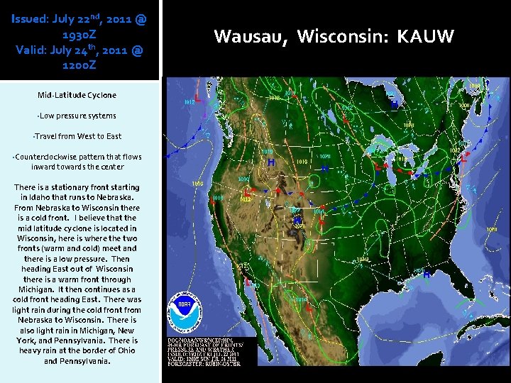
Issued: July 22 nd, 2011 @ 1930 Z Valid: July 24 th, 2011 @ 1200 Z Mid-Latitude Cyclone • Low pressure systems • Travel from West to East • Counterclockwise pattern that flows inward towards the center There is a stationary front starting in Idaho that runs to Nebraska. From Nebraska to Wisconsin there is a cold front. I believe that the mid latitude cyclone is located in Wisconsin, here is where the two fronts (warm and cold) meet and there is a low pressure. Then heading East out of Wisconsin there is a warm front through Michigan. It then continues as a cold front heading East. There was light rain during the cold front from Nebraska to Wisconsin. There is also light rain in Michigan, New York, and Pennsylvania. There is heavy rain at the border of Ohio and Pennsylvania. Wausau, Wisconsin: KAUW

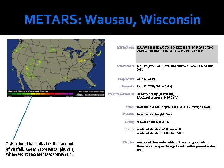
METARS: Wausau, Wisconsin METAR text: KAUW 241454 Z AUTO 31005 KT 10 SM SCT 065 SCT 100 23/19 A 3003 RMK AO 2 SLP 166 T 02330194 50013 Conditions at: KAUW (WAUSAU , WI, US) observed 1454 UTC 24 July 2011 Temperature: 23. 3°C (74°F) Dewpoint: 19. 4°C (67°F) [RH = 79%] Pressure (altimeter): 30. 03 inches Hg (1017. 0 mb) [Sea-level pressure: 1016. 6 mb] Winds: from the NW (310 degrees) at 6 MPH (5 knots; 2. 6 m/s) Visibility: 10 or more miles (16+ km) Ceiling: at least 12, 000 feet AGL Clouds: scattered clouds at 6500 feet AGL scattered clouds at 10000 feet AGL This colored bar indicates the amount of rainfall. Green represents light rain, where violet represents extreme rain. Weather: automated observation with no human augmentation; there may or may not be significant weather present at this time

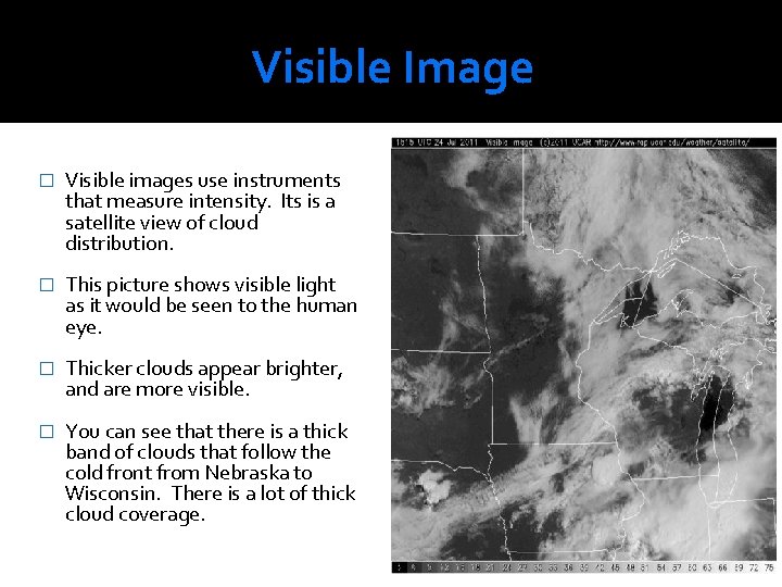
Visible Image � Visible images use instruments that measure intensity. Its is a satellite view of cloud distribution. � This picture shows visible light as it would be seen to the human eye. � Thicker clouds appear brighter, and are more visible. � You can see that there is a thick band of clouds that follow the cold front from Nebraska to Wisconsin. There is a lot of thick cloud coverage.

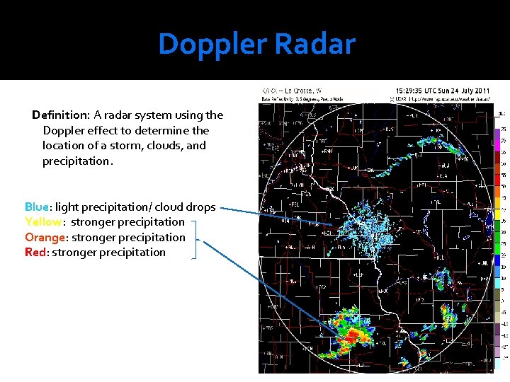
Doppler Radar Definition: A radar system using the Doppler effect to determine the location of a storm, clouds, and precipitation. Blue: light precipitation/ cloud drops Yellow: stronger precipitation Orange: stronger precipitation Red: stronger precipitation

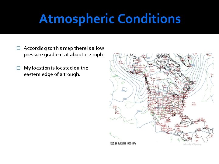
Atmospheric Conditions � According to this map there is a low pressure gradient at about 1 -2 mph � My location is located on the eastern edge of a trough.

Reflection According to my weather map there should have been light rain from Nebraska to Wisconsin (which was my chosen location). When reflecting upon the METAR it says that there may or may not be significant weather at that time. However, according to the visible image and the Doppler radar I believe that there was light precipitation. On the visible image there was a thick layer of clouds along the same route from Nebraska to Wisconsin; and on the Doppler radar it showed that there was light rain near my chosen location. I have learned a lot about the different types of fronts. A cold front occurs when cold are displaces warmer air. Cold fronts cause a temperature drop and a wind shift. I think that it is very important to learn these things so that you can decipher what the environment around you will be like. We all watch the news and sometimes they are not correct, or sometimes it changes between forecasts. If you know how to look at weather maps yourself, you could always look at the Doppler radar, or a METAR map. The information learned in the class has been very useful to me.