Air Masses and Fronts Wind Wind is the


- Slides: 18
Air Masses and Fronts
Wind • Wind is the movement of air from places of high pressure to places of low pressure • Wind moves in large masses called air masses – Air masses also move from areas of high pressure to areas of low pressure • These air masses retain the characteristics of where they form
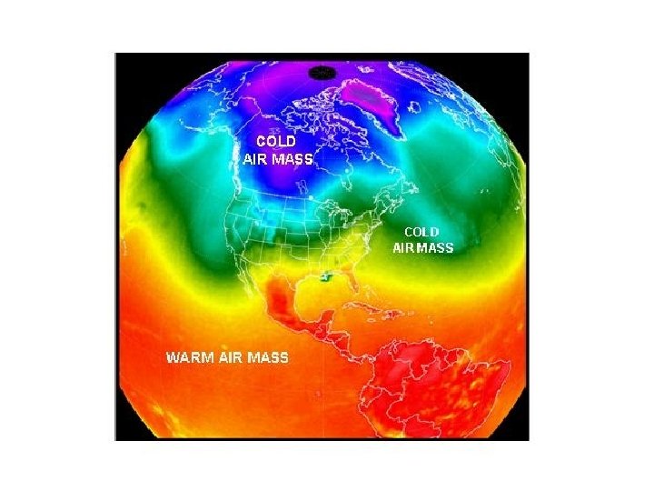
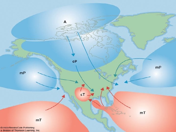
Types of Air Masses • Air masses can be described in two ways • Moisture/Humidity • Continental (dry air) vs. Maritime ( moist air) – The moisture of an air mass depends on whether it forms over land or water. Temperature • Tropical (warm air) vs. Polar (cold air) vs. Arctic (coldest air) – The temperature of the air mass depends on whether it formed closer to the equator or closer to the poles
Putting it all together Continental Maritime Tropical: c. T Tropical: m. T Polar Continental Maritime Polar: c. P Polar: m. P Arctic Continental Arctic: c. A Knowing moisture and temperature, what would the characteristics be of… • Continental Polar (c. P)? • Maritime Tropical (m. T)? • Continental Arctic (c. A)?
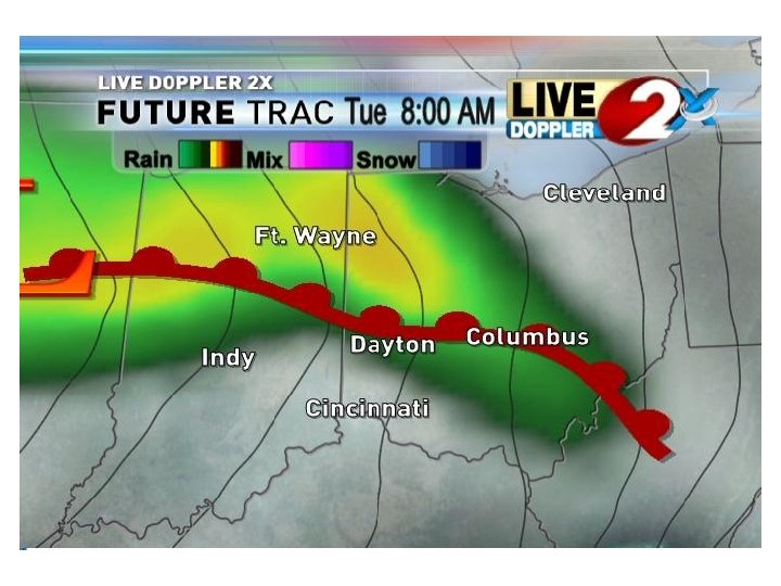
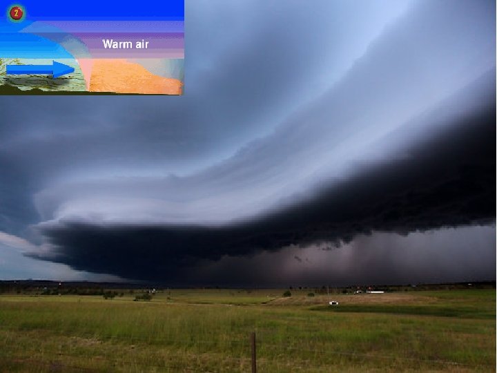
Fronts • Front – the boundary between two different air masses • Along a front, warmer, less dense air is always forced upwards • 4 types of fronts – Warm – Cold – Stationary – Occluded
Warm Front • A warm front occurs when warm air slowly moves into an area covered by cooler air. • Takes a long time for warm air to displace colder air • Marked by long and steady rain • Red semi-circles are symbols for warm front
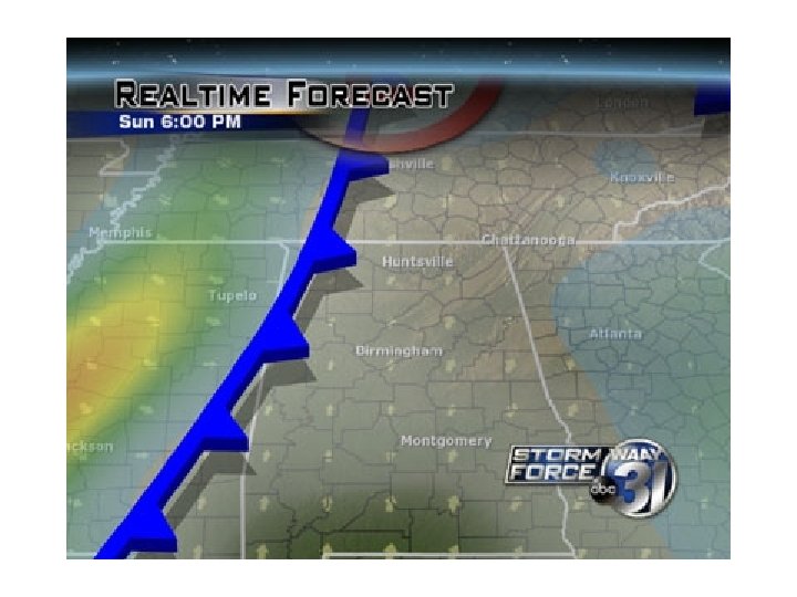
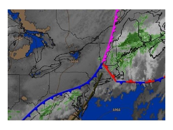
Cold Front • A cold front forms when cold, dense air quickly moves into an area occupied by warm air. • Compared to speed of warm front, cold fronts move very fast • Marked by heavy precipitation/thunderstorms for a short period of time • Blue triangles are symbols for cold front
Stationary Front • If fronts are not moving towards each other, but rather moving parallel, a stationary front occurs. • Mild precipitation can occur on a stationary front. • Red semi-circles on one side, blue triangles on other
Colder air Warmer air
Occluded Front • Cold fronts move faster than warm fronts • When an active cold front overtakes a warm front, an occluded front forms • This will force the warm front up into the air, which will lead to heavy rain • Usually marked by purple semi-circle and triangles in same direction
m. T c. P What air masses can be found moving in at each orange arrow? What is the weather like at the H and L?