Air Masses An air mass is a large

- Slides: 37

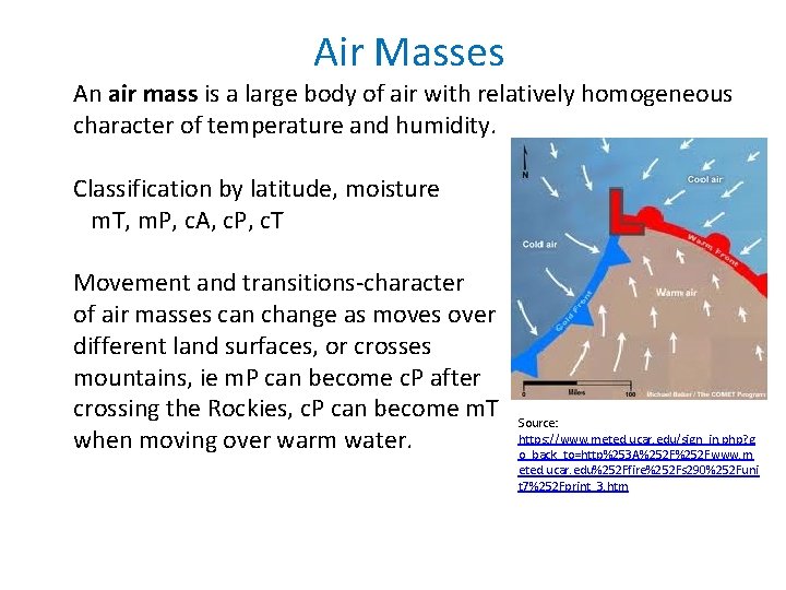
Air Masses An air mass is a large body of air with relatively homogeneous character of temperature and humidity. Classification by latitude, moisture m. T, m. P, c. A, c. P, c. T Movement and transitions-character of air masses can change as moves over different land surfaces, or crosses mountains, ie m. P can become c. P after crossing the Rockies, c. P can become m. T when moving over warm water. Source: https: //www. meted. ucar. edu/sign_in. php? g o_back_to=http%253 A%252 Fwww. m eted. ucar. edu%252 Ffire%252 Fs 290%252 Funi t 7%252 Fprint_3. htm

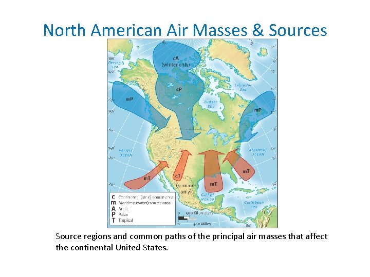
North American Air Masses & Sources Source regions and common paths of the principal air masses that affect the continental United States.

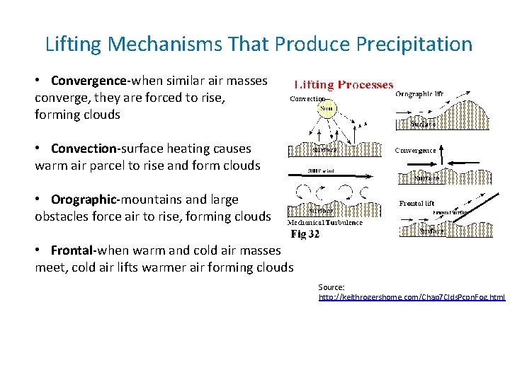
Lifting Mechanisms That Produce Precipitation • Convergence-when similar air masses converge, they are forced to rise, forming clouds • Convection-surface heating causes warm air parcel to rise and form clouds • Orographic-mountains and large obstacles force air to rise, forming clouds • Frontal-when warm and cold air masses meet, cold air lifts warmer air forming clouds Source: http: //keithrogershome. com/Chap 7 Clds. Pcpn. Fog. html

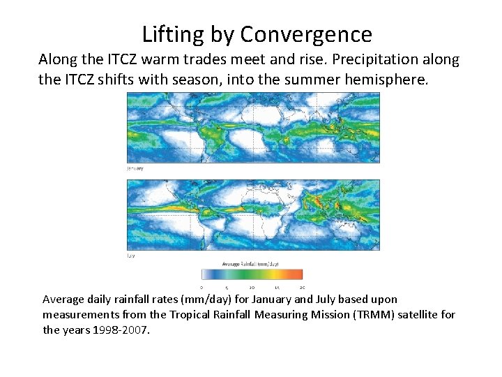
Lifting by Convergence Along the ITCZ warm trades meet and rise. Precipitation along the ITCZ shifts with season, into the summer hemisphere. Average daily rainfall rates (mm/day) for January and July based upon measurements from the Tropical Rainfall Measuring Mission (TRMM) satellite for the years 1998 -2007.

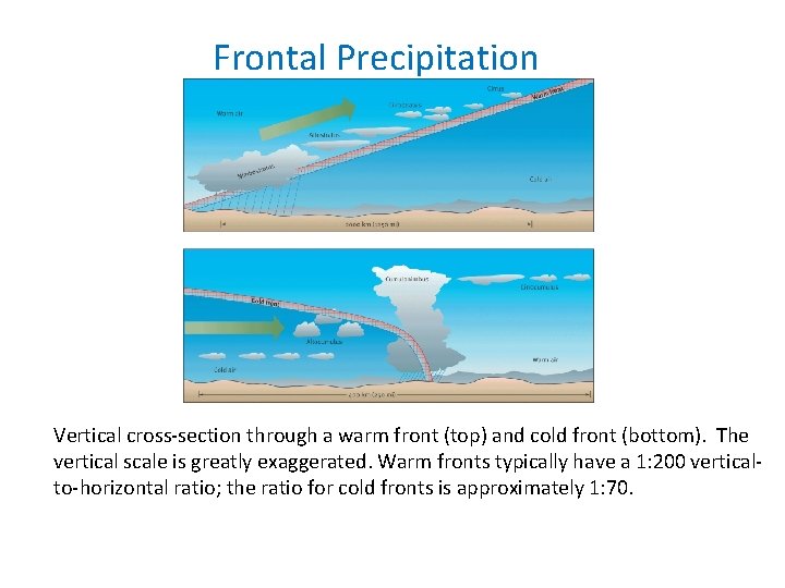
Frontal Precipitation Vertical cross-section through a warm front (top) and cold front (bottom). The vertical scale is greatly exaggerated. Warm fronts typically have a 1: 200 verticalto-horizontal ratio; the ratio for cold fronts is approximately 1: 70.

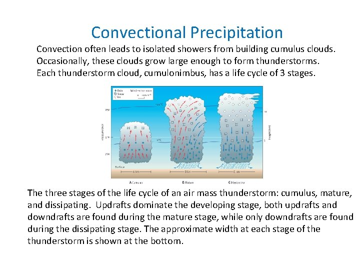
Convectional Precipitation Convection often leads to isolated showers from building cumulus clouds. Occasionally, these clouds grow large enough to form thunderstorms. Each thunderstorm cloud, cumulonimbus, has a life cycle of 3 stages. The three stages of the life cycle of an air mass thunderstorm: cumulus, mature, and dissipating. Updrafts dominate the developing stage, both updrafts and downdrafts are found during the mature stage, while only downdrafts are found during the dissipating stage. The approximate width at each stage of the thunderstorm is shown at the bottom.

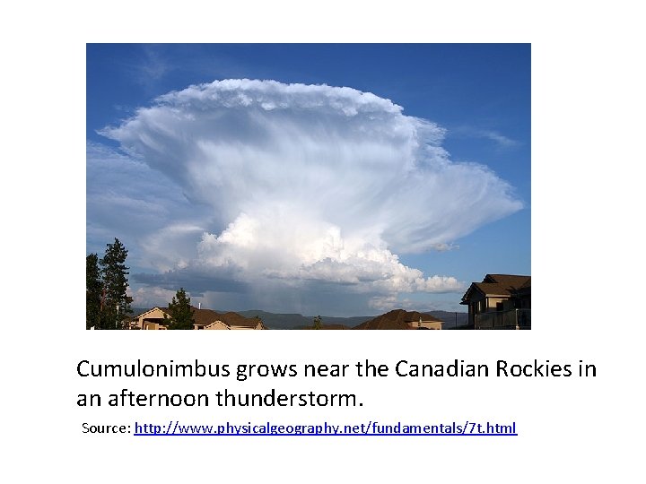
Cumulonimbus grows near the Canadian Rockies in an afternoon thunderstorm. Source: http: //www. physicalgeography. net/fundamentals/7 t. html

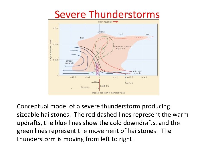
Severe Thunderstorms Conceptual model of a severe thunderstorm producing sizeable hailstones. The red dashed lines represent the warm updrafts, the blue lines show the cold downdrafts, and the green lines represent the movement of hailstones. The thunderstorm is moving from left to right.

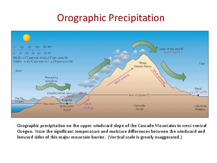
Orographic Precipitation Fig 13. 7 Orographic precipitation on the upper windward slope of the Cascade Mountains in west-central Oregon. Note the significant temperature and moisture differences between the windward and leeward sides of this major mountain barrier. (Vertical scale is greatly exaggerated. )

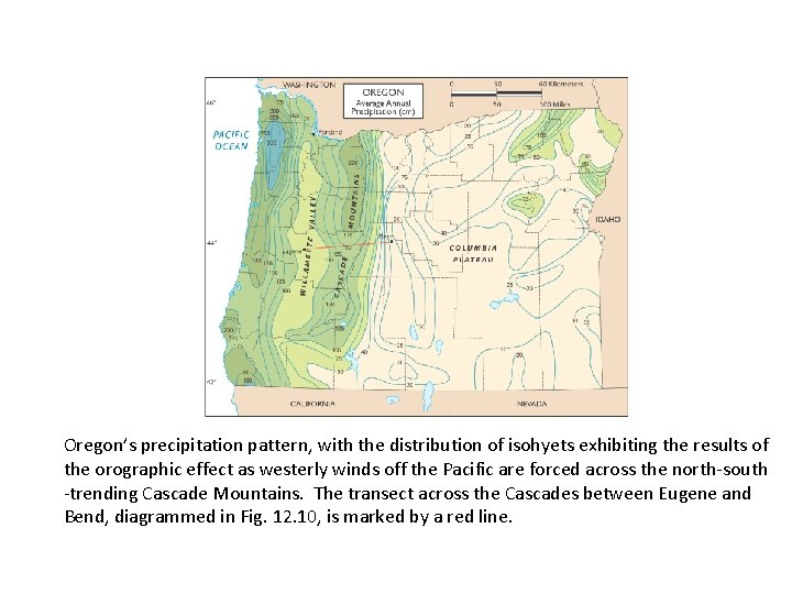
Fig 13. 8 Oregon’s precipitation pattern, with the distribution of isohyets exhibiting the results of the orographic effect as westerly winds off the Pacific are forced across the north-south -trending Cascade Mountains. The transect across the Cascades between Eugene and Bend, diagrammed in Fig. 12. 10, is marked by a red line.

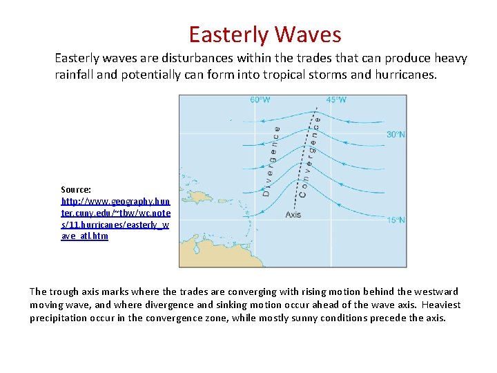
Easterly Waves Easterly waves are disturbances within the trades that can produce heavy rainfall and potentially can form into tropical storms and hurricanes. Source: http: //www. geography. hun ter. cuny. edu/~tbw/wc. note s/11. hurricanes/easterly_w ave_atl. htm The trough axis marks where the trades are converging with rising motion behind the westward moving wave, and where divergence and sinking motion occur ahead of the wave axis. Heaviest precipitation occur in the convergence zone, while mostly sunny conditions precede the axis.

Tropical Storms and Hurricanes Tropical cyclones can form over land or water, however hurricanes always develop over warm oceans. As cyclones increase their energy, their winds increase. Storms are defined by wind speed: Tropical Depression-winds below 40 mph Tropical Storm-winds 40 to 74 mph Hurricane-winds exceed 74 mph Hurricanes may form if 1. They occur over warm water-80 F or 28 C 2. There is an initial disturbance (ITCZ, convergence, mid-latitude cyclone 3. There is sufficient Coriolis force. Most hurricanes form in 8 -15 degrees latitude 4. There are weak upper air winds. Strong flow destroys formation. Hurricanes can form over all tropical oceans where these conditions are met.

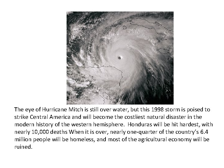
Fig 14. 2 The eye of Hurricane Mitch is still over water, but this 1998 storm is poised to strike Central America and will become the costliest natural disaster in the modern history of the western hemisphere. Honduras will be hit hardest, with nearly 10, 000 deaths When it is over, nearly one-quarter of the country’s 6. 4 million people will be homeless, and most of the agricultural economy will be ruined.

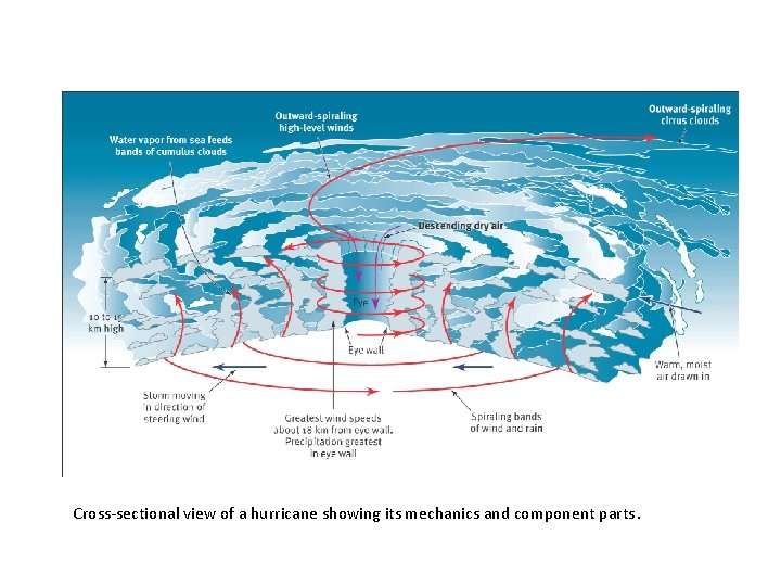
Fig 14. 3 Cross-sectional view of a hurricane showing its mechanics and component parts.

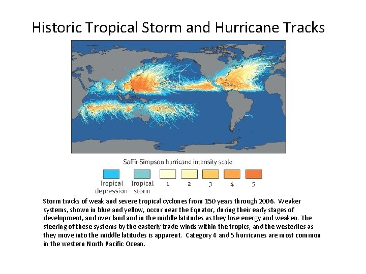
Historic Tropical Storm and Hurricane Tracks Storm tracks of weak and severe tropical cyclones from 150 years through 2006. Weaker systems, shown in blue and yellow, occur near the Equator, during their early stages of development, and over land in the middle latitudes as they lose energy and weaken. The steering of these systems by the easterly trade winds within the tropics, and the westerlies as they move into the middle latitudes is apparent. Category 4 and 5 hurricanes are most common in the western North Pacific Ocean.

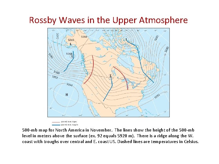
Rossby Waves in the Upper Atmosphere Westerlies 500 -mb map for North America in November. The lines show the height of the 500 -mb level in meters above the surface (ex. 92 equals 5920 m). There is a ridge along the W. coast with troughs over central and E. coast US. Dashed lines are temperatures in Celsius.

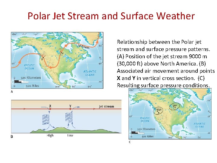
Polar Jet Stream and Surface Weather Relationship between the Polar jet stream and surface pressure patterns. (A) Position of the jet stream 9000 m (30, 000 ft) above North America. (B) Associated air movement around points X and Y in vertical cross section. (C) Resulting surface pressure conditions.

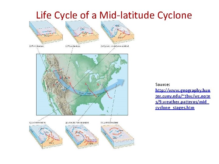
Life Cycle of a Mid-latitude Cyclone Source: http: //www. geography. hun ter. cuny. edu/~tbw/wc. note s/9. weather. patterns/mid_ cyclone_stages. htm

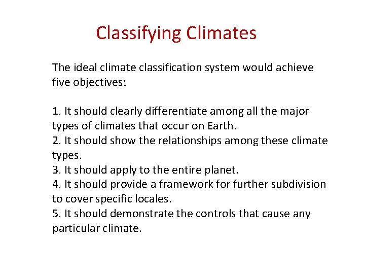
Classifying Climates The ideal climate classification system would achieve five objectives: 1. It should clearly differentiate among all the major types of climates that occur on Earth. 2. It should show the relationships among these climate types. 3. It should apply to the entire planet. 4. It should provide a framework for further subdivision to cover specific locales. 5. It should demonstrate the controls that cause any particular climate.

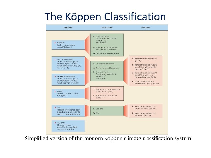
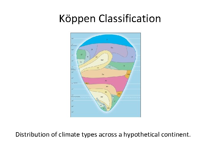
The Köppen Classification Simplified version of the modern Koppen climate classification system.

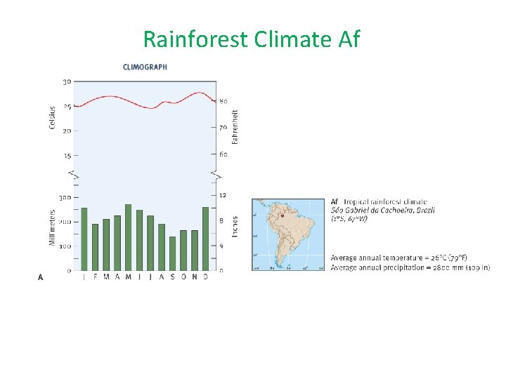
Rainforest Climate Af

Köppen Classification Fig 16. 2 Distribution of climate types across a hypothetical continent.

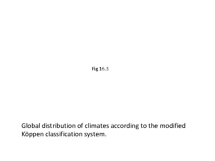
Fig 16. 3 Global distribution of climates according to the modified Köppen classification system.

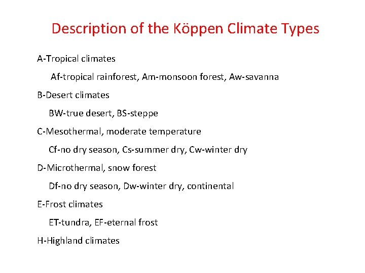
Description of the Köppen Climate Types A-Tropical climates Af-tropical rainforest, Am-monsoon forest, Aw-savanna B-Desert climates BW-true desert, BS-steppe C-Mesothermal, moderate temperature Cf-no dry season, Cs-summer dry, Cw-winter dry D-Microthermal, snow forest Df-no dry season, Dw-winter dry, continental E-Frost climates ET-tundra, EF-eternal frost H-Highland climates

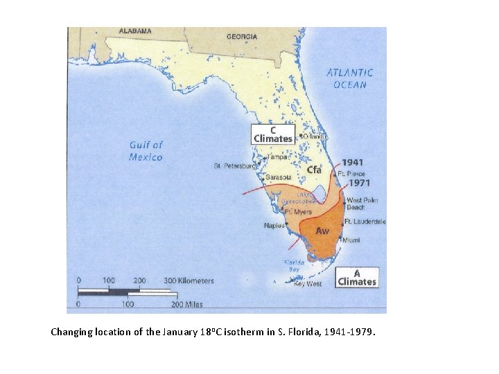
Changing location of the January 18 o. C isotherm in S. Florida, 1941 -1979.

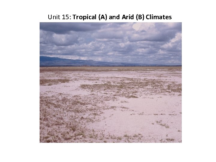
Unit 15: Tropical (A) and Arid (B) Climates

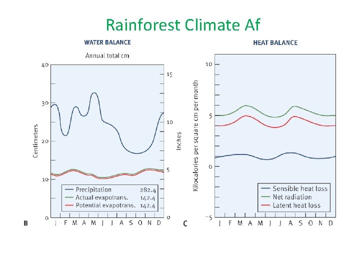
Rainforest Climate Af

Rainforest Climate Af

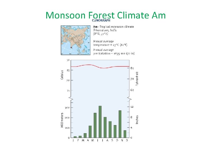
Monsoon Forest Climate Am

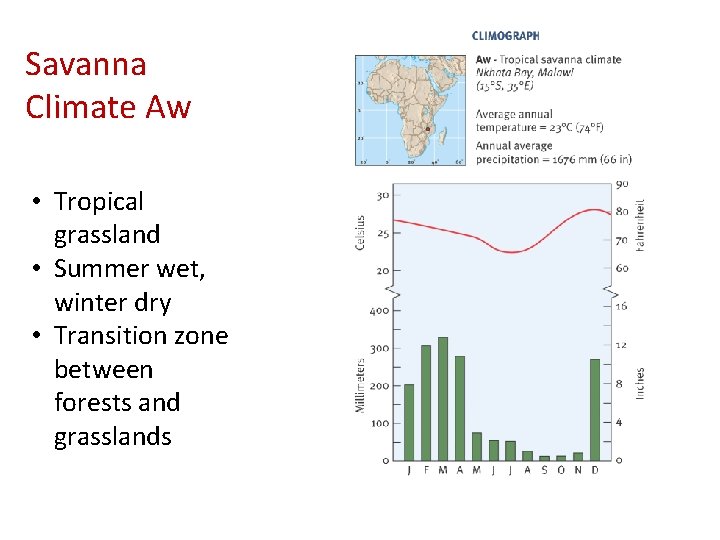
Savanna Climate Aw • Tropical grassland • Summer wet, winter dry • Transition zone between forests and grasslands

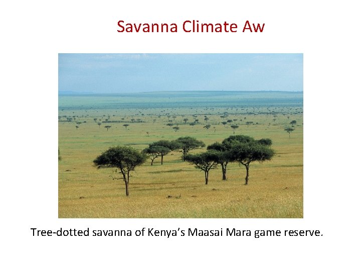
Savanna Climate Aw Tree-dotted savanna of Kenya’s Maasai Mara game reserve.

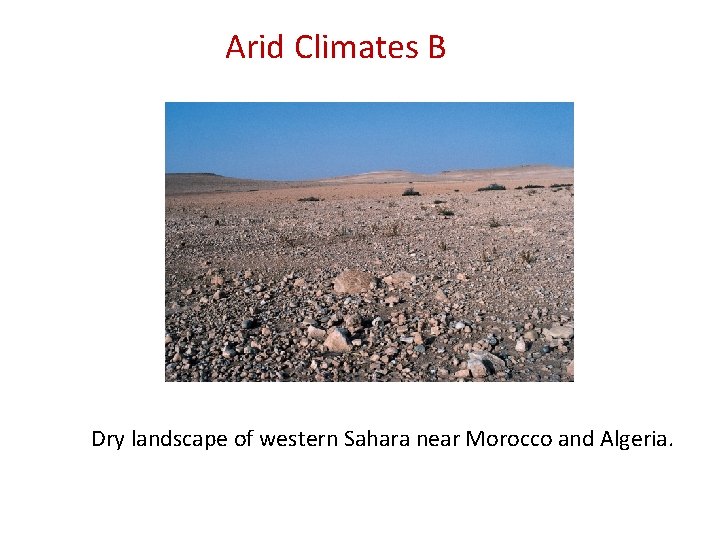
Arid Climates B Dry landscape of western Sahara near Morocco and Algeria.

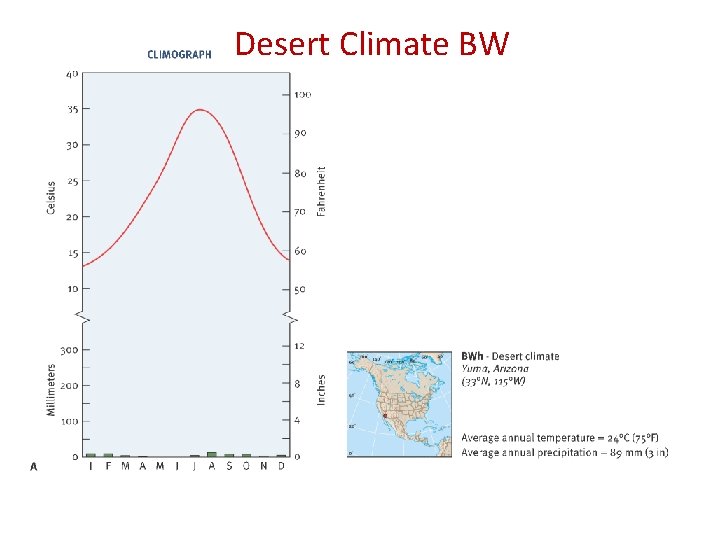
Desert Climate BW

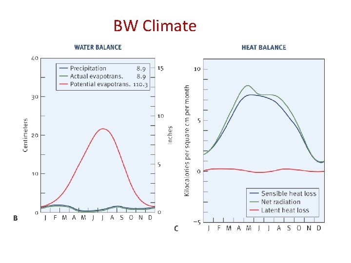
BW Climate

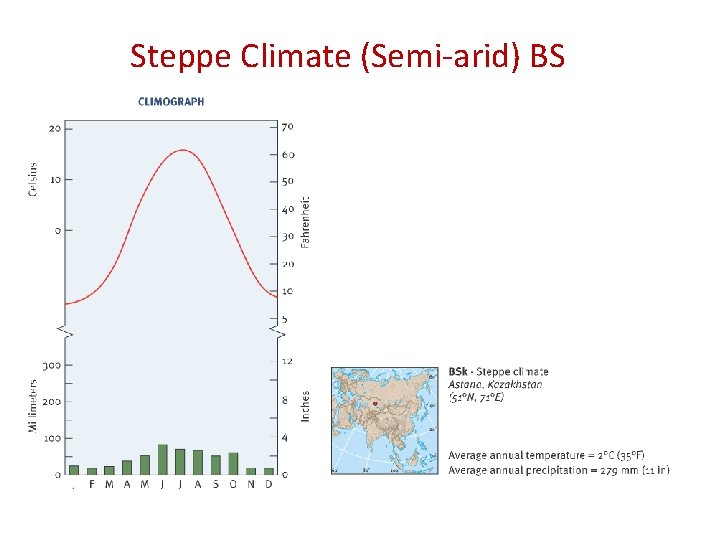
Steppe Climate (Semi-arid) BS

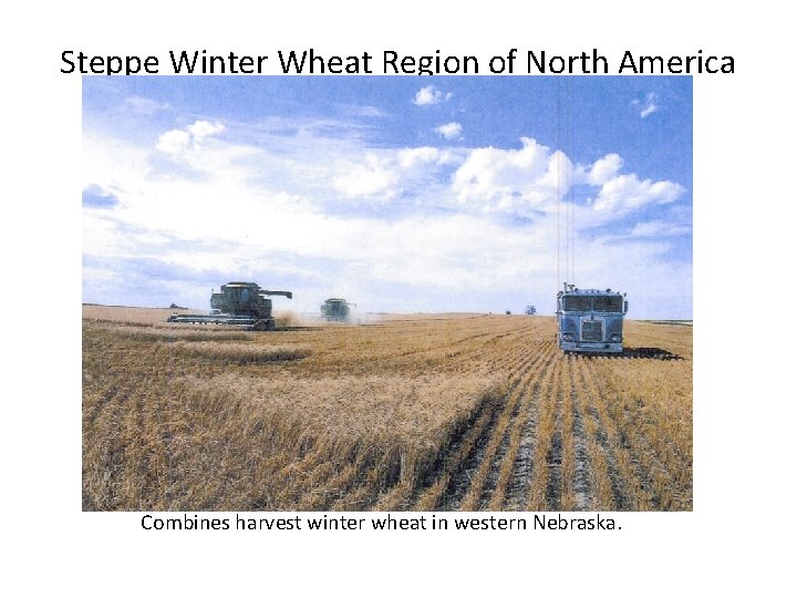
Steppe Winter Wheat Region of North America Combines harvest winter wheat in western Nebraska.

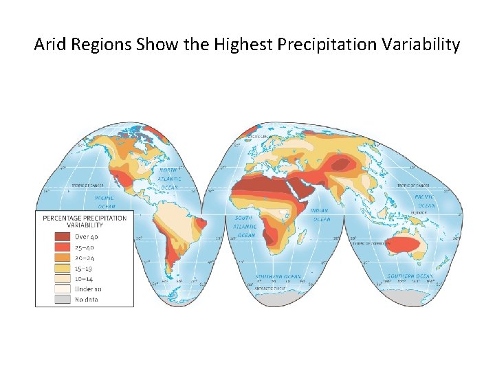
Arid Regions Show the Highest Precipitation Variability