AERIAL ROADWAY DIAGRAMMING FOR POLICE AND ENGINEERS Sgt

 Benefits")


 total station and import points")


")


 was")


 Rover (Unknown Pt. ) +X")

 Photo Courtesy: Shawn")


- Slides: 41
AERIAL ROADWAY DIAGRAMMING FOR POLICE AND ENGINEERS Sgt. Chad Sell – Livingston Co. Sheriff Deputy Russ Nowiski – St. Clair Co. Sheriff
Objectives � � � � Technology in mapping scenes Use of UAV (Drones) Benefits in using UAV vs. other methods Reduce time on scene Reduce roadway closure times Accuracy of data collected Improve responder safety and motorist Challenges experienced
History Tape Measures: • Coordinate Method • Triangulation Method Time Consuming Data Collection (accuracy, accepted) Long roadway time closures
History Total Stations • • • Ease of collecting data Reliable Accurate and accepted Depending on model, one or two person operation Cut down on roadway closure time
UAV Technology Several different types/brands of drones available on the market. Ranging from $500 to $75000.
UAV Benefits � � � � Aerial View of scene and/or roadway Easy to use FAA 107 license Quality photographs/video Great for court/project demonstration Reduce roadway closure time Reduce responder safety Reduce secondary crashes
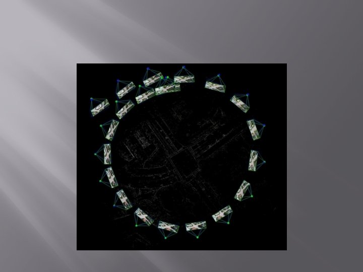
Pix 4 D Mapper
Pix 4 d � � Takes the pictures obtained from UAV and/or ground photographs. Creates a point cloud-similar to 3 d scanner. Project can be viewed in 2 d or 3 d. The point cloud has been proven accurate by numerous agencies in the country and is accepted by courts.
Pix 4 d
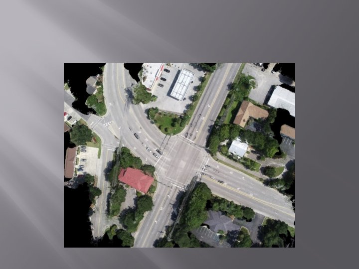
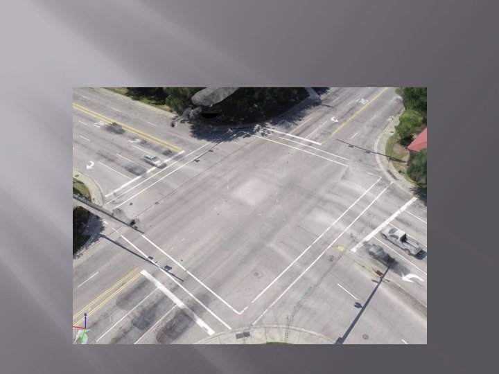
WHAT CAN BE DONE
Accuracy
Accuracy
Accuracy � � Drones take pictures with GPS coordinates imbedded into the picture. Pix 4 d uses GPS data to map to real world location. Do we need to know where in the world the photographs were taken? Do we need to overlay on Google earth? Or do we just need a scaled photograph of our scene for our purposes?
Accuracy � � You can use a RTK (GPS) total station and import points directly into Pix 4 d project. This has been done and is proven accurate. However, cost of RTK is expensive. You can use normal total station points and import them into a Pix 4 d project with certain steps. This has been done and is proven accurate.
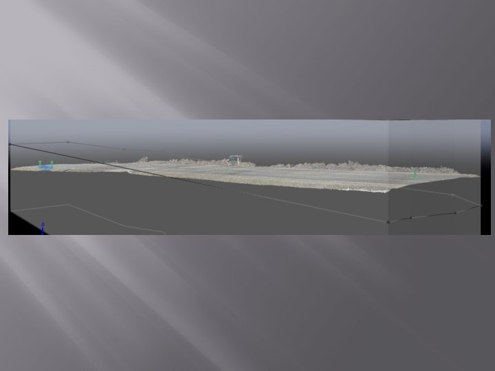
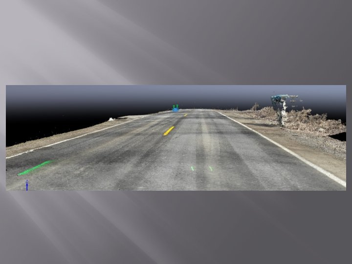
Pix 4 d with Total Station Data Scene mapped with total station and UAV. • Total station data imported into Pix 4 d.
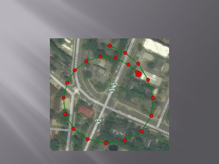
Example � � Double Fatal Crash scene Occurred at night Mapped short-lived evidence at night with total station. Less than ½ hr. time. Mapped with UAV during daylight with no roadway closure. Less than 10 minutes.
Example
Example
Example
Example Mapped at night with total station UAV during day light (no road closure) On scene at night with road closure (1 hour)
Relative Accuracy v. Absolute Accuracy � � � What is the difference Consumer Grade GNSS Industrial Grade GNSS
Types of GNSS Receivers & Purposes:
Relative Accuracy
Absolute Accuracy
Terminology: Why GNSS and Not just GPS? 1978 The Global Positioning System (GPS) was developed by the U. S. Department of Defense (DOD), Ivan Getting, and the Massachusetts Institute of Technology (MIT). Originally consisting of 11 orbiting satellites, the GPS–official name NAVSTAR (Navigation System with Timing And Ranging)–was launched by DOD in 1978 strictly for military use. • • Position Time Measurement Data Lighthouses in Space
Not to Be Dependent on the USA Nav System: GLONASS – Russian Federation First launch in 1982 2000 Vladimir Putin took over – World Class System Galileo – European Union System went operational 2016 Beidou – China Beidou 3 went operational in 2015 • GNSS : Global Navigation Satellite Systems • Modern Receivers Track All Constellations
Most Important Concept of GNSS Operations: • • • GNSS generates a coordinate based on a differential measurement between two points (base & rover) Accurate Precise Fast (sub-seconds per shot) Repeatable (over any time period) Definable (geodetically) Works under any weather conditions GNSS fixes the measured position in time and space Collected data directly exportable to Google Earth It has limitations Requires connection to wireless web & sky visibility
Earth Centered Cartesian Coordinates +Z Base (Known Pt. ) Rover (Unknown Pt. ) +X Vector Components: -Y -Delta X +Delta Y -Delta Z
AT 504 ARP dx, dy, d z EC ve • • • ctor AX 1202 ARP MDOT’s Spider Software measures from MSRN Station ARP To Rover ARP Eliminates specific antenna types at the rover locations Surveyor only needs to ensure that ADVNULLANTENNA type is set on Rover
GNSS Absolute Accuracy The Michigan Spatial Reference Network ( CORS ) Photo Courtesy: Shawn Roy, P. S. / MDOT / Director of the MSRN
Cost of a GNSS Package: System Cost GNSS Receiver + Controller + Software + Training + Access $19, 00. 00 AT&T or VERIZON SIM $300. 00 Yearly FW / Support $500. 00 Two Days Onsite Training Total Cost If you have an existing total station … keep it…. . You will need it on some scenes where GNSS criteria isn’t met Included $19, 800. 00
End Product
Overview � � Using drones & Pix 4 d, cuts roadway closure and on-scene time by 50% on average. You never miss a point of interest/evidence Safer for responders Safer for the other motorist-reduce secondary crashes
Questions? � Contact Information: Chad Sell, Livingston Co. Sheriff’s Office 1 -517 -712 -5330 / csell@livgov. com Russell Nowiski, St. Clair Co. Sheriff’s Office 1 -810 -705 -1682 / rnowiski@stclaircounty. org Thank you and be safe!