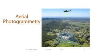
Aerial Photogrammetry Prof Mandar Mahajan SurveyingII RSCOE 1


- Slides: 11

Aerial Photogrammetry Prof. Mandar Mahajan Surveying-II RSCOE 1

Lecture outline • Photogrammetry ? • Principle of photogrammetry • Uses • Aerial camera • Aerial photograph. • Scale of vertical and tilted photograph • Ground coordinates Prof. Mandar Mahajan • Procedure of aerial survey. • Photomaps and mosaics • Stereoscopes • Parallax Bar Surveying-II RSCOE 2

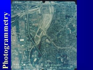
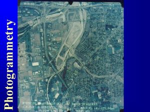
What is photogrammetry? Art and Science of obtaining information about physical objects and the environment by photographic and electromagnetic images through processes of recording, measuring, and interpreting photographic images Science: Measuring From Art: Photo Interpretation ( examining Photograph (Geometric Char) Photograph Objects) Prof. Mandar Mahajan Surveying-II RSCOE 3

Principle of photogrammetric survey • Principle of photogrammetric survey is very similar to that of the plane table survey. • The principal point of each photograph is used as a fixed station and rays are drawn to get points of intersections very similar to those used in plane table. • suitable for topographical or engineering surveys and also for those projects demanding higher accuracy Prof. Mandar Mahajan Surveying-II RSCOE 4

Broadly photogrammetry requires • Planning and taking photographs • Processing the photographs • Measuring the photographs and reducing the measurments to produce the results Prof. Mandar Mahajan Surveying-II RSCOE 5

Photogrammetry for Engineering Photogrammetry is the process of measuring images on a photograph • measuring images - accurate measurements - without any physical contact • photograph - planimetric/Topographic maps - preparation of composite picture on the ground • Classification of photogrammetry - Terrestrial Photogrammetry : fixed position - Aerial Photogrammetry : aircraft flying over the area (Aerial survey) Prof. Mandar Mahajan Surveying-II RSCOE 6

Principal application of photogrammetry ? § Topographic application : To determine the spatial position of the natural and man- made features situated on the earth's surface § Non-topographic applications : measuring tool in 1. Architecture 2. industrial design 3. deformation studies of structures 4. accident investigation 5. medicine etc Prof. Mandar Mahajan Surveying-II RSCOE 7

Applications of Photogrammetry Topographic mapping Prof. Mandar Mahajan Surveying-II RSCOE 8

Applications of Photogrammetry • Creation of value added product - Orthoimages - Digital Elevation Model (DEM) - Virtual Landcapes Prof. Mandar Mahajan Surveying-II RSCOE 9

What can photogrammetry do? ØAccurate 2 D and 3 D measurements ØInformation required: images and sensor (camera) parameters Aerial photos : can not be used ØDesert or plains areas, sandy beaches, snow -the photograph as uniform shades with little texture. ØDeep canyons or high buildings that conceal ground surface ØAreas covered by dense forest. Prof. Mandar Mahajan Surveying-II RSCOE 10

• Mapping, Interpretation, Map substitute • Mapping from Aerial photos is the best mapping procedure yet developed for most large projects. • Maps scale from 1: 1, 000 , 1: 120 with C. I. from as small as 1 foot. • Reconstruct a scaled 3 -dimensional optical model of the lands surface using Stereoplotter Prof. Mandar Mahajan Surveying-II RSCOE 11
 Mandar mahajan
 Photogrammetry
 Stereoscopic model
 Institute of geodesy and photogrammetry
 Principal point photogrammetry
 A tomato flames
 Flight planning in photogrammetry
 Definition of photogrammetry
 Imagine mandar um sinal para todos os dispositivos
 As ondas atendem ao meu mandar numero
 Mandar series
 Como responder un correo formal
