Advanced Quantitative Precipitation Information System What is it
- Slides: 9

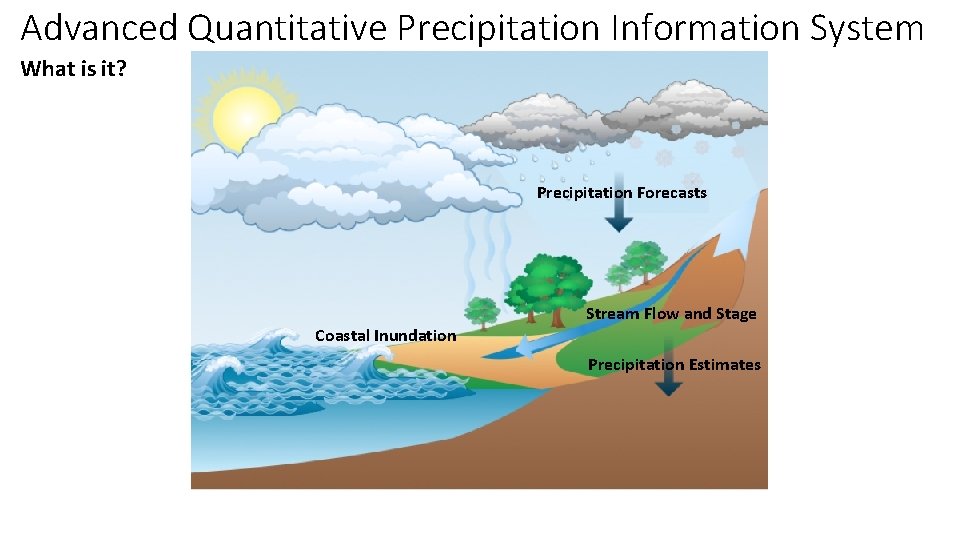
Advanced Quantitative Precipitation Information System What is it? Precipitation Forecasts Stream Flow and Stage Coastal Inundation Precipitation Estimates

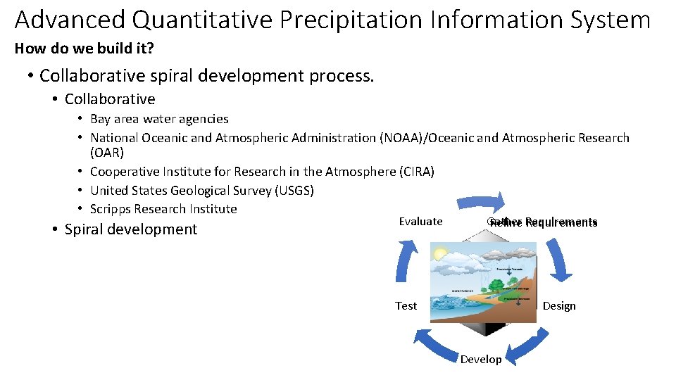
Advanced Quantitative Precipitation Information System How do we build it? • Collaborative spiral development process. • Collaborative • Bay area water agencies • National Oceanic and Atmospheric Administration (NOAA)/Oceanic and Atmospheric Research (OAR) • Cooperative Institute for Research in the Atmosphere (CIRA) • United States Geological Survey (USGS) • Scripps Research Institute • Spiral development Evaluate Gather Refine Requirements Test Design Develop

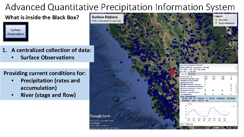
Advanced Quantitative Precipitation Information System What is inside the Black Box? Surface Observations 1. A centralized collection of data: • Surface Observations Providing current conditions for: • Precipitation (rates and accumulation) • River (stage and flow)

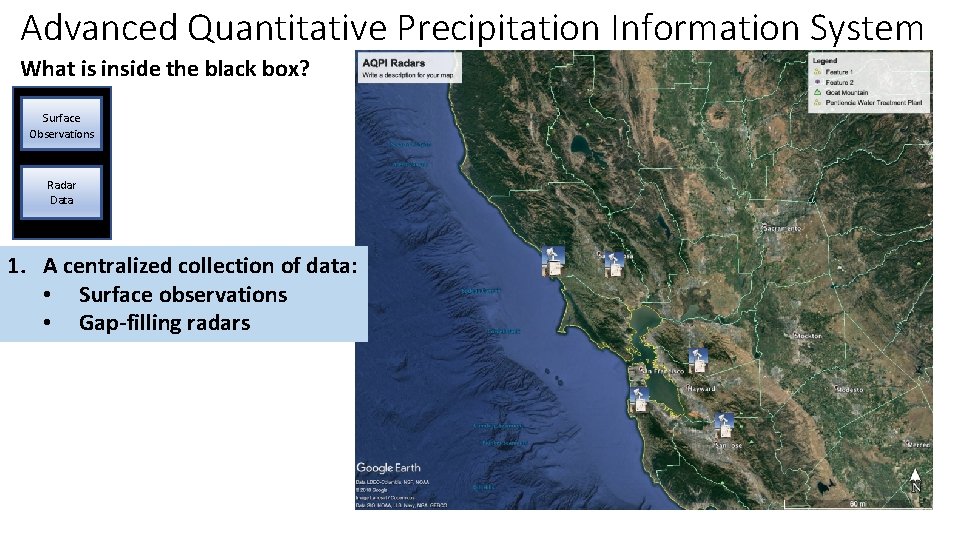
Advanced Quantitative Precipitation Information System What is inside the black box? Surface Observations Radar Data 1. A centralized collection of data: • Surface observations • Gap-filling radars

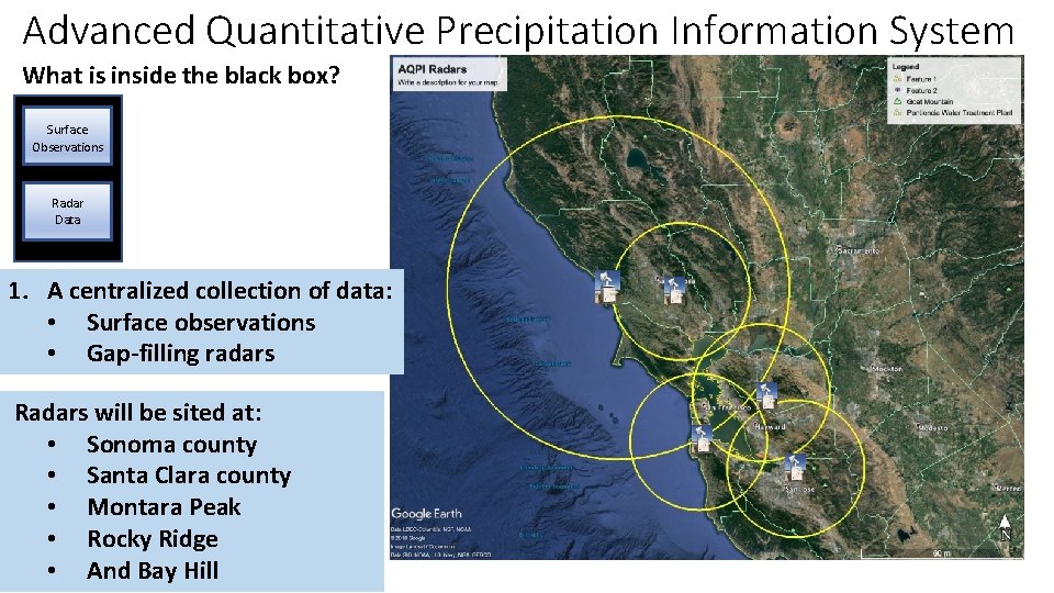
Advanced Quantitative Precipitation Information System What is inside the black box? Surface Observations Radar Data 1. A centralized collection of data: • Surface observations • Gap-filling radars Radars will be sited at: • Sonoma county • Santa Clara county • Montara Peak • Rocky Ridge • And Bay Hill

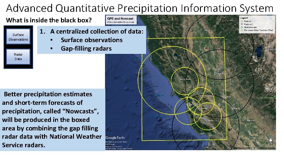
Advanced Quantitative Precipitation Information System What is inside the black box? Surface Observations Radar Data 1. A centralized collection of data: • Surface observations • Gap-filling radars Better precipitation estimates and short-term forecasts of precipitation, called “Nowcasts”, will be produced in the boxed area by combining the gap filling radar data with National Weather Service radars.

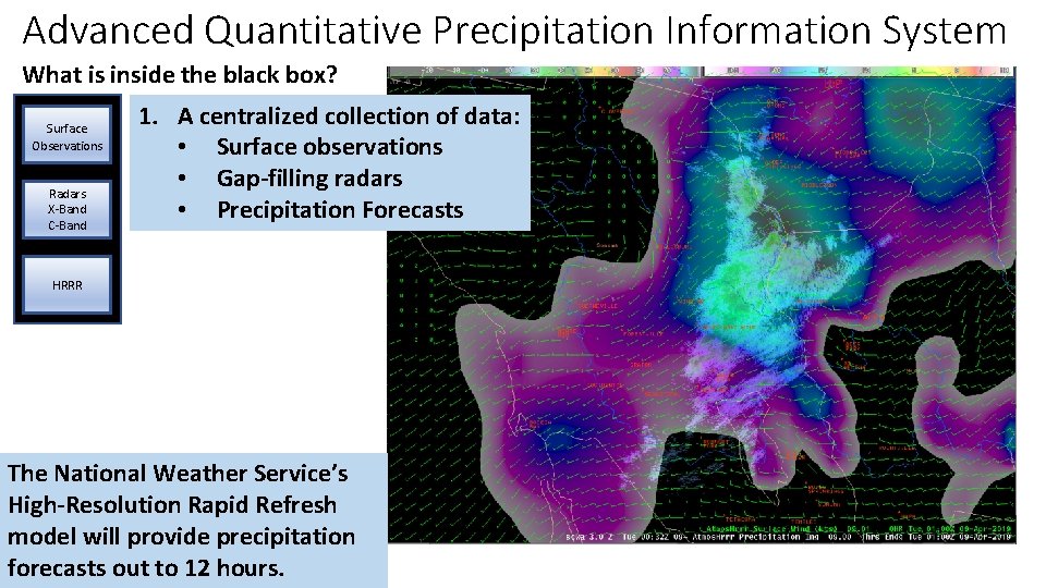
Advanced Quantitative Precipitation Information System What is inside the black box? Surface Observations Radars X-Band C-Band 1. A centralized collection of data: • Surface observations • Gap-filling radars • Precipitation Forecasts HRRR The National Weather Service’s High-Resolution Rapid Refresh model will provide precipitation forecasts out to 12 hours.

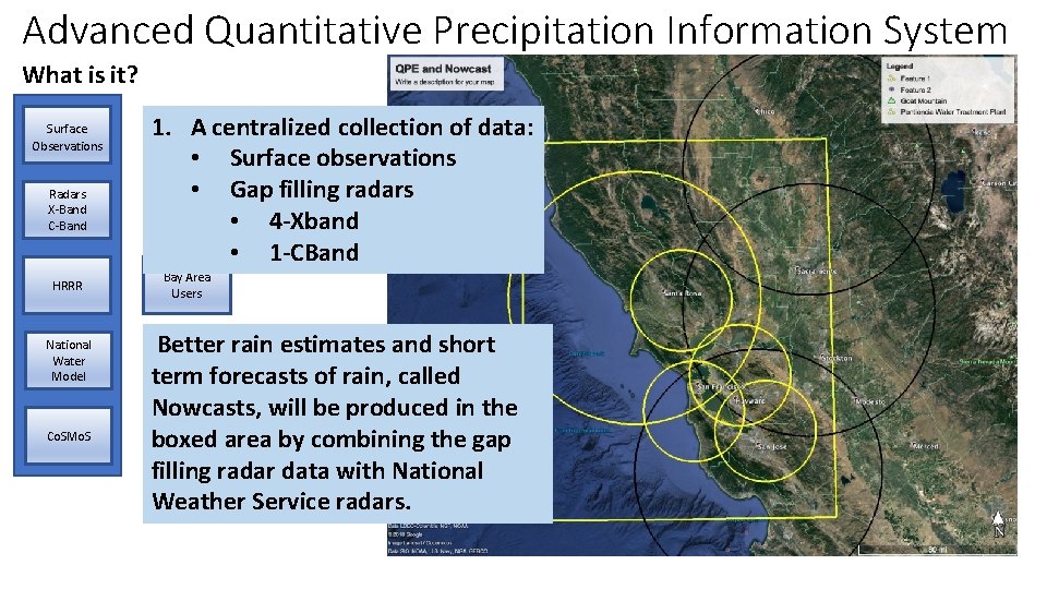
Advanced Quantitative Precipitation Information System What is it? Surface Observations Radars X-Band C-Band HRRR National Water Model Co. SMo. S 1. A centralized collection of data: • Surface observations • Gap filling radars • 4 -Xband • 1 -CBand Bay Area Users Better rain estimates and short term forecasts of rain, called Nowcasts, will be produced in the boxed area by combining the gap filling radar data with National Weather Service radars.

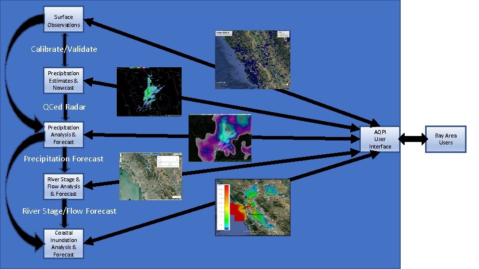
Surface Observations Calibrate/Validate Precipitation Estimates & Nowcast QCed Radar Precipitation Analysis & Forecast Precipitation Forecast River Stage & Flow Analysis & Forecast River Stage/Flow Forecast Coastal Inundation Analysis & Forecast a AQPI User Interface Bay Area Users