
A watershed is the land that water flows


- Slides: 20
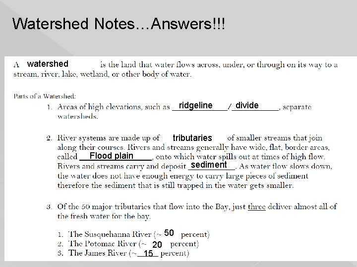
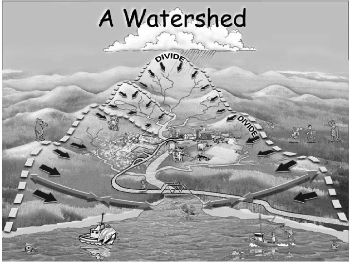
A watershed is the land that water flows across, under, or through on its way to a stream, river, lake, wetland or other body of water 1
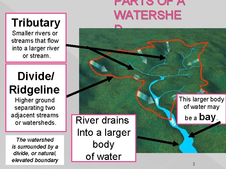
Tributary Smaller rivers or streams that flow into a larger river or stream. PARTS OF A WATERSHE D Divide/ Ridgeline Higher ground separating two adjacent streams or watersheds. The watershed is surrounded by a divide, or natural, elevated boundary This larger body of water may River drains Into a larger body of water be a 2 bay.
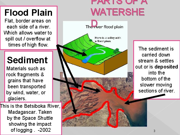
Flood Plain Flat, border areas on each side of a river. Which allows water to spill out / overflow at times of high flow. Sediment Materials such as rock fragments & grains that have been transported by wind, water, or glaciers. This is the Betsiboka River, Madagascar. Taken by the Space Shuttle showing the impact of logging. -2002 PARTS OF A WATERSHE D The sediment is carried down stream & settles out or is deposited into the bottom of the slower moving sections of river. 3
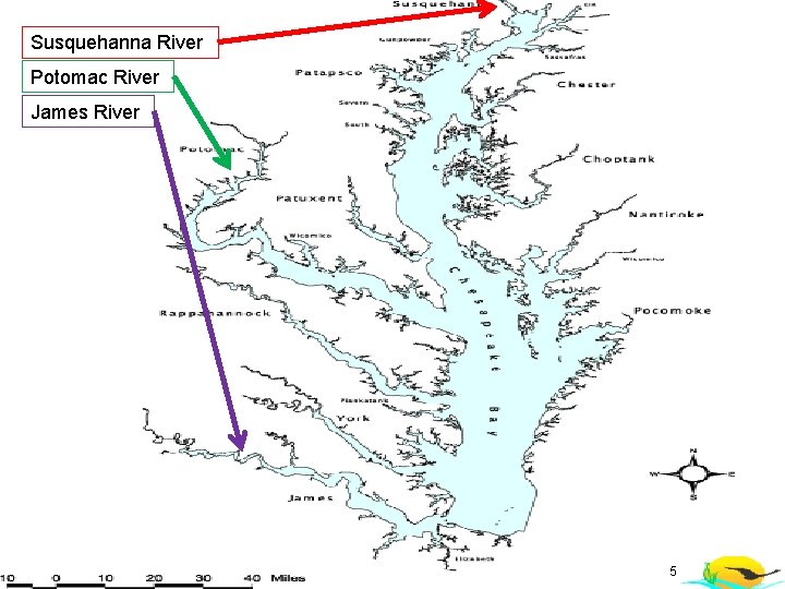
Tributaries that flow into the Chesapeake Bay Of the 50 major tributaries that feed to the Chesapeake Bay just three deliver almost all the fresh water for the bay. 1. Susquehanna River ~50% 2. Potomac River ~ 20% 3. James River ~ 15% *See if you can find them on the next slide! 4
Susquehanna River Potomac River James River 5
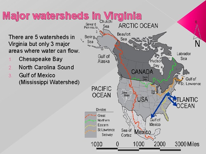
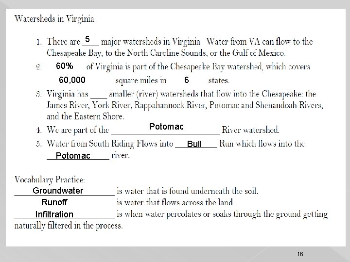
Major watersheds in Virginia There are 5 watersheds in Virginia but only 3 major areas where water can flow. 1. Chesapeake Bay 2. North Carolina Sound 3. Gulf of Mexico (Mississippi Watershed) 6
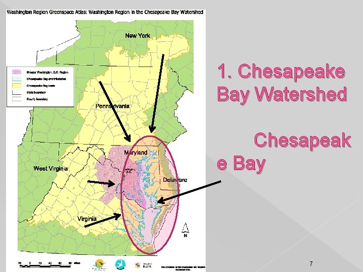
1. Chesapeake Bay Watershed Chesapeak e Bay 7
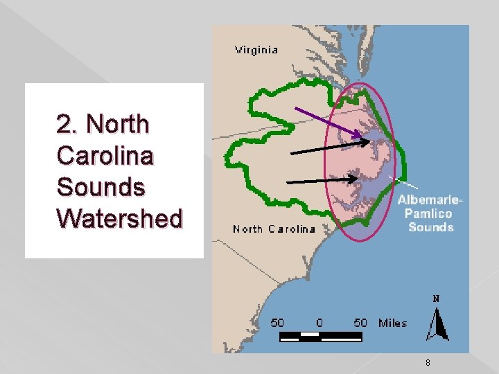
2. North Carolina Sounds Watershed 8
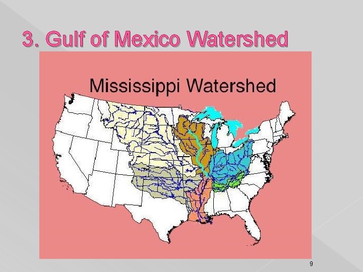
3. Gulf of Mexico Watershed 9
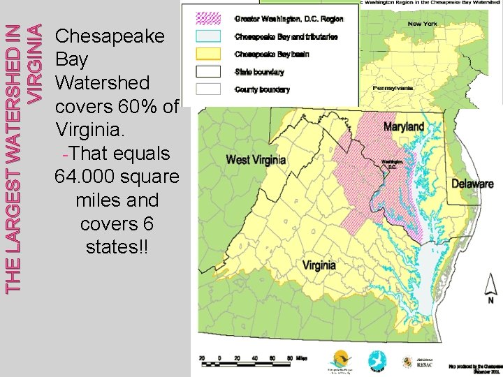
THE LARGEST WATERSHED IN VIRGINIA Chesapeake Bay Watershed covers 60% of Virginia. -That equals 64. 000 square miles and covers 6 states!! 10
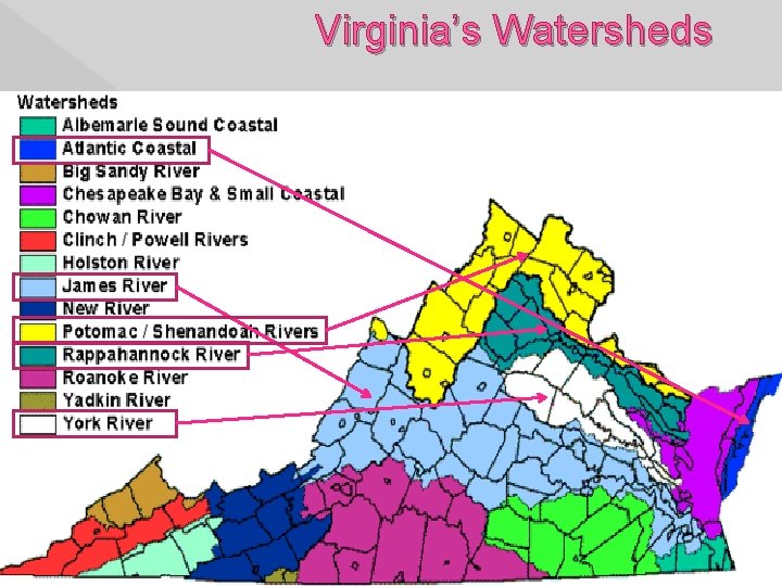
Watersheds can be Broken Down into Smaller Watersheds…. . Virginia’s Top 5 smaller watershed’s - James (River) -York (River) -Rappahannock (River) - Potomac/Shenandoah (River) - Atlantic Coastal See if you can locate them in next slide!!! 11
Virginia’s Watersheds 12
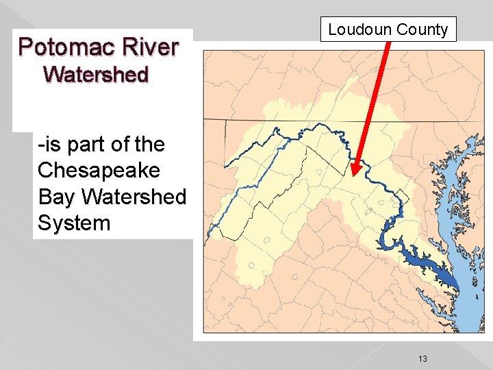
Potomac River Loudoun County Watershed -is part of the Chesapeake Bay Watershed System 13
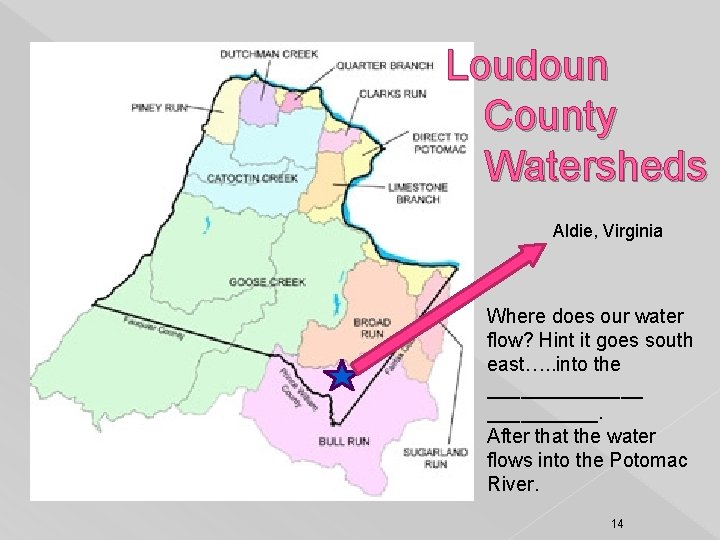
Loudoun County Watersheds Aldie, Virginia Where does our water flow? Hint it goes south east…. . into the _______. After that the water flows into the Potomac River. 14
Watershed Notes…Answers!!! watershed ridgeline divide tributaries Flood plain sediment 50 20 15 15
5 60% 60, 000 6 Potomac Bull Potomac Groundwater Runoff Infiltration 16
17
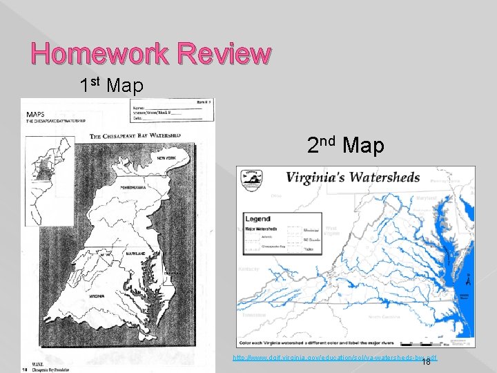
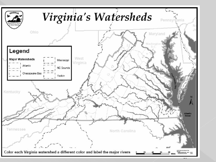
Homework Review 1 st Map 2 nd Map http: //www. dgif. virginia. gov/education/sol/va-watersheds-bw. pdf 18
19
20