A TRAVELLING THROUGH THE NEVA RIVER THE ROUTE


")


- Slides: 35
A TRAVELLING THROUGH THE NEVA RIVER
THE ROUTE OF OUR TRAVELLING 1. The Neva On The Map 2. Etymology 3. The History Of The Delta 4. Topography And Hydrography 5. Floods 6. Ecological Condition
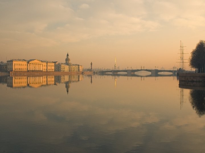
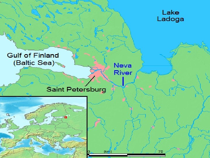
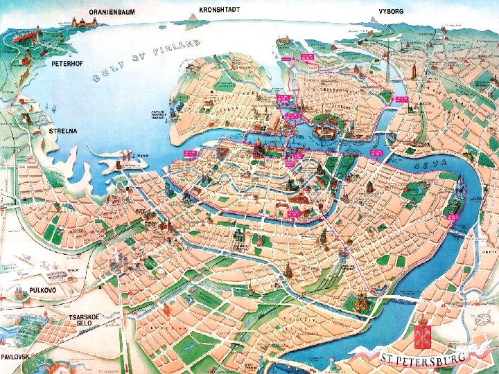
1. The Neva On The Map The Neva is a river in northwestern Russia flowing from Lake Ladoga through the western part of Leningrad Oblast to the Neva Bay of the Gulf of Finland. Despite its modest length (74 km), it is the third largest river in Europe in terms of average discharge (after the Volga and the Danube).
Russian Federation and Leningrad Oblast
The Neva is the only river flowing from Lake Ladoga Neva
Map of St. Petersburg (1720)
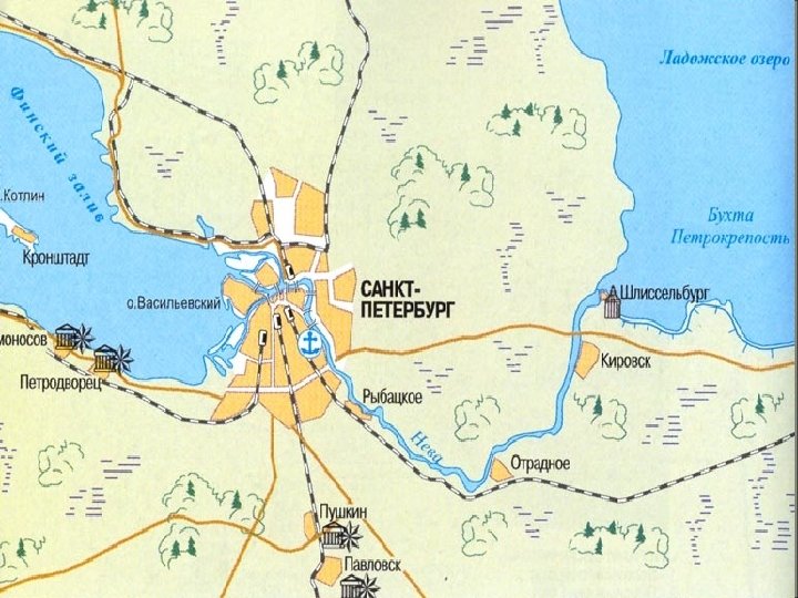
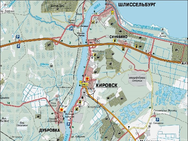
The Neva flows through the city Saint Petersburg, three smaller towns of Shlisselburg, Kirovsk and Otradnoye, and dozens of settlements. Shlisselburg
The Neva River near Kirovsk
The river is navigable throughout and is part of the Volga-Baltic Waterway and White Sea–Baltic Canal.
White Sea–Baltic Canal
The Neva is a site of numerous major historical events, including the Battle of the Neva in 1240 which gave Alexander Nevsky his name, the founding of Saint Petersburg in 1703, and the Siege of Leningrad by the German army during World War II. Battle of the Neva Leningrad blockade
2. Etymology There at least three versions of the origin of the name Neva: from the ancient Finnish name of Lake Ladoga (Finnish: nevo meaning sea), from the Finnish: neva (short from Finnish: Nevajoki, Nevajärvi) meaning swamp, or from the Swedish: ny – new river. N E V A
3. The History Of The Delta In the Paleozoic, 300– 400 million years ago, the entire territory of the modern delta of the Neva River was covered by a sea.
Modern relief was formed as a result of glacier activity. Its retreat formed the Littorina Sea, the water level of which was some 7– 9 meters higher than the present level of the Baltic Sea.
Then, the Tosna River was flowing in the modern bed of the Neva, from east to west into the Litorinal Sea. In the north of the Karelian Isthmus, the Littorina Sea united by a wide strait with Lake Ladoga. The Mga River then flowed to the east, into Lake Ladoga, near the modern source of the Neva River; the Mga then was separated from the basin of the Tosna. The Tosna River
Near the modern Lake Ladoga, land rose faster, and a closed reservoir was formed. Its water level began to rise, eventually flooded the valley of Mga and broke into the valley of the river Tosna. The Ivanovo rapids of the modern Neva were created in the breakthrough area. So about 2000 BC the Neva was created with its tributaries Tosna and Mga. The valley of Neva is formed by glacial and post-glacial sediments and it did not change much over the past 2500 years. The Ivanovo rapids
The delta of Neva was formed at that time, which is actually pseudodelta, as it was formed not by accumulation of river material but by plunging into the past sediments.
4. Topography And The Neva flows from Lake Ladoga near Hydrography Shlisselburg, runs on the Neva Lowland falls into the Gulf of Finland, Baltic Sea. Its length is 74 km and the shortest distance from the source to the mouth is 45 km.
The average decline of the river is 4. 27 meters. At one point the river crosses a moraine ridge and forms the Ivanov rapids. There, at the beginning of the rapids is the narrowest place of the river (210 m).
The average width along the river is 400– 600 m. The widest places (1000– 1250 m) are in the delta, near the gates of Sea trading port, at the end of the Ivanovo rapids near the confluence of the river Tosna, and near the island Fabrinchny near the source.
The Liteyny Bridge
Neva freezes throughout from early December to early April. The ice thickness is 0. 3– 0. 4 m within Saint Petersburg and 0. 5– 0. 6 m in other areas. Average summer water temperature is 17– 20 °C. Swimming season is short and lasts only about 1. 5 months.
5. Floods in St. Petersburg are usually caused by the overflow of the delta of Neva and by surging water in the eastern part of Neva Bay. They are registered when the water rises above 160 cm with respect to a gauge at the Mining Institute.
7 November 1824, in front of Bolshoi Theatre
The Mining Institute
More than 300 floods occurred after the city was founded in 1703. Three of them were catastrophic: on 7 November 1824, when water rose to 421 cm; on 23 September 1924 (369 cm) and 10 September 1777 (321 cm).
6. Ecological Сondition The Neva is a heavily polluted river. The main pollutants are copper, zinc, manganese, nitrites and nitrogen. The dirties tributaries of Neva are Mga, Slavyanka, Ohta and Chernaya. Hundreds of factories pour waste waters into Neva within St. Petersburg and petroleum is regularly transported along the river.
The biggest polluters in the Leningrad Oblast are the cities of Shlisselburg, Kirovsk and Otradnoye. More than 40 oil spills are registered on the river every year. No beach of Neva is fit for swimming.
Cleaning of waste water in St. Petersburg was started in 1979 and in now about 94% of wastewater is purified.
The End