A Rural Subdivision in the Northern Territory Neville

A Rural Subdivision in the Northern Territory Neville L. Brayley LS April 2015

What does a 2 Lot Subdivision in the NT bush look like? Large Hot Things want to kill or hurt you There are lots of those things There are two seasons – the Wet and the Dry – both are hot 4 wheel driving is a given Quad bikes are a given GNSS equipment is a given Geodesy is relevant (who would ever have thought Rod Deakin’s dissertations actually mattered in real life? ) • It’s large, hot & things really do want to kill you • • •

Large Similarities • Some jobs like we have in Western & North Western Victoria • A few hundred acres, or maybe a thousand + acres occasionally • Some river boundaries • Some ocean boundaries • They are mostly all bush, not much pasture grazing • In the NT we produce a Survey Plan & a Surveyors Report

Large Differences • The wet makes fords, creeks and rivers totally un-passable at times • Sometimes you can’t get to jobs. Or get home! • It can be a very long drive to a job – sometimes all day • A tidal range of about 7 metres • Mangroves and mud flats along the ocean and rivers • Things live in those mangroves – they move quicker than you – and want to kill you • Stock are mustered with helicopters • Areas are spoken about in square kilometres • Land tenure is often quite different to what we know here • When the client shows you around the job, he does it in his plane!

What is large? • If a Victorian surveyor had a rural job where one lot was 95 ha and the other 112 ha, they would consider that a pretty big job • In the one I have just completed one lot is 95, 000 ha and the other 112, 000 ha. • The entire southern boundary is the Daly River – about 50 km of river frontage • And things in it want to kill you

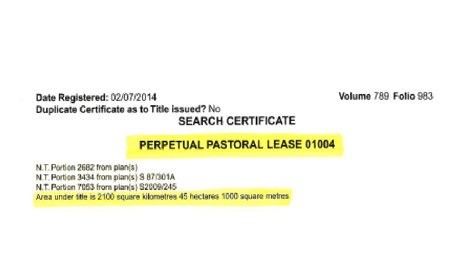
Large • Tipperary Station • About 250 km south west of Darwin • Title area is over 2, 100 Sq. Km • The size of a small country

Large

The components of the survey • Get all of your survey search • Mobilise • Reconnaissance – plane and vehicle • Construct all of your permanent marks (knowns as CRMs in the NT) • Do the Static network • Do AUSPOS observations (log while doing RTK in excess of 6 hours) • Look for cadastral marks • Cadastral Survey – pick up old marks, posts, new marks, pegging • Comps, reports and plan production

GNSS Equipment – Static Session Planner

GNSS Equipment – Static Observation Key Diagram

GNSS Equipment – Static Logging & Booking Sheet

GNSS Equipment – Network Diagram showing distances

GNSS Equipment – TBC Software Screen Shot

GNSS Equipment – Static & AUSPOS Things to lodge with the Plan to the Surveyor General • Static Logging Sheet • Network Control Diagram • Network Adjustment Report • Adjusted Co-ordinate list – MGA 94 and Lats & Longs • Technical Report detailing field and office processes and demonstrating adherence to regulated accuracy requirements • RINEX data for the static network • RINEX data for the AUSPOS determinations

Geodesy is Relevant In the NT when doing large jobs two items that Surveyors have to adhere to I find extremely interesting • When pegging a line of Latitude, you MUST put a bend in the line every 10 kilometres! • When calculating final plan areas you MUST adjust the area using the Large Area Misclose formula

Geodesy is Relevant

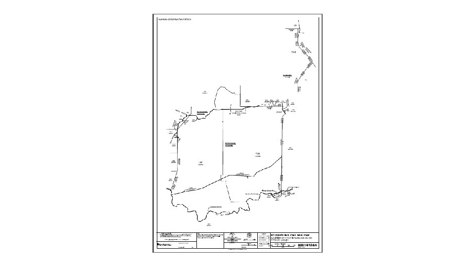
The Final Plan of Subdivision • This was only a 3 sheet plan • The plan numbering system is different to Victoria's, as is their method of having multiple sheets in a plan • Nearly all plans are currently drawn at A 1 • Like Victoria, there are many subtleties relating to the drawing and presentation methods. But they can be quite different so a whole new learning curve • In rural areas the bearing datum MUST be “True Mid”. There’s that geodesy stuff again – you get forward and reverse bearing differences on east/west lines. The longer the line, the greater the differences.
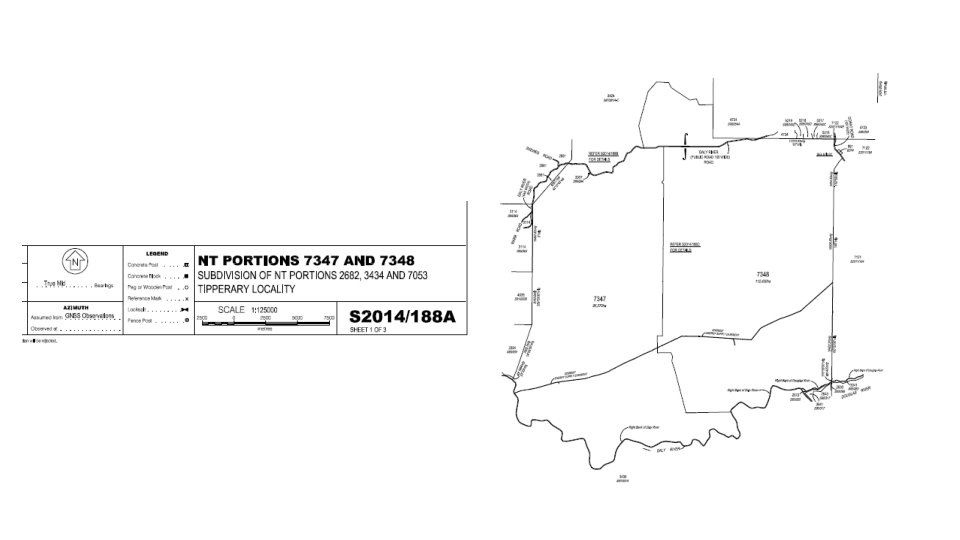

The final areas were: • NT Portion 7347 = 95, 370 ha • NT Portion 7348 = 112, 400 ha

Sheet 2 Created Daly River Road

Sheet 3 was the new boundary. Between the Daly River Road & the Daly River

Sheet 3 was the new boundary. Between the Daly River Road & the Daly River

Surveying Territory Style all in a hard days yakka Rural Surveying is heaps of fun Neville Brayley
- Slides: 25