50 Years Ago HURRICANE DONNA Wednesday May 19

- Slides: 39

50 Years Ago HURRICANE DONNA Wednesday, May 19, 2010 AMS Local Chapter Meeting, Miami, FL

1960 Dwight D. Eisenhower is President Cold War Le. Roy Collins is Governor US sends 3500 soldiers to Vietnam Soviet missile shoots down U 2 Castro nationalizes US interests in Cuba “The Flintstones” premiers Tiros I weather satellite Kennedy/Johnson elected

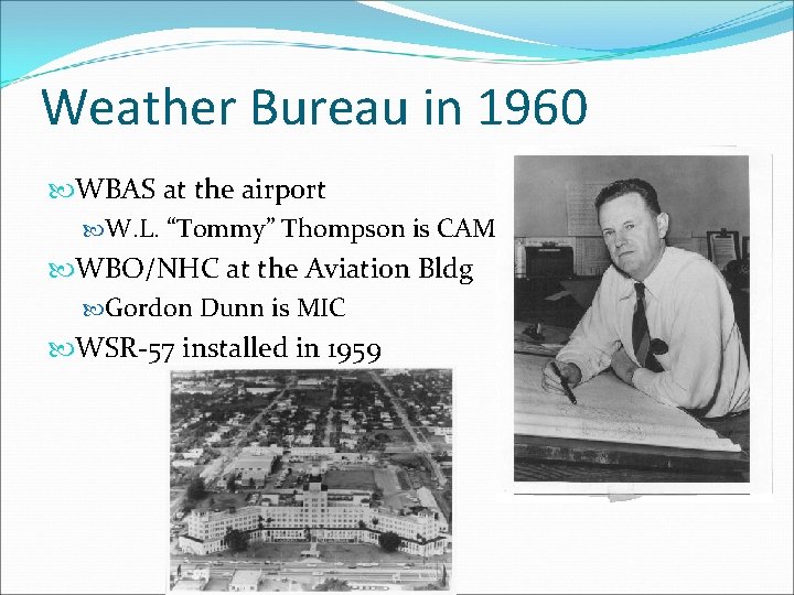
Weather Bureau in 1960 WBAS at the airport W. L. “Tommy” Thompson is CAM WBO/NHC at the Aviation Bldg Gordon Dunn is MIC WSR-57 installed in 1959

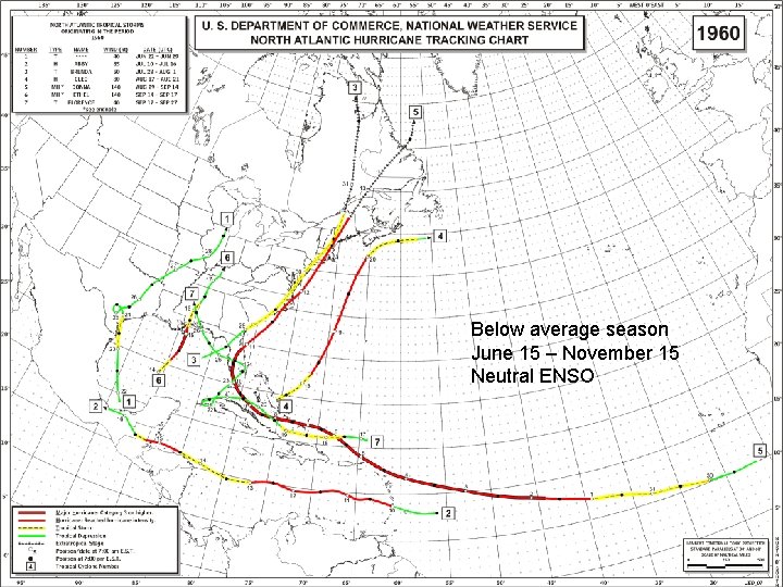
Below average season June 15 – November 15 Neutral ENSO

Hurricane Donna August 29 – September 17 Record for maintaining major hurricane (Cat 3) status 9 days, September 2 -11 Briefly category 5 on September 4 over Atlantic Ocean Direct hits Florida Keys, FL (Marathon, Vaca Key) category 4 Fort Myers/Naples, FL category 4 Cape Hatteras, NC Long Island, NY and New England

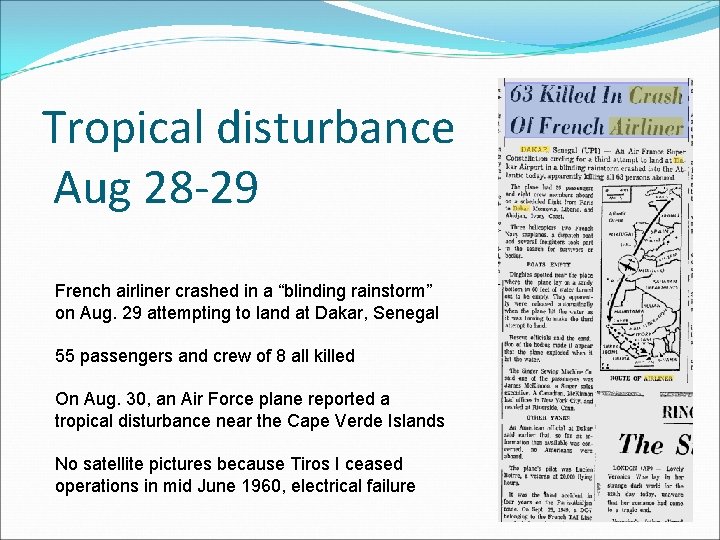
Tropical disturbance Aug 28 -29 French airliner crashed in a “blinding rainstorm” on Aug. 29 attempting to land at Dakar, Senegal 55 passengers and crew of 8 all killed On Aug. 30, an Air Force plane reported a tropical disturbance near the Cape Verde Islands No satellite pictures because Tiros I ceased operations in mid June 1960, electrical failure

First advisory – Sep 2 Located by Navy reconnaissance invest flight First advisory 6 PM AST Sep 2 by Hurricane Warning Center, San Juan, PR 12 noon AST Sep 3 - Hurricane Watch for Leeward Islands 6 PM AST Sep 3 - Hurricane Warning for Leeward Islands, Hurricane Watch for Puerto Rico 6 AM AST Sep 4 - Hurricane Warning for Puerto Rico and Virgin Islands 9 AM and 12 Noon AST Sep 5 – Hurricane Warnings changed to Gale Warnings for PR and VI

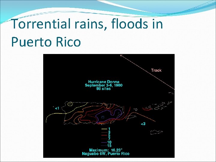
Torrential rains, floods in Puerto Rico

Donna’s effect on the islands Category 5 storm for a short time on Sep 4 St. Maarten reported 120 mph sustained wind St. Maarten – 7 dead, extensive damage, 25% homeless Anguilla – 1 dead Virgin Islands – 7 dead Puerto Rico – over 10 inches of rain produced flash floods, killing 107 people By noon on Sep 5, apparent that the center of Donna will miss Puerto Rico to the north

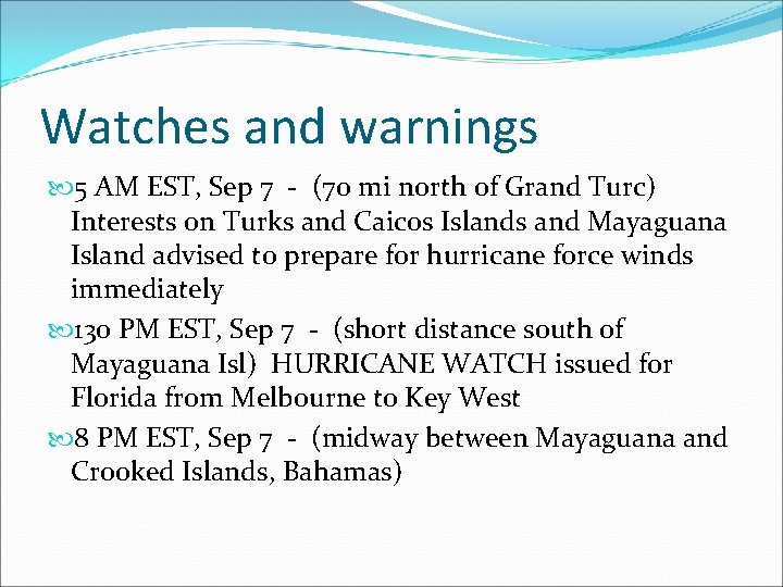
Watches and warnings 5 AM EST, Sep 7 - (70 mi north of Grand Turc) Interests on Turks and Caicos Islands and Mayaguana Island advised to prepare for hurricane force winds immediately 130 PM EST, Sep 7 - (short distance south of Mayaguana Isl) HURRICANE WATCH issued for Florida from Melbourne to Key West 8 PM EST, Sep 7 - (midway between Mayaguana and Crooked Islands, Bahamas)

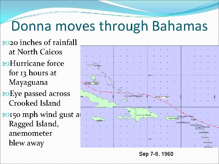
Donna moves through Bahamas 20 inches of rainfall at North Caicos Hurricane force for 13 hours at Mayaguana Eye passed across Crooked Island 150 mph wind gust at Ragged Island, anemometer blew away winds Sep 7 -8, 1960

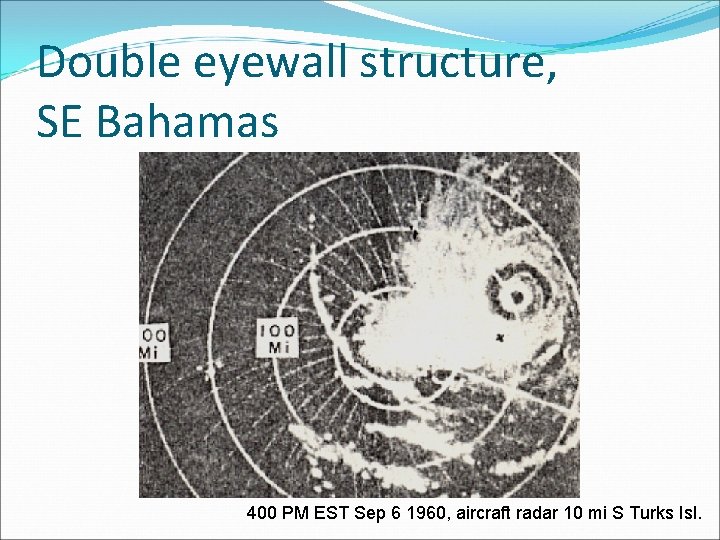
Double eyewall structure, SE Bahamas 400 PM EST Sep 6 1960, aircraft radar 10 mi S Turks Isl.

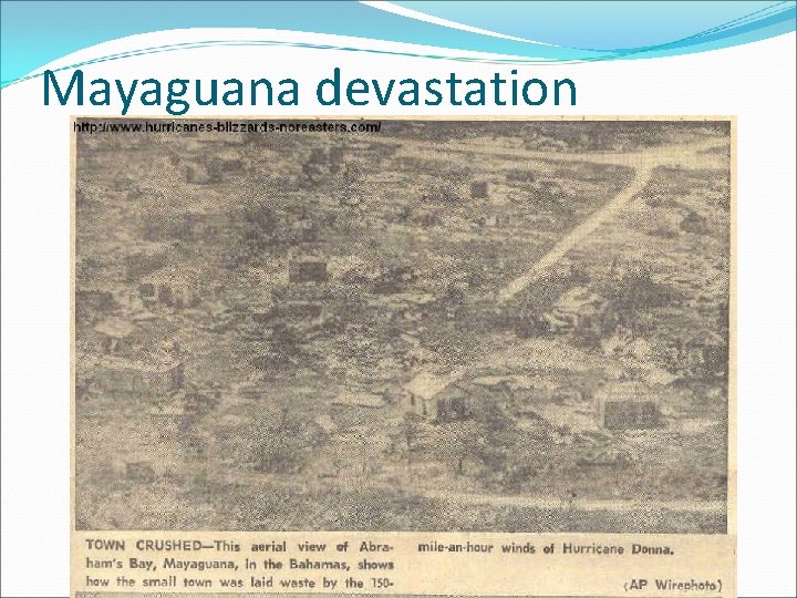
Mayaguana devastation

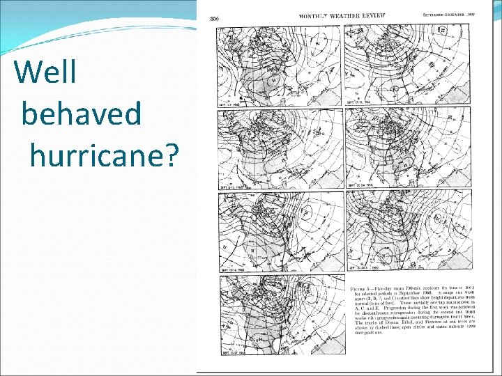
Well behaved hurricane?

Hurricane Warning for Florida 11 AM EST, Sep 8 - (20 mi W of Ragged Island) Hurricane Warning for Florida Keys from Key Largo to Dry Tortugas, Hurricane Watch Melbourne to Fort Myers 8 AM EST, Sep 9 - term EMERGENCY inserted 11 AM EST, Sep 9 - (154 mi SSE of Miami) Hurricane Warning extended, Fort Lauderdale to Punta Gorda, Hurricane Watch Melbourne to Cedar Keys 5 PM EST, Sep 9 - Carysfort Reef Light 90 mph, Miami 55 mph 11 PM EST, Sep 9 - (35 mi E of middle keys) Hurricane Warning extended, Melbourne to Clearwater including Lake Okeechobee

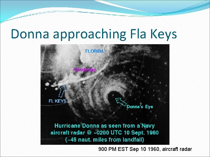
Donna approaching Fla Keys 900 PM EST Sep 10 1960, aircraft radar

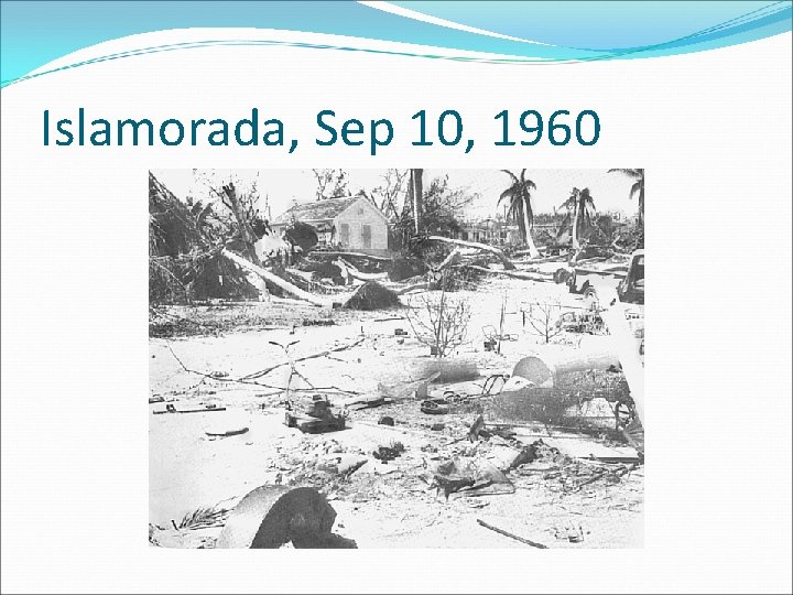
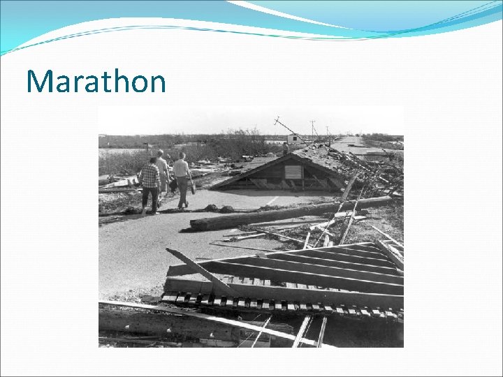
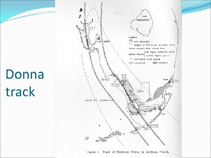
Devastation in the Keys 1 AM EST, Sep 10 - 135 mph wind at Tavernier 3 AM EST, Sep 10 - eye moving onto Long Key 5 AM EST, Sep 10 - eye over Cape Sable, Hurricane Warning extended Daytona Beach to Cedar Keys 7 AM EST, Sep 10 - about 25 mi south of Everglades City 9 AM EST, Sep 10 - 97 mph gust at MIA 1 PM EST, Sep 10 - near Naples 3 PM EST, Sep 10 - near Fort Myers 7 PM EST, Sep 10 - 30 mi east of Sarasota

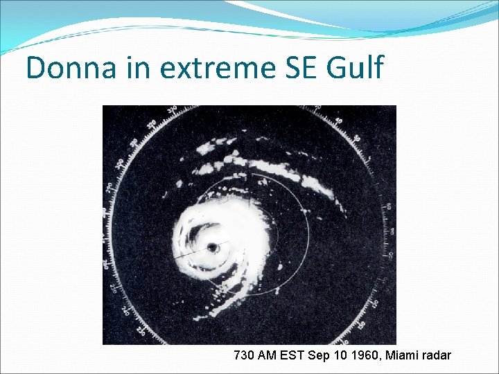
Donna in extreme SE Gulf 730 AM EST Sep 10 1960, Miami radar

Islamorada, Sep 10, 1960

Marathon


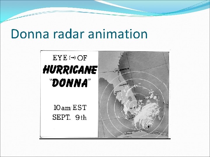
Donna radar animation

Donna track

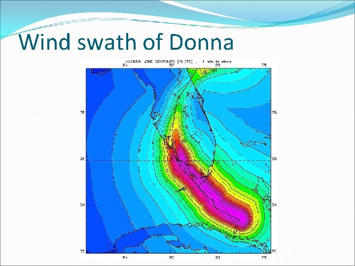
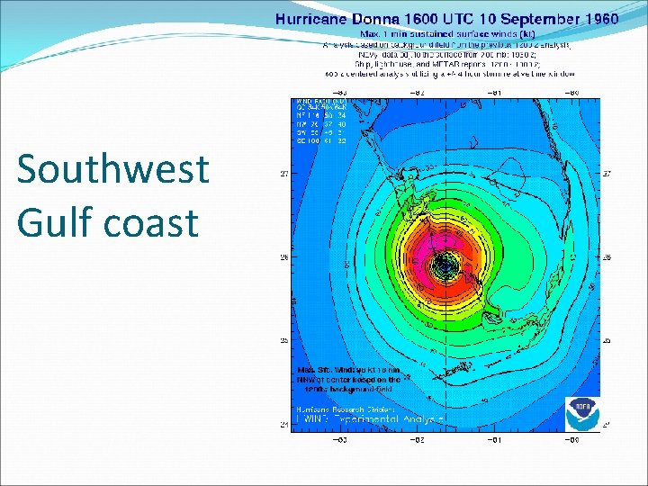
Wind swath of Donna

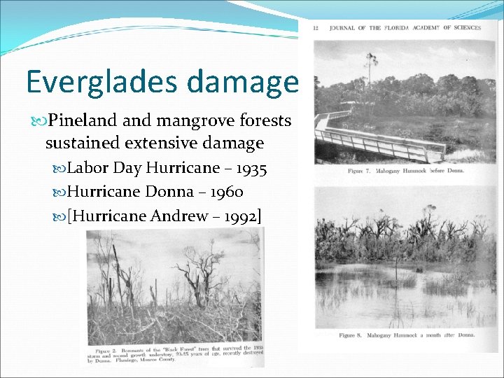
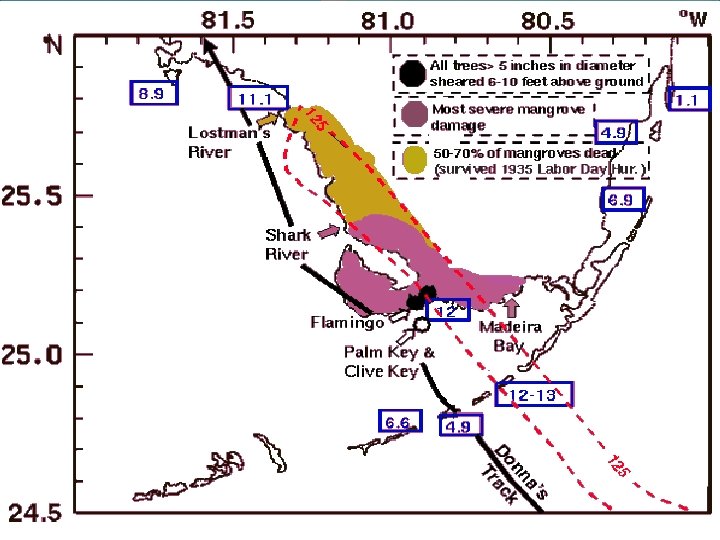
Everglades damage Pineland mangrove forests sustained extensive damage Labor Day Hurricane – 1935 Hurricane Donna – 1960 [Hurricane Andrew – 1992]

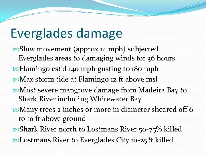
Everglades damage Slow movement (approx 14 mph) subjected Everglades areas to damaging winds for 36 hours Flamingo est’d 140 mph gusting to 180 mph Max storm tide at Flamingo 12 ft above msl Most severe mangrove damage from Madeira Bay to Shark River including Whitewater Bay Many trees 2 inches or more in diameter sheared off 6 to 10 ft above ground Shark River north to Lostmans River 50 -75% killed Lostmans River to Everglades City 10 -25% killed


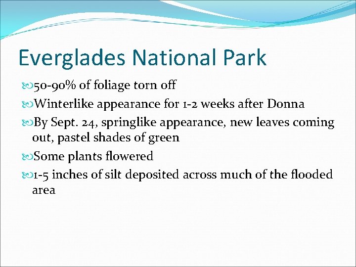
Everglades National Park 50 -90% of foliage torn off Winterlike appearance for 1 -2 weeks after Donna By Sept. 24, springlike appearance, new leaves coming out, pastel shades of green Some plants flowered 1 -5 inches of silt deposited across much of the flooded area

Everglades City

Southwest Gulf coast

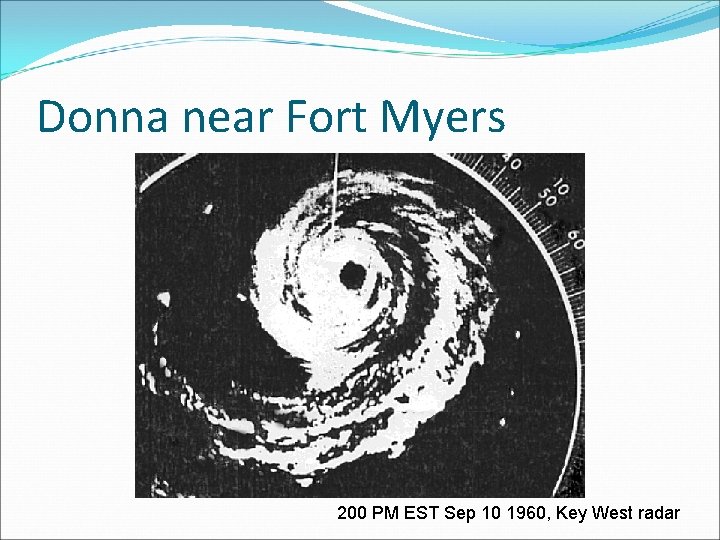
Donna near Fort Myers 200 PM EST Sep 10 1960, Key West radar

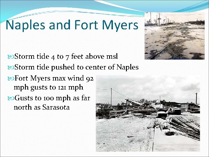
Naples and Fort Myers Storm tide 4 to 7 feet above msl Storm tide pushed to center of Naples Fort Myers max wind 92 mph gusts to 121 mph Gusts to 100 mph as far north as Sarasota

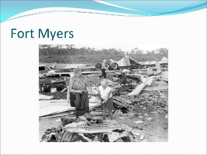
Fort Myers

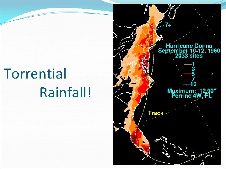
Torrential Rainfall!

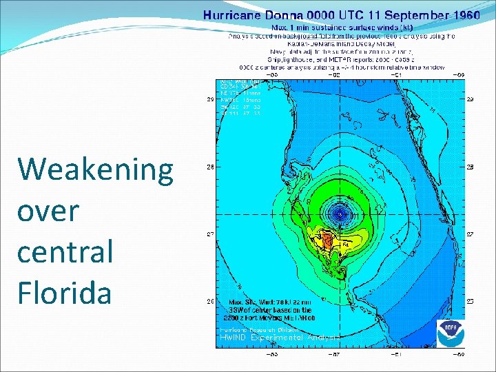
Weakening over central Florida

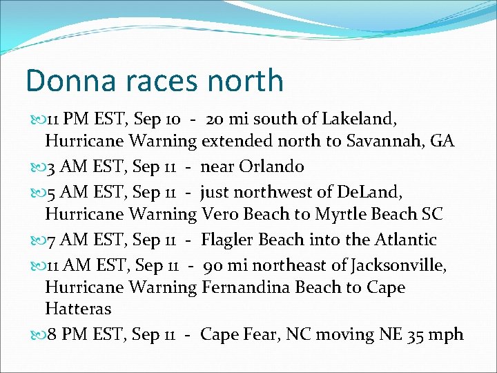
Donna races north 11 PM EST, Sep 10 - 20 mi south of Lakeland, Hurricane Warning extended north to Savannah, GA 3 AM EST, Sep 11 - near Orlando 5 AM EST, Sep 11 - just northwest of De. Land, Hurricane Warning Vero Beach to Myrtle Beach SC 7 AM EST, Sep 11 - Flagler Beach into the Atlantic 11 AM EST, Sep 11 - 90 mi northeast of Jacksonville, Hurricane Warning Fernandina Beach to Cape Hatteras 8 PM EST, Sep 11 - Cape Fear, NC moving NE 35 mph

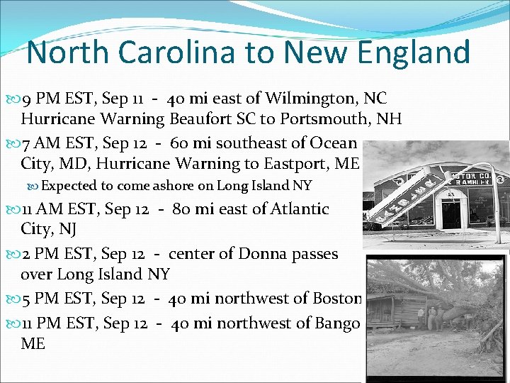
North Carolina to New England 9 PM EST, Sep 11 - 40 mi east of Wilmington, NC Hurricane Warning Beaufort SC to Portsmouth, NH 7 AM EST, Sep 12 - 60 mi southeast of Ocean City, MD, Hurricane Warning to Eastport, ME Expected to come ashore on Long Island NY 11 AM EST, Sep 12 - 80 mi east of Atlantic City, NJ 2 PM EST, Sep 12 - center of Donna passes over Long Island NY 5 PM EST, Sep 12 - 40 mi northwest of Boston 11 PM EST, Sep 12 - 40 mi northwest of Bangor ME

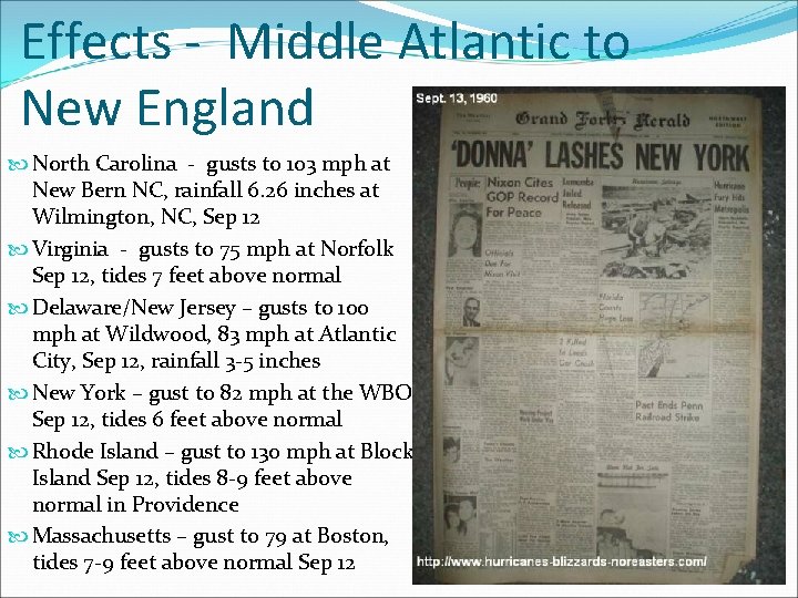
Effects - Middle Atlantic to New England North Carolina - gusts to 103 mph at New Bern NC, rainfall 6. 26 inches at Wilmington, NC, Sep 12 Virginia - gusts to 75 mph at Norfolk Sep 12, tides 7 feet above normal Delaware/New Jersey – gusts to 100 mph at Wildwood, 83 mph at Atlantic City, Sep 12, rainfall 3 -5 inches New York – gust to 82 mph at the WBO Sep 12, tides 6 feet above normal Rhode Island – gust to 130 mph at Block Island Sep 12, tides 8 -9 feet above normal in Providence Massachusetts – gust to 79 at Boston, tides 7 -9 feet above normal Sep 12

Summary Hurricane Donna 9 th costliest storm, damages estimated 6. 6 billion (in 2010 dollars) 364 direct deaths (over 100 in Puerto Rico, 50 in the United States, 63 in the jet crash) Category 5 over the Atlantic, category 4 at landfall 35 percent of Florida grapefruit crop lost, 10 -15% of the orange crop lost