5 Themes of Geography Geography Geography is the


- Slides: 24

5 Themes of Geography

Geography • Geography is the study of: – People, the places they live, and how they all interact.

5 Themes Location Region Place 5 themes of Geography Movement Human. Environment Interaction

Location and Place • Location gives a definite location – Absolute or Relative locations • Place - describes the human/ physical characteristics – Describes mountains, rivers, deserts, etc. – Ex. Ashburn is flat and heavily populated with few rivers. It also has people from many different nations • Location and place are different because… – One describes WHERE you are – The other describes WHAT your place is like

• Human-Environment Interaction, Movement, and Region Human-Environment Interaction – Explains how humans adapt and modify their environment to better suit their needs – Ex. Air conditioning or leveling land for housing • Movement looks at how and why humans move around the world and what they bring with them – Ex. Cultural diffusion and migration • Regions are units of geographic study – Formal regions- clearly defined regions (countries) – Functional regions- defined by connections • Ex. DC Metro Area – connected by the Beltway – Vernacular regions- no formal boundaries, but known • Ex. The Midwest or The South or Northern VA

NOW LETS SING ALONG TO THE 5 Themes of Geography Song! I know you are super excited

Latitude & Longitude : the Global Grid • An imaginary grid of lines used to find location • Can be found on most maps throughout the world • It is a uniform measurement (all countries use it)

LATITUDE • Imaginary lines that run Across the earth • Parallel - they never touch!!! • They measure distance North or South of the equator

LATITUDE A = ACROSS !!!!!!! FROM LEFT TO RIGHT

• Remember - THEY ARE LONG • Measure distance East or West of the Prime Meridian • Intersect above the North and South Pole • (Run Up & Down on a map) Usually!!!

Reading Latitude and Longitude • When reading maps for location, you must use latitude and longitude to locate your destination • Latitude always comes first, then Longitude – Ex. 40 N, 160 E or 27 S, 17 E • Use the worksheets given to practice finding location • Use the sheet to define and sketch the different types of geographic features

Want another song? ? If not too bad

Types of Land Forms

Island – land area that is surrounded by water Long Island Archipelago – chain of islands Hawaiian Islands

Cape – Narrow point of land that extends into a body of water Cape Cod, MA Peninsula – piece of land that is surrounded by water on three sides Florida

Hill – area of raised land that is lower and more rounded than a mountain Hills Acadia National Park Maine Mountain – high, steep, rugged land that rises sharply above the surrounding land. Mount Mc. Kinley, Alaska

Plain – broad area of fairly level land that is generally close to sea level Plains Cheyenne River Sioux Reservation Wyoming Plateau – large area of high, flat, or gently rolling land Bateke Plateau Gabon, Africa

Desert – area that has little or no moisture or vegetation Sahara Desert, Africa Coast – land that borders the sea Jones Beach

Continent – any of seven large land masses on the Earth’s surface Europe North America Africa Asia Sub-continent – an area of land that is part of a continent but is separated by something (landform, language, etc. India Central (Latin) America South America Antarctica Australia

Isthmus – narrow strip of land joining two large land areas or joining a peninsula to a mainland. Isthmus of Panama Strait – narrow channel that connects two larger bodies of water Strait of Gibraltar

Tributary – stream or small river that flows into a larger stream or river tributary map of Lake Erie River – large stream of water that empties into an ocean, lake, or another river Hudson and Mohawk Rivers

Bay – part of a body of water that is partly enclosed by land Jamaica Bay Gulf – arm of an ocean or sea that is partly enclosed by land, usually larger than a bay. Gulf of Mexico

Lake – body of fresh water surrounded by land Great Lakes Sea – large body of salt water that is smaller than an ocean Black Sea

Ocean – any of the large bodies of salt water on the Earth’s surface. Arctic. COcean Pacific A Ocean Atlantic B Ocean Indian D Ocean
 5 themes of geography ap human geography
 Sự nuôi và dạy con của hổ
 Các châu lục và đại dương trên thế giới
 Dạng đột biến một nhiễm là
 điện thế nghỉ
 Bổ thể
 Nguyên nhân của sự mỏi cơ sinh 8
 độ dài liên kết
 Phép trừ bù
 Thiếu nhi thế giới liên hoan
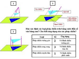
 Vẽ hình chiếu vuông góc của vật thể sau
 Chúa sống lại
 Một số thể thơ truyền thống
 Sơ đồ cơ thể người
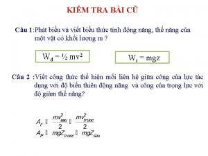
 Công thức tính độ biến thiên đông lượng
 Số nguyên là gì
 Tỉ lệ cơ thể trẻ em
 đặc điểm cơ thể của người tối cổ
 Các châu lục và đại dương trên thế giới
 ưu thế lai là gì
 Thẻ vin
 Môn thể thao bắt đầu bằng từ chạy
 Tư thế ngồi viết
 Cái miệng nó xinh thế chỉ nói điều hay thôi
 Hình ảnh bộ gõ cơ thể búng tay
