24 2 FRONTS Fronts When 2 air masses


- Slides: 23
24 -2 FRONTS
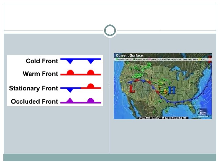
Fronts �When 2 air masses meet density differences keep them separate �Front- boundary between air masses � 100’s to 1, 000’s of miles wide
Cold Front �Cold air mass overtakes a warm air mass �Cold air lift warm air up �Short lived �Violent
�Squall line – long line of heavy thunderstorms
Warm Front �Front edge of an advancing warm air mass �Cold mass retreats from an area �Precipitation over a large area
Stationary Front �Fronts either move very slow or don’t move
Occluded Front �Cold air mass overtakes warm air mass �Lift warm air up above
Polar Front �Cold polar air meets warm tropical air
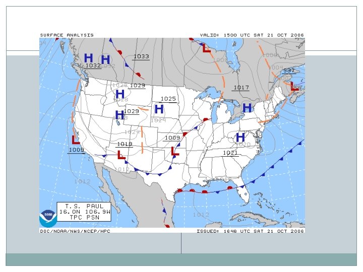
Midlatitude Cyclone �Low pressure �Rotating wind �Moves towards the rising air of central low pressure regions
Midlatitude Cyclone Stages
Anticyclone �Air sinks and flows outward from a center of high pressure �Clockwise in NH �Dry weather
Thunderstorms �Heavy storm with rain, thunder, lightning, and winds � 3 stages: 1. Cumulus – warm moist air rises � 2. Mature – dark cumulonimbus (heavy rain) � 3. Dissipating - end
Lightning �Clouds discharge electricity �Rapid expansion of air – thunder �Lightning fun facts!
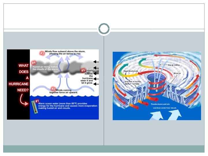
Hurricanes �Tropical oceans � 120 mph winds in a spiral �Intense low pressure
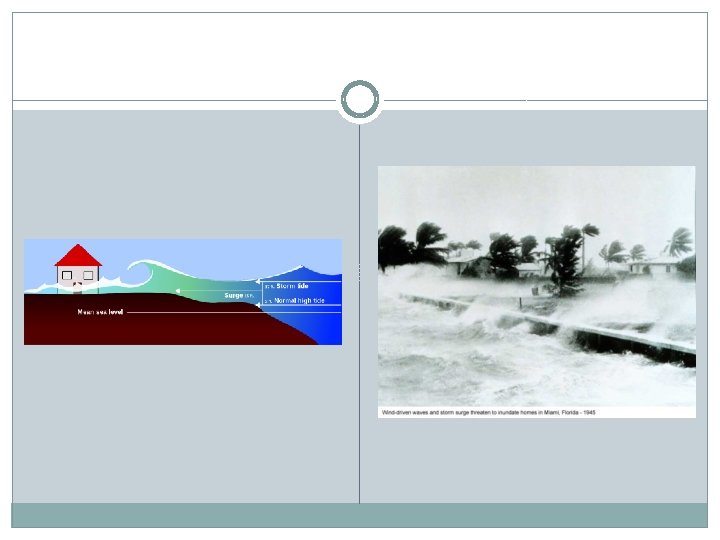
�Winds increase towards the center – eye �Eye – calm sinking air �Storms surge – rising sea level
Safir-Simpson Scale
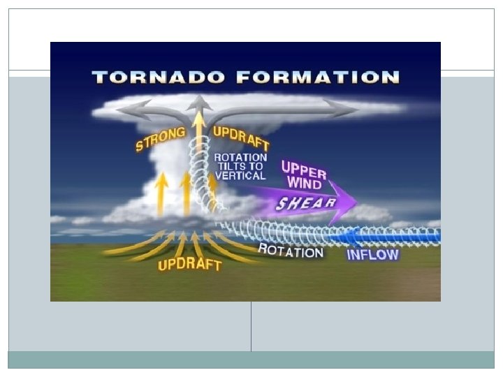
Tornadoes �Rotating column of air �High winds �Funnel-shaped � 400 km/hr �Thunderstorm meets a high altitude horizontal wind
Tornado Alley