
2003 GFDL HURRICANE PREDICTION SYSTEM 2003 IHC Conference

- Slides: 20
2003 GFDL HURRICANE PREDICTION SYSTEM 2003 IHC Conference, Miami Florida Morris Bender, Timothy Marchok (GFDL) Robert Tuleya, Hua-Lu Pan (NCEP) Isaac Ginis, Biju Thomas (URI)
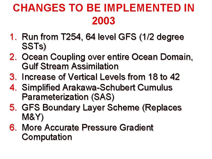
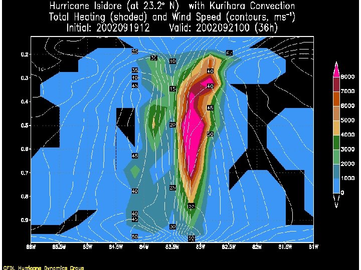
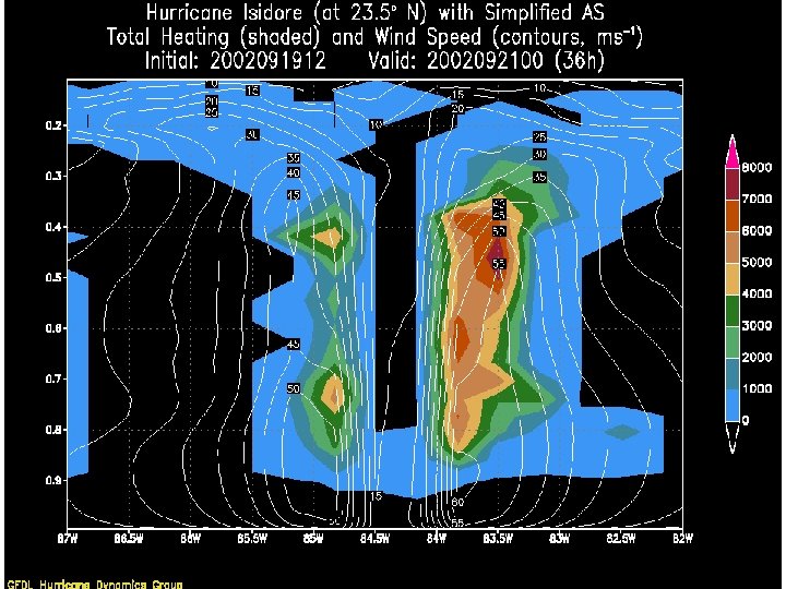
CHANGES TO BE IMPLEMENTED IN 2003 1. Run from T 254, 64 level GFS (1/2 degree SSTs) 2. Ocean Coupling over entire Ocean Domain, Gulf Stream Assimilation 3. Increase of Vertical Levels from 18 to 42 4. Simplified Arakawa-Schubert Cumulus Parameterization (SAS) 5. GFS Boundary Layer Scheme (Replaces M&Y) 6. More Accurate Pressure Gradient Computation
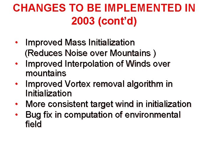
CHANGES TO BE IMPLEMENTED IN 2003 (cont’d) • Improved Mass Initialization (Reduces Noise over Mountains ) • Improved Interpolation of Winds over mountains • Improved Vortex removal algorithm in Initialization • More consistent target wind in initialization • Bug fix in computation of environmental field
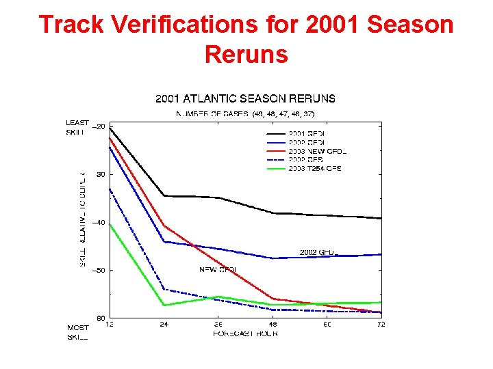
Track Verifications for 2001 Season Reruns
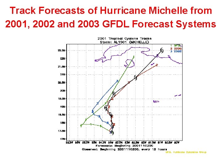
Track Forecasts of Hurricane Michelle from 2001, 2002 and 2003 GFDL Forecast Systems
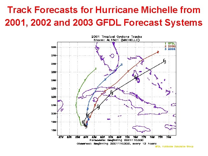
Track Forecasts for Hurricane Michelle from 2001, 2002 and 2003 GFDL Forecast Systems
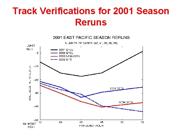
Track Verifications for 2001 Season Reruns
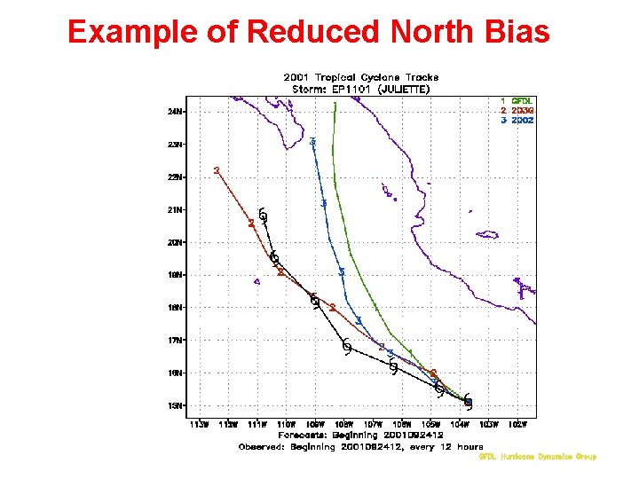
Example of Reduced North Bias
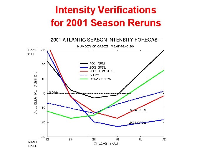
Intensity Verifications for 2001 Season Reruns
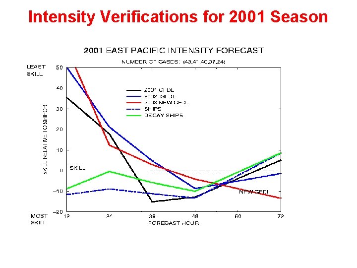
Intensity Verifications for 2001 Season Reruns
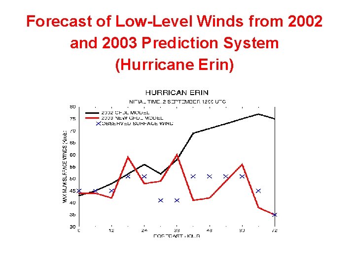
Forecast of Low-Level Winds from 2002 and 2003 Prediction System (Hurricane Erin)
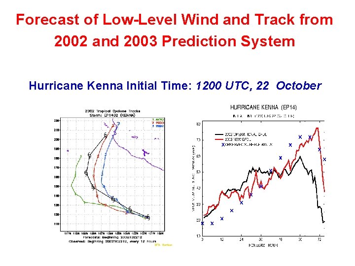
Forecast of Low-Level Wind and Track from 2002 and 2003 Prediction System Hurricane Kenna Initial Time: 1200 UTC, 22 October
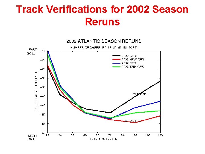
Track Verifications for 2002 Season Reruns
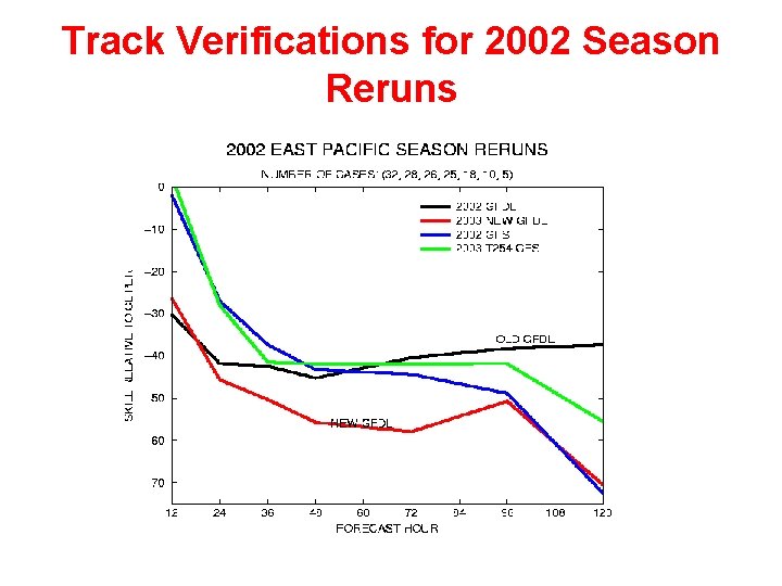
Track Verifications for 2002 Season Reruns
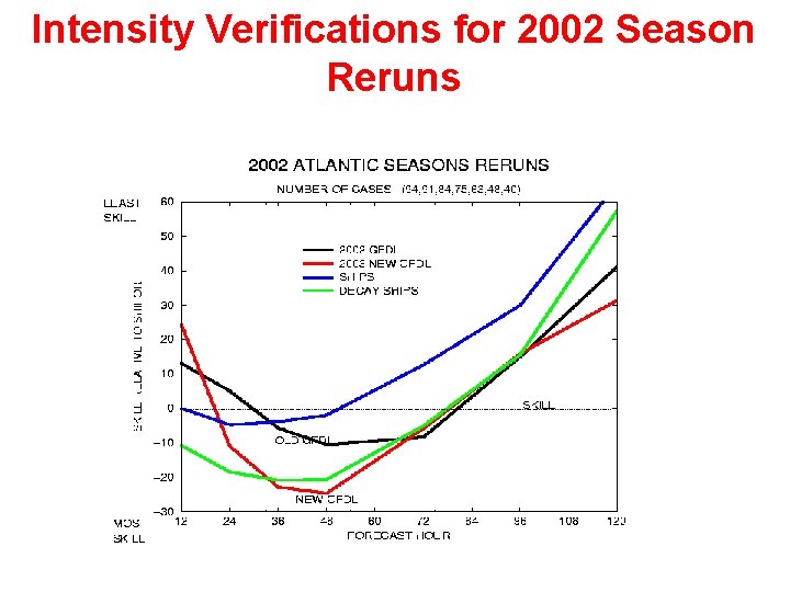
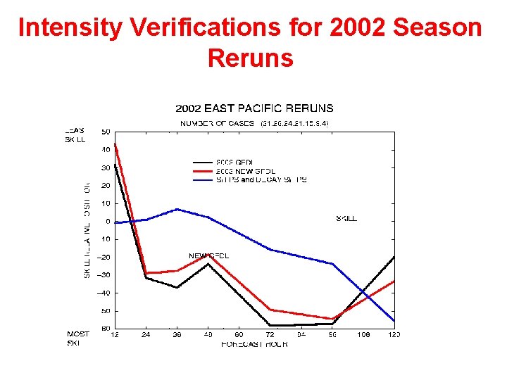
Intensity Verifications for 2002 Season Reruns
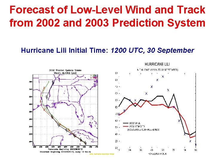
Forecast of Low-Level Wind and Track from 2002 and 2003 Prediction System Hurricane Lili Initial Time: 1200 UTC, 30 September
Intensity Verifications for 2002 Season Reruns
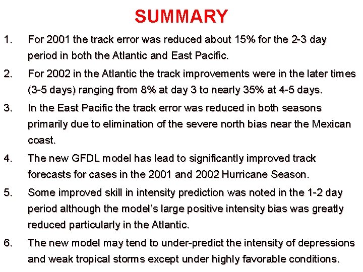
SUMMARY 1. For 2001 the track error was reduced about 15% for the 2 -3 day period in both the Atlantic and East Pacific. 2. For 2002 in the Atlantic the track improvements were in the later times (3 -5 days) ranging from 8% at day 3 to nearly 35% at 4 -5 days. 3. In the East Pacific the track error was reduced in both seasons primarily due to elimination of the severe north bias near the Mexican coast. 4. The new GFDL model has lead to significantly improved track forecasts for cases in the 2001 and 2002 Hurricane Season. 5. Some improved skill in intensity prediction was noted in the 1 -2 day period although the model’s large positive intensity bias was greatly reduced particularly in the Atlantic. 6. The new model may tend to under-predict the intensity of depressions and weak tropical storms except under highly favorable conditions.