1811 1812 earthquakes New Madrid Missouri The Legend


- Slides: 18

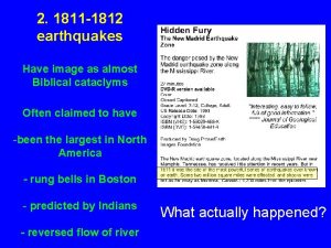
1811 -1812 earthquakes New Madrid Missouri The Legend: A Biblical cataclysm Often claimed to have been the largest in North America rung bells in Boston predicted by Indians reversed flow of river What actually happened?

New Madrid 1811 The Mississippi river valley was the frontier. New Madrid, which claims to be the oldest city west of the Mississippi, was settled in 1789. It was named in hope of pleasing the Spanish, who controlled the area. The river became the major transportation route for settlements west of the Appalachians. Most people in the area lived in small towns along the river. St. Louis was small, and the city of Memphis didn’t exist yet. The New Madrid area had about 3000 residents.

Tension with England had been building for years, and war seemed forthcoming. The country was bitterly divided. “War hawks” from the south and west favored war to expand the country, while New Englanders and New Yorkers were opposed. The U. S. was already fighting frontier Indians, backed by England. Although in November 1811 U. S. forces defeated a coalition of Indian tribes led by Shawnee chief Tecumseh at the battle of Tippecanoe, the Indian threat A bad time http: //www. legen dsofamerica. com / http: //www. ohiohi storycentral. org/

New Madrid: Sequence of earthquakes over months, with three major shocks December 16, 1811: “The house danced about, and seemed as if it would fall on our heads. I soon conjectured the cause of our trouble, and cried out that it was an Earthquake, and for the family to leave the house, which we found very difficult to do, owing to its rolling and jostling about. The shock was soon over, and no injury was sustained, except the loss of the Trees chimney. ” were falling in every direction — some The earthquakes went on and on. Most torn up by their roots, were small, but one on January 23, 1812 was large enough to disrupt riverbanks others breaking off above the ground, and limbs and create more sand blows. February 7, 1812 : ” A concussion took branches of all sizes flying about us place much more violent than those preceding. ” The town’s houses, which sustained some damage like broken chimneys in the previous earthquakes but

“The earth was horribly torn to pieces. The surface of hundreds of acres was, from time to time, covered over of various depths of the sand which issued from the features, some of which closed up immediately after they had vomited forth their sand water. ” Liquefaction of soil greatly increases earthquake damage DD 5. 1

Postdiction, not prediction Shawnee chief Tecumseh didn’t prophecy the earthquakes Addressing tribes after the earthquakes, he pointed to what had happened as divine support for his cause: “The Great Spirit is angry with our enemies. He speaks in thunder, and the earth swallows up villages. ”

Did the Mississippi run backwards after February shock? Historical Society of Missouri DD 5. 4 “The current of the Mississippi was driven back upon its source with the greatest velocity for several hours in consequence of the elevation of its bed. But this noble river was not to be stayed in its course. Its accumulated waters came booming on, and over topping the barrier thus suddenly raised, carried everything before them with resistless power. ” Reverse current lasted a few hours. Real or legend?

Vertical motion on Reelfoot fault created temporary dams on riverbed that disrupted flow until current cleared them away DD 5. 7 Flow over low head dam creates zone where surface water flows backwards, with waterfalls on upstream and downstream sides Sieh and Le. Vay, 1998 Boatmen perhaps encountered bigger & more complicated version, with back flow downriver from natural dams and slower current upriver

Shaking intensity yields low magnitude 7 first inferred, not subsequently quoted 8 DD 5. 8 Log cabin damage at New Madrid Minor damage in St Louis, Nashville, Louisville, etc. Not felt in Boston, no church bells ring Hough et al, 2000

Magnitude keeps shrinking

Scenario 40 x 15 km; 2 m slip 30 x 30 km; 5 m slip 60 x 15 km; 3. 7 m slip Hough, 2004 DD 8. 10

AFTERMATH “Loss and suffering were brought to the attention of Congress, but in the light of subsequent events it is not certain to what extent assistance was the real object of the agitation or to what extent it was a pretext for land grabbing on the part of certain unscrupulous persons. ” (M. Fuller, 1912) People whose lands had been destroyed could get certificates to replace them. Most stayed and sold their certificates for a few cents per acre. Of 516 certificates issued, original claimants used only 20. Speculators in St. Louis acquired most of the others, and “perjury and forgery became so common that for a time a New Madrid claim was regarded as a synonym for fraud. ”

Reconstructed Time Series to predict frequency (large uncertainties)

Very active on small scales which is good


Seismic monitoring map – well defined locations (faults)

But, model of faults is getting more complex with time

Evolution of Threat Assessment Evolving a different conception of the 1811/12 events: Not a single quake every 500 years “Feedback” cluster quakes instead The 2008 maps include a set of scenarios in which the New Madrid earthquakes are modeled as a cluster. That is, the maps capture the probability of ground motion from three temporally correlated earthquakes that rupture each of three NMSZ fault segments separately. In its ever-growing logic tree, the USGS assigns equal weight to the clustered source model and to all scenarios of the non-clustered model.
 1811 food revolution
 Las asambleas orientales
 Martenehe
 Dish new madrid
 You born
 Chinese new year legend
 10 causes of earthquakes
 Http://earthquake.usgs.gov/earthquakes/map/
 Chapter 19 earthquakes
 Plastic deformation earthquakes
 The ______ of a seismograph moves.
 Chapter 19 earthquakes
 How high does the richter scale go
 Btn earthquakes
 Chapter 8 earthquakes and earth's interior answer key
 Chapter 8 earthquakes and volcanoes
 Why do earthquakes occur
 Frequent earthquakes in an area may indicate
 Chapter 8 section 2 earthquake measurement answer key


