15 th South West Pacific Hydrographic Commission Conference


- Slides: 15

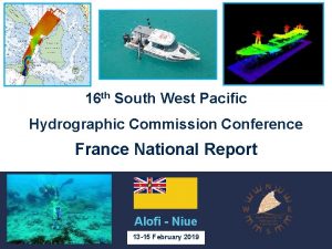
15 th South West Pacific Hydrographic Commission Conference France National Report Nadi - Fiji 21 -22 February 2018

NEW SURVEYS – New Caledonia • Surveys scheme overseen by the hydrographic commission of New Caledonia and executed by Shom’s Pacific survey unit (GOP) • Main focus on the Grand Lagon Nord (in support to maritime surveillance and development of cruise activity) And • Harbor and access channel surveys • Spatiopreparation (field survey in support to SDB) • SLS deployment and maintenance • Hydrographic support to Kea Trader grounding • Beach surveys 2 February 21 st 2018

NEW SURVEYS – New Caledonia Support to maritime surveillance New recommended tracks in unsurveyed & unfrequented areas 4 « blue boats » arrested in January 2017 2 « blue boats » arrested in November 2017 by French Navy using these new tracks 3 February 21 st 2018

NEW SURVEYS – New Caledonia KEA TRADER GROUNDING - DURAND REEF – July 2017 Surveys – including cooperation with SPC Very short notice and quick product delivery 1 st survey (SBES) to secure the area for rescue operations 2 nd survey (MBES) in support to refloating attempt Support – from July to December 2017 Seafloor models and analysis Tide predictions improvement Water level analysis (ocean dynamics, uncertainties) 4 February 21 st 2018

NEW SURVEYS – French Polynesia • Survey scheme validated by the sub-committee for hydrography of French Polynesia and executed by Shom/GOP • Mooring areas • Spatiopreparation (field survey in support to SDB) • Stereopreparation (field survey for exploitation of aerial images) • SLS deployment and maintenance 5 February 21 st 2018

STATUS OF HYDROGRAPHIC SURVEYS & SURVEY PLAN 2018 -2020 New Caledonia Prioritized survey works defined by the hydrographic commission of New Caledonia: • see New-Caledonia Hydrographic master plan (updated annually) • And Shom’s 2017 -2020 national hydrographic survey programme N/O L’Atalante should be deployed in the area in 2019 (tbc) http: //www. shom. fr/fileadmin/data-www/01 -LE_SHOM/01 PRESENTATION_GENERALE/06 -LE_PROGRAMME_ANNUEL/PNH_20172020_WEB_BD. pdf 6 February 21 st 2018

STATUS OF HYDROGRAPHIC SURVEYS & SURVEY PLAN 2018 -2020 French Polynesia Prioritized survey works defined by the subcommittee for hydrography of French Polynesia: • see French Polynesia hydrographic master plan (updated annually) • And Shom’s 2017 -2020 national hydrographic survey programme N/O L’Atalante should be deployed in the area in 2019 (tbc) Airborne Lidar survey project covering Iles de la Société (funded – to be specified and contracted ) http: //www. shom. fr/fileadmin/data-www/01 -LE_SHOM/01 PRESENTATION_GENERALE/06 -LE_PROGRAMME_ANNUEL/PNH_20172020_WEB_BD. pdf 7 February 21 st 2018

STATUS OF HYDROGRAPHIC SURVEYS & SURVEY PLAN 2018 -2020 Wallis & Futuna • Survey works in lagoon waters (using deployable equipment) and opportunity surveys • See Shom’s 2017 -2020 national hydrographic survey programme No survey planned in 2018 2019 -2020 – requirements TBC http: //www. shom. fr/fileadmin/data-www/01 -LE_SHOM/01 PRESENTATION_GENERALE/06 -LE_PROGRAMME_ANNUEL/PNH_20172020_WEB_BD. pdf 8 February 21 st 2018

GOP IMPROVED SURVEY CAPABILITY NEW MULTIBEAM ECHOSOUNDER • Deployable MBES (Kongsberg 2040 P) • Depth range : 1 -500 meters • 800 soundings/ping (High density – dual swath) • 1 MBES installed on hull: Louis-Hénin (NC-2018) • 2 MBES installed on pole: Chambeyron (NC-2018) & BHPF. 1 (FP - 2019) 9 February 21 st 2018

CHARTING – REGION L INT charts • 7 new INT charts produced (1 publication & 6 new editions) • 3 new INT charts planned in 2018 -2019 (INT 6840, INT 6841 & INT 654) • INT Charts approved since last conference : o INT 6840 (FR 7760) : to be published o INT 6841 (FR 7761) : to be published o INT 6842 (FR 7762) : published 2017/11/17 o INT 6843 (FR 6686) : to be published o INT 6844 (FR 6768) : to be published 10 February 21 st 2018

CHARTING – REGION L INT charts SWPHC 14 Action Agenda SWPHC 14 Action by Item 14. 08 9 Producer Nations to review INT Producer Nations Chart proposal from France for Wallis and Futuna. Deadline End Feb 2017 • FR 7283 will remain a national chart. Action 14. 08 can be closed. • FR intends to produce a band 3 cell derived from FR 7283 to cover W&F EEZ (the only ENC cell intersecting W&F EEZ: FR 368760 will be transformed into band 4 cell) 11 February 21 st 2018

CHARTING – REGION L ENC • 7 new cells published since the last conference • 55 new cells planned in 2018 -2019 • Full coverage of New Caledonian waters by the end of 2018 12 February 21 st 2018

SEA LEVEL OBSERVATION • All 14 stations installed (last one in Ouvéa - March 2017) • Maintenance operated by Shom on yearly basis • Funding remains a challenge • Contribute to PTWS, monitoring of sea level rise & storm surge http: //data. shom. fr/#donnees/refmar 13 February 21 st 2018

MSDI DEVELOPMENTS Since December 3 rd 2017, easier access to Shom core data: bathymetric data, wrecks, cables, bottom types, maritime limits, and toponyms databases. Distributed under Creative Commons « CC-BY-SA 4. 0 » licence Shom’s portals Data. shom. fr Diffusion. shom. fr Regularly updated with new data and products 14 02 December 2020

Adresse postale 13 rue du Chatellier CS 92803 29228 Brest CEDEX 2 Internet www. shom. fr data. shom. fr diffusion. shom. fr Renseignements Tel. +33 (0) 2 56 312
 North indian ocean hydrographic commission
 Passed in several western states granger laws
 International hydrographic organisation
 International hydrographic organisation
 International hydrographic organisation
 International hydrographic organisation
 Iptes
Iptes Intogis
 International hydrographic organisation
 International hydrographic organisation
 Mention two defects of present curriculum
 What is graduated commission
 Business ethics in west virginia
 South carolina human affairs commission right to sue
 West kenya union conference
 South african transport conference
